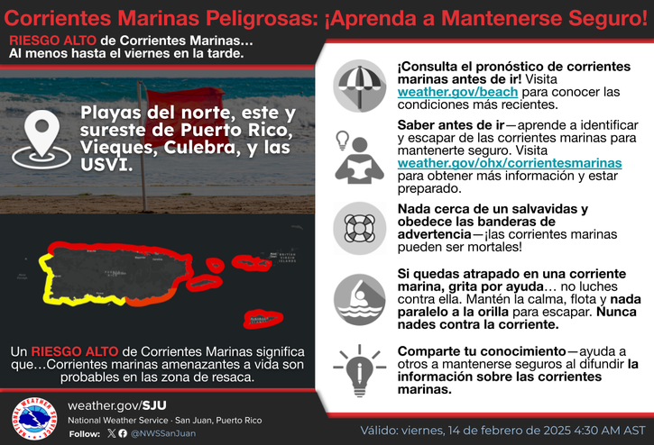
There is a moderate risk of rip current for the north -oriented, eastern and southeastern beaches of Puerto Rico, as well as the beaches of the USVI, Vieques and Culebra. These conditions will spread to beaches of southwestern Puerto Rico tonight. | Existe un riesgo moderado de corrientes marinas para las playas orientadas al norte y las playas del este y sureste de Puerto Rico, como tambien las playas de las Islas Virgenes Estadounidenses, Vieques y Culebra. Estas condiciones se esparciran a playas del suroeste de Puerto Rico esta noche.


 Graphical Hazardous Weather Outlook
 Tropical Analysis
 Tropical Weather
 Regional Satellite
  Puerto Rico and U.S. Virgin Islands
 Local Radar