National Weather Service United States Department of Commerce

Heavy Snow in the West; Fire Weather Conditions in Southern New England and Hawaii

A system crossing the Intermountain West today will continue to bring areas of moderate snowfall from the central Sierra Nevada to the Northern Rockies. Gusty winds and low relative humidity will bring critical fire weather to parts of southern New England and Hawaii. Read More >

TJUA Radar - Cayey, P.R.
A northerly swell will maintain hazardous marine and coastal conditions across the Atlantic waters and passages and most western, northern, and eastern coastal areas of the islands. Therefore several products are in effect: Coastal Flood Advisory in effect until 6 PM this evening High Surf Advisory in effect until 6 AM High Rip Current Risk remains in effect though Monday afternoon.
A frontal boundary north of the area, followed by another approaching cold front tonight, will maintain wet and unstable conditions and will continue to promote showers and thunderstorms across the local islands during the weekend. In the afternoon, with southwestern winds, enough instability and local effects, the heavy rain is anticipated for the San Juan metro area and northeastern Puerto Rico.
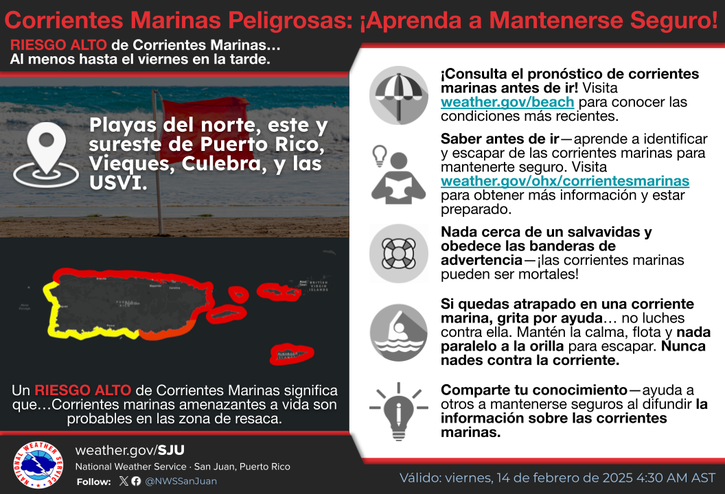
[ Nov 16th] There is a High Risk of Rip Currents for the northern coastline of Puerto Rico, from Rincon to Fajardo, including Culebra, as well as for St. Thomas and St. John through 6 PM AST Monday. There is also a High Risk of Rip Currents for Vieques through 6 PM AST this evening.