WARNING A warning is issued when a hazardous weather or hydrologic event is occurring, imminent or likely. A warning means weather conditions pose a threat to life or property. People in the path of the storm need to take protective action. ADVISORY An advisory is issued when a hazardous weather or hydrologic event is occurring, imminent or likely. Advisories are for less serious conditions than warnings, that cause significant inconvenience and if caution is not exercised, could lead to situations that may threaten life or property. WATCH A watch is used when the risk of a hazardous weather or hydrologic event has increased significantly, but its occurrence, location or timing is still uncertain. It is intended to provide enough lead time so those who need to set their plans in motion can do so. A watch means that hazardous weather is possible. People should have a plan of action in case a storm threatens and they should listen for later information and possible warnings especially when planning travel or outdoor activities.
|
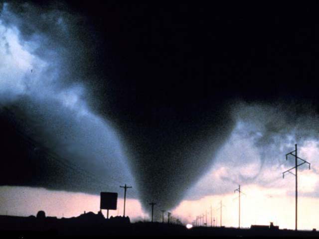
 Severe weather season is fast approaching and now is the time to develop a plan to help keep you safe during times of inclement weather. Knowing the severe weather safety recommendations will help keep you and your family (as well as your pets and property) free from harm this spring. Severe weather season is fast approaching and now is the time to develop a plan to help keep you safe during times of inclement weather. Knowing the severe weather safety recommendations will help keep you and your family (as well as your pets and property) free from harm this spring.West Central Texas experiences its share of severe weather. Large hail, damaging winds and even tornadoes are expected each and every year. However, two weather phenomena that are routinely overlooked are lightning and flash floods. In the United States, flash floods kill more individuals each year than large hail, tornadoes, and damaging straight-line winds combined. Over the past several years, West Central Texas has experienced relatively "quiet" severe weather seasons. However, we don't know when that trend will come to an end. Across the nation, 2014 was much slower than the record setting statistics from 2011. The national tornado related death toll for 2014 was listed at 47, compared to the 553 killed in 2011. This page will offer basic storm information and statistics but will also serve as a vehicle to provide weather safety recommendations so you know what to do whenever severe weather strikes. |
NOAA Weather Radio
The National Weather Service in San Angelo operates 8 NWR transmitters across West Central Texas. These radio transmitters provide potentially life saving information in the event of severe weather or a natural/man made disaster. Signal availability is good across almost all of the San Angelo forecast area with a few exceptions in extremely remote areas of western Crockett County as well as central Sutton/Schleicher Counties. Below is a table of the NWS San Angelo transmitters, their frequencies and wattage.
|
Related Links:
 |
|
| Preparedness Info | Hazard Map |


 Virtual Tour
 Current Observations
 Weather Briefing
 Satellite Loops
 Past Weather Reports
 Past Rainfall Maps
 Drought Information
 River & Lake Levels
 Fire Weather
 Aviation Weather
 Additional Resources
 Social Media