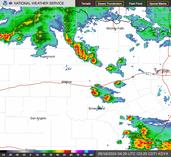
Isolated to scattered thunderstorms will continue to develop and move northeast across mainly the northern Concho Valley and Big Country this evening through early tonight.
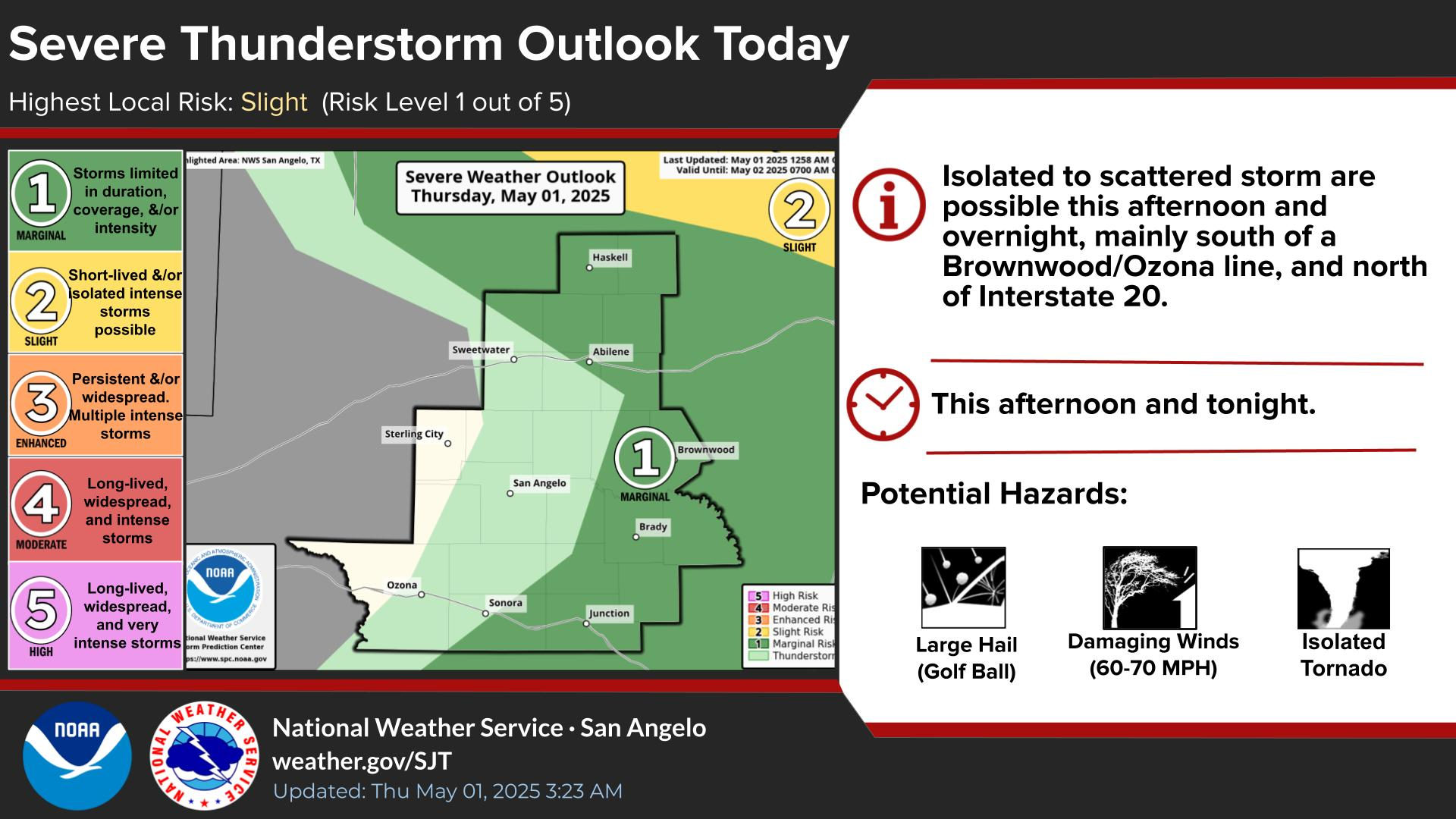
Strong to severe storms are possible Tuesday across much of the area. Areas from Sweetwater to Haskell and north have been upgraded to an enhanced risk. Very large hail, damaging winds and even a tornado are possible. Be sure you have at least two ways to receive warnings!
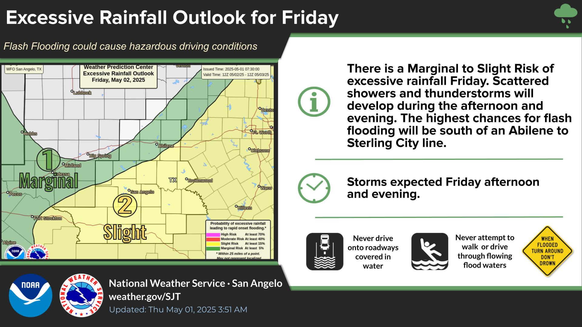
Heavy rainfall associated with afternoon and evening storms on Tuesday will pose a risk of flash flooding over the Big Country and parts of the Concho Valley.
There is a medium probability (40 to 70 percent) of 1 inch or more of rainfall in the Big Country into Wednesday. The heaviest rainfall is expected Tuesday night.


 Virtual Tour
 Current Observations
 Weather Briefing
 Satellite Loops
 Past Weather Reports
 Past Rainfall Maps
 Drought Information
 River & Lake Levels
 Fire Weather
 Aviation Weather
 Additional Resources
 Social Media