National Weather Service United States Department of Commerce

Active Pattern for the Center of the Nation

Critical fire weather conditions, severe thunderstorms capable of producing severe wind gusts, large hail, strong tornadoes and heavy rainfall remain on tap for the central U.S. this evening. Flash flooding is also possible for portions of the Plains and Mississippi Valley. Very large hail up to 3 inches in diameter will be possible this evening across western Kansas. Read More >

Overview
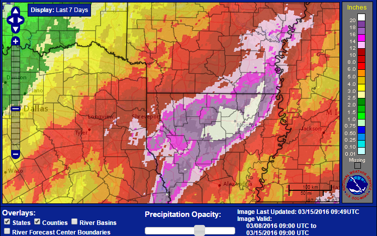
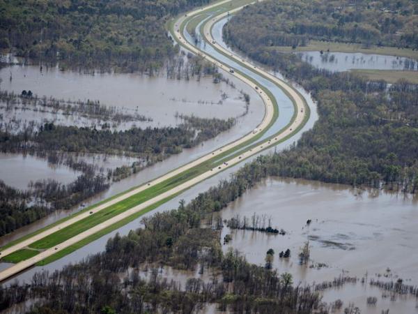
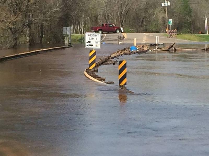
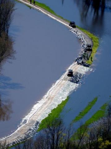
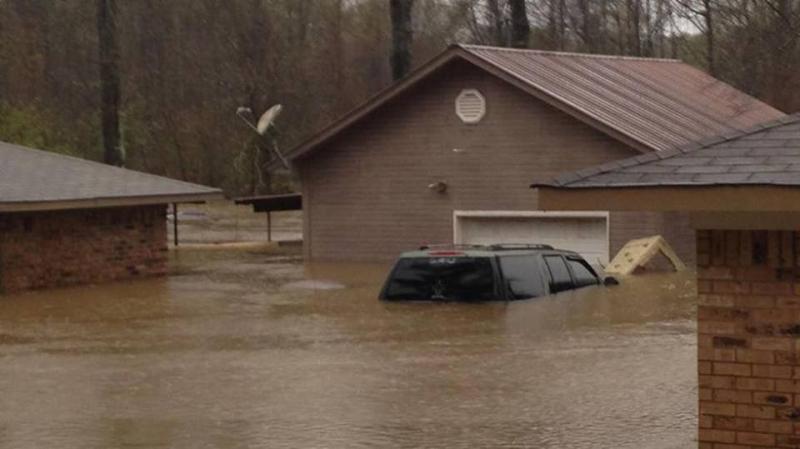
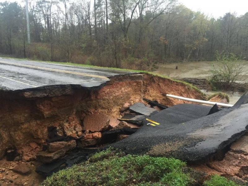
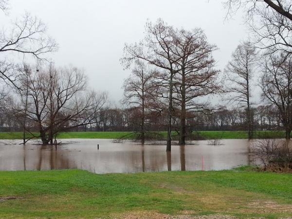
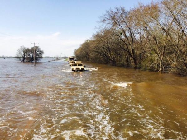
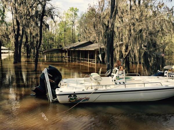
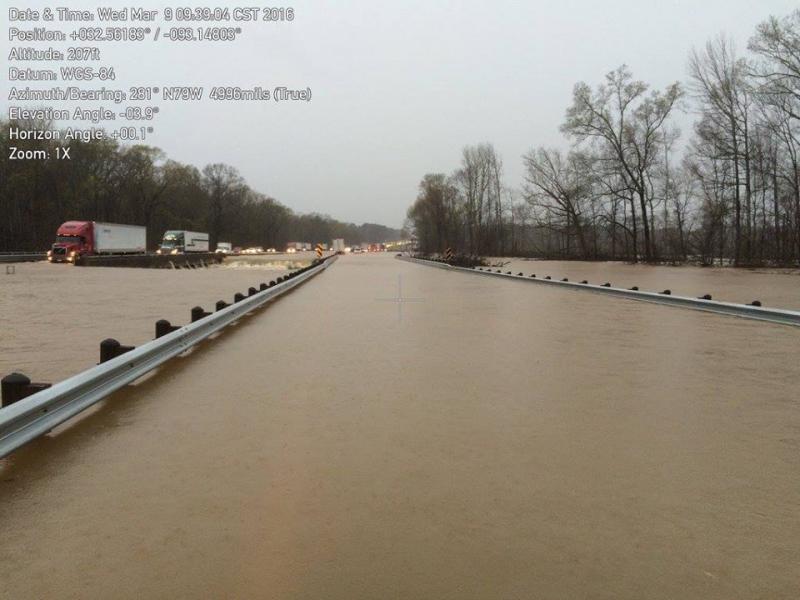
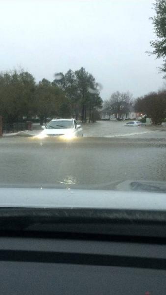
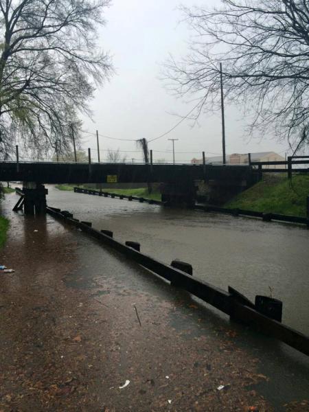
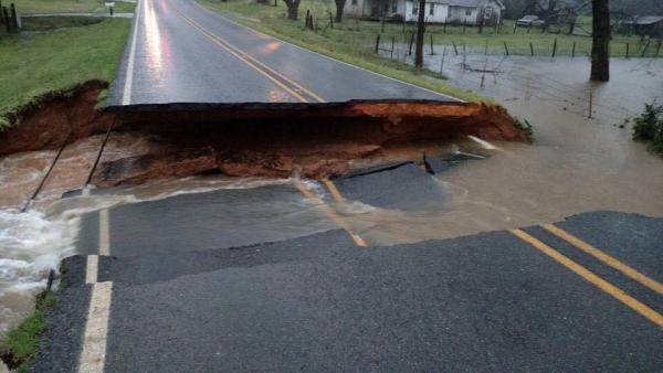
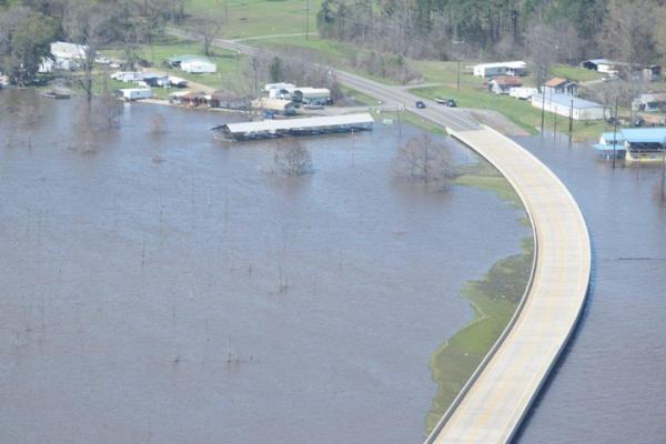
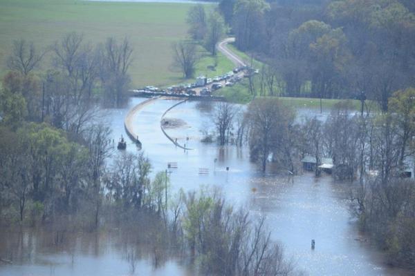
Very heavy rainfall developed during the afternoon of Tuesday March 8, 2016, and continued off and on through Saturday March 12. Rainfall amounts of over 20 inches were  recorded in a few locations before the rain ended. Many locations have experienced extreme flash flooding, particularly across East Texas and North Louisiana. Numerous roadways were flooded and closed.  Many schools across the area were closed. Numerous high-water rescues were performed. Homes and businesses were evacuated in many locations, mainly across northern Louisiana. Many historical records were broken on area rivers and lakes.
 
Preliminary Rainfall Totals from Selected Locations as of 10am, 3/11//2016
LOCATION RAINFALL AMOUNTS (INCHES) TIME OF REPORT
Taylortown (7 miles ESE of Barksdale AFB), Bossier Parish, LA 18.39 7:00am, 3/10/2016
Red River Research Station, Bossier City, Bossier Parish, LA 16.8 7:00am, 3/12/2016
Barksdale AFB, Bossier Parish, LA 18.84 7:00am, 3/12/2016
Jamestown, Bienville Parish, LA 15.72 7:00am, 3/11/2016
Koran, Bossier Parish, LA 15.35 7:00am, 3/12/2016
Center, Shelby County, TX 10.42 7:00am, 3/12/2016
1 mile N of Homer, Claiborne Parish, LA 14.66 7:00am, 3/12/2016
Minden, Webster Parish, LA 18.03 7:00am, 3/12/2016
Arcadia, Bienville Parish, LA 15.20 7:00am, 3/12/2016
Swartz, Ouachita Parish, LA 22.25 7:30am, 3/11/2016
Longview, Gregg County, TX 9.10 10:00am, 3/12/2016
Tyler, Smith County, TX 7.32 9:00am, 3/12/2016
Monroe, Ouachita Parish, LA 20.26 9:00am, 3/12/2016
Columbia Lock, Columbia, Caldwell Parish, LA 8.93 7:00am, 3/12/2016
Southern Hills, Shreveport, Caddo Parish, LA 13.14 7:00am, 3/12/2016
Natchitoches, Natchitoches Parish, LA 16.44 7:00am, 3/12/2016
Marshall, Harrison County, TX 10.76 7:00am, 3/12/2016
Carthage, Panola County, TX 11.13 7:00am. 3/12/2016
Shreveport Regional Airport, Caddo Parish, LA 11.51 9:00am, 3/12/2016
 
Rainfall totals for March 8-15, 2016.
 
Caddo Parish
  • Home on Bagley Road near the Red River.
  • Wallace Lake flooding along I-49 south of Shreveport.
  • 12 Mile Bayou flooding State Highway 530 between Oil City and I-49.
Bossier Parish
  • Red Chute Levee near Haughton.
  • Flooding in the Golden Meadows subdivision of Bossier City.
  • Flooding in Bossier Parish.
  • State Highway 157 washed out south of Highway 527.
  • Willow Chute Bayou flooding.
  • US Highway 71 flooded in South Bossier Parish.
  • Lake Bistaneau flooding.
Webster Parish and Bienville Parish
  • I-20 near Exit 55.
  • I-20 flooded near Exit 55. Photo is courtesy of LADOTD.
  • Near Dubberly, LA.
Lincoln Parish, Union Parish, and Ouachita Parish
  • River Oaks subdivision of Monroe, LA.
  • Flooding in West Monroe, LA.
  • Flooding on Highway 165 between Bastrop and Sterlington.
  • Highway 552 washed out near Downsville, LA.
Natchitoches Parish
  • Black Lake flooding near Clarence, LA.
  • Black Lake flooding near Clarence, LA.


Aerial footage of flooding in the Golden Meadows subdivision in south Bossier City. Video is courtesy of Sky Pixel LA.


Aerial footage of flooding along Red Chute Bayou in north Bossier City. Video is courtesy of Black Helmet Films.


Aerial footage of flooding at Cross Lake in Shreveport. Video is courtesy of the Twin Blends YouTube channel.