National Weather Service United States Department of Commerce
Overview
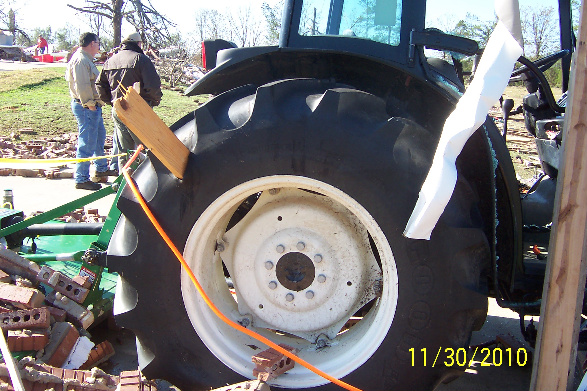
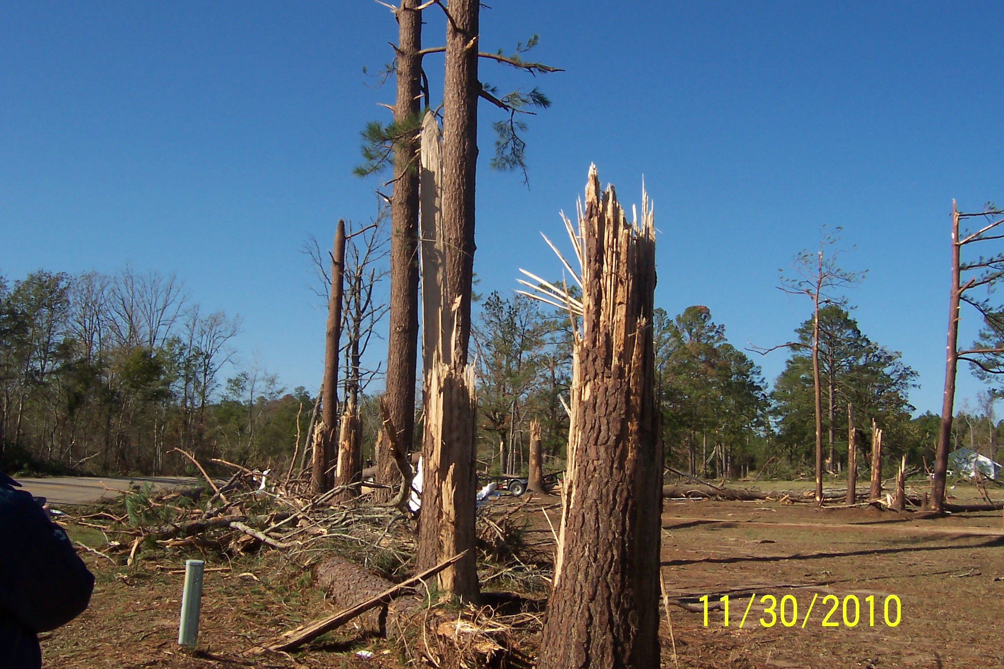
A damage survey was conducted on November 30, 2010 over portions of north Louisiana for storms that occurred on Monday November 29, 2010. Two tornado tracks were found and are summarized below.

TOTAL TORNADO COUNT = 2

EF1 = 1
EF4 = 1
 
TOR. # START POINT END
POINT
RATING PEAK WIND START TIME END TIME LENGTH/
WIDTH
FATALITIES/
INJURIES
REMARKS
#1 4 miles W of Atlanta, Winn Parish, LA 2 miles NNW of Winnfield, Winn Parish, LA EF4 170 mph 3:12pm CST 3:25pm CST 14 miles/
400 yards
None Numerous trees were snapped near the intersection of Collier and Water Well Roads. The tornado crossed Gum Springs Road, where it completely destroyed one well-built two-story brick home and an adjacent brick garage. The home was approximately 4,000 square feet in size, and its destruction was the basis of the EF4 rating.

Many of the nearby trees were snapped, with several near the home snapped of at their base. One mobile home was also destroyed, with its remnants blown into a wooded area about 300 yards away. Another nearby home was moderately damaged, while two other homes suffered only minor damage.

The tornado crossed into an open field before entering a heavily wooded area. It traveled northeast across Highways 84 and 167, where sporadic minor tree damage was observed just northwest of Winnfield.

Some of these same homes sustained damage from an EF1 tornado that moved through this area in 2008. It should also be noted that the last F4/EF4 tornado that occurred in the Four State Region occurred in Benton, LA, in 1999.
 #2 13 miles SSW of Richwood, Ouachita Parish, LA 11 miles SSW of Richwood, Ouachita Parish, LA EF1 90 mph 4:18pm CST 4:26pm CST 3.5 miles/
100 yards
None This tornado began in an inaccessible wooded area west of the Ouachita River. The tornado traveled east into an open field off of Hooter Road West, where it entered a wooded area. Numerous trees and branches were snapped. A metal awning on a home on Hooter Road East was torn off and deposited in a large open field between the home and a levee along the Ouachita River. Some shingles were also ripped of the home. Tree tops along the levee were also snapped as the tornado traveled northeast and lifted along Highway 165 in the Bosco community.
Radar image of the tornadic thunderstorm
Radar image from the Fort Polk radar approximately 2 minutes prior to the tornado crossing Gum Springs Road.
Before picture of the brick home that was destroyed
Before picture of the brick home that was destroyed.
 
After picture showing the destroyed brick home
After picture of the brick home.
 
Trees were snapped off a few feet from the ground
Trees in front of the home snapped off a few feet off the ground. A few trees to the left of this picture were snapped off at ground level.
         
A 2x4 board was embedded in a tractor tire
2x4 board through a tractor tire which was sitting in a brick garage.
 
Destroyed vegetation
Looking southwest back toward where the house was. Note the marks in the grass where the tornado tracked.
 
Trees snapped along Gum Springs Road
More trees along Gum Springs Road were snapped.
         
   
NWS meteorologist surveying the damage
Meteorologists from the NWS surveying the damage.
   
Click here to download the survey KMZ file.
This survey data is preliminary and subject to change as more information becomes available.  Road accessibility and inconsistencies between mapping and GPS software may limit the accuracy of the tracks plotted on this map. Line widths are not representative of actual tornado widths.  The information plotted on this map is intended for general reference use only.

For official post-storm information, use 
Storm Data from the National Centers for Environmental Information.
Back to Top