Numerous severe thunderstorms are expected across a broad region from the Ohio Valley to the Mid-Atlantic and Northeast States today into tonight. Swaths of damaging wind gusts are expected and some tornadoes are possible. Bertha is expected to bring tropical storm conditions to portions of the Gulf Coast from the Florida Panhandle westward to southeastern Louisiana later today and Wednesday. Read More >
| Overview | ||||||||||||||||||||||||||||||||
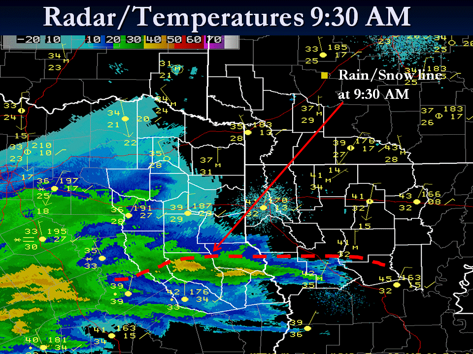
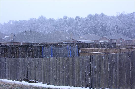
| A late-season winter storm affected portions of East Texas and Northwest Louisiana which began in the late morning and lasted through the evening of Tuesday February 23, 2010. Cold arctic air filtered into the region late Monday and early Tuesday ahead of an upper level disturbance moving out of the southwestern United States. The upper disturbance was weakening as it progressed east and was eventually phased into a larger scale upper level trough over the eastern United states. However,before it weakened significantly, there was enough lift and moisture to dump up to 4" of snow across portions of Cherokee County and northern Nacogdoches County Texas. Temperatures started the day in the mid to upper 30's across the region but slowly fell as evaporative cooling and snow falling into the warmer air cooled the lowest 1000 feet of atmosphere. Other areas in Smith, Rusk, Gregg, and Angelina Counties reported anywhere from 1-3" of snow which quickly melted due to warmer ground temperatures. Numerous accidents were reported where the heaviest snow occurred in Cherokee and Nacogdoches counties as well as several in the Tyler area. Locations in Northwest Louisiana warmed too quickly into the lower 40's during the day Tuesday and the evaporative cooling process was not enough to cool many locations to a level which would support the amounts of snow which occurred across East Texas. However, light snow and snow flurries occurred and some trace amounts of snow were reported in the Shreveport area as well as in Natchitoches Louisiana. |
|
|||||||||||||||||||||||||||||||
|
||||||||||||||||||||||||||||||||
|
||||||||||||||||||||||||||||||||
|
||||||||||||||||||||||||||||||||