| Overview | ||||||||||||||||||||||||||||||||||||||||||||||||||||||||||||||||||||||||||
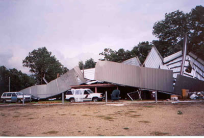
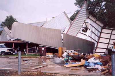
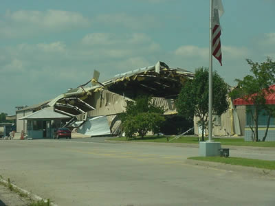
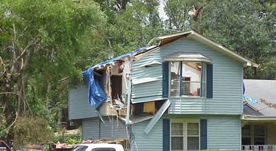
| During the very early morning hours on Tuesday, June 1, 2004, severe storms producing damaging winds and very large hail tup to the size of baseballs developed across North Louisiana and adjacent areas of East Texas along a cold front. These storms caused several trees to fall across the area and hail broke out windoes in Shreveport. Late Tuesday evening, a complex of storms developed across North Central Texas and moved east along the weakening cold front, which was located along the Interstate 20 corridor. This line of storms produced a wind gust of 59 mph at the Shreveport Regional Airport. National Weather Service storm surveys concluded all of the damage was from straight-line winds. By sunrise on Wednesday, June 2, the complex of storms that affected the area overnight had pushed east and southeast out of the area. The stalled frontal boundary across the area had dissipated, but another cold front approached. This front was located across Northern Oklahona and Northwest Arkansas Wednesday morning. A line of storms developed along this front around midday and surged southeast into the area by Wednesday evening. This round of storms affected the entire area, while the previous couple of complexes of storms had missed Southeast Oklahoma, Southwest Arkansas, and adjacent areas of Northeast Texas. The Texarkana Regional Airport recorded a 67 mph wind gust as the line of storms moved through. In the surveys conducted by National Weather Service officials, no tornadic activity was found. All of the damage appeared to be from straight-line winds with speeds up to 85 mph or higher in spots. These rounds of thunderstorms brough widespread wind damage in the form of thousands of broken, snapped, or uprooted trees across the area. There were some homes and buildings damaged by the strong winds, and some were damaged by falling trees. There were also reports of large hail, generally up to the size of quarters, except for the hail that occurred just after midnight on June 1st. There was one fatality in Franklin County, TX, where a man was killed when a tree fell on his mobile home. Interstate 30 in Hempstead and Nevada Counties was closed for a time due to overturned trucks blocking the road. Two people were reported injured with the overturned trucks. Two other people in Hempstead County were injured when a car hit a downed tree. In Shreveport, a young boy was hurt when a tree fell on the bedroom where he was sleeping. There were thousands of homes and business without electrical power, some for several days, due to trees knocking down power lines. This was one of the largest power outages across Northwest Louisiana and adjacent areas of East Texas since the December 2000 ice storm. |
||||||||||||||||||||||||||||||||||||||||||||||||||||||||||||||||||||||||||
|
Graphics
Photos
|
||||||||||||||||||||||||||||||||||||||||||||||||||||||||||||||||||||||||||
| Back to Top | ||||||||||||||||||||||||||||||||||||||||||||||||||||||||||||||||||||||||||