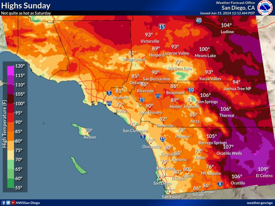
Heading to the beach to escape the heat? Make sure to look at the surf forecast before you choose a beach. Always swim near a lifeguard.
By Wednesday afternoon, a much higher amplitude swell associated with Hurricane Genevieve will reach Southern California and create high surf with sets up to 11 feet possible along south and southwest facing beaches.


 San Diego Radar
 Santa Ana Radar
 Satellite
 Weather Stats