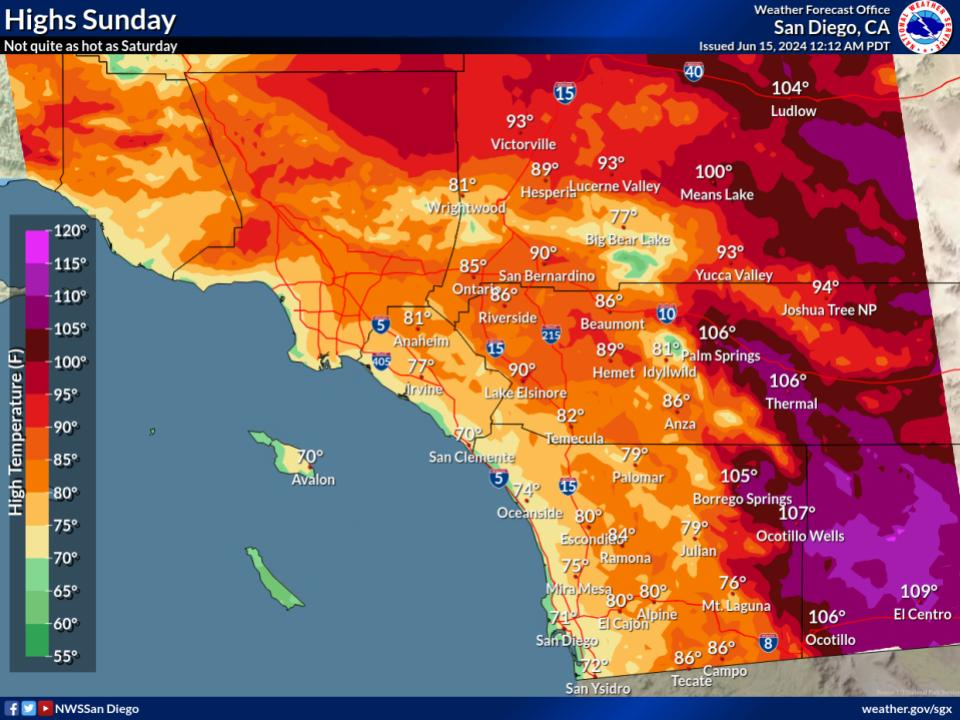
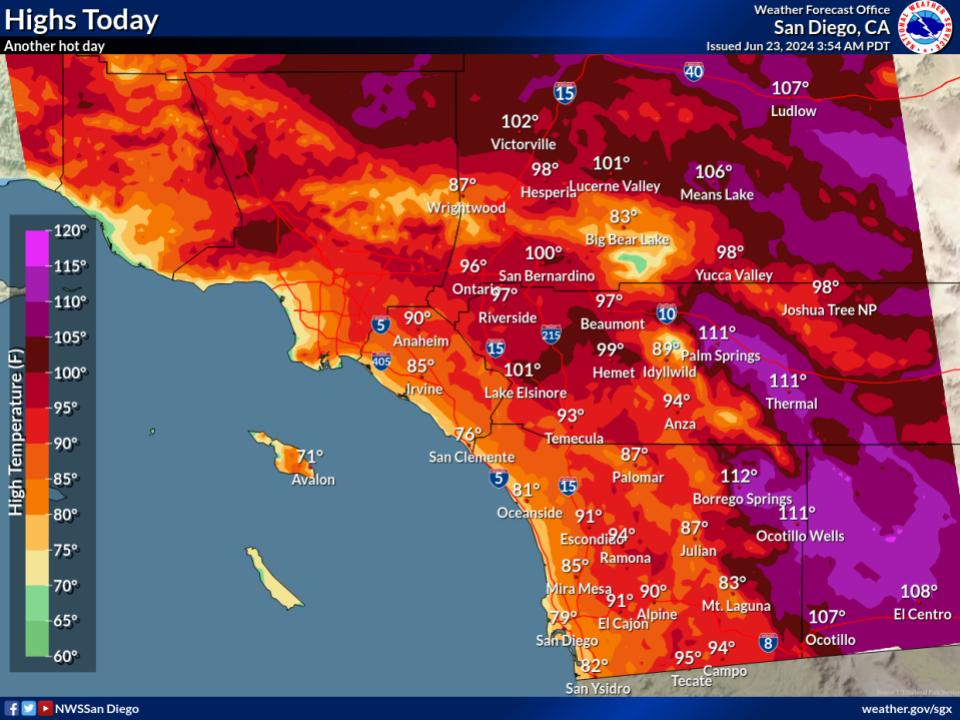
Saturday will be the hottest days for most locations. Highs 5 to 10 degrees above normal for coastal areas will create moderate HeatRisk. Highs 6 to 14 degrees above normal for inland areas will create moderate to major HeatRisk (locally extreme HeatRisk in the low deserts).


 San Diego Radar
 Santa Ana Radar
 Satellite
 Weather Stats