Blacksburg, VA
Weather Forecast Office
Overview
|
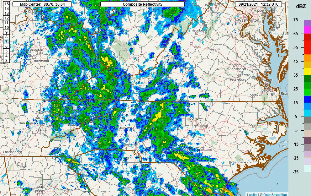
Tropical moisture left over from TS Nicholas combined with a deep southeast flow, and a cold front, brought several rounds of steady to heavy rains to most of the area Sept 21st through the 22nd. Highest rainfall amounts of 4 to 8" fell in a corridor from Mount Airy to Danbury, NC, north through the Blue Ridge of Virginia, the New River Valley, and the Southern Shenandoah Valley. Most of this rain fell within a 48 hour period, and some of the heavier bands produced 3+ inches in less than 3 hours.(See rainfall total image to the right) Flash flooding occurred during the morning of the 22nd across portions of Surry County, NC, and during the afternoon and evening of the 22nd over portions of the Virginia foothills and mountains north and east of Roanoke. Due to recent dryness, the flooding was not widespread. |
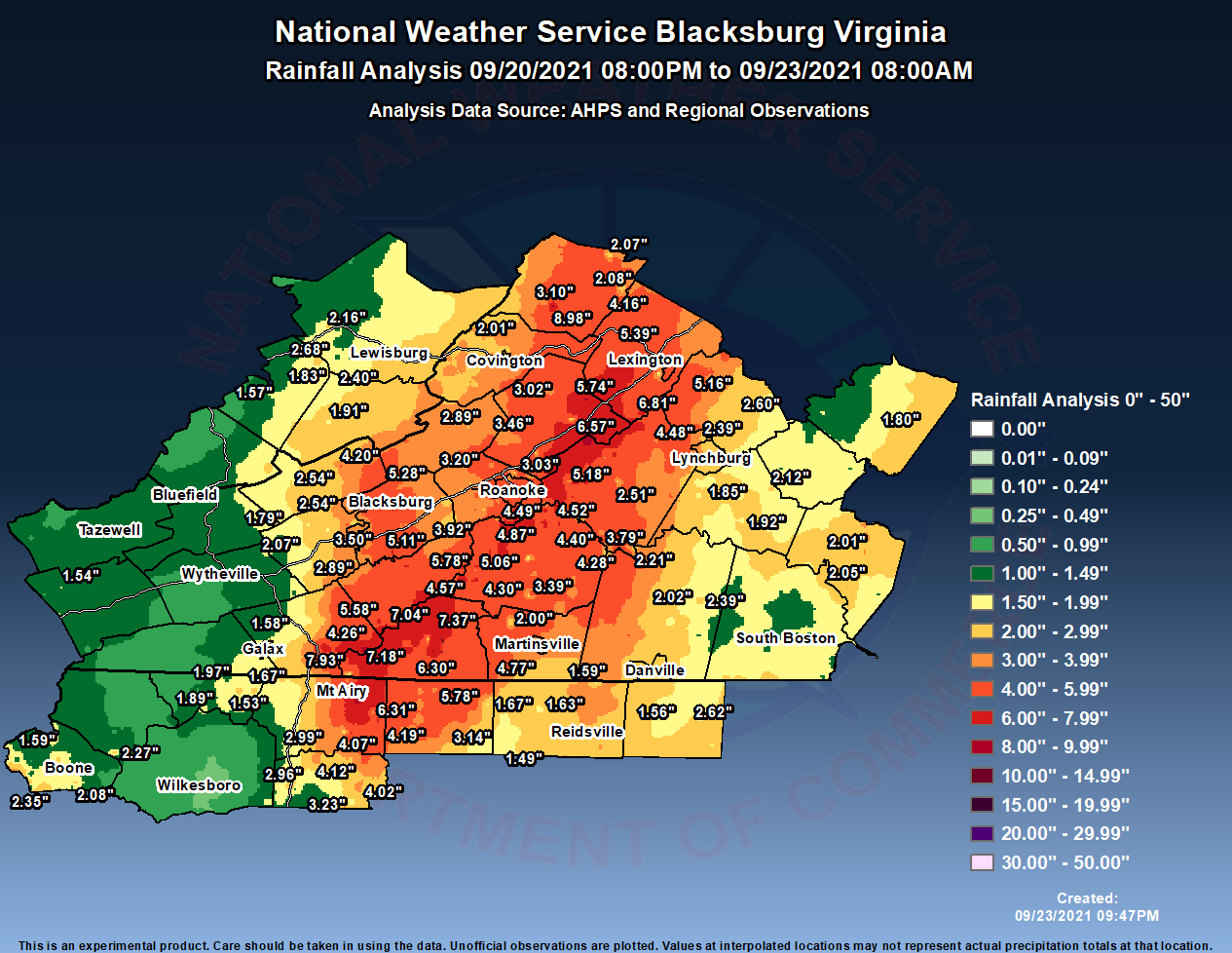 Rainfall Analysis from Sept 21-23rd, 2021 |
 |
 |
 |
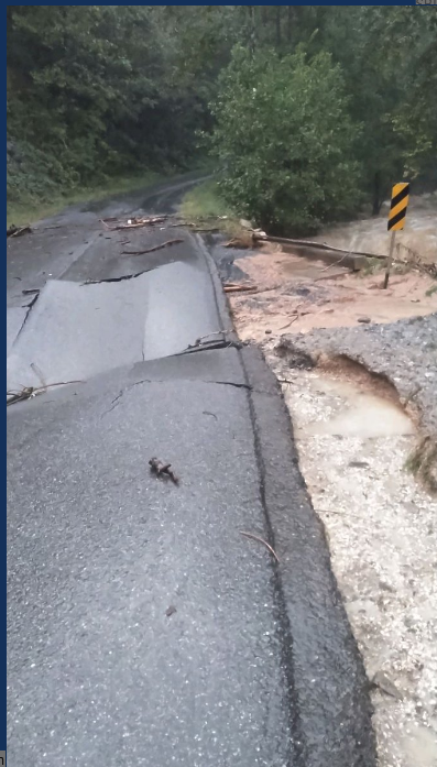
| Hourly radar loop from Sep 21-22nd | Indian Rock Road Collapsed by Renick Run near Buchanan, VA (credit: Laura Burks) |
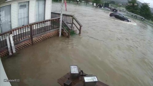
Flooding in Montvale, VA along U.S. 460 (credit: Angie Rizzo) |
 |
Media use of NWS Web News Stories is encouraged! Please acknowledge the NWS as the source of any news information accessed from this site. |
|
Current Hazards
Severe Weather
Winter Weather
Flooding
Local Storm Reports
Drought Conditions
Current Conditions
Air Quality
Observations List
Observations Map
Upper Air Soundings
Forecasts
Bufkit Data
Fire Weather
Spot Forecasts
Air Quality Forecast
National Graphical Forecast
Aviation Forecasts
Hydrology
River Observations (Map)
River Forecasts (Map)
Current and Past Streamflow
Excessive Rainfall Outlooks
Experimental Long-Range Flood Risk
Climate/Past Weather
Climate Information
CoCoRaHS
Precipitation Estimate (Click Enabled)
Snow and Ice Information (Click Snow and Ice)
Past Events
Weather Extremes / Top 10s
Citizens Weather Observing Program (CWOP)
Tropical Cyclone Reports
US Dept of Commerce
National Oceanic and Atmospheric Administration
National Weather Service
Blacksburg, VA
1750 Forecast Drive
Blacksburg, VA 24060
540-553-8900
Comments? Questions? Please Contact Us.

