Dangerous, record-breaking heat will intensify across most of the central and eastern U.S this week. Heat indices will likely exceed 100 degrees. Severe thunderstorms are forecast from parts of the central High Plains into the Upper Midwest, and across parts of the Northeast. Critical fire weather conditions will continue across portions of the Four Corners and Great Basin. Read More >
…Wyoming February 2018 precipitation was 135 to 145 percent of average...
...Current water year precipitation is averaging 95 to 105 percent of normal across Wyoming…
…Mountain snowpack across Wyoming is 110 to 120 percent of median...
…Near normal (95 to 105 percent) snowmelt streamflow volumes are still expected across Wyoming during the upcoming snowmelt runoff season…
…Wyoming reservoir storages remain at 115 to 125 percent of average for March…
February 2018 precipitation totals across Wyoming were 135 to 145 percent of average. Precipitation numbers varied between 206 percent of normal over the Belle Fourche Drainage (extreme northeast Wyoming) to near 87 percent of average over the Sweetwater/Lower North Platte Watershed (central Wyoming). Current water year (October 2017 - February 2018) precipitation across Wyoming is averaging 95 to 105 percent of average.
Mountain snowpack across Wyoming remained at 110 to 120 percent of median by early March. Snowpack "water" numbers and/or SWEs were the highest across basins in northwest to north central Wyoming—varying between 125 to 160 percent of median. SWEs across basins in southern Wyoming remained at 70 to 100 percent of median.
Near normal (95 to 105 percent) snowmelt streamflow volumes are expected across Wyoming during the upcoming snowmelt runoff season. Above average (>120 percent) streamflow volumes are still forecasted across portions of the Wind, Bighorn, Shoshone, and Upper Yellowstone Watersheds. The Tongue, Lower Green, Upper North Platte, and Little Snake Basins are still expected to have below to near normal streamflow volumes during the upcoming snowmelt runoff season.
Reservoirs storages across Wyoming remained above average at 115 to 125 percent for March.
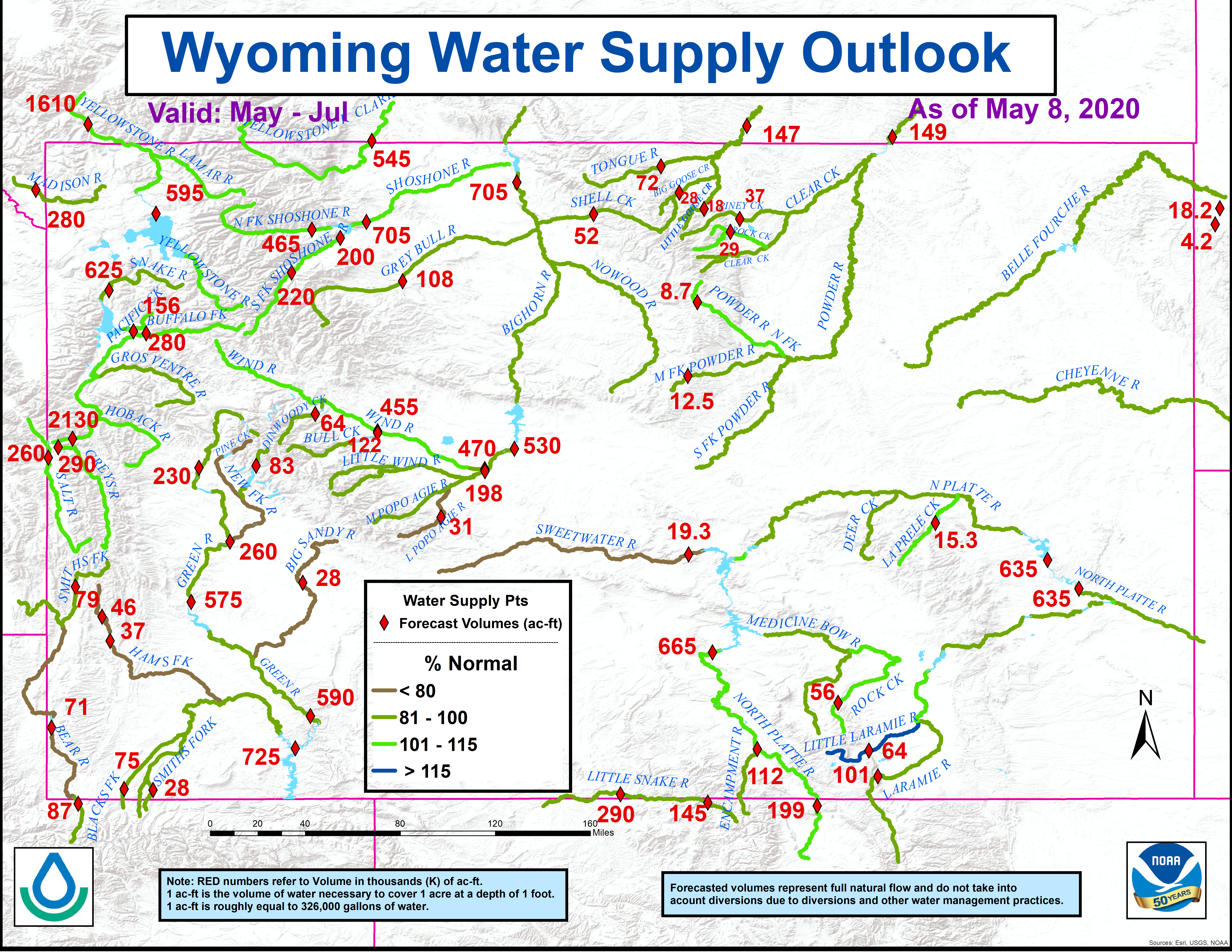
The latest Wyoming water supply outlook graphic: