Western and Central Wyoming
Weather Forecast Office
--Late February snowpack and/or SWEs were above average (105 to 115% of median) across almost all major basins in Wyoming. The highest SWEs were over the Big Horn Mountains and the Sierra Madre Mountains (southern Wyoming).​
--Above average snow depths across western Wyoming.
--Above average soil moisture percentages across basins in northeastern Wyoming and potions of the Wind River Basin; below average soil moisture percentages across southern Wyoming.
--Widespread pine bark beetle damage (2010-2018) across the Upper North Platte, Little Snake, Laramie, and Wind River Basins.
--No significant precipitation trends during the spring runoff season (May – July). Above average temperatures are expected across central to western Wyoming during the runoff season.
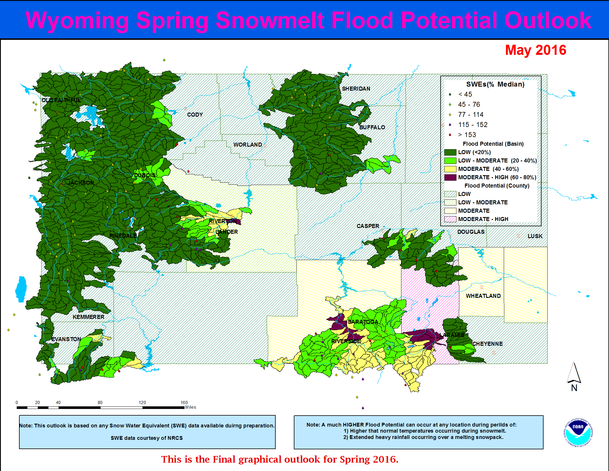
…Low to Moderate potential for snowmelt runoff flooding is forecasted along the portions of the Laramie and the Salt River Basins (far western Wyoming)…
…All other of headwater basins across Wyoming can expect a generally Low potential for flooding due to springtime snowmelt runoff...
The current Wyoming Spring 2020 Snowmelt Runoff Flood Potential Outlook graphic:

Forecasts
Severe Weather
Forecast Discussion
User Defined Forecast
Fire Weather
Activity Planner
Hourly Forecasts
Snow and Avalanche
Aviation Weather Decision Support
Hydrology
Rivers and Lakes
SnoTel Page
Weather Safety
NOAA Weather Radio
Preparedness
SkyWarn
StormReady
US Dept of Commerce
National Oceanic and Atmospheric Administration
National Weather Service
Western and Central Wyoming
12744 West U.S. Hwy 26
Riverton, WY 82501
307-857-3898
Comments? Questions? Please Contact Us.

