
Heavy to excessive rainfall is forecast over north Texas into Oklahoma Tuesday. Locally catastrophic flooding will be possible across portions of southwest Oklahoma. Flood Watches have been issued. Scattered severe thunderstorms are possible within a broad swath from the lower Great Lakes to the southern High Plains Tuesday afternoon into the evening. Read More >
***While this page highlights the burn scar associated with the Roosevelt Fire, these impacts can occur down slope and/or downstream of any burn area, big or small. Please contact local officials if you are unsure of your risk.***
|
Greatest Risk Area
Creeks / Streams Impacted
Other Impacted Areas
|
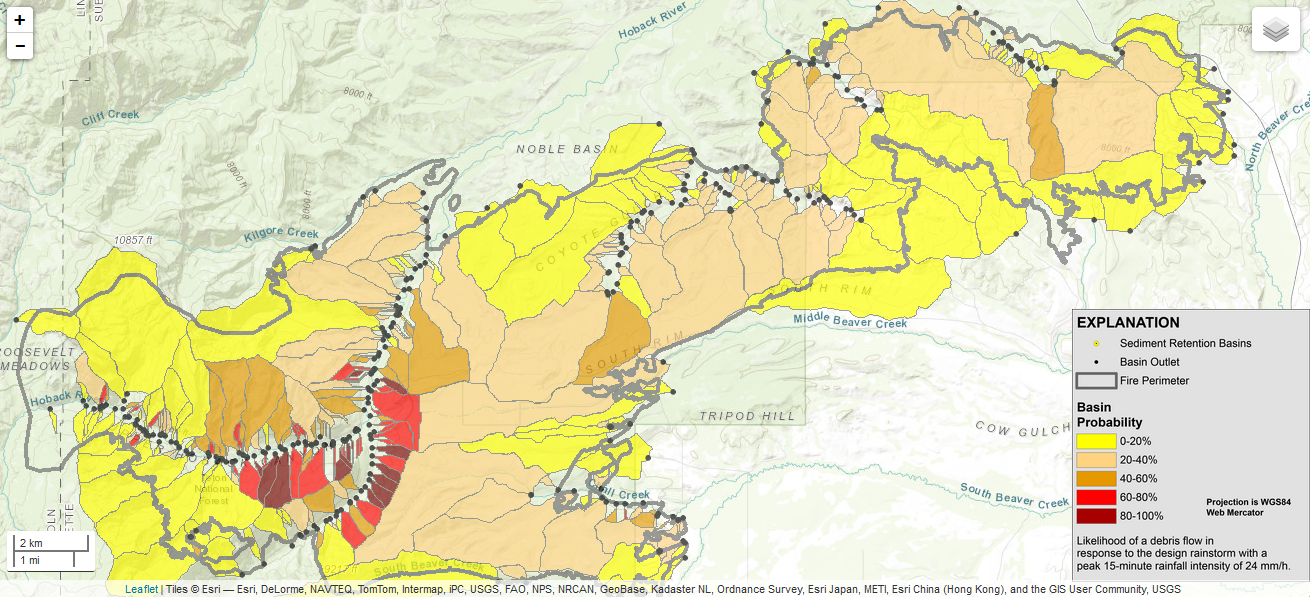
Click map above for close-up picture. Visit this link for a complete What should people who live near burn areas do to protect themselves from potential Flash Flooding and Debris Flows?
|

