
High winds and very dry conditions will bring extremely critical fire weather over a large part of New Mexico today. Red Flag and High Wind Warnings have been issued. Isolated to scattered severe thunderstorms may produce large to very large hail and localized damaging winds late this afternoon into evening from the eastern Central Plains to the Upper Midwest. Read More >
Links | Map | Warnings, Radar, & Satellite | Fire & Thunder Forecasts
Outlooks and Climate| Fuels and Fire Danger Maps
 |
||
|
||
| Richard Mountain Inciweb Page | ||
| WFO Riverton Fire Weather Page | ||
| Fire Weather Planning Forecast For Zone 279 (Wyoming) | ||
| Fire Weather Planning Forecast For Zone 485 (Utah) | ||
| Facebook Richard Mountain Fire Information | ||
| Click Boxes to Expand Product on Page | ||
|
||
Current Warnings, Radar, and Satellite
(Click thumbnails to expand Images)
 |
|
|
|
| Pictures from the Richard Mountain Fire | ||
 |
 |
|
|
Photo from InciWeb.com |
Photo from InciWeb.com |
|
<
|
|
|
|
|

|

|

|
 |
|
|
|
|
|
|
Storm Prediction Center Critical Fire Areas and Thunderstorm Forecasts
(Click thumbnails to expand Images)
|
|
|
|
 |
 |
 |
|
|
Day 2 Categorical | Day 3 Categorical |
 |
 |
 |
|
|
|
|
|
|
 |

|
 |
 |
 |
|
|
|
|
|
|
 |

|
 |
 |
 |
Weather Outlook and Climate Information
(Click thumbnails to expand Images)
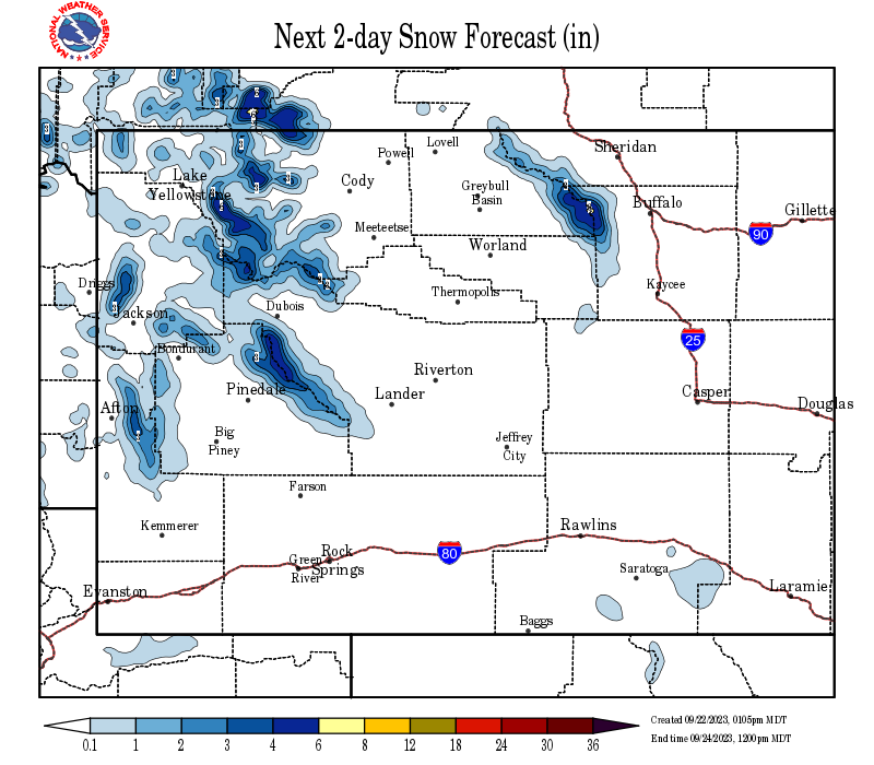
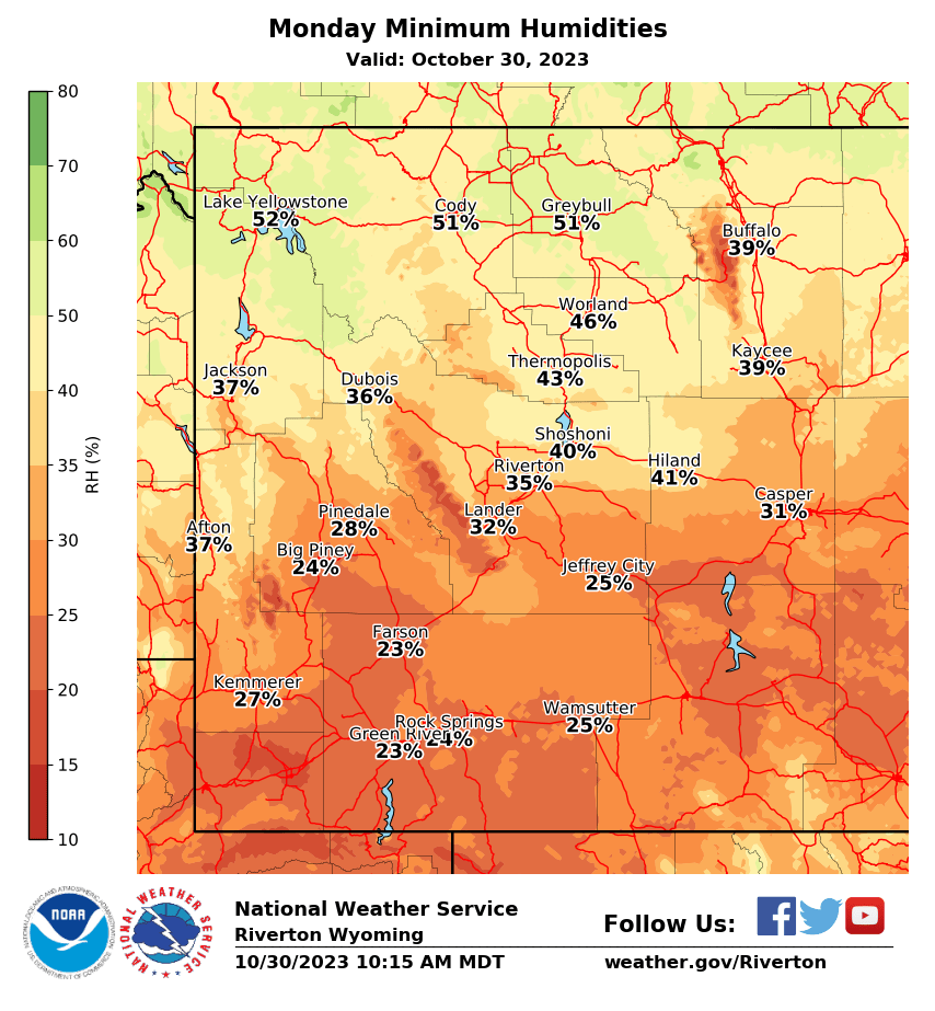
| Local Precipitation, Wind, and Humidity Information (NWS) |
|
|
|
|
|
 |
 |
 |
 |
|
|
|
|
|
 |
 |
 |
 |
|
|
|
|
|
|
|
 |
 |
 |
 |
|
|
|
|
|
 |
 |
 |
 |
USFS Fire Danger Graphics and Fuels
(Click thumbnails to expand Images)
|
|
|
|
 |
 |
 |
|
|
|
|
|
 |
 |
 |
 |
|
|
|
|
|
 |
 |
 |
 |
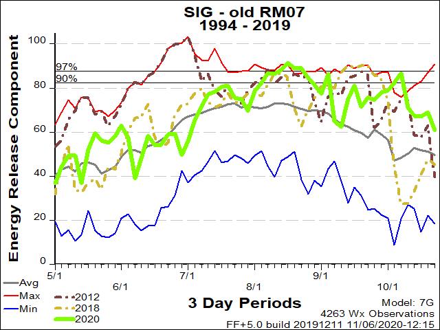
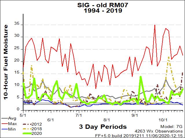
| RM07 ERC Fuels Graph |
|
|
 |
 |
 |
Return to NWS Riverton Homepage
 |
Building a Weather-Ready Nation |


