
Widespread strong thunderstorms with damaging winds and locally heavy rain are expected across portions of the Ohio Valley into southern Mid-Atlantic and Carolinas. Rounds of strong thunderstorms are expected to develop across the northern and central Plains. Sweltering heat remains most persistent across the South-Central Plains and Lower/Middle Mississippi Valley through next week. Read More >
Western and Central Wyoming
Weather Forecast Office
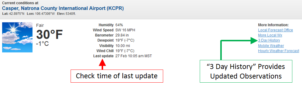
Problems continue with old weather observations displaying on NWS weather forecast pages. This issue seems to be more intermittent than past days, but it still does exist. National Weather Service officials continue to troubleshoot the cause of this problem on a national level. We apologize for the inconvenience. The graphic below shows where you can look to see if the displayed observation is current. If the time/date step is not current, please click on "3 Day History" for an up-to-date observation listing.
 |
Forecasts
Severe Weather
Forecast Discussion
User Defined Forecast
Fire Weather
Activity Planner
Hourly Forecasts
Snow and Avalanche
Aviation Weather Decision Support
Hydrology
Rivers and Lakes
SnoTel Page
Weather Safety
StormReady
NOAA Weather Radio
Preparedness
SkyWarn

US Dept of Commerce
National Oceanic and Atmospheric Administration
National Weather Service
Western and Central Wyoming
12744 West U.S. Hwy 26
Riverton, WY 82501
307-857-3898
Comments? Questions? Please Contact Us.


 Follow us on X
 Follow us on Facebook
 Follow us on YouTube
 RIW RSS Feed