
Strong to severe thunderstorms may produce heavy to excessive rainfall over portions of the Central/Southern Plains and Mississippi Valley today. There is a Slight Risk (Level 2 of 4) for Excessive Rainfall and a Slight Risk (Level 2 of 5) for severe thunderstorms today. Elevated fire weather conditions are possible over parts of western Florida today. Read More >
Summary | Forecast | Travel Center | Monitoring & Reporting | Safety
SYNOPSIS:
Fire Danger Transitioning to A Cold and Wet Pattern Sunday
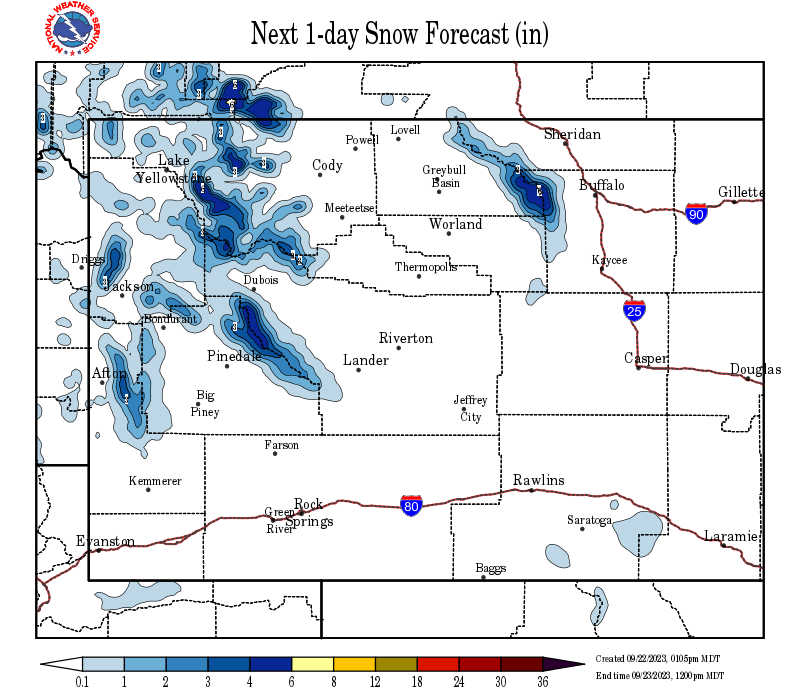
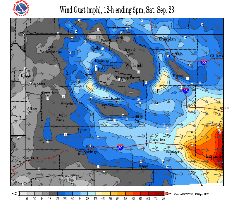
A cold front will move through on Saturday and will shift winds to the west behind the front, with wind gusts over 25 mph expected across the state, and a few wind gusts exceeding 45 mph in the Cody Foothills. It will be dry and warm ahead of the front, increasing fire danger in the low elevation grasses. Today is NOT a good day to burn anything outside, especially along the Cody foothills, and from South Pass to Kaycee, including the Casper area each afternoon.
Click Here for forecasts and tips related to safe agricultural burning
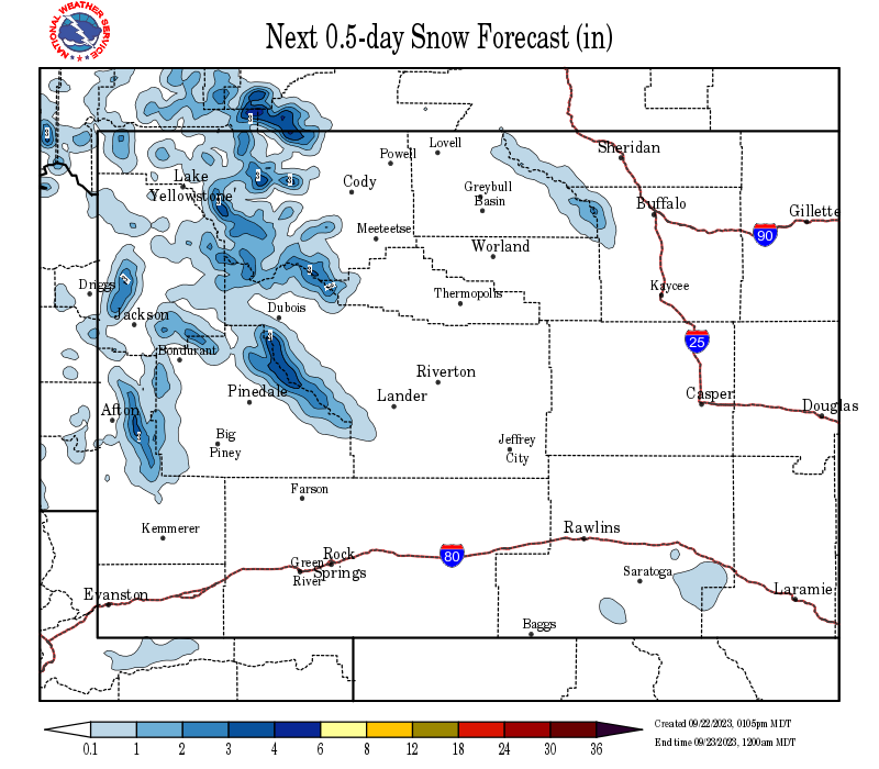
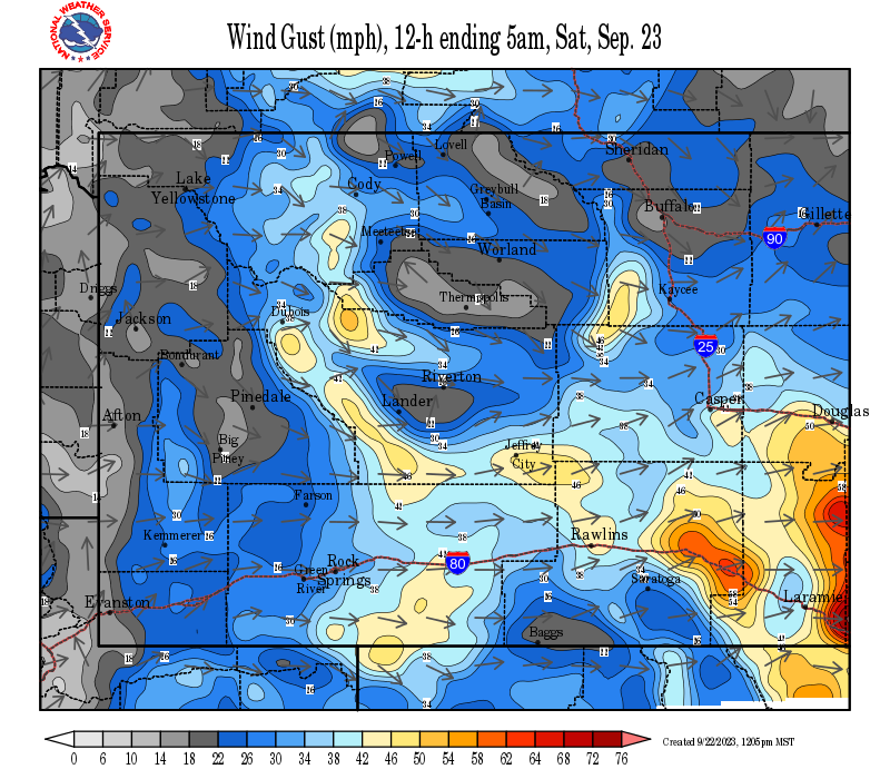
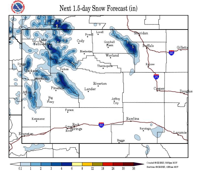
Rain and snow will increase across the western mountains and valleys on Sunday, spreading east of the Divide on Monday. The airmass moving in on Monday will be cold enough to produce mainly snow on both sides of the divide, with a measurable snow possible just about anywhere. A cool and wet pattern will persist through the week next week.
IMPACTS:
 |
|
Click Image To Enlarge |
 |
|
Click Image To Enlarge Don't forget to spring your clocks forward one hour Saturday night or Sunday morning, as Daylight Savings Time ends at 2 AM Sunday. |
|
|
|
|
|
|
|
|
High Wind Statement |
|
Snow and Wind Forecasts - Update Every 3 Hours
 |
 |
|
12 Hour Snow Accumulation Forecast |
12 Hour Peak Wind Gusts |
 |
 |
|
24 Hour Snow Accumulation Forecast |
12-24 Hour Peak Wind Gusts |
 |
 |
|
36 Hour Snow Accumulation Forecast |
24-36 Hour Peak Wind Gusts |
Summary | Forecast | Travel Center | Monitoring & Reporting | Safety
|
|
|
|
|
|
|
|
|
 |
 |
 |
 |
|
|
|
|
|
 |
 |
 |
 |
|
|
|
|
|
|
|
 |
 |
 |
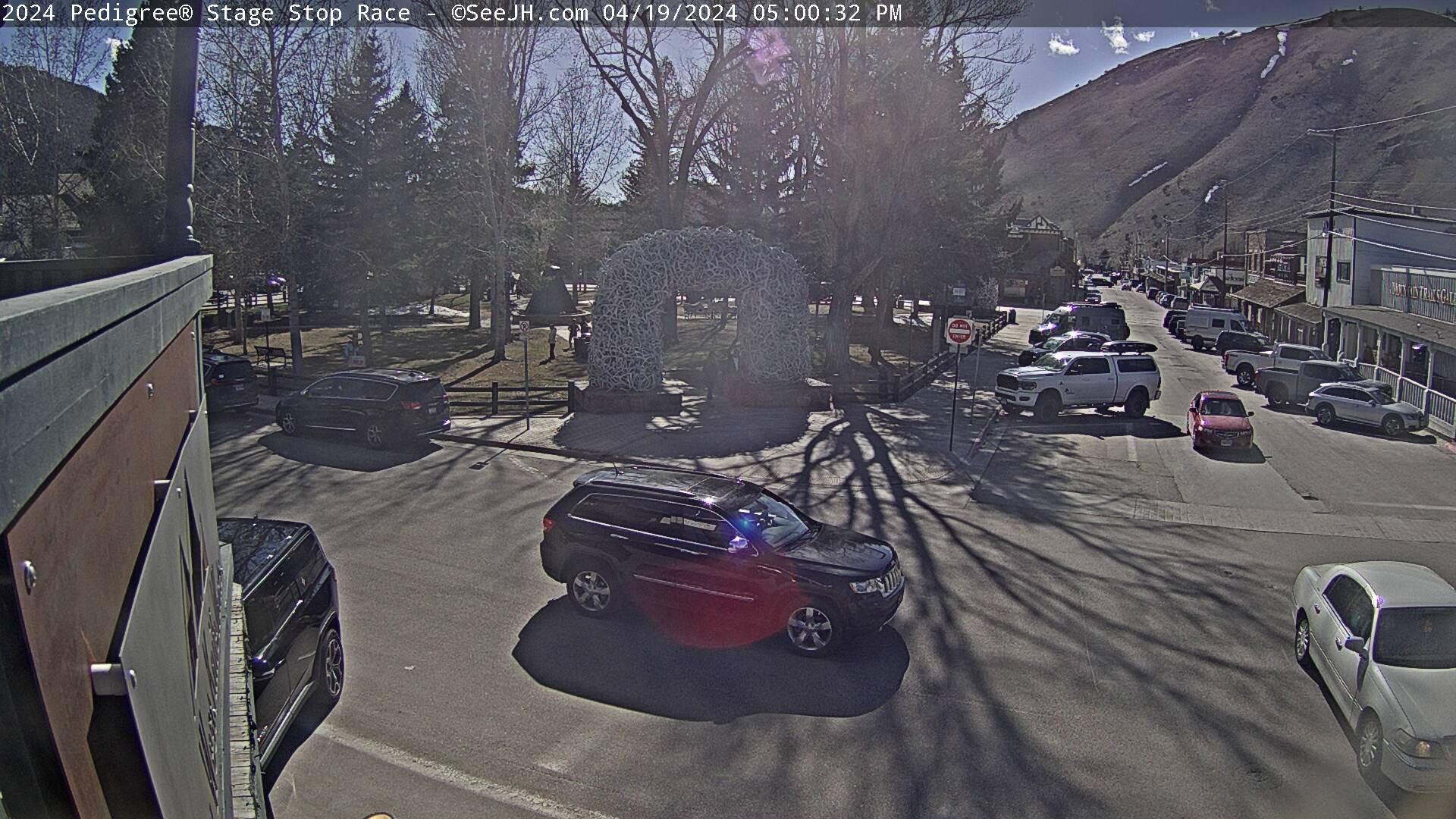
Click Here to See All Webcams (New Window)
If you plan to travel, we recommend checking road conditions along your route and staying on top of road closures here. If you are on Twitter, follow the hashtag: #WyoRoad (or look below) for the latest weather affecting roads and road conditions in and around Wyoming.
| Tweets by @NWSRiverton | #WyoRoad Tweets |
|
Get the play-by-play on this storm and contribute your own snow reports to #wywx |
On the road? Tweet road conditions to #WyoRoad! |
 |
 |
|
Winter Terminology |
Snow Plow Safety |
 |
 |
|
Prepare You and Your Car Before Traveling |
Always Have A Winter Survival Kit In Your Car |
 |
 |
|
Remember Proper Winter Driving Tips |
Stay In Your Vehicle If Stranded |

Summary | Forecast | Travel Center | Monitoring & Reporting | Safety
PLEASE SEND US YOUR SNOW REPORTS (CLICK HERE)
 |
Monitor our Severe Weather Summary Page for current Warnings, Watches, and Advisories. What's the difference? |
 |
Check the latest Weather Story graphic for an overview of the area forecast. |
 |
Check out what's on the radar. Riverton | Pocatello | Cheyenne | Billings | Salt Lake City | Rapid City | Mosaic |
 |
Submit storm reports/images and keep up to date with us on Facebook! |
 |
Submit storm reports/images and keep up to date with us on Twitter! |
 |
Other reporting methods include submitting an online report, email (cr.wxriw@noaa.gov), or by phone at 1-800-211-1448. |
 |
Check the latest Public Information Statement for the latest storm reports. |
 |
Monitor current road conditions by visiting the Wyoming Dept. of Transportation (WYDOT) or by calling 5-1-1. |
Summary | Forecast | Travel Center | Monitoring & Reporting | Safety

Winter Safety Kit | Winter Weather Safety
 |
Learn more about the National Weather Service's efforts to build a Weather-Ready Nation! |