
Thunderstorms, some severe, may produce heavy to excessive rainfall and isolated flooding over portions of the Southern Plains through Saturday. Widespread showers and thunderstorms will spread east into the Great Lakes, Ohio Valley, Mid Atlantic and Northeast. Dry conditions, combined with gusty winds will continue to support an elevated fire weather threat in the Desert Southwest. Read More >

Early Spring Storm System To Impact Central Wyoming
A low pressure system over the central high plains will bring upslope flow and snow or a rain and snow mix across much of central Wyoming today. Some roads may become slushy and slick in the basins, while mountain passes will likely be snow-covered with limited visibility in snow and blowing snow at times.
What/When: Snowfall will begin Saturday morning, and continue through late Saturday evening. Moderate snowfall accumulations are expected above 6000 feet, with increased wind creating blowing snow over mountain passes.
Amounts / Intensity:
Natrona County: 2-4 inches with higher accumulations possible south of Casper. 4-6 inches possible over Casper Mountain. Areas of northeast wind 10 to 20 mph with gusts to 30 mph.
Johnson County: 1 to 3 inches. North wind 15 to 20 mph with gusts 30 to 35 mph.
Fremont County: 1-3 inches. 4-8 inches over the eastern slopes of the Wind River Mountains, including the South Pass area. Northeast wind 20 to 30 mph causing blowing snow and limited visibility over South Pass.
Absaroka Mountains: 4-8 inches, with the highest accumulations anticipated over the southern half the the mountain range. Blowing snow will be possible with gusty wind expected Saturday afternoon.
General Impacts:
 |
Blowing snow can create periods of limited visibilities on mountain passes through the event. |
 |
Those with outdoor recreation plans should monitor current weather conditions. Dress in layers if heading outdoors, and avoid overexertion. |

Here are the latest graphics for winter weather advisories and snow amounts through Saturday evening. (click for a larger view):
 |
 |
|
|
|

Want to track the storm? Here are the local and regional radar loops:
 |
  |

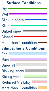
Latest WYDOT Road Information Map
 |
|
|
Twitter: www.twitter.com/NWSRiverton Facebook: www.facebook.com/NWSRiverton |
| Webcams - Click on Image to Enlarge (For the main Webcam-by-Route Page >> Click Here) |
|||
|
|
|
|
|
 |
 |
 |
 |
|
|
|
|
|
 |
 |
 |
 |
|
|
|
|
|
 |
 |
 |
 |
Here are some additional links to help monitor the winter weather:

