Multiple corridors of severe thunderstorms are expected across the Upper Midwest on Monday into Monday night, with a regional severe weather outbreak possible. The most dangerous period is likely during the late afternoon and evening when strong tornado potential should be maximized. Scattered large to very large hail and damaging winds are likely as well. Read More >
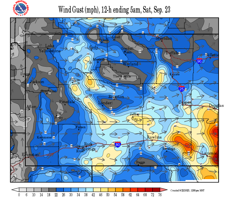
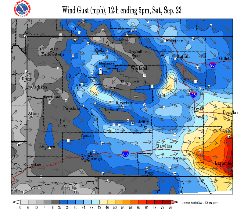
SYNOPSIS: A strong surface pressure gradient and strong winds aloft will create the potential for high winds for the Cody Foothills and the Absaroka Mountains for Sunday night through Monday morning. A high wind warning is in effect from Sunday 5 pm through Monday at 5 am. Wind speeds of 40 mph with gusts to 65 mph are expected in the Cody Foothills, with gusts as high as 75 mph possible around Chief Joseph Highway.
GRAPHICAST
 |
|
Click Image To Enlarge |
|
|
|
High Wind Warning |
|
Wind Forecasts - Update Every 3 Hours
 |
|
12 Hour Peak Wind Gusts |
 |
|
12-24 Hour Peak Wind Gusts |
 |
|
24-36 Hour Peak Wind Gusts |
Summary | Forecast | Travel Center | Monitoring & Reporting
|
|
|
| Tweets by @NWSRiverton | #WyoRoad Tweets |
|
Get the play-by-play on this wind storm and contribute your own wind gust reports to #wywx |
On the road? Tweet road conditions to #WyoRoad!
|

Summary | Forecast | Travel Center | Monitoring & Reporting
PLEASE SEND US YOUR WIND REPORTS (CLICK HERE)
 |
Monitor our Weather Summary Page for current Warnings, Watches, and Advisories. What's the difference? |
 |
Check the latest Weather Story graphic for an overview of the area forecast. |
 |
Check out what's on the radar. Riverton | Pocatello | Cheyenne | Billings | Salt Lake City | Rapid City | Mosaic |
 |
Submit storm reports/images and keep up to date with us on Facebook! |
 |
Submit storm reports/images and keep up to date with us on Twitter! |
 |
Other reporting methods include submitting an online report, email (nws.riverton@noaa.gov), or by phone at 1-800-211-1448. |
 |
Check the latest Public Information Statement for the latest storm reports. |
 |
Monitor current road conditions by visiting the Wyoming Dept. of Transportation (WYDOT) or by calling 5-1-1. |
 |
Get current road conditions, web camera images, road alerts, and much more on your mobile device by downloading the Wyoming 511 Mobile App. |
 |
Learn more about the National Weather Service's efforts to build a Weather-Ready Nation! |