National Weather Service United States Department of Commerce

Severe Thunderstorms and Heavy Rain in the Southern Plains; Fire Weather Threat in the Southwest U.S.

Thunderstorms, some severe, may produce heavy to excessive rainfall and isolated flooding over portions of the Southern Plains today and Saturday. Dry conditions, combined with gusty winds and low relative humidities will continue to support an elevated to critical fire weather threat in the Desert Southwest into to early next week. Read More >

Links | Map | Warnings, Radar, & Satellite | Fire & Thunder Forecasts
Outlooks and Climate| Fuels and Fire Danger Maps

Fire Weather Banner
Useful Links
Fishhawk Fire Inciweb Page            Stink Water Inciweb Page
WFO Riverton Fire Weather Page
Fire Weather Planning Forecast For Zone 286
Park County Sheriff's Office Facebook Page
Park County Emergency Management Page
U.S. Forest Service Shoshone National Forest Facebook Page
Click Boxes to Expand Product on Page
Cody Airport
Observations
Eagle (RAWS)
Observations

Surrounding
Wyoming
Observations

Hourly Weather Graph with
Fire Weather Parameters
Hourly Tabular Forecast with
Fire Weather Parameters
Spot Forecast
Monitor
Page
Area Forecast Discussion National Fire Weather Page
 
 
Wildfire Map Location
Yellow outline is the fire perimeter as of 9/06 - Total  11,130 acres

Click image to enlarge


Current Warnings, Radar, and Satellite

(Click thumbnails to expand Images)

 
Most Recent Fire Weather Watch/Red Flag Warning Text

Please click on the map to see the latest watch and warning products, as well as the complete color code for public products - some are similar to the Fire Weather colors. In addition, other products highlighted on this map may be important to fire users.

Northern Rockies
Riverton
Billings


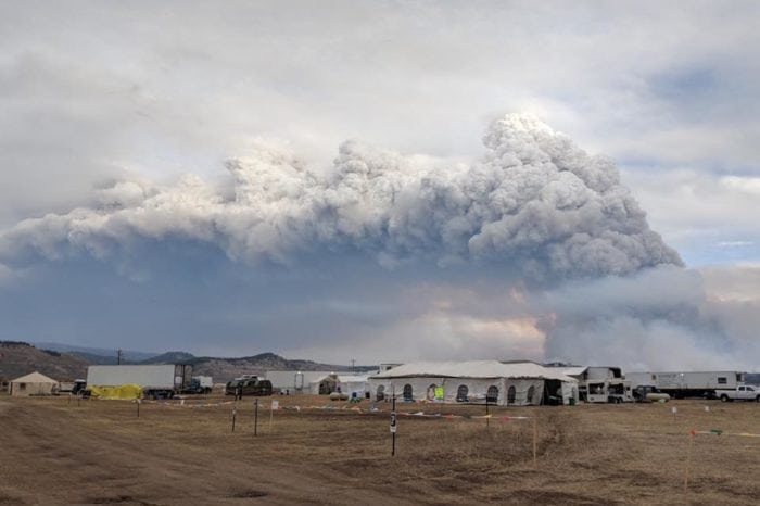
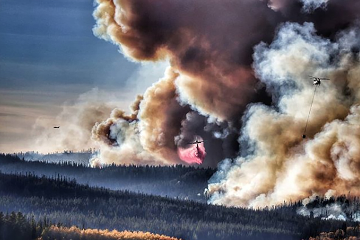
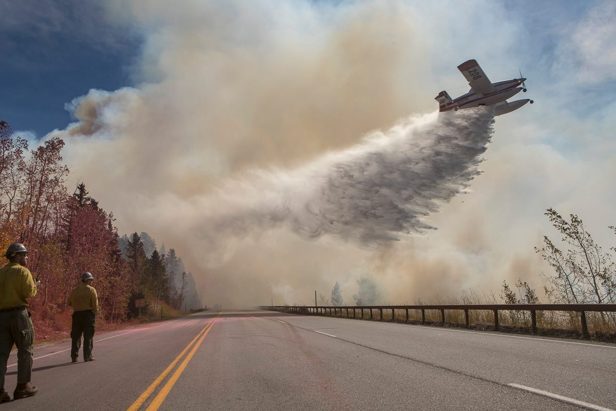
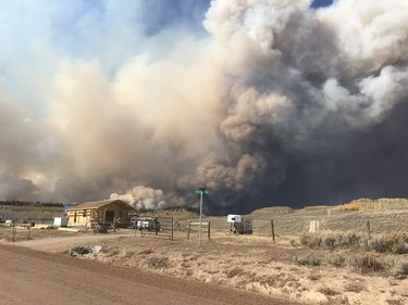
Pictures from the Fishhawk Fire
 

Fishhawk Fire
near Wapati (9/2)
Photo from inciweb.nwcg.gov

Fishhawk Fire
near Wapati (9/2)
Photo from inciweb.nwcg.gov

 
Aerial Survey of Firehawk Fire on 9/3
Photo from Fishhawk Fire Facebook Page

Fishhawk Fire on 9/3
Map from inciweb.nwcg.gov


Visible
Infrared
Latest Surface Obs
Latest Fronts


>>Loop
>>Loop
   
Additional Satellite Resources


 Top


Storm Prediction Center Critical Fire Areas and Thunderstorm Forecasts

(Click thumbnails to expand Images)

All Graphics


Day 1-Critical Fire Areas
Day 2-Critical Fire Areas
Days 3-8 Critical Fire Areas


Day 1 Categorical 
Day 2 Categorical Day 3 Categorical


Thunderstorm Potential Forecasts (Updated Hourly)


Hour 1-3
Hour 4-6
Hour 7-9
Hour 9-11
Hour 11-13
 
Hour 15-17
Hour 17-19
Hour 19-21
Hour 21-23
Hour 23-25


Top                                                              


Weather Outlook and Climate Information

(Click thumbnails to expand Images)

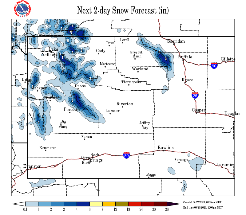
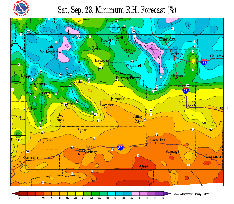
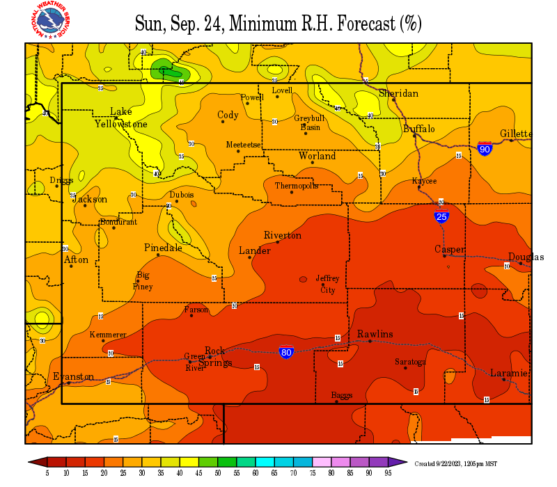
Local Precipitation, Wind, and Humidity Information (NWS)
48 Hour Liquid Precipitation
48 Hour Snow Accumulation
Period 1 Peak Wind Gusts
Period 3 Peak Wind Gusts
96 Hour Liquid Precipitation
96 Hour Snow Accumulation
Today Minimum Humidity
Tomorrow Minimum Humdity


Climate Outlooks (CPC)
6-10 Day Temperature
6-10 Day Precipitation
8-14 Day Temperature
8-14 Day Precipitation


0-30 Day Temperature
0-30 Day Precipitation
0-90 Day Temperature
0-90 Day Precipitation


 Top


USFS Fire Danger Graphics and Fuels

(Click thumbnails to expand Images) 

All Graphics


Observed Fire Danger Class
Forecast Fire Danger Class
Observed Haines Index
Fire Danger Today
Fire Danger Tomorrow
Current Haines Index


Burning Index
Spread Component
Ignition Component
Energy Release Component


1 Hr. Fuel Moisture
10 Hr. Fuel Moisture
100 Hr. Fuel Moisture
1000 Hr. Fuel Moisture


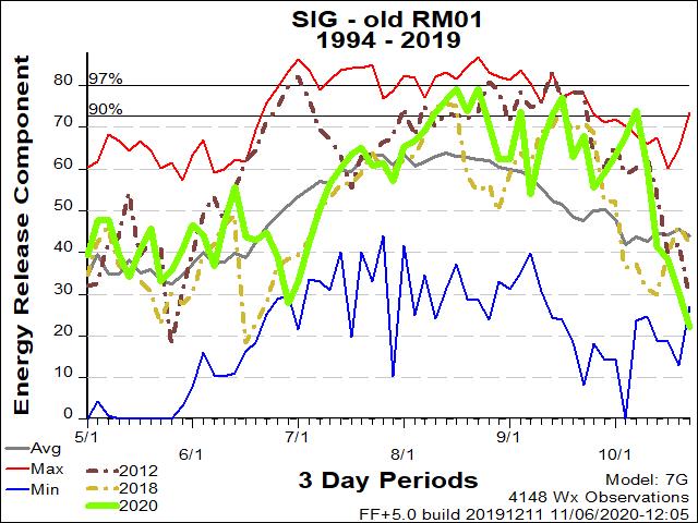
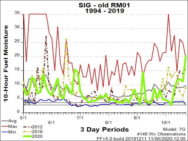
RM01 ERC Fuels Graph
RM01 10hr. Fuels Graph
Pocket Card
ERC
100 Hour Fuels
100 Hour Fuels

***IMPORTANT*** Select the ERC, 10-hr fuel moisture and pocket card graphics closest to the wildfire. Your best option may be to save
the image and then upload to CMS for display in this table.  Change headers, then DELETE this cell.

ERC and 10-hr Fuel Graphs are found at:

  • Rocky Mountain: https://gacc.nifc.gov/rmcc/predictive/erc_10_100_1000_map.htm
  • Great Basin: https://gacc.nifc.gov/gbcc/predictive/PSA_ERCmap/erc-100-1000/index.html
  • Northern Rockies: https://gacc.nifc.gov/nrcc/predictive/fuels_fire-danger/graphs/psa12.htm

Pocket Cards Found Here: https://famit.nwcg.gov/applications/WIMS/PocketCards/PocketCards


Top


Return to NWS Riverton Homepage

The National Weather Service
Building a Weather-Ready Nation