National Weather Service United States Department of Commerce

Powerful Pacific System Impacting the West; First Significant Snow for Portions of the East

Power Pacific system will continue to bring significant impacts for Pacific Northwest into northern California the remainder of the week. Dangerous coastal affects, heavy rain, flooding, strong winds, and higher elevation mountain snow continues. Meanwhile, a storm across the east is set to bring the first accumulating snow to many higher elevations of the Catskills into the central Appalachians. Read More >

Summary | Forecast | Observed Snow and Wind | Travel Center | Monitoring & Reporting | Safety


SYNOPSIS:

Snow is still falling over the area this evening and will continue into the night.  Snowfall will taper off through Tuesday morning.

A gusty north wind will occur east of the continental divide along with the snow.  This will create blowing and drifting snow and reduced visibility.  Sustained wind speed will be 15 to 25 mph with gusts of 30 to 40 mph. 


IMPACTS: Tonight through Tuesday Morning

  • Slick and hazardous roads.
  • Severely reduced visibility at times from snow and blowing snow.
  • Strong wind gusts may create dangerous cross winds. 
  • Sharply colder temperatures in wake of the cold front.

op Menu


 Summary | Forecast | Observed Snow and WindTravel Center | Monitoring & Reporting | Safety
 

NWS Text Products and Forecasts

  Area Forecast Discussion
  Winter Weather Statement
  Special Weather Statement
  What's a "Watch?"
  Observed Snow Totals or High Wind
 High Wind Statement
 Weather Story

Quick View of Hazards and Forecast Snow Totals
 
Click to enlarge Click to enlarge

Click Image To Enlarge
 

Click Image To Enlarge
Snowfall Forecast


Max Wind Gusts Forecasts

  Click to enlarge


Monday's Forecast Wind Gusts
Click Image To Enlarge 

 Top Menu


Snow Totals and Wind Reports will be posted and updated here once the storm occurs
(Please double check date and time of product)

                        
115
NOUS45 KRIW 200605
PNSRIW
WYZ001>020-022>030-201801-

Public Information Statement
National Weather Service Riverton WY
1101 PM MST Tue Nov 19 2024

...Snowfall Totals from Sunday Evening through Monday Night...

A weak weather system moved through the region, bringing snow to
many locations across western and central Wyoming. Below are
snowfall reports of one inch or greater.

Location                     Amount     Elevation (ft.)

...Big Horn County...
19 N Shell                   11.0 in    9372
17 E Shell                   6.0 in     9571
14 NE Shell                  4.0 in     9355

...Fremont County...
23 NW Dubois                 4.5 in     9347
6 WSW Dubois                 2.0 in     9419
7 NNW South Pass City        2.0 in     8941
1 WNW Dubois                 1.0 in     6947
15 W Fort Washakie           1.0 in     8426

...Johnson County...
27 WNW Buffalo               7.0 in     8543
18 WNW Buffalo               4.0 in     9860
14 WNW Mayoworth             3.0 in     8065
16 W Buffalo                 2.0 in     8691
15 WSW Buffalo               1.0 in     8300

...Lincoln County...
10 ESE Smoot                 13.0 in    9378
3 SE Turnerville             13.0 in    8219
15 ESE Smoot                 9.0 in     9033
6 ENE Smoot                  7.0 in     8380
10 ENE Turnerville           6.0 in     6642
1 SE Thayne                  6.0 in     6079
16 ENE Turnerville           6.0 in     8796
4 NE Thayne                  5.3 in     6199
4 NNE Thayne                 5.2 in     6247
16 ENE Turnerville           5.0 in     9022
3 N Etna                     3.2 in     5929
5 SSE Smoot                  3.0 in     6971
21 NE Cokeville              3.0 in     9329
Afton                        2.9 in     6249
15 ENE Cokeville             2.0 in     7886
15 NNE Cokeville             2.0 in     8368
8 S Smoot                    2.0 in     7577
2 NNW Turnerville            2.0 in     6346
2 SSW Fossil Butte National  1.6 in     6787
Fossil Butte                 1.1 in     6785

...Natrona County...
20 N Arminto                 1.0 in     8590

...Park County...
2 WSW East Entrance          5.0 in     7352
16 N Pahaska                 5.0 in     9327
12 SE Pahaska                5.0 in     9643
13 WSW Sunlight Basin        5.0 in     9358
19 SW Valley                 4.0 in     8546
Tower Junction               3.5 in     6268
1 SW Canyon                  2.0 in     7868
8 W East Entrance            2.0 in     8416
14 N Sunlight Basin          2.0 in     9361
20 SW Pitchfork              2.0 in     9784
7 NW Sunlight Basin          2.0 in     8031
2 WSW Cody                   1.0 in     5158
6 SW Pitchfork               1.0 in     7925

...Sublette County...
17 ESE Turnerville           7.0 in     8500
20 NW Calpet                 4.0 in     8065
14 E Bondurant               3.0 in     8202
11 NNE Pinedale              2.0 in     9016
16 SW Dubois                 2.0 in     9738
20 E Bondurant               2.0 in     7730
17 WNW South Pass City       2.0 in     8878
3 W Boulder                  1.0 in     6945
11 E Big Sandy               1.0 in     9082
12 N Cora                    1.0 in     8392

...Sweetwater County...
Wamsutter                    2.0 in     6740
Wamsutter                    2.0 in     6732
7 SSE Rock Springs           1.1 in     6769
2 NNE Farson                 1.0 in     6624
1 NNW Green River            1.0 in     6086

...Teton County...
5 ENE Alta                   15.0 in    8807
6 ENE Alta                   14.0 in    9259
3 NW Teton Village           12.0 in    9657
4 WNW Teton Village          12.0 in    9634
3 NW Teton Village           10.0 in    8225
6 NNW Moose                  10.0 in    9580
4 WNW Moran Junction         9.0 in     6806
5 N South Entrance           8.0 in     7881
8 W South Entrance           8.0 in     7357
2 NW Wilson                  8.0 in     8020
16 E Moran Junction          6.0 in     9190
23 ESE Moran Junction        6.0 in     9624
2 NW Teton Village           5.0 in     6611
South Entrance               5.0 in     7005
2 NNE Teton Village          4.3 in     6338
2 SSW Teton Village          4.2 in     6221
1 S Jackson                  4.0 in     7808
8 NNE Moran Junction         4.0 in     7677
10 N Bondurant               4.0 in     6904
Jackson                      3.8 in     6210
Jackson                      3.6 in     6263
2 SSW Grant Village          3.0 in     7967
Moose                        2.7 in     6458
Jackson 12 NE                2.0 in     6663
Kelly                        2.0 in     6650
22 E South Entrance          2.0 in     9320
3 SSW Wilson                 2.0 in     7002
19 NE Bondurant              2.0 in     8768
1 N Lake                     1.0 in     7893
1 N Alta                     1.0 in     6446

...Washakie County...
12 SE Big Trails             4.0 in     7628
18 ENE Ten Sleep             3.0 in     9455

Observations are collected from a variety of sources with varying
equipment and exposures. We thank all volunteer weather observers
for their dedication. Not all data listed are considered official.

$$


 Top Menu


Summary | Forecast | Observed Snow and WindTravel Center | Monitoring & Reporting | Safety

Current Radar & Web Cams - Click Thumbnails To Enlarge
Northern Rockies Radar
Riverton Radar
Pocatello
Billings
Salt Lake
Cheyenne


WYDOT Road Legend Wyoming Road Conditions from WYDOT
For more detailed Wyoming road conditions, please visit WYDOT at: wyoroad.info


Road Conditions for Surrounding States
CODOT logo IDDOT logo MTDOT logo
NEDOT logo SDDOT logo UTDOT logo


Teton Pass - Hwy 22
Alpine Junction - U.S. Hwy 26/89/191
Jackson
Bondurant - U.S. Hwy 189
Togwotee Pass - U.S. Hwy 26
Dubois
Granite Pass - U.S. Hwy 14
Powder River Pass - U.S. Hwy 16
South Pass - Hwy 28
Salt River Pass
Buffalo - I-25/I-90 Interchange
Casper
I-80 - Little America
Beaver Rim - U.S. Hwy 287
I-80 - Rock Springs
I-80  - Laramie


                                                                       Click Here to See All Webcams                                                  

If you plan to travel, we recommend checking road conditions along your route and staying on top of road closures here. If you are on Twitter, follow the hashtag: #WyoRoad (or look below) for the latest weather affecting roads and road conditions in and around Wyoming. 


Get the play-by-play on this storm and contribute your own snow reports to #wywx

Follow Us on Twitter @NWSRiverton


 Summary | Forecast | Observed Snow and WindTravel Center | Monitoring & Reporting | Safety

PLEASE SEND US YOUR SNOW REPORTS (CLICK HERE)

Monitor our Weather Summary Page for current Warnings, Watches, and Advisories. What's the difference?
Current            Weather Story Check the latest Weather Story graphic for an overview of the area forecast.
NWS Riverton Radar Check out what's on the radar.
Riverton | Pocatello | Cheyenne | Billings | Salt Lake City | Rapid City | Mosaic
Submit storm reports/images and keep up to date with us on Facebook!
Submit storm reports/images and keep up to date with us on Twitter!
Other reporting methods include email (nws.riverton@noaa.gov), or by phone at 1-800-211-1448.
Check the latest Public Information Statement for the latest storm reports.
WyDoT's Webpage Monitor current road conditions by visiting the Wyoming Dept. of Transportation (WYDOT) or by calling 5-1-1.
Get current road conditions, web camera images, road alerts, and much more on your mobile device by downloading the Wyoming 511 Mobile App.


Top Menu

 Summary | Forecast | Observed Snow and WindTravel Center | Monitoring & Reporting | Safety
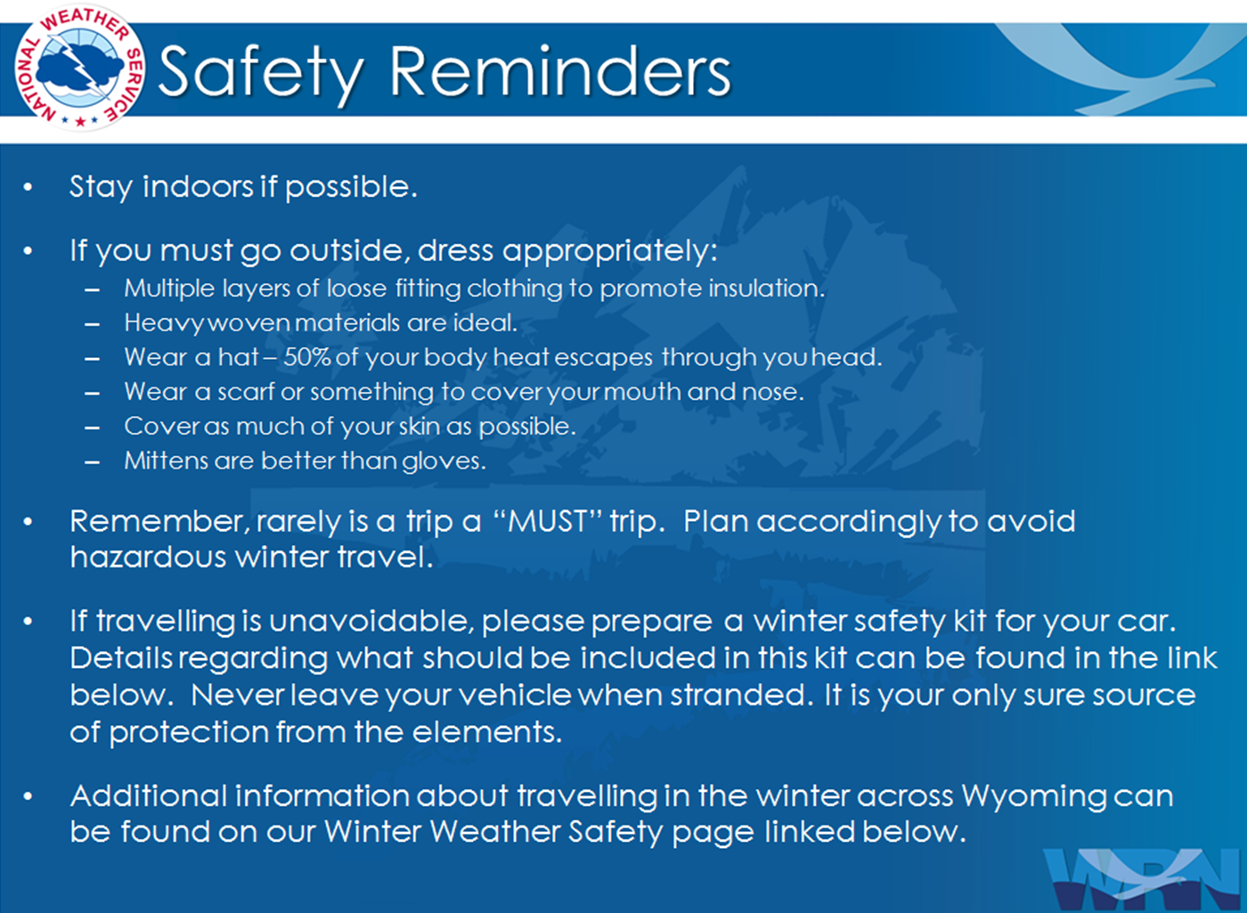
 

Winter Safety Kit      |      Winter Weather Safety


Learn more about the National Weather Service's efforts to build a Weather-Ready Nation!


 Top Menu