|
Event
Intense thunderstorms raked the highly populated McAllen/Edinburg/Mission area of Hidalgo County during the mid evening of March 29th. The storms dumped hail up the size of baseballs for more than half an hour, drove that hail with 70 to 75 mph winds, added 4 to 6 inches of torrential rains, and produced frequent cloud to ground lightning. Initial storms developed across the King Ranch during the mid afternoon of March 29th, and spread west into northern Hidalgo and Starr County by early evening. The storms, fed by warm, humid air near the surface, colder air aloft, and boundaries (providing lift) from earlier storms which moved across the Coastal Bend, appeared to have intensified further as they approached the highly populated Edinburg/McAllen/Mission area. Why they intensified was a mystery, but one possibility was the interaction with an upper level disturbance moving across northeast Mexico. This disturbance spawned dangerous storms in Nuevo Léon and Tamaulipas, and boundaries from these cells may have been the ultimate trigger to a night hundreds of thousands will not forget.
Impact
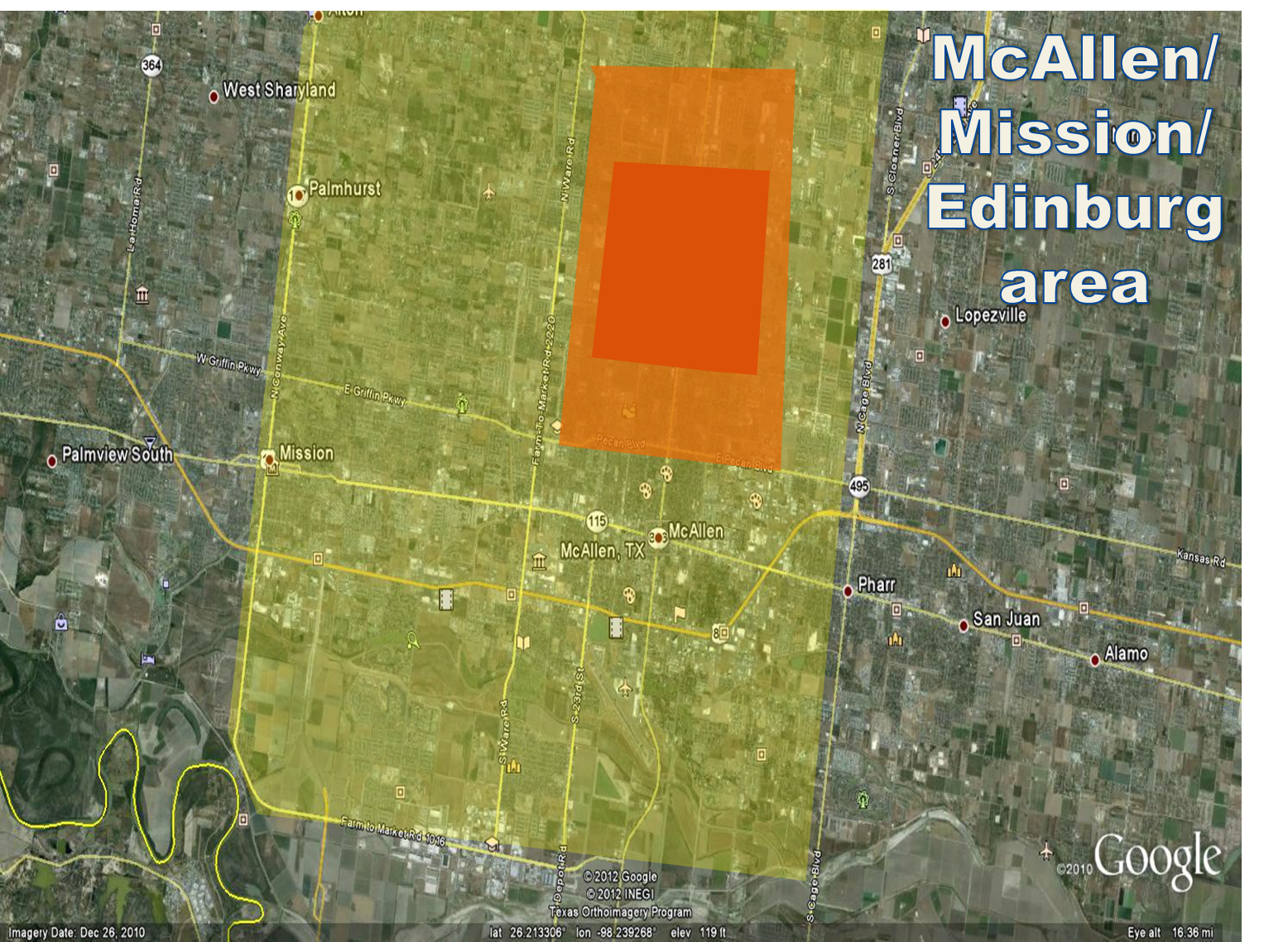
The City of McAllen won’t soon forget the scary evening of March 29th. Preliminary storm reports received as the event was unfolding can be found here. The following is a sampling of the damage and devastation experienced by many, particularly in the north half of the city (map, below):
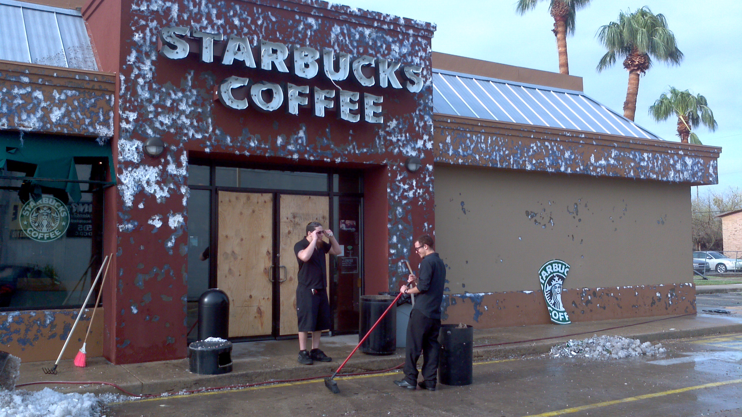
- Wind and Hail. In a small portion of north McAllen (red square, below), up to an hour of continuous hail, driven by frequent winds estimated at 70 to 75 mph, knocked at least one window out of every north–facing home, defoliated nearly every tree, left up to a half foot of accumulated hail on the ground, and produced hail drifts up to 4 feet high. Numerous tree limbs were blown down, many homes had roof damage, and broken glass and water littered the north facing rooms and apartments. Hundreds of vehicles left outdoors were severely damaged by golf ball to baseball size hail dents, including many shattered windows.
At the McAllen/Miller Airport, a wind gust to hurricane force – 74 mph – was recorded, which came from the northwest. Surrounding the hardest hit areas, locations in central McAllen to the edge of Edinburg received less hail and wind, but still enough to strip many leaves from trees, knock down fences, dent vehicles, and damage some windows and roofs.
Additional wind damage reported South Pharr ripped a roof from a small house, and uprooted or snapped trees in the yard. This area was not investigated by the survey team; whether damage was caused by straight line wind or a small tornado will be determined.
- Flooding and Rain. Torrential rain accompanied the hail; 4 to more than 6 inches fell in less than two hours, creating ice and water "rivers" with the height of the water as high as 4 to 6 feet in poor drainage locations. More than 100 vehicles were submerged and numerous others were abandoned during the peak of the storm. At one point, the city’s interconnected system of pipes, sewers, and drainage pools reached more than 90 percent of capacity. At one point, most of the city roads were under water. A preliminary rainfall map for the Rio Grande Valley can be found here.
- Other. Frequent to excessive lightning was common with the long duration storm. At least two apartment fires were preliminarily attributed to lightning strikes. Many residents noted lightning streaking across the sky from north to south, indicative of impressive positive and negative charge distribution through the depth of the storm. Pockets of steam quickly formed as hail began to melt, and rose above eye level reducing visibility to near zero.
- Assessment and Aftermath. For McAllen, the storm was epic. Given the magnitude, the community is fortunate to have escaped with no serious injuries and no fatalities as of this writing. Reasons may include time of day (mid to late evening), proactive services by the City’s Emergency Management apparatus, and good luck. In all, 217 persons were rescued from being trapped in hail and wind damaged homes and flood waters, more than 1,000 homes and businesses were damaged, and more than 25,000 customers were without power during the peak of the storm. March 2013 Update: According to the Insurance Council of Texas and verified by the Property Claims Service of the Insurance Services Office, insured damages tallied $260 million; total damage, including uninsured property, is likely tens of millions of dollars more. In all, 2,800 homeowners’ claims and 3,000 auto claims had been made by the end of 2012. The storm ranked 21st costliest in Texas since 1950 (in 2012 dollars).
Additional videos, photos, and more can be found at the following locations:
- YouTube®. Start here and proceed through dozens more first hand accounts of the March 29th fury.
- City of McAllen. This link provides a well produced video detailing the hail, wind, and flood damage.
- Facebook. "Like" us today and see more photos and videos.
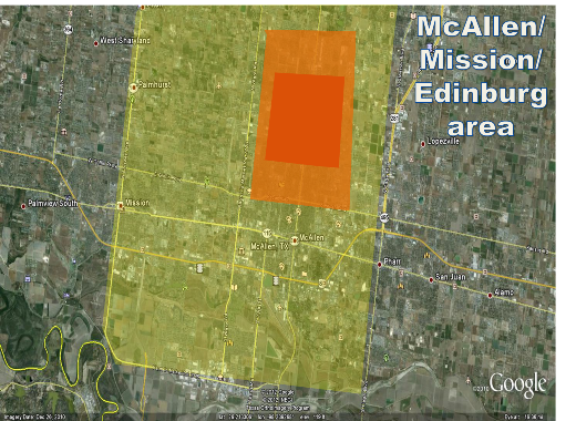
Image showing locations of increasingly intense damage in McAllen/Edinburg/Mission. Yellow shading indicates scattered wind damage (trees and some older buildings) with minimal hail impact; Orange shading indicates moderate hail impact and scattered wind damage; Red shading indicates severe hail impact (driven by the winds). Significant flooding occurred in all shaded areas. |
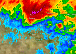
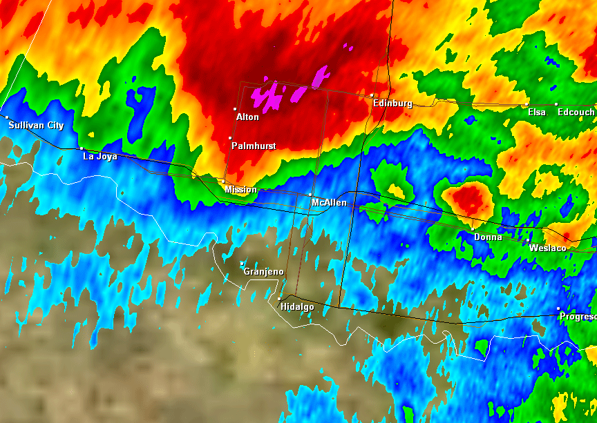
Loop of radar reflectivity as hailstorm was peaking in McAllen, between 848 and 941 PM March 29th, 2012. Magenta, purple, and white shades indicate general hail areas. |
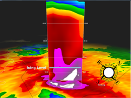
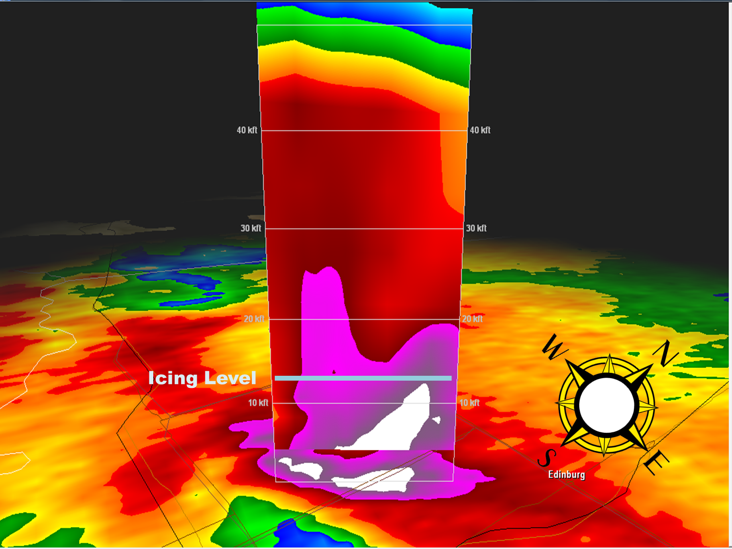
Vertical cross section of reflectivity (precipitation) at 905 PM March 30th, over North McAllen. Note the incredible amount of particulates (red, magenta, and purple) above the icing level, assumed to be around 13,000 feet above the ground. |


 Follow us on YouTube