Click here for latest Drought Information Product (issued ONLY when drought condition is D2 or greater):
Primary resources:
Current Drought Situation:
Maps of the latest drought conditions can be found at the U.S. Drought Monitor.
Archives can be found at the Drought Monitor Archive Page.
| Precipitation/Temperature Outlooks: |
|
Ground Water Impacts: |
|
USGS Ground-Water Climate Response Network
Click here to see the latest ground water level near Duke Forest, North Carolina.
|
|
Fire Danger Hazards: |
|
Keetch-Byram Drought Index (KBDI): This is a drought index that is specifically related to fire potential. The KBDI is broken into four categories which indicate the susceptibility of ground fuels to fire danger. The table in the right hand column indicates what the categories mean.
Dead fuel moisture responds solely to ambient environmental conditions and is critical in determining fire potential. Dead fuel moistures are classed by time lag. A fuel's time lag is proportional to its diameter and is loosely defined as the time it takes a fuel particle to reach 2/3's of its way to equilibrium with its local environment. Dead fuels in NFDRS fall into four classes (1-hour, 10-hour, 100-hour, and 1000-hour); however, when looking at droughts usually only the 100-hour and 1000-hour fuel moisture are watched.
|
KBDI data can be found on the Wildland Fire Assessment System (WFAS) web site at: Dead Fuel Moisture data can be found on the Wildland Fire Assessment System (WFAS) web site at: |
||||||||||||
|
Agriculture Impacts: |
|
For additional information on agriculture impacts may be viewed at the United States Department of Agriculture (USDA) National Agricultural Statistics Service NASS Web Site. |


 Heat Safety
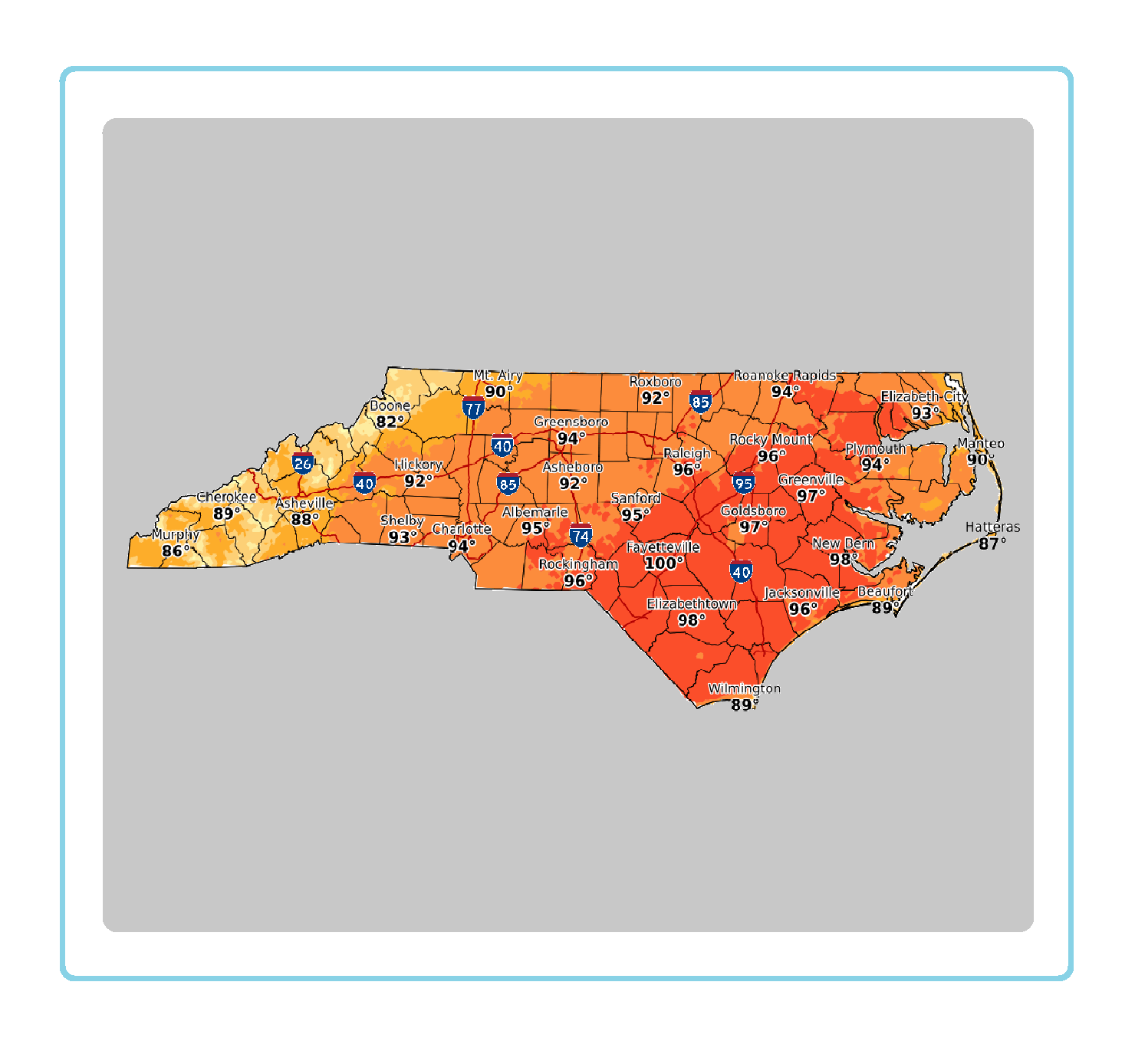 Statewide Maps
 Forecaster Discussion