Impacts: Heavy rain with major flash flooding
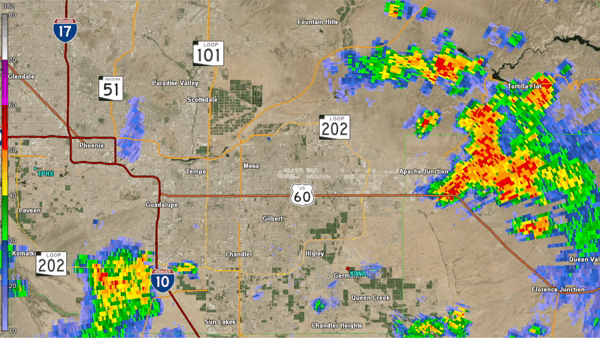
Fig. 1. Reflectivity loop between 11:29 AM and 12:54 PM MST on July 28, 2022 from the KIWA (Phoenix, AZ) radar showing the heavy rain affecting the Apache Junction area
Significant shower and thunderstorm activity developed across portions of south-central Arizona during the late morning into the early afternoon hours of July 28, 2022. The heaviest activity was concentrated just east of Phoenix, towards the upslope and adjacent mountainous areas of eastern Maricopa, southern Gila and northeast Pinal counties. One area of heavy rainfall in particular developed and affected the Superstition and Goldfield mountains extending into Apache Junction, where between 1-3 inches fell in a matter of 1-2 hours (Fig. 2-3).
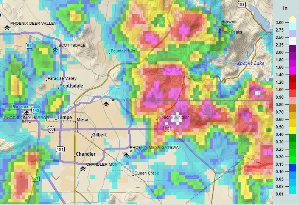
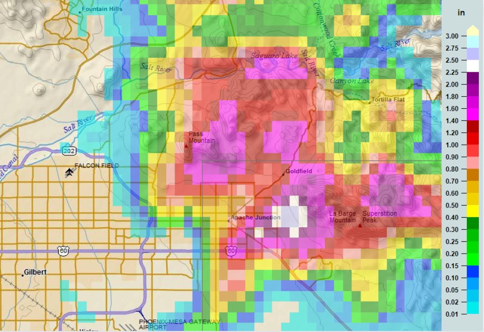
Fig 2-3. 3-hr estimated rainfall totals from 10 AM to 1 PM MST on July 28, 2022 based on the Multi-Radar Multi-Sensor (MRMS) mosaic: zoomed out (top); zoomed in (bottom)
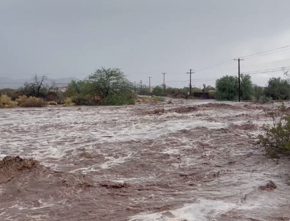
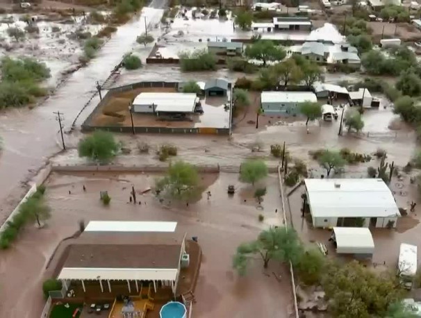
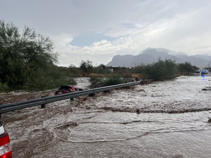
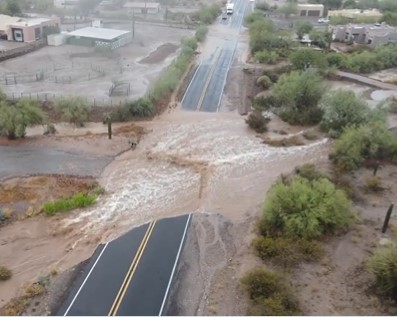
Runoff from both the Superstition and Goldfield mountains drained towards Weekes Wash and other washes, which run through the city of Apache Junction. These washes went out of their banks, inundating several crossroads, causing multiple road closures as well as road damage across the city (Fig. 4-5). Multiple water rescues were required to remove people from either homes or vehicles. Several homes were either surrounded by or inundated with water (Fig. 6). One of the more dramatic water rescues occurred when a woman had to be rescued from her vehicle that was swept away by the flood waters of Weekes Wash. The vehicle traveled half a mile downstream before encountering a box culvert, where the woman was able to be rescued (Fig. 7).
|
|
 |
|
|
|
Fig 4-7. Images of the flooding in Apache Junction. Image location and sources (clockwise from top-left): Weekes Wash along the intersection of N. Cortez Rd and E. Tepee St. (Apache Junction Police Department); North Mountain View Rd. (Mark Sudduth); Weekes Wash along E. Superstition Blvd, where the woman in the vehicle was rescued (Apache Junction Police Department); Aerial drone view of the flooding inundating roads and homes (AZ Family)
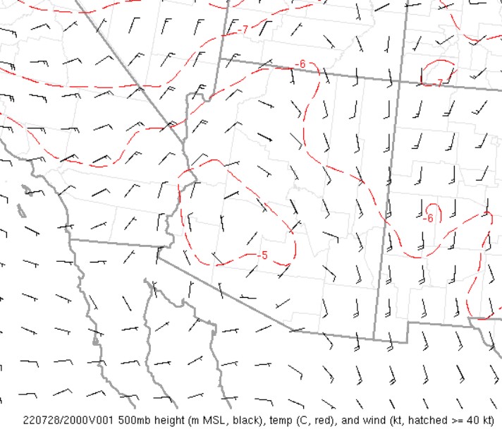
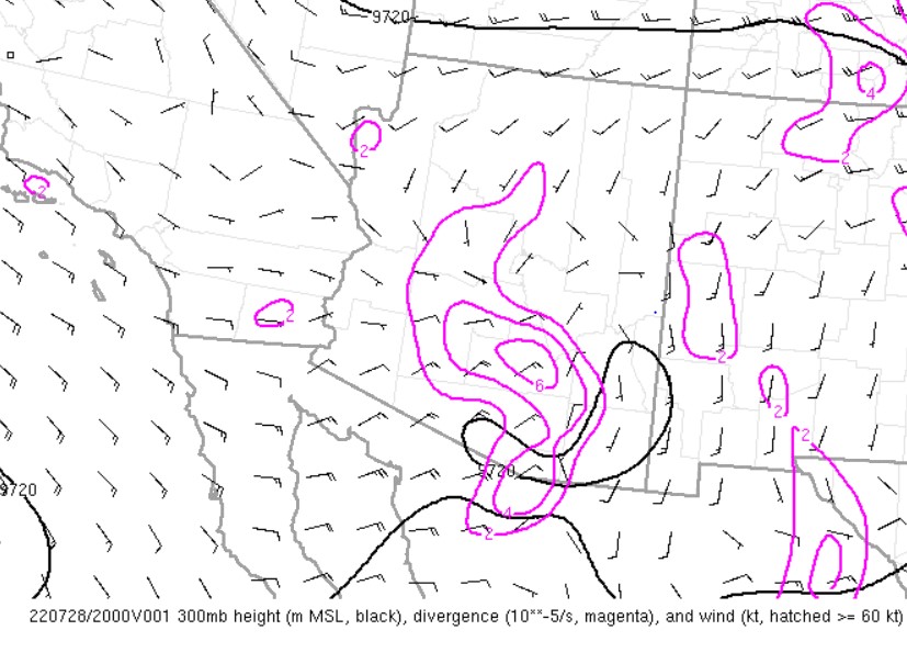
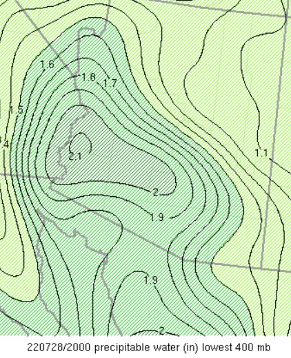
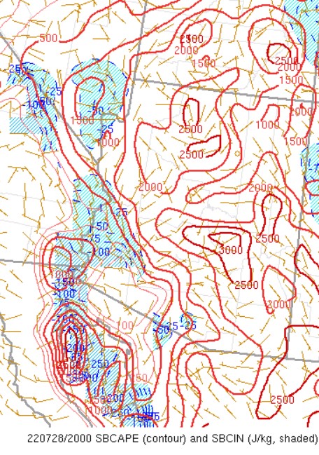
Setup: Highly anomalous moisture content was in place across most of Arizona on July 28, 2022. Precipitable water values, a measure of the amount of moisture in the atmosphere, were in excess of 1.8 inches (above the 95th percentile) across most of central and southern Arizona (Fig. 8). Instability values were on the moderate to high side across south-central Arizona, with the surface based convective available potential energy ranging between 1500 to 2500 J/KG (Fig. 9). Concurrently, there was favorable forcing for ascent in the form of an inverted trough at the mid-levels of the atmosphere along with pockets of divergence in the upper-levels of the atmosphere (Fig. 10-11). The combination of all of these factors led to the development of enhanced shower and thunderstorm activity.
 |
 |
|
|
|
Fig 8-11. Objective analysis fields at 1 PM MST on July 28, 2022, of (clockwise from top-left): Precipitable Water Values; Surface-Based Convective Available Potential Energy (SBCAPE); 300 mb heights, divergence, and winds; 500 mb heights, temp, and winds
Fig 12. Spatial extent of Flash Flood Watch and Flash Flood/Flood Warnings issued by the NWS offices in Phoenix, Flagstaff, and Tucson. Locations where flooding was reported noted with green dots.