Thunderstorms developed across central Arizona during the afternoon hours of Sunday 18 October 2015 as a larger storm system moved through the southwest. The atmosphere was characterized by moderate instability and wind shear (winds varying in direction and speeds with height). Being October, temperatures were also cooler, better supporting the development of hail in the upper parts of the strongest storms. These factors combined to allow one storm in particular to become severe, producing a north-south swath of damage through parts of Phoenix and Glendale.
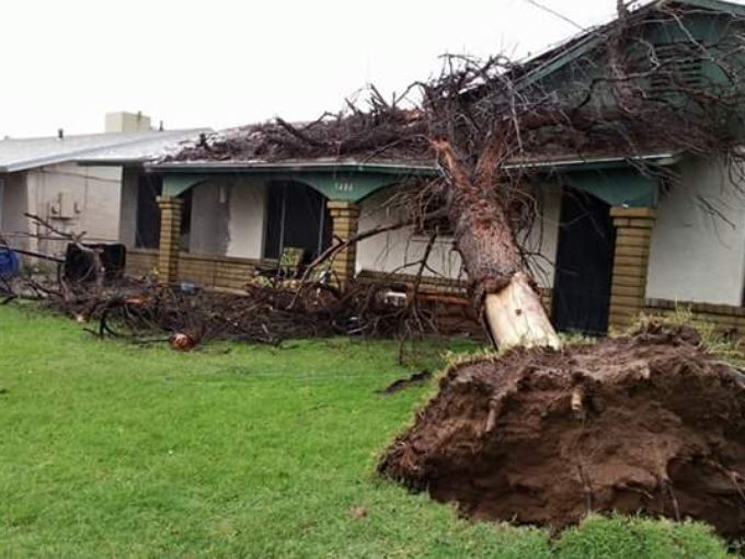
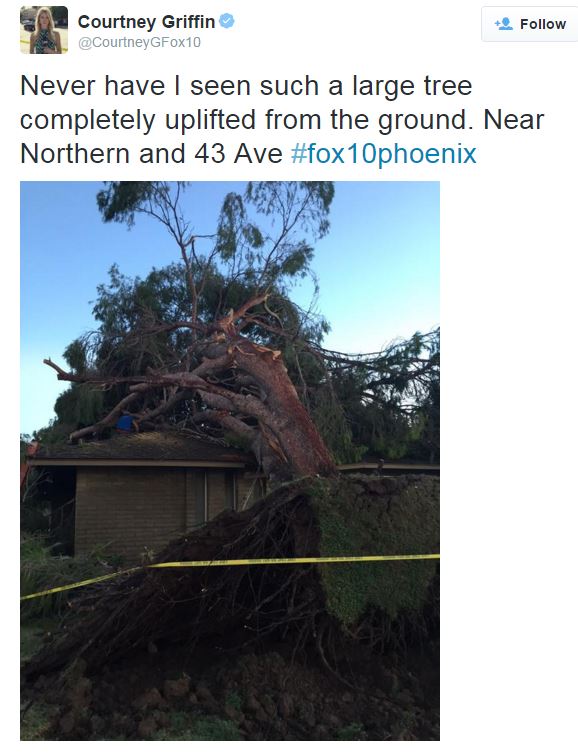
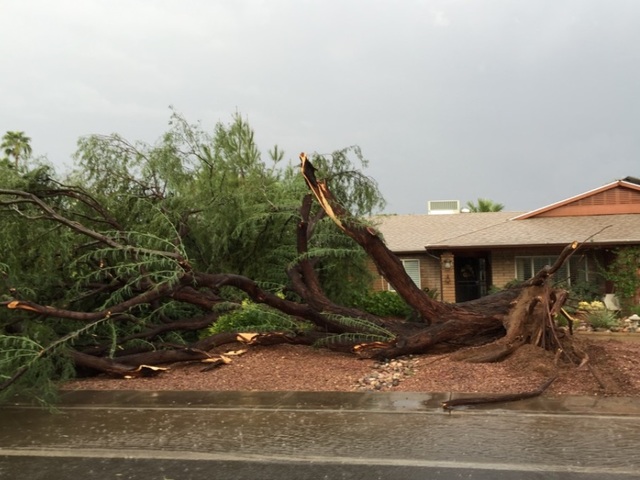
Fairly extensive damage was reported with the storm moving through Phoenix and Glendale. Based on analysis of media images and NWS radar data, we concluded the damage was caused by straight-line severe winds. The image below indicates a swath of where hail was possible, with green being the most likely. This coincided with the path of damage noted.
 |
|
Plot of Maximum Estimated Size of Hail for Sunday afternoon; green corresponds to largest hail.
|
|
Local Storm Reports received by NWS Phoenix (click for larger image).
|
For an alternative view, here is a "cross-section" of the radar data as the storm moved from south (right) to north (left). You may note several instances of deep reds reaching quite high in the sky, which then came crashing toward the ground. This pattern is indicative of downburst behavior in the thunderstorms.
While rain amounts were not particularly high, some minor flooding was noted.
Below are a collection of various images as shared on either the NWS Facebook page or obtained via Twitter.
 |
 |
 |
 |
 |
 |
 |
 |
 |
 |
 |
 |
 |
 |
 |
 |
 |
 |
 |
 |
 |
 |
 |
 |
 |
 |
 |
 |
 |
 |
 |
 |
 |
 |
 |
 |