Storm Report for 9 July 2018
By NWS Phoenix -- last updated 8 PM 14 July 2018
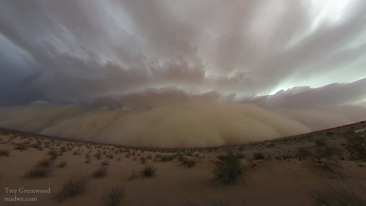
Dust storm along Interstate 8 near Dateland, AZ. Courtesy Trey Greenwood.
Widespread thunderstorm activity occurred across Maricopa and Pinal Counties during the afternoon of Monday 9 July 2018. It was a classic setup for severe weather across the lower deserts. Due to outflow winds from the previous day, the air across the region was very moist, warm, and unstable. Surface dew points were generally in the 60s °F. Afternoon temperatures climbed into the 100-105 °F range. Meanwhile, a strong upper level low was spinning westward across New Mexico toward Arizona. This cause winds blowing from the east in the upper parts of the atmosphere to be much stronger than usual. The stage was set for storms to develop over the higher terrain of Arizona and quickly move into the lower elevations. Given the degree of instability and strong winds to move the storms, damaging winds and heavy rain were very likely. Click here to view upper level maps for 12Z Monday 9 July 2018 from the NWS Storm Prediction Center.

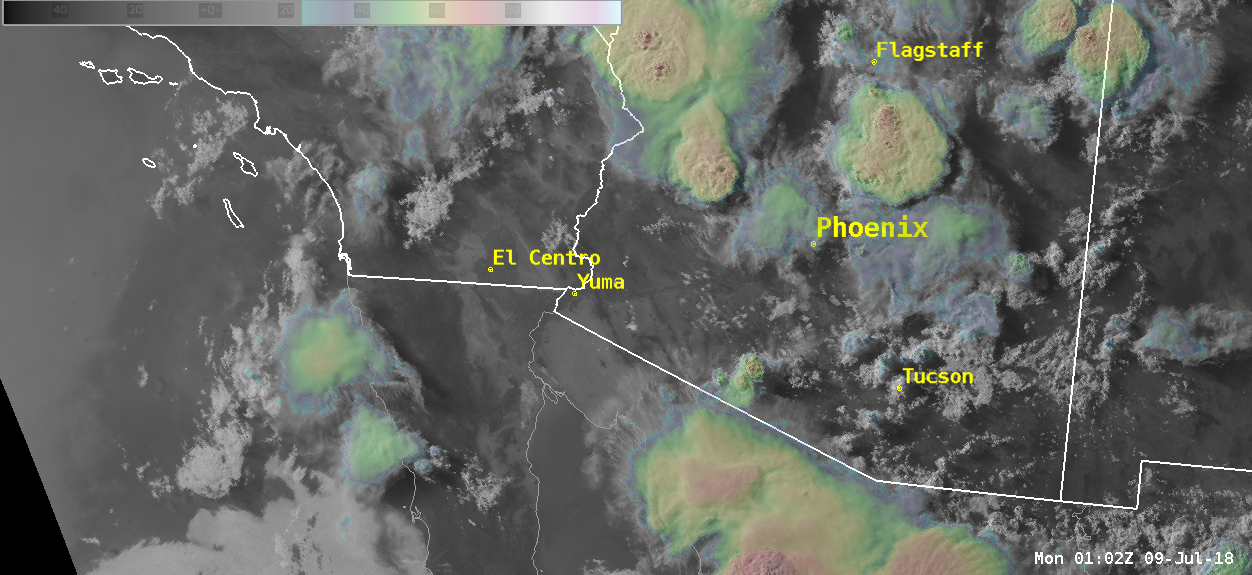
GOES-16 Low-Level Water Vapor Channel at 10:42 AM on Monday 9 July 2018. Click image for loop.
Showers and thunderstorms quickly developed over the mountains of eastern Arizona early during the afternoon hours. With the strong easterly winds in the middle of the atmosphere, these storms were ushered westward toward the lower elevation deserts. Once they reached the deserts, the storms ingested the unstable air in place and exploded. The strongest storms developed over the far East Valley (a storm which tracked west across Mesa, causing considerable damage) and the far northeast valley. Outflow winds from these storms raced to the south and west, colliding and causing continual invigoration of the storms.

Radar at 5 PM Monday 9 July 2018. Click image for full event loop.
GOES-16 satellite at 7 PM Monday 9 July 2018. Click image for full event loop.
As the thunderstorms began to move past Phoenix, they began to weaken (though not disappear) as the air was not quite as unstable. From start to finish, approximately 8,000 cloud-to-ground lightning strikes and 45,000 in-cloud flashes were generated by these storms. The potent outflow from the activity caused a considerable dust storm to develop in the open deserts. This pronounced wall of dust traveled clear across the Sonoran Desert, a distance of roughly 200 miles.

Outflow/dust storm seen on radar at 830 PM 9 July 2018. Click on image for loop.

