Portland, OR
Weather Forecast Office
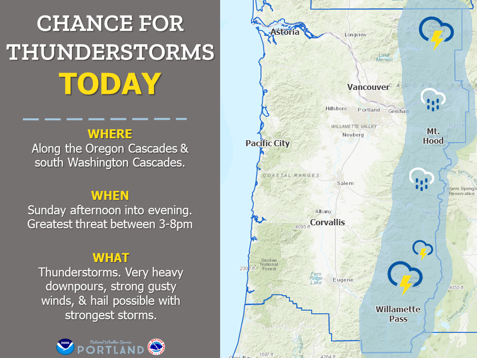
Many have seen the rain today, but another system is quickly approaching that could bring some thunder to the area this afternoon & evening. The most at risk regions will be along the Cascades, especially the central Oregon Cascades. With the strongest storms you can expect to see heavy rain, gusty winds & even some hail! Remember: When thunder roars, head indoors.
Here is what to expect. Areas most impacted: Along the Oregon and south Washington Cascades...especially the central Cascades. When to expect thunderstorms: Sunday afternoon & evening. Highest chances between 3-8pm. What to expect: Thunderstorms. Very heavy downpours, strong gusty winds, and hail possible with strongest storms.
US Dept of Commerce
National Oceanic and Atmospheric Administration
National Weather Service
Portland, OR
5241 NE 122nd Avenue
Portland, OR 97230-1089
(503) 261-9246
Comments? Questions? Please Contact Us.

