
Scattered to numerous severe thunderstorms are likely across the region on Saturday, July 18th, including a risk of flash flooding for portions of the area. View this briefing for the details regarding these hazards. Read More >
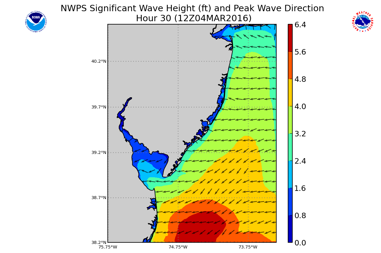
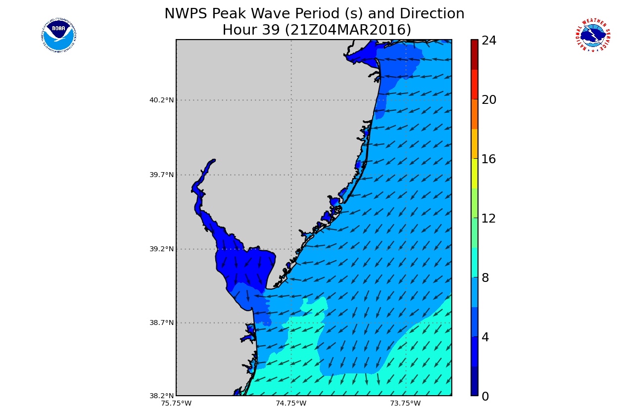
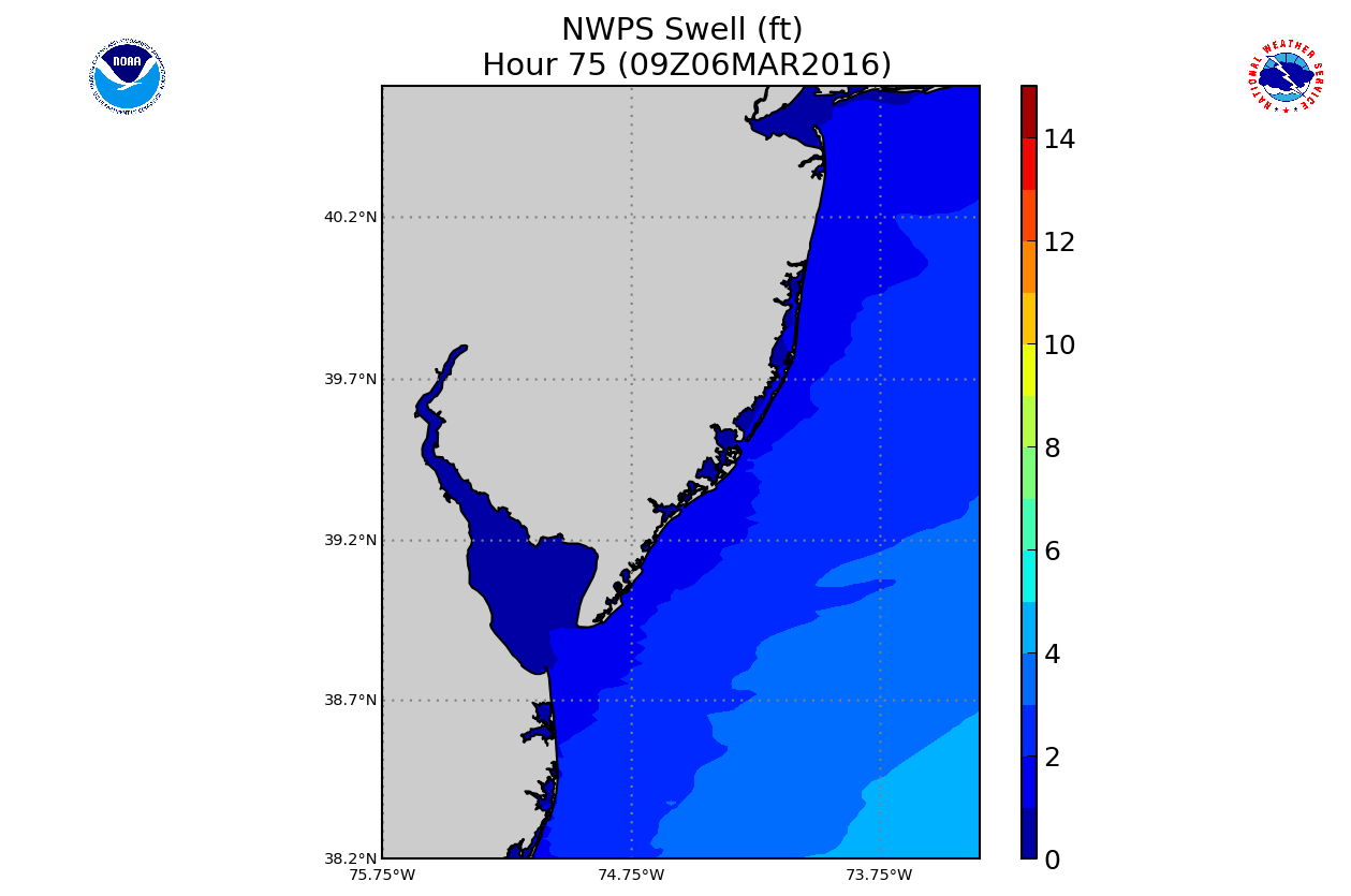
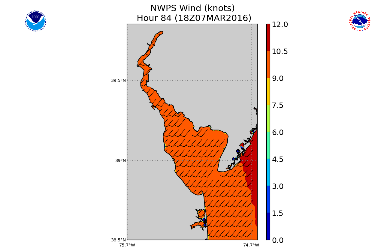
Full Domain for WFO-PHI Shown Below:
|
|
|
|
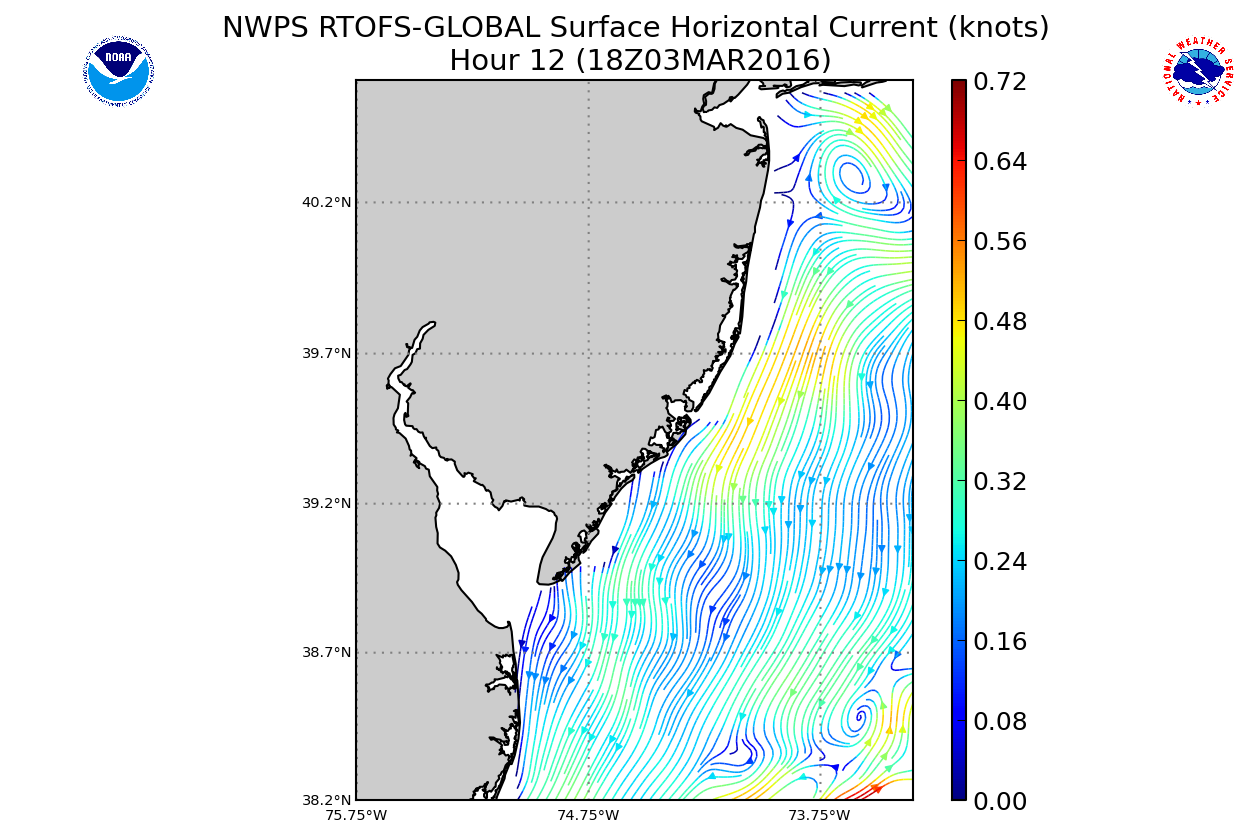
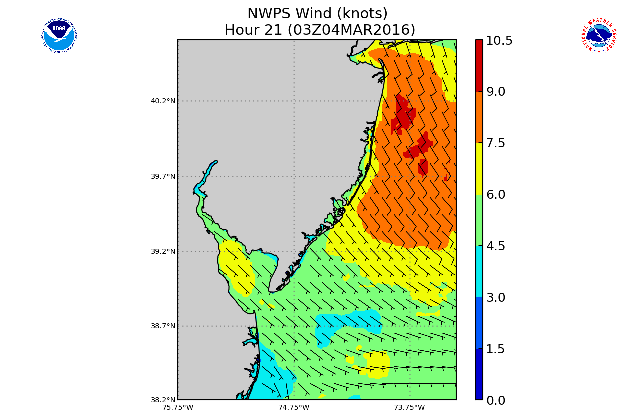
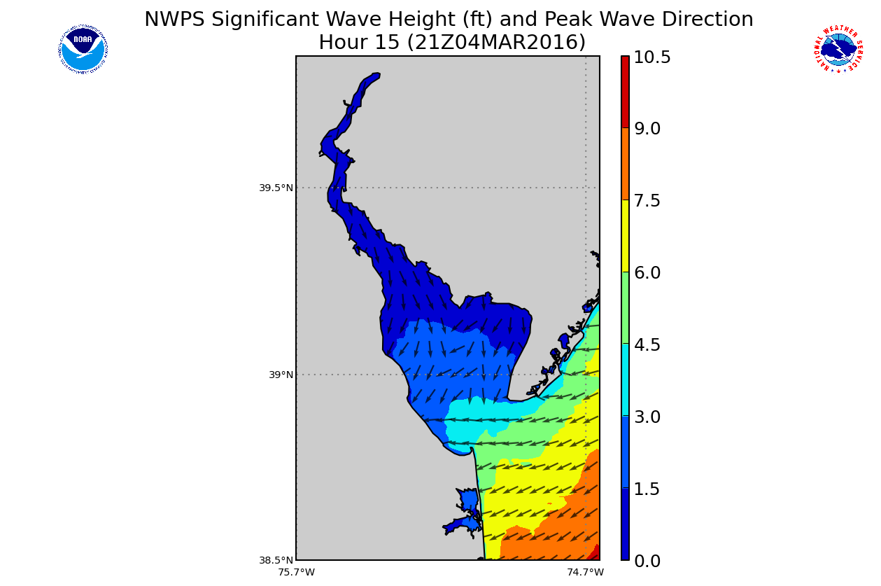
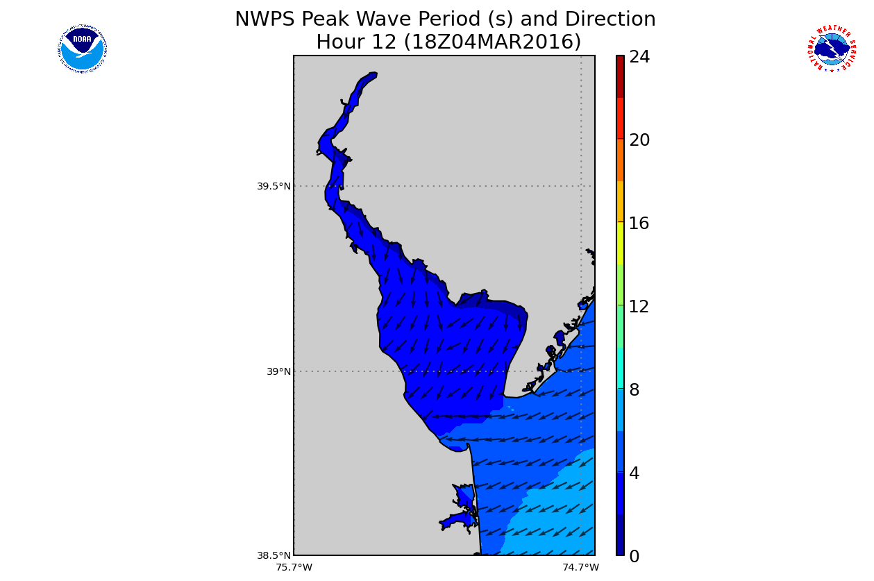
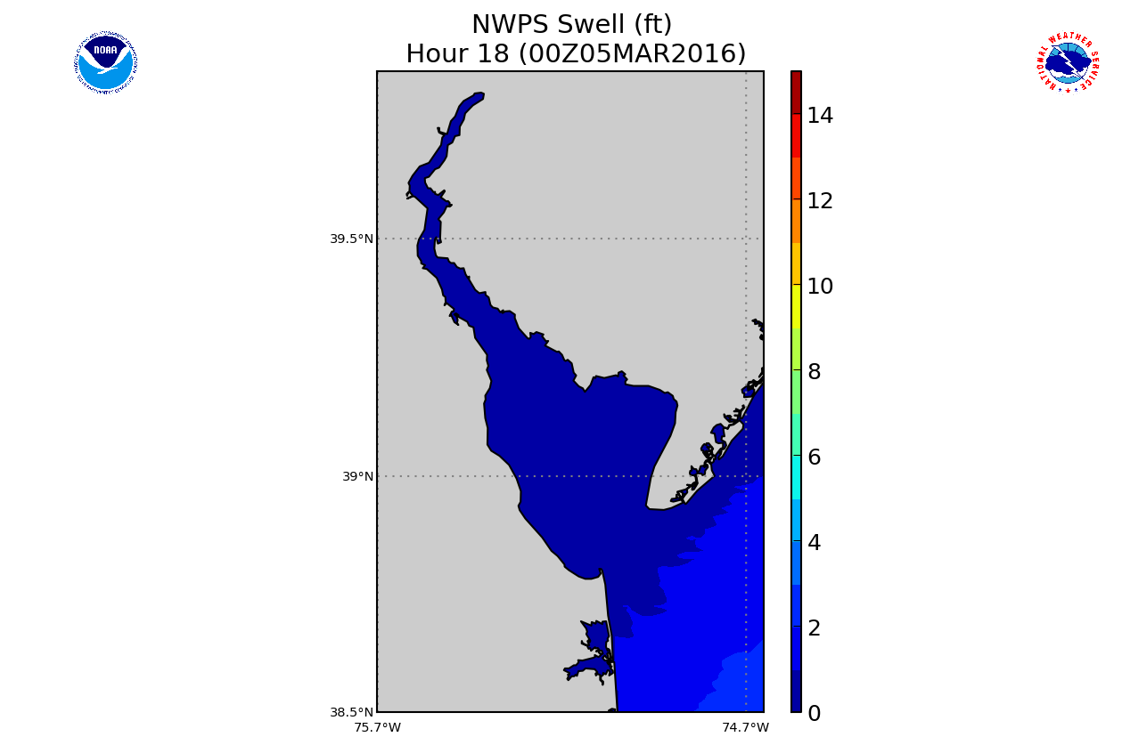
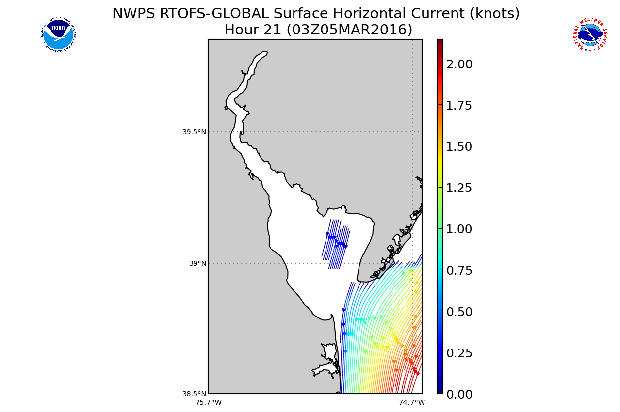
Delaware Bay Model Shown Below:
|
|
|
|
These models forecasts are produced by WFO-PHI Mt Holly, NJ using the NWPS wave models and the Real Time Ocean Forecast System
NWPS accounts for the following physics:
In here you will see 3-hourly forecast outputs for significant wave height, peak wave direction, peak wave period, and significant swell height (heights in feet and periods in seconds). Additionally, individual wave system heights, periods, and directions contributing to the significant wave heights are provided further below. In addition you will see the wind speed and direction used as input for the models. Our local version of NWPS also uses input from WAVEWATCH III for boundary conditions. NOTE: Significant Swell Height output from NWPS is the average height of the highest 1/3 of the group of waves with periods of 10 secs or longer. |


 Coastal Flood
 Marine Forecasts
 Text Products
 Climate Information
 Skywarn
 Submit Storm Report
 Weather Event Archives
 Forecast Discussion
 Emergency Managers
 Briefing Page