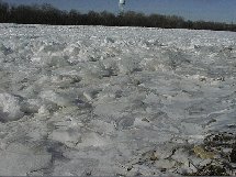
| When Arctic air stays in our area for an extended period of time during the winter months there may be ice buildup on the rivers. If the ice moves there can be a rapid rise in the water level and there is potential for subsequent flooding behind jams. The National Weather Service monitors the rivers and streams and will issue ice statements and flood potential outlooks on a periodic basis. The following products discuss these conditions: |
 |
|
|
|
| The National Ice Center (NIC) website provides worldwide operational sea ice analyses and forecasts for the armed forces of the U. S. and allied nations, the Departments of Commerce and Transportation, and other U. S. Government and international agencies, and the civil sector. more... | |
 Several pictures of ice packs are available from our storm archives. |
|
|
River Ice Reports |
|