Local Hazards
Note: Please check the date and time to ensure that the product is current.
Warnings
- State warnings issued by the Interactive Weather Information Network (IWIN):
- National warnings from IWIN
- Latest warnings issued by NWS Mt. Holly, NJ - including EXPIRED warnings:
Watches
Statements
U.S. Hazards Assessment
Radar Imagery
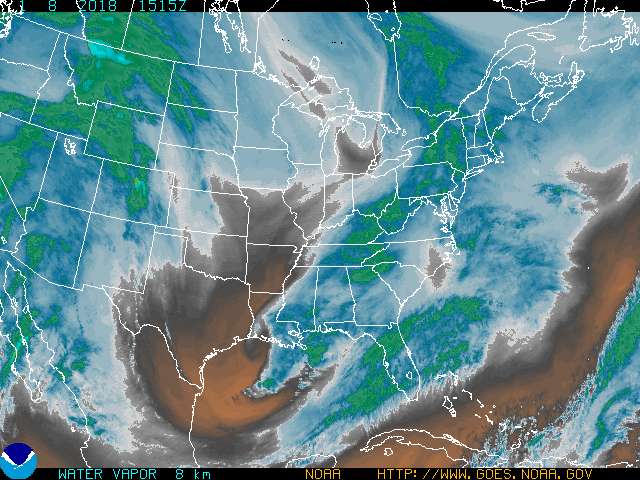
Satellite Imagery
| Watch/Warning/Advisory |
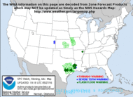 |
|
| Convective Watches |
 |
|
| Mesoscale Discussions |
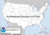 |
|
Convective Outlooks
| Day 1 Outlook |
|
|
| Day 2 Outlook |
 |
|
| Day 3 Outlook |
 |
|
Safety and Preparedness


 Coastal Flood
 Marine Forecasts
 Text Products
 Climate Information
 Skywarn
 Submit Storm Report
 Weather Event Archives
 Forecast Discussion
 Emergency Managers
 Briefing Page