Overview
|
A warm front moved through the mid-Atlantic on the morning hours of March 31. This was associated with a strong area of low pressure moving through the Great Lakes, which had brought widespread severe weather to the Southeast US in prior days. Behind the warm front, widespread cloud cover and scattered showers lingered for most of the day over the eastern mid-Atlantic. Despite temperatures that still warmed to above average values, this greatly limited instability. However, more sunshine and subsequent instability developed further west over central Pennsylvania and northern Maryland. As a cold front approached by late afternoon, forcing for ascent increased, and strong wind fields were in place across the region in the warm sector of the Great Lakes low. Widespread convection developed over the interior mid-Atlantic, some of which became strong to severe. Convection generally favored a linear evolution with some embedded supercell structures. Because of the orientation of mid and upper level winds and the decreasing instability to the east, thunderstorms were very slow to move east and gradually lost intensity with time. In the local area, reports of severe weather were mostly isolated and confined to eastern Pennsylvania. However, a short-lived EF1 tornado did touch down over Bucks County, producing a 2 mile path of tree, utility, and some structural damage. Shower and thunderstorm activity continued through much of the night, slowly making its way to the coast, but was well below severe limits over New Jersey and Delmarva in the later hours of the night. Quieter and cooler weather returned for the following day behind the front. |
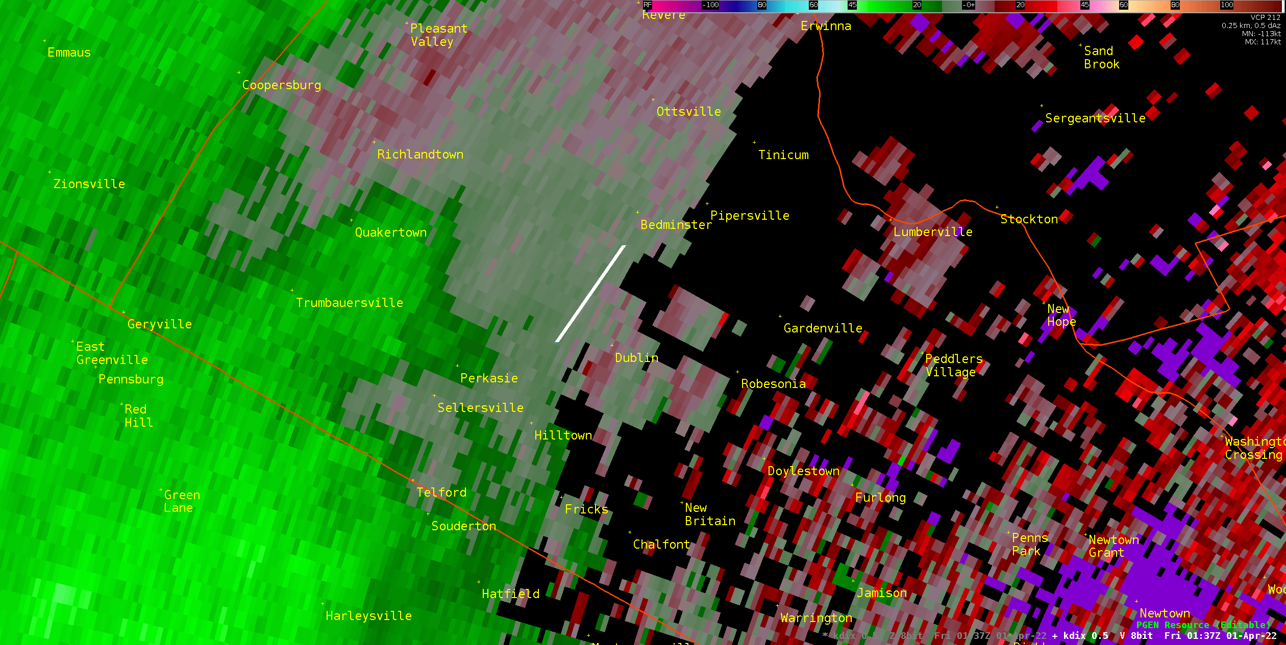
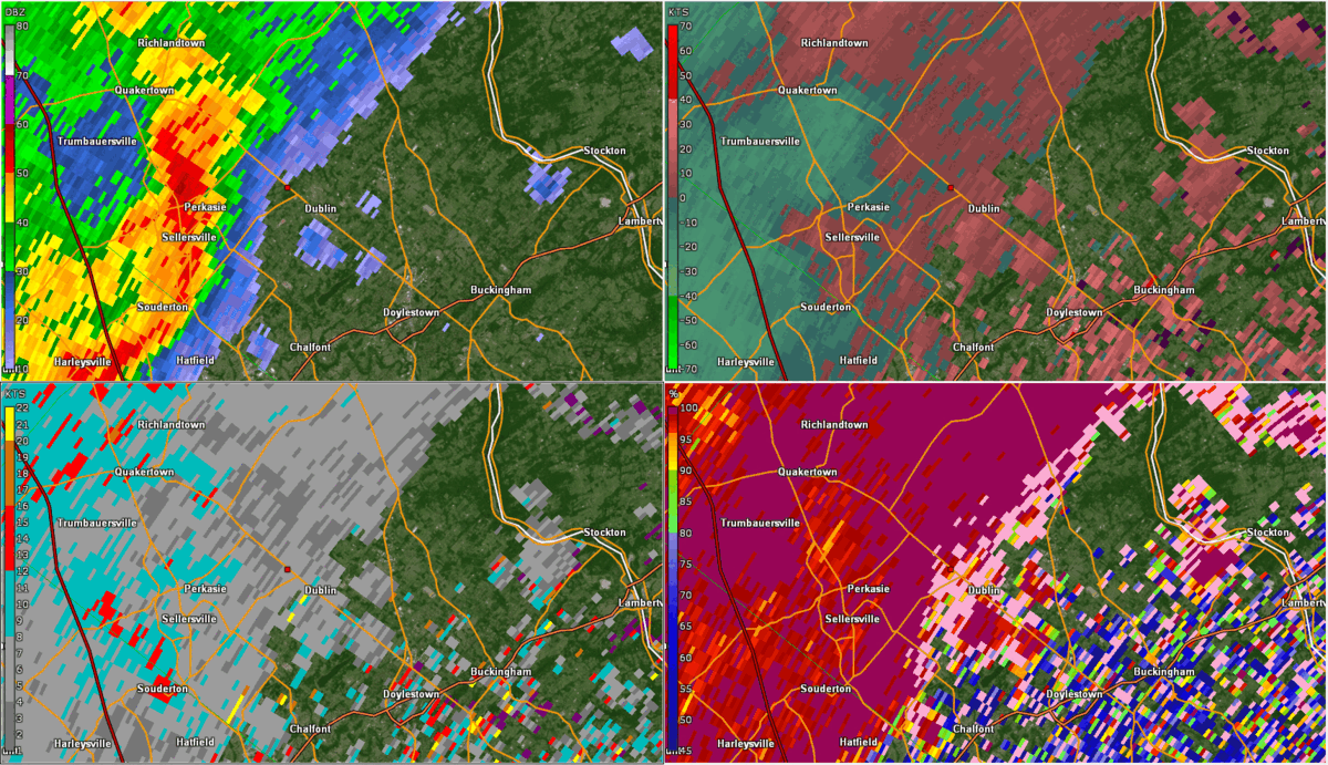 KDIX radar loop from 9:38PM to 10:02PM EDT on March 31, 2022, showing the lifecycle of the Bucks County tornado, including the presence of a Tornado Debris Signature (TDS) in correlation coefficient (CC) data. The small red dot indicates the approximate touchdown point. |
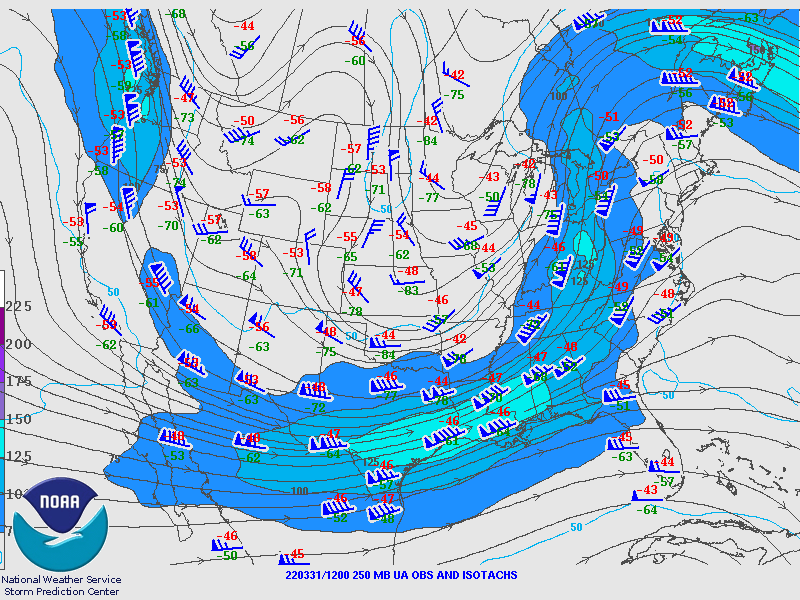
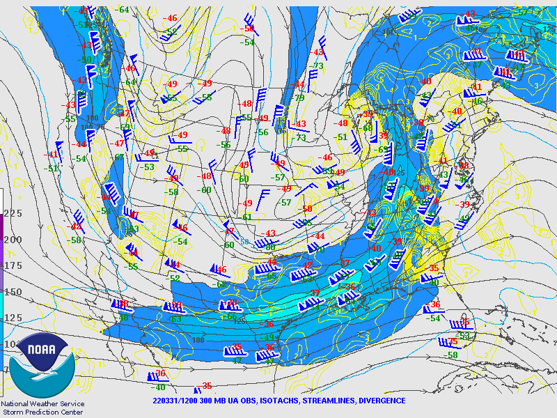
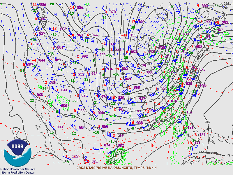
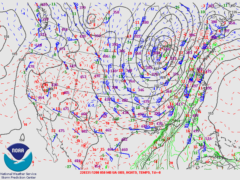
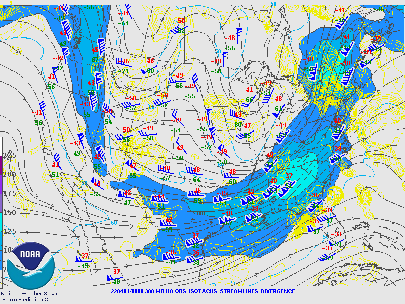
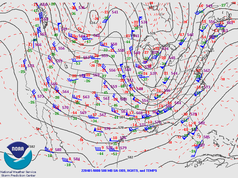
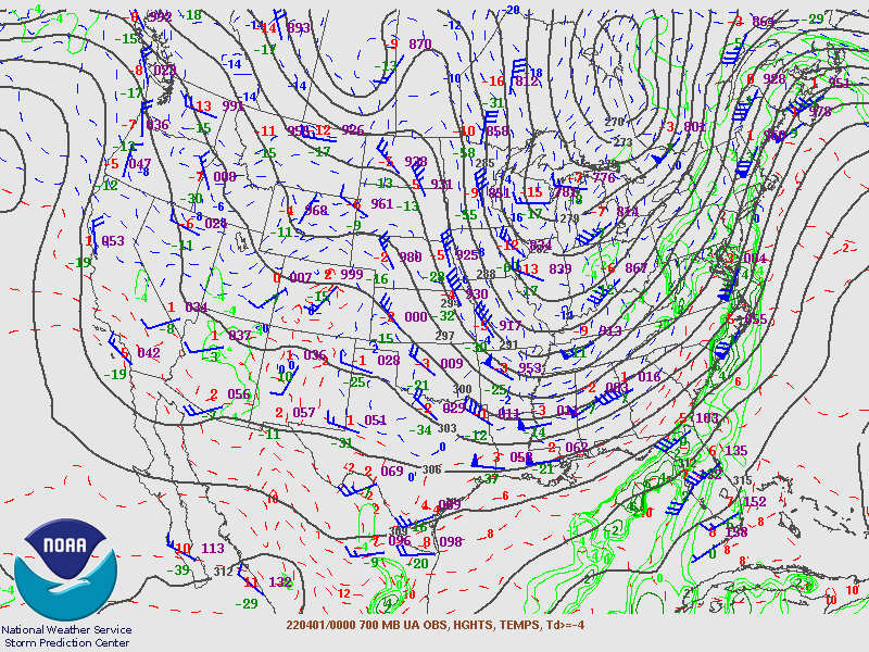
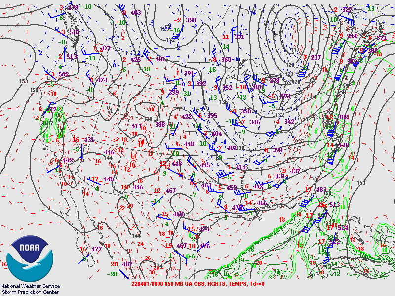
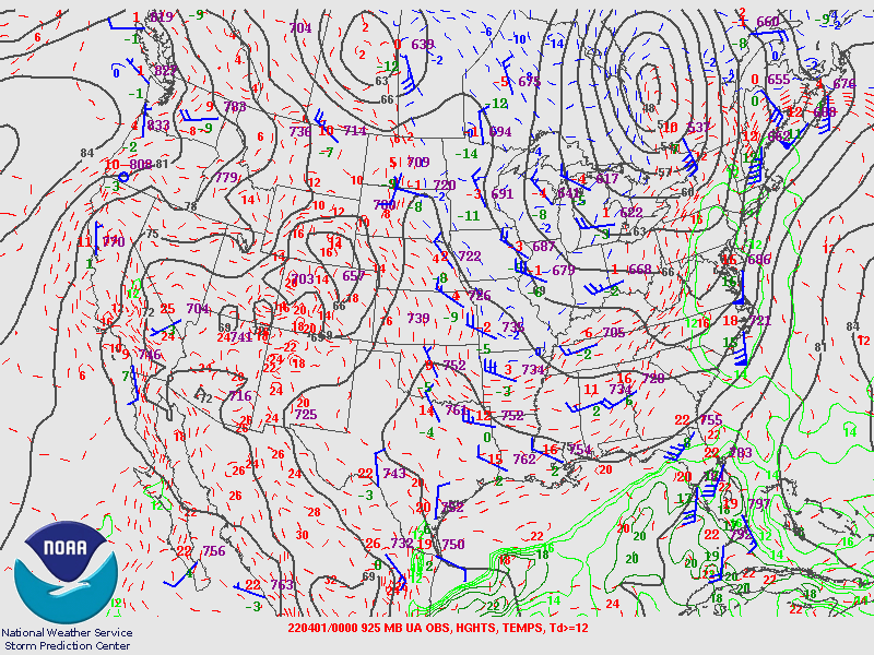
Synoptic Overview at 12z 31 Mar 2022 (courtesy of SPC)
 |
 |
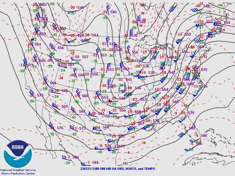 |
| Figure 1: 250-mb analysis | Figure 2: 300-mb analysis | Figure 3: 500-mb analysis |
 |
 |
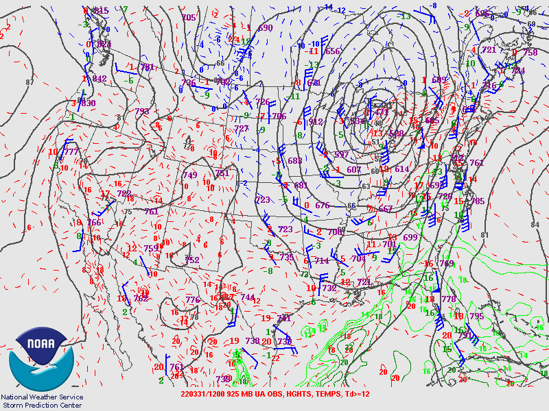 |
| Figure 4: 700-mb analysis | Figure 5: 850-mb analysis | Figure 6: 925-mb analysis |
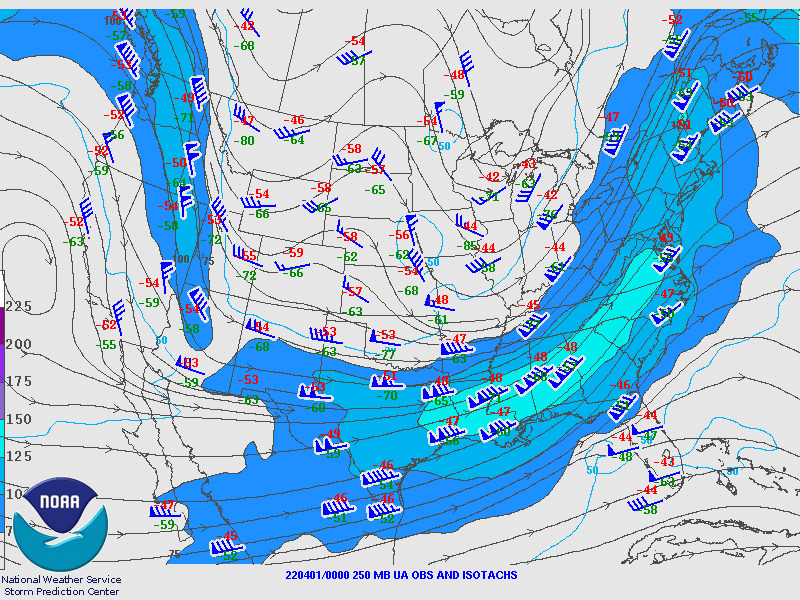
Synoptic Overview at 00z 1 Apr 2022 (courtesy of SPC)
 |
 |
 |
| Figure 7: 250-mb analysis | Figure 8: 300-mb analysis | Figure 9: 500-mb analysis |
 |
 |
 |
| Figure 10: 700-mb analysis | Figure 11: 850-mb analysis | Figure 12: 925-mb analysis |
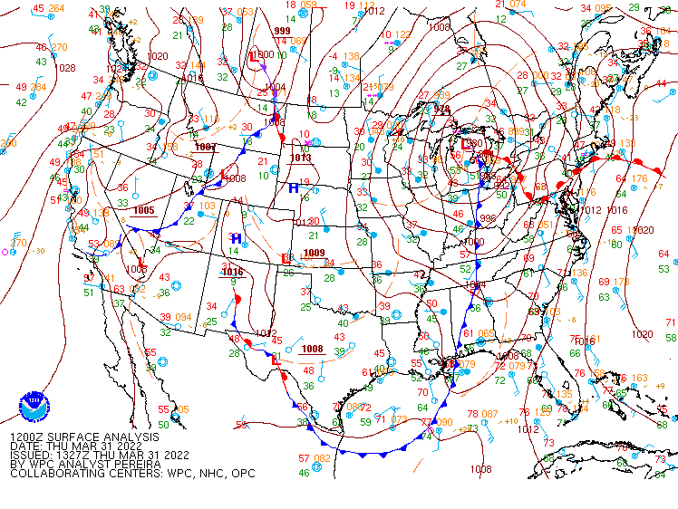
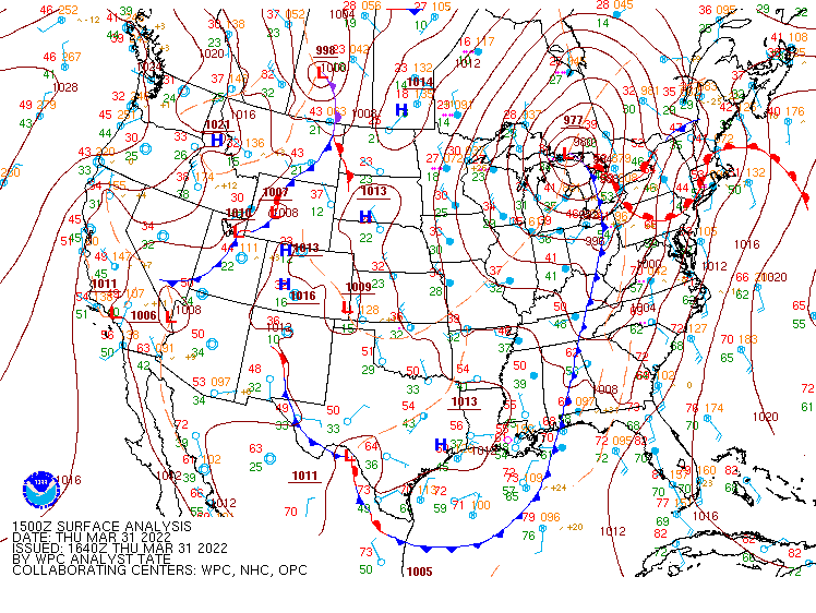
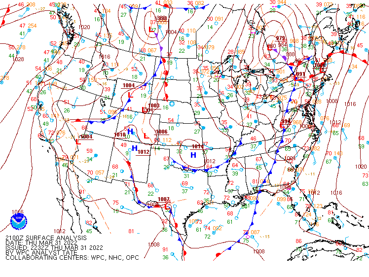
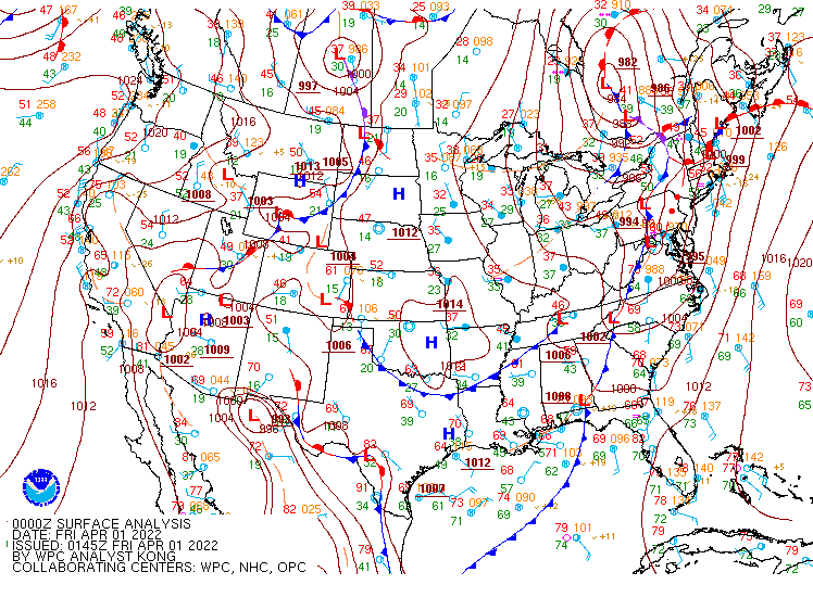
Surface Maps (courtesy of WPC)
 |
 |
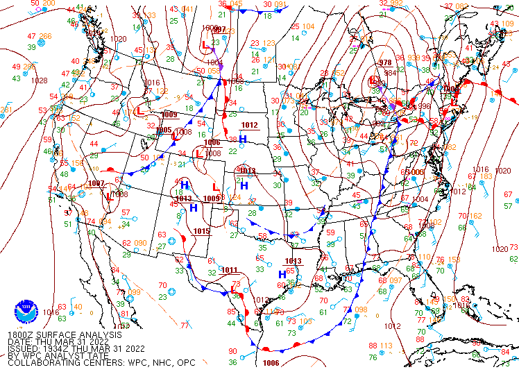 |
| Figure 13: 12z surface map | Figure 14: 15z surface map | Figure 15: 18z surface map |
 |
 |
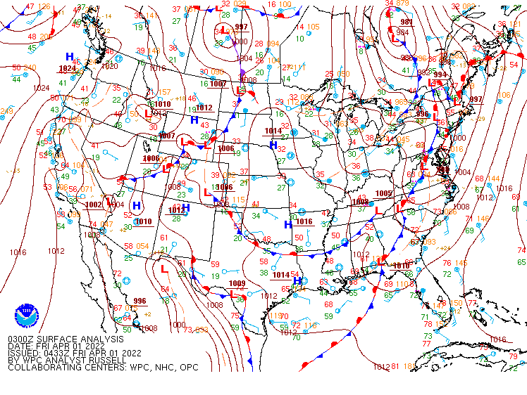 |
| Figure 16: 21z surface map | Figure 17: 00z surface map | Figure 18: 03z surface map |
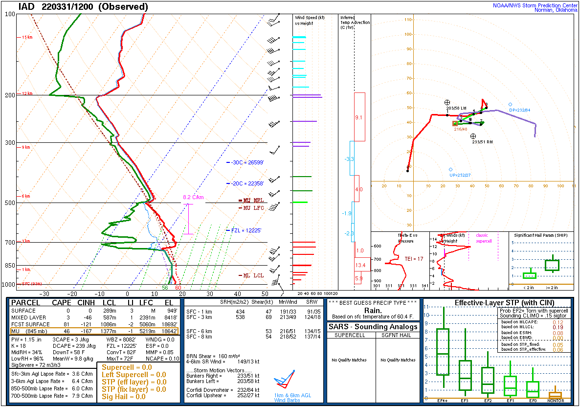
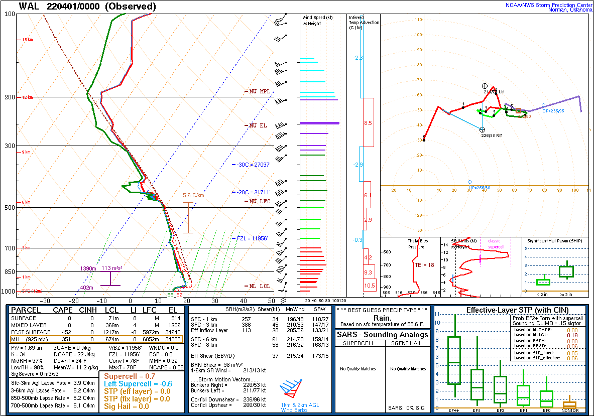
Observed and Forecast Soundings (Observed Sounding Availability Limited by Global Lifting Gas Shortage)
 |
 |
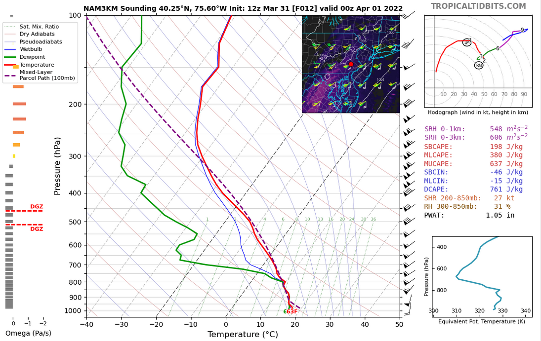 |
| Figure 19: 12z Sterling, VA sounding | Figure 20: 00z Wallops Island, VA sounding | Figure 21: 12z March 31 3km NAM model forecast sounding near the time and location of the Bucks County tornado. This is believed to be a reasonable approximation of the environment present when that tornado occurred. |
 |
 |
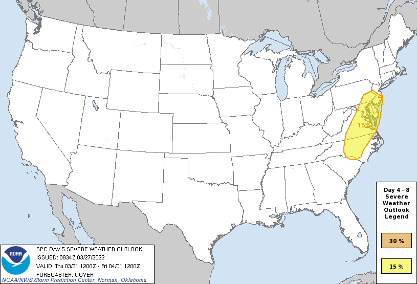 |
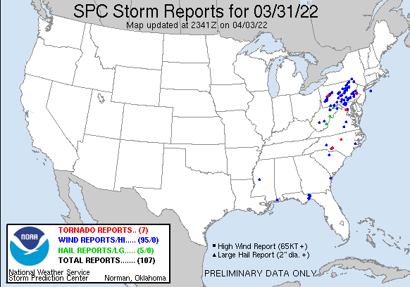
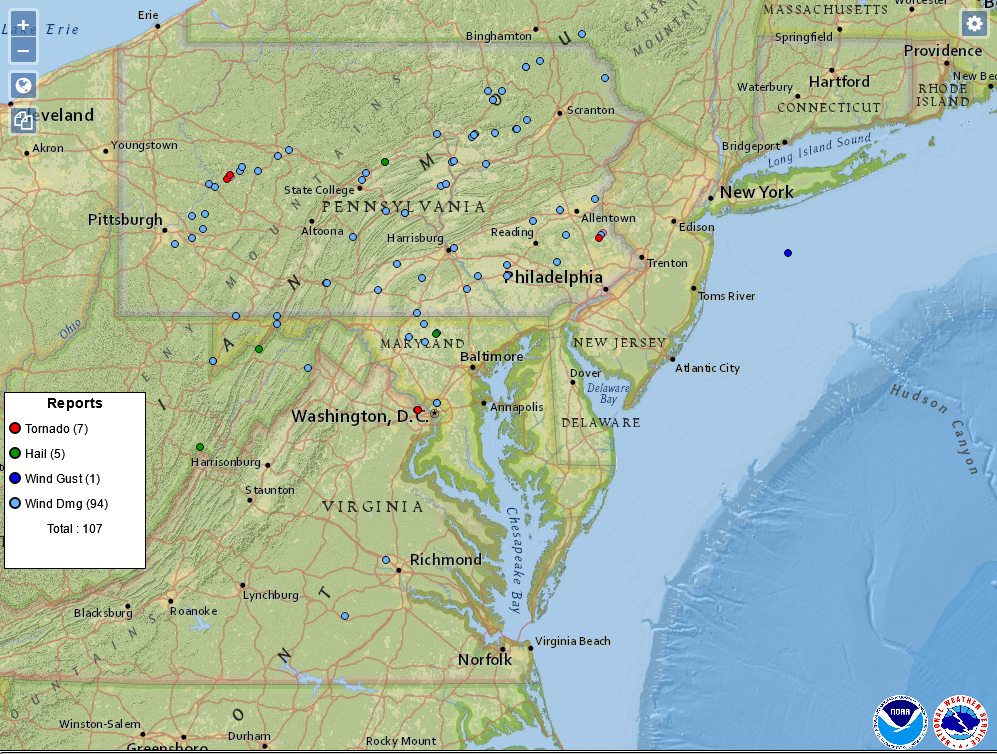
| Figure 1: National Preliminary Reports 12z 31 Mar 2022 to 12z 1 Apr 2022 | Figure 2: Zoomed Preliminary Reports for the same period. | Figure 3: Evolution of SPC outlooks leading into this event, beginning with an initial indication of severe weather potential on the Day 5 outlook from March 27. |
Click here for a county warning area based plot of local storm reports and warnings/advisories issued for the 31 Mar 2022 event.
NWUS51 KPHI 011446
LSRPHI

PRELIMINARY LOCAL STORM REPORT...SUMMARY
NATIONAL WEATHER SERVICE MOUNT HOLLY NJ
1046 AM EDT FRI APR 1 2022

..TIME...   ...EVENT...      ...CITY LOCATION...     ...LAT.LON...
..DATE...   ....MAG....      ..COUNTY LOCATION..ST.. ...SOURCE....
            ..REMARKS..

0744 PM     TSTM WND DMG     2 N SHOEMAKERSVILLE     40.52N 75.96W
03/31/2022                   BERKS              PA   FIRE DEPT/RESCUE

            A TREE WAS REPORTED DOWN IN PERRY TWP NEAR
            ZIONS CHURCH RD. TIME ESTIMATED FROM RADAR.

0812 PM     TSTM WND GST     WHITEHALL TWP           40.63N 75.47W
03/31/2022  M54 MPH          LEHIGH             PA   TRAINED SPOTTER


0813 PM     TSTM WND DMG     1 SW CLAUSSVILLE        40.61N 75.66W
03/31/2022                   LEHIGH             PA   UTILITY COMPANY

            TREE DOWN ON WIRES ON WERTMAN RD. TIME
            ESTIMATED FROM RADAR.

0830 PM     HAIL             NAZARETH                40.74N 75.31W
03/31/2022  M0.25 INCH       NORTHAMPTON        PA   PUBLIC


0836 PM     TSTM WND DMG     2 NW PALMER HEIGHTS     40.70N 75.28W
03/31/2022                   NORTHAMPTON        PA   UTILITY COMPANY

            TREE LIMBS DOWN ON WIRES ON HECKTOWN RD.
            TIME ESTIMATED FROM RADAR.

0910 PM     HAIL             POTTSTOWN               40.25N 75.65W
03/31/2022  M0.70 INCH       MONTGOMERY         PA   TRAINED SPOTTER


0915 PM     TSTM WND DMG     1 W SOUTH COVENTRY TWP  40.18N 75.69W
03/31/2022                   CHESTER            PA   UTILITY COMPANY

            DOWNED TREE OR LIMBS ON WIRES NEAR GRACE RD
            AT COVENTRYVILLE RD. TIME ESTIMATED FROM
            RADAR.

0920 PM     TSTM WND DMG     BALLY                   40.40N 75.60W
03/31/2022                   BERKS              PA   FIRE DEPT/RESCUE

            TREE DOWN AT SYCAMORE RD AND N CHURCH ST.
            TIME ESTIMATED FROM RADAR.

0930 PM     MARINE TSTM WIND SURF CITY               39.66N 74.17W
03/31/2022  M46 MPH          ANZ451             NJ   PUBLIC

            WUNDERGROUND GAUGE KNJSURFC12 MEASURED GUST.
            DAVIS UNIT.

0950 PM     HAIL             SKIPPACK                40.22N 75.39W
03/31/2022  M0.75 INCH       MONTGOMERY         PA   TRAINED SPOTTER

            TIME ESTIMATED FROM RADAR.

0950 PM     TSTM WND DMG     1 SSW BEDMINSTER        40.42N 75.19W
03/31/2022                   BUCKS              PA   FIRE DEPT/RESCUE

            WIRES DOWN WITH POLES SNAPPED IN BEDMINSTER
            TWP. TREES ALSO SNAPPED AND UPROOTED. SOME
            ROADS REPORTED IMPASSABLE. KDIX INDICATED
            TDS. PROBABLE TORNADO. TIME ESTIMATED FROM
            RADAR.

0950 PM     TSTM WND DMG     2 N DUBLIN              40.40N 75.21W
03/31/2022                   BUCKS              PA   911 CALL CENTER

            WIRES DOWN AT ELEPHANT ROAD & BEDMINSTER
            ROAD. TIME ESTIMATED FROM KDIX.

0954 PM     MARINE TSTM WIND 2 S ISLAND BEACH STATE  39.85N 74.09W
03/31/2022  M46 MPH          OCEAN              NJ   PUBLIC

            WUNDERGROUND GAUGE KNJBERKE13 MEASURED GUST.
            DAVIS UNIT.


&&

$$
NOUS41 KPHI 012047
PNSPHI
DEZ001-NJZ007-009-015>019-027-PAZ060>062-070-071-101>106-020900-

Public Information Statement
National Weather Service Mount Holly NJ
447 PM EDT Fri Apr 1 2022

...NWS Damage Survey for March 31st, 2022 Bucks County Tornado...

.Hilltown Township-Bedminster Township Tornado...

Rating:                 EF-1
Estimated Peak Wind:    100 mph
Path Length /statute/:  2.0 miles
Path Width /maximum/:   100 yards
Fatalities:             0
Injuries:               0

Start Date:             March 31, 2022
Start Time:             9:48 PM EDT
Start Location:         Hilltown Township, Bucks County, PA
Start Lat/Lon:          40.3790/-75.2266

End Date:               March 31, 2022
End Time:               9:52 PM EDT
End Location:           Bedminster Township, Bucks County, PA
End Lat/Lon:            40.3991/-75.1989

A tornado began in Hilltown Township along Souderton Road about a
half mile west of Route 313/Dublin Pike. The tornado continued to
the northeast along Souderton Road where it uprooted and snapped
numerous trees and also caused primarily cosmetic damage to a few
homes. The CVS Pharmacy at the intersection of Souderton Road and
Route 313 also sustained minor cosmetic damage, including the front
door being blown out. Also near this intersection, a home sustained
minor cosmetic damage and a number of trees were uprooted and
snapped where the tornado crossed into Bedminster Township. The
tornado continued northeast along Bedminster Road weakening
somewhat, but still uprooting and snapping several trees and causing
cosmetic damage to some homes, especially near the intersection of
Bucks Road.

The tornado continued northeast toward Elephant Road while
continuing to cause mainly sporadic tree damage, including uprooting
several trees in front of a home. The tornado passed over the
Bedminster Municipal Authority complex, where it blew off roof
shingles from several well constructed buildings and uprooted a few
small trees nearby. The tornado crossed Elephant Road about 700 feet
south of Irish Meetinghouse Road where it caused some more
substantial tree damage. At least a dozen or more healthy trees were
uprooted or snapped along a driveway, one of which fell onto a
parked vehicle. The home on this property sustained minor cosmetic
damage and had some roof shingles blown off. The tornado then
continued into a wooded area with homes paralleling Irish
Meetinghouse Road where the tree damage became more sporadic once
again, and no additional structural damage was noted. The tornado
then crossed just north of Irish Meetinghouse Road where it uprooted
a few small trees in an open field then dissipated.

No known injuries or fatalities occurred from this tornado.

The National Weather Service survey team would like to thank the
Bucks County Emergency Management Agency, the Bedminster Township
Police Department, and Lou Ruh for their assistance with this survey.


&&

EF Scale: The Enhanced Fujita Scale classifies tornadoes into the
following categories:

EF0...Weak......65 to 85 mph
EF1...Weak......86 to 110 mph
EF2...Strong....111 to 135 mph
EF3...Strong....136 to 165 mph
EF4...Violent...166 to 200 mph
EF5...Violent...>200 mph

NOTE:
The information in this statement is preliminary and subject to
change pending final review of the event and publication in NWS
Storm Data.

$$

AKL/Staarmann
Notable Radar Imagery (AWIPS)
 |
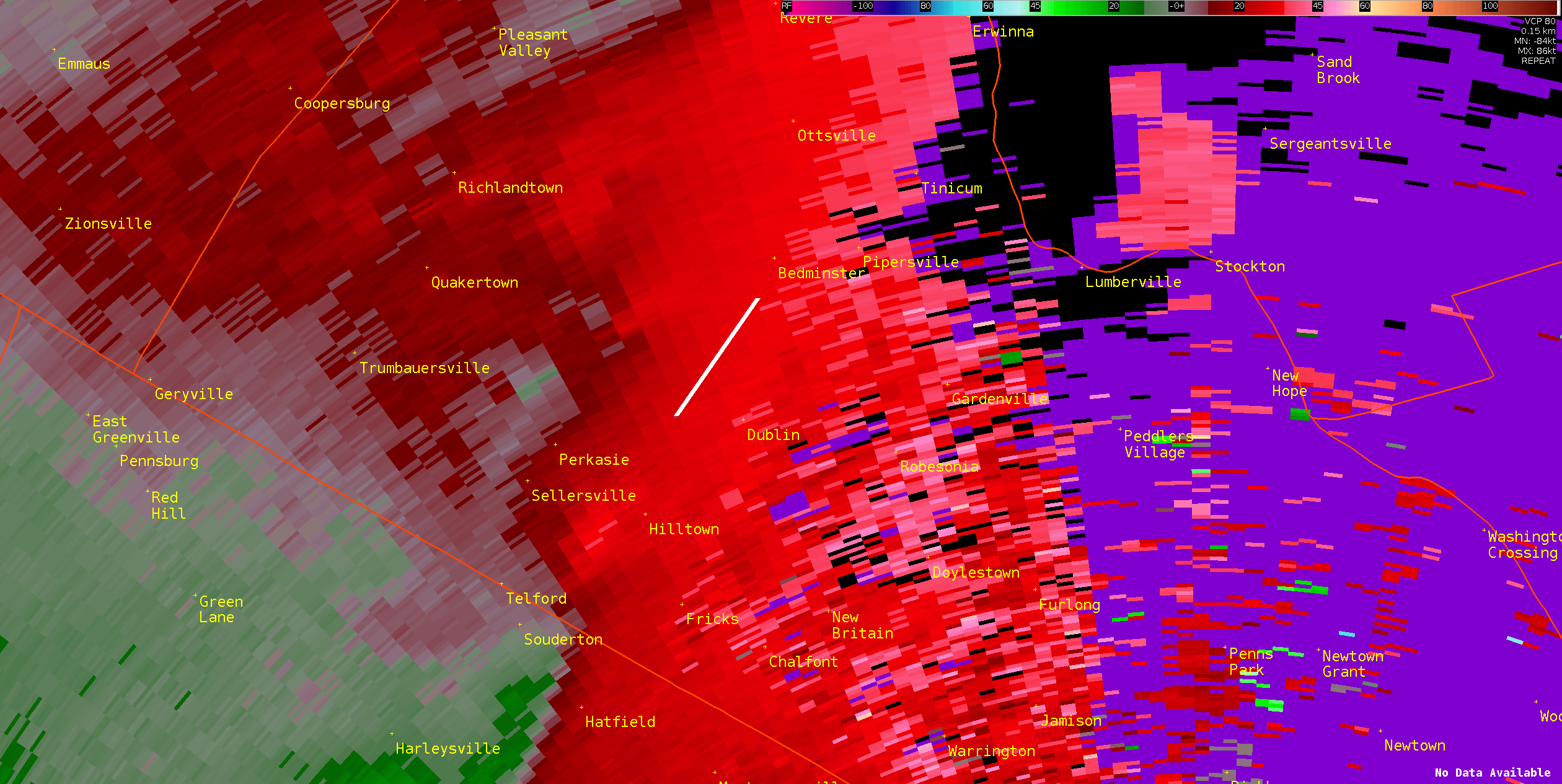 |
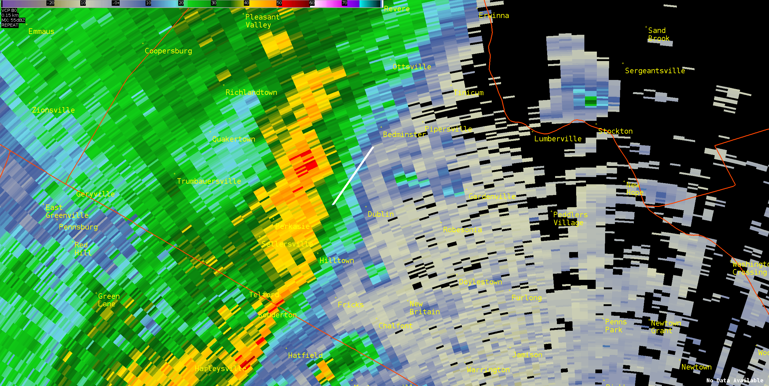
| Figure 1: TPHL radar reflectivity loop from approximately 9:40 to 9:55 PM EDT March 31, 2022. The approximate path of the Bucks County tornado is seen in the white line. The Bucks County tornado did not have a classic tornadic appearance in reflectivity data, not surprising given it was relatively weak and brief. However, the reflectivity pattern resembles a "Broken S" type signature which previous research has linked to QLCS type tornadoes. | Figure 2: TPHL base velocity data for the same time as Figure 1, again with the approximate Bucks County tornado track overlaid. While the data is noisy at times, common with TDWR data, a well-defined velocity couplet can be seen progressing along the tornado track line. The TPHL data was vital in detecting this tornado, as is illustrated in Figure 4. |
 |
 |
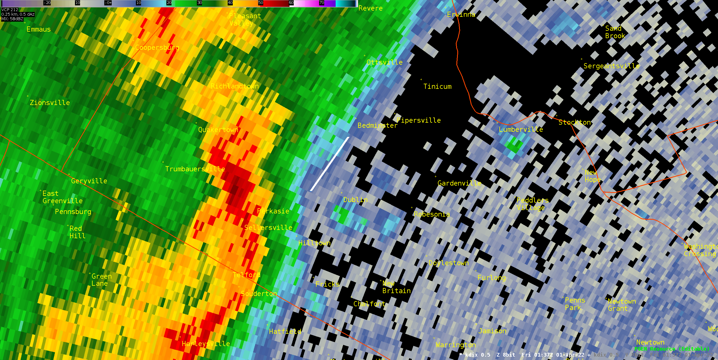
| Figure 3: Same as Figure 1 but for the KDIX radar. The reflectivity presentation is similar overall between KDIX and TPHL. | Figure 4: Same as Figure 2 but for the KDIX radar. Here, much more significant differences are seen between the two radars. While some rotation is seen along the tornado track, it is quite weak and broad. The KDIX data alone would likely have been insufficient to detect this tornado via radar. |


 Coastal Flood
 Marine Forecasts
 Text Products
 Climate Information
 Skywarn
 Submit Storm Report
 Weather Event Archives
 Forecast Discussion
 Emergency Managers
 Briefing Page