
Scattered to numerous severe thunderstorms are likely across the region on Saturday, July 18th, including a risk of flash flooding for portions of the area. View this briefing for the details regarding these hazards. Read More >
Overview
|
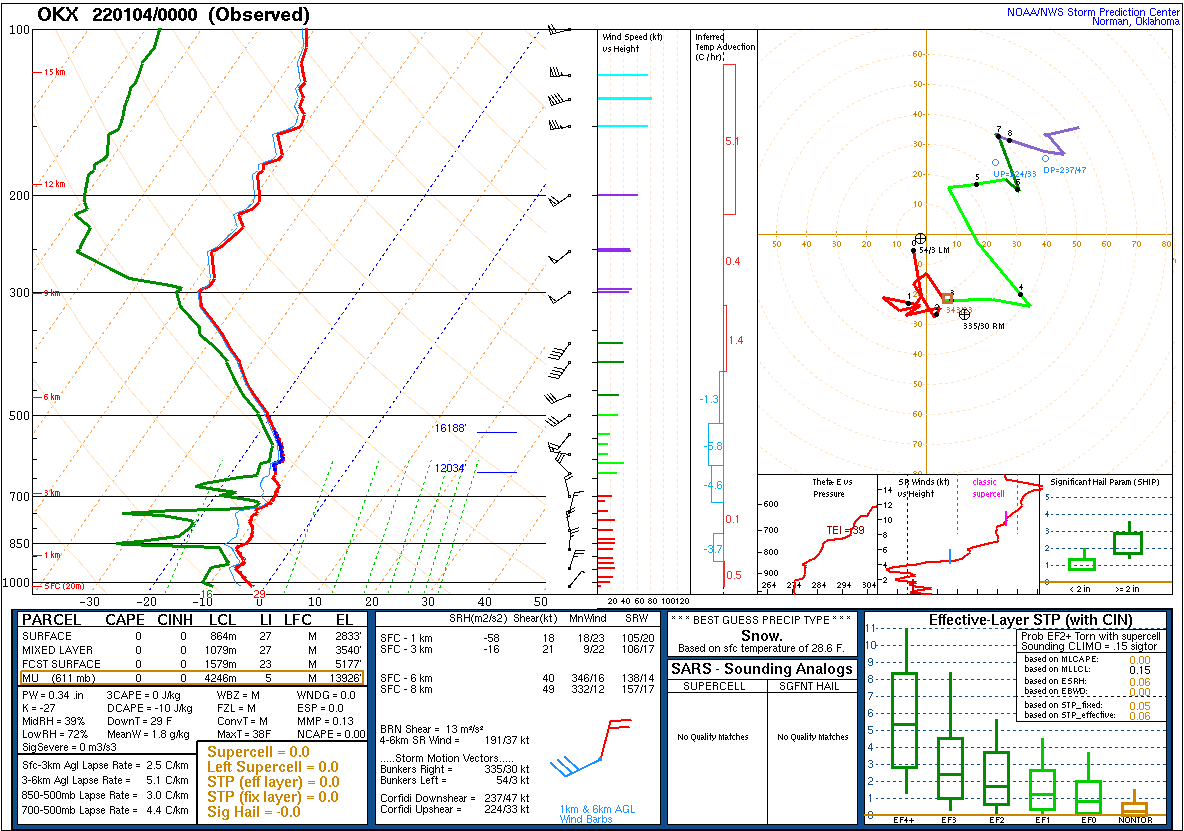
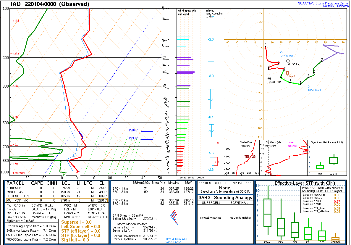
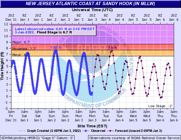
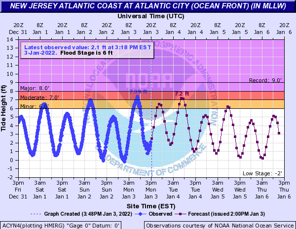
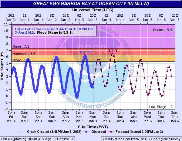
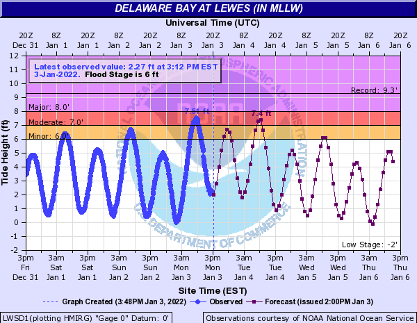
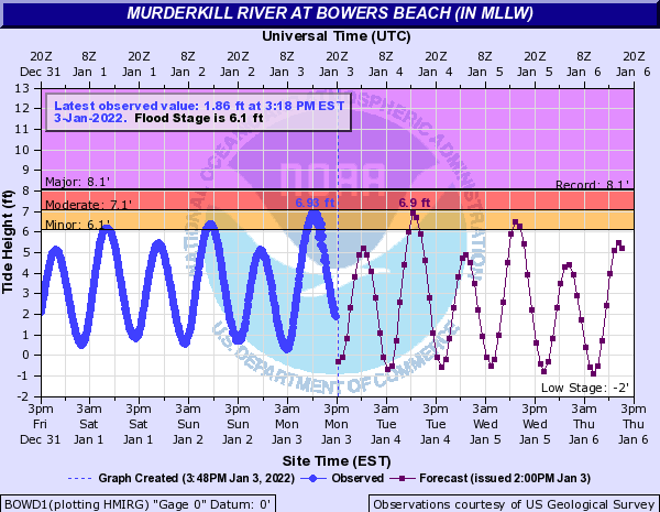
A winter storm impacted most of Delmarva and southern New Jersey on January 3, 2022. A widespread 6 to 12 inches of snow with locally higher amounts fell across the Eastern Shore of Maryland, most of Delaware, and several counties of southern New Jersey. This storm was noteworthy for a couple of reasons. Foremost, it was unusually poorly anticipated in the so-called “medium range”, the period about 3 to 6 days in the future. Most computer model guidance showed little indication of any storm system in that range. Only about 36 to 48 hours in advance of the first snowflakes did it become apparent that a winter storm would occur, and unusually large and rapid changes had to be made to the forecast. The storm was also notable for having a very sharp cutoff in the northern extent of accumulating snow. While areas mentioned above received significant accumulations, one only had to travel as far north as Philadelphia or Toms River to almost entirely exit the zone of snowfall. This was due to very dry air invading from the north, eating away at the storm’s precipitation shield. Even more impressive was that an unseasonably warm air mass had been in place prior to this storm’s arrival, with areas that saw the most snowfall having been in the 50s and 60s less than 12 hours before snow began! A strong cold front brought rapid cooling in the hours leading up to the storm, and very heavy snowfall rates, at times well in excess of 1 inch per hour, overwhelmed the lingering warm ground and caused accumulation to occur. Finally, this storm occurred the day after a new moon, which led to higher than normal astronomical tides. Several tide cycles of minor coastal flooding occurred in advance of this storm. On the morning of the storm, the added surge of water produced by strengthening onshore flow caused some coastal areas to experience a round of moderate flooding. A few hydrographs are presented for review on this page.
|
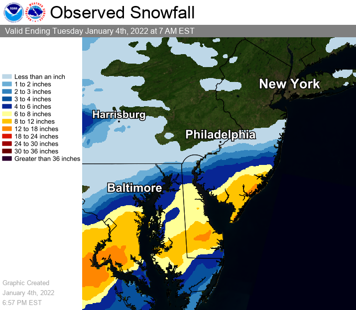 Map of storm total snowfall for the event, derived from snowfall reports graciously provided from various sources including emergency managers, trained spotters, and the public. The map is an approximation, limited by factors such as a varying spatial density of reports, but it provides a good overview. |
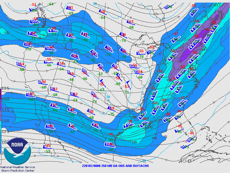
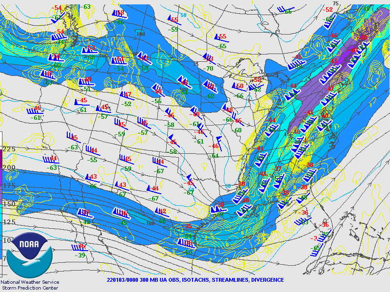
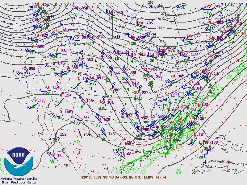
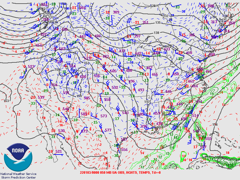
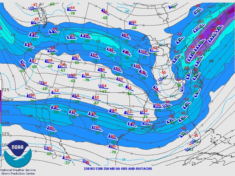
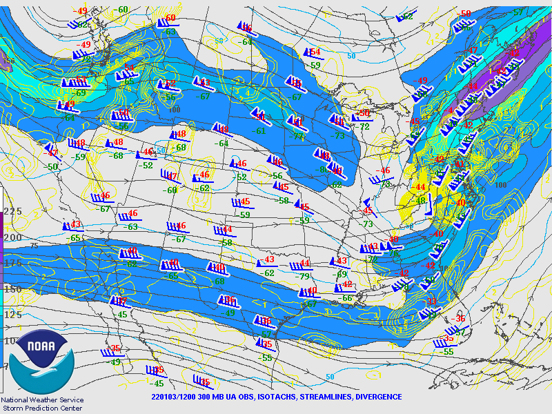
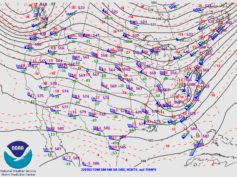
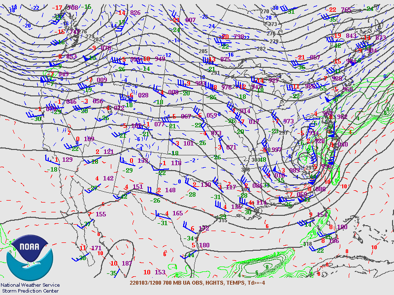
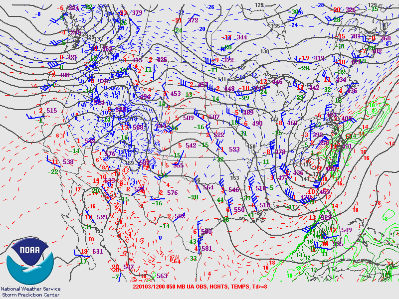
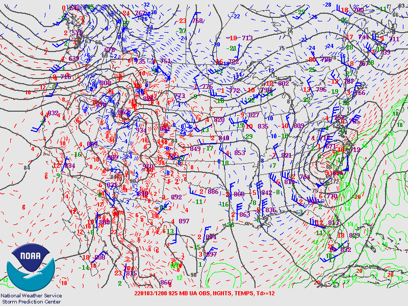
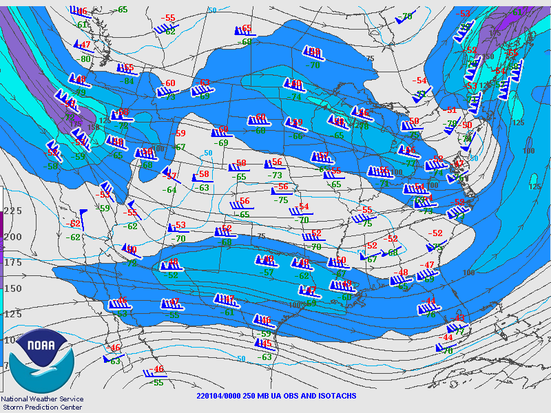
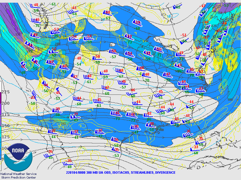
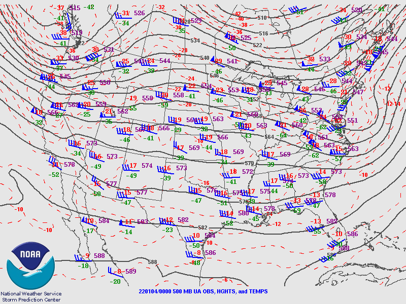
Upper Air Analysis: 00z 3 Jan (Courtesy of SPC)
 |
 |
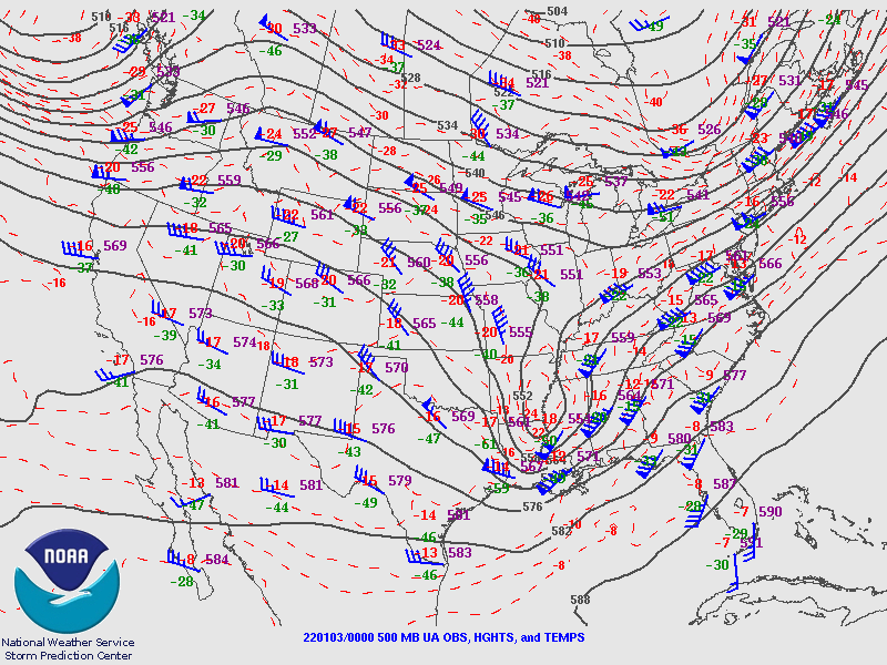 |
| Figure 1: 250 mb analysis | Figure 2: 300 mb analysis | Figure 3: 500 mb analysis |
 |
 |
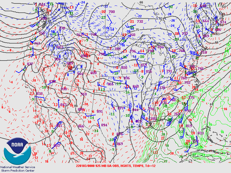 |
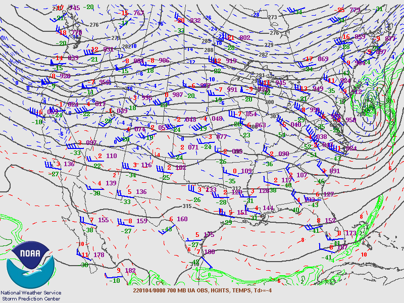
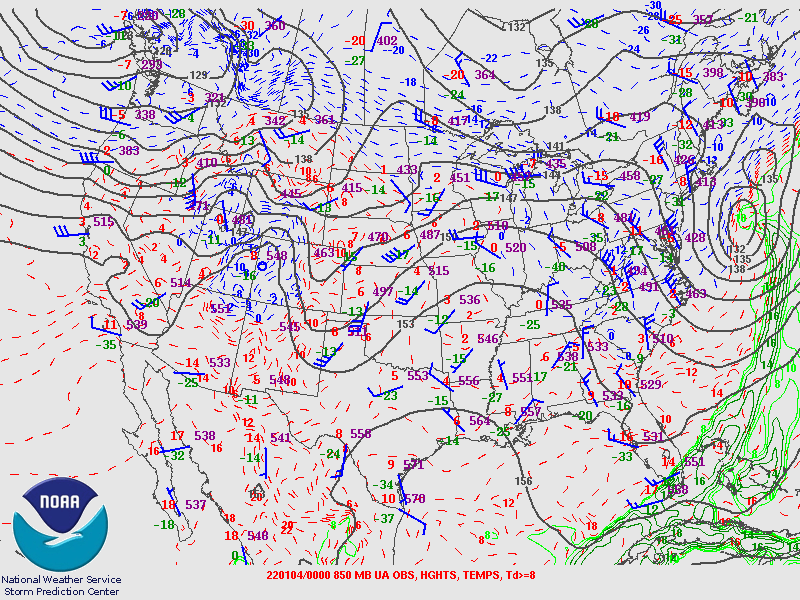
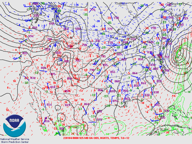
| Figure 4: 700 mb analysis | Figure 5: 850 mb analysis | Figure 6: 925 mb analysis |
Upper Air Analysis: 12z 3 Jan (Courtesy of SPC)
 |
 |
 |
| Figure 7: 250 mb analysis | Figure 8: 300 mb analysis | Figure 9: 500 mb analysis |
 |
 |
 |
| Figure 10: 700 mb analysis | Figure 11: 850 mb analysis | Figure 12: 925 mb analysis |
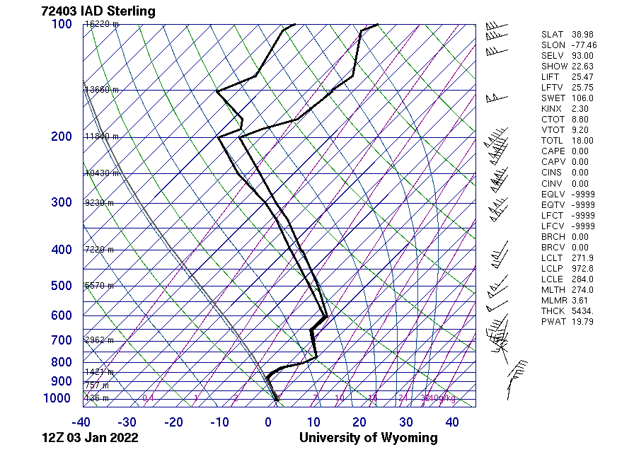
Upper Air Analysis: 00z 4 Jan (Courtesy of SPC)
 |
 |
 |
| Figure 13: 250 mb analysis | Figure 14: 300 mb analysis | Figure 15: 500 mb analysis |
 |
 |
 |
| Figure 16: 700 mb analysis | Figure 17: 850 mb analysis | Figure 18: 925 mb analysis |
Surface Analysis from 00z 3 Jan to 00z 4 Jan (Courtesy of WPC)
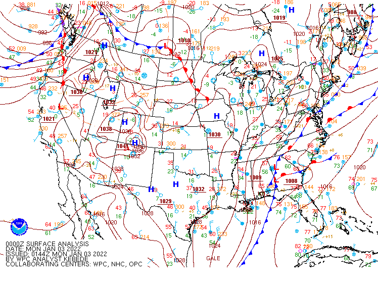 |
| Figure 19: WPC Surface Analysis, in 3 hour increments. |
 |
 |
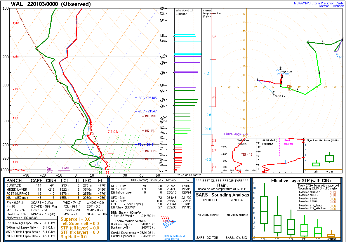 |
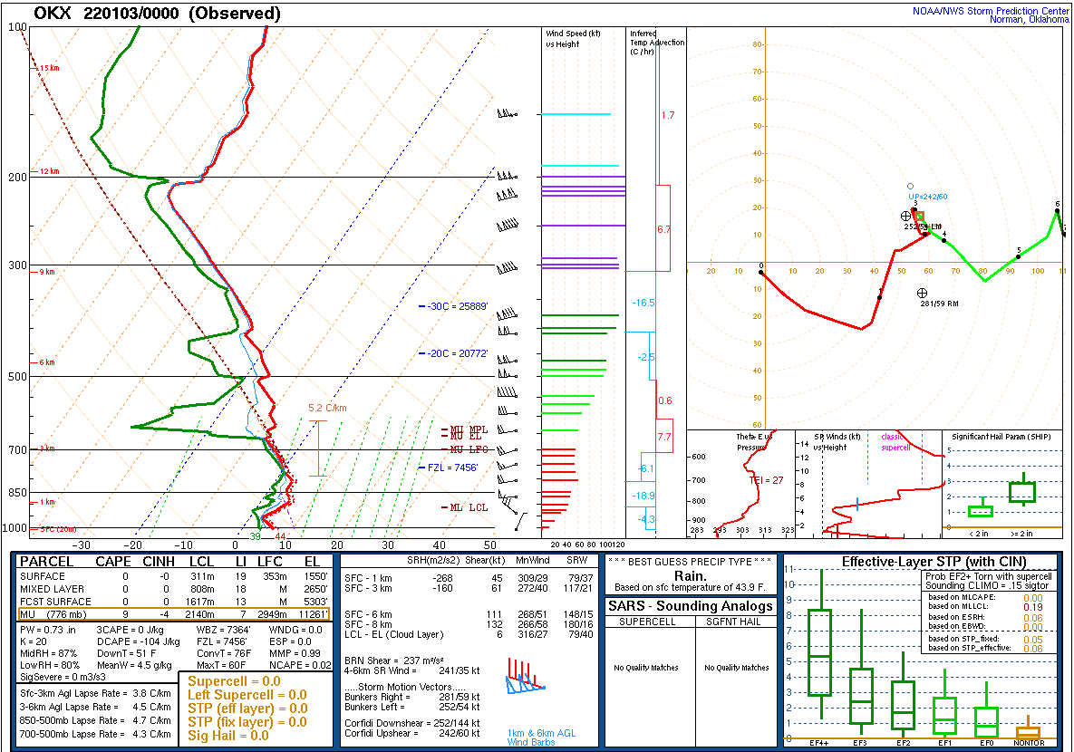
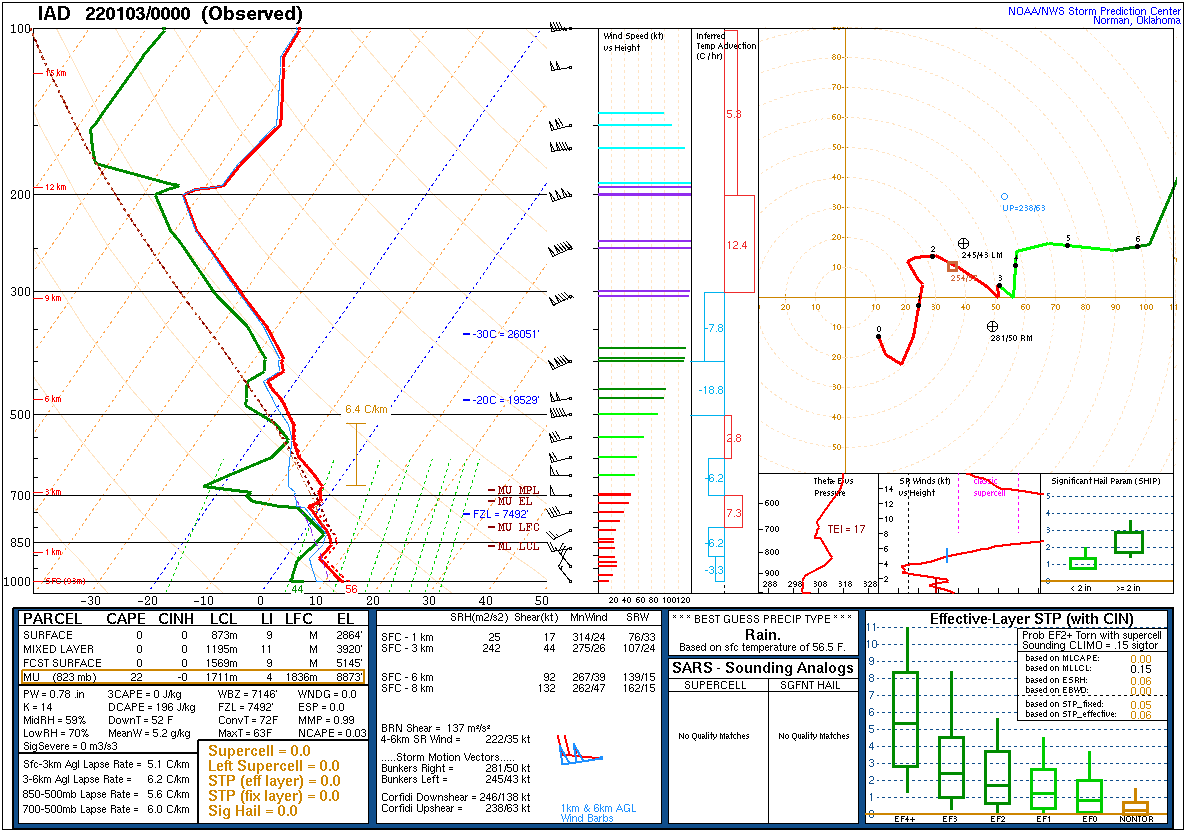
| Figure 20: 00z 3 Jan Long Island, NY sounding | Figure 21: 00z 3 Jan Sterling, VA sounding | Figure 22: 00z 3 Jan Wallops Island, VA sounding |
 |
 |
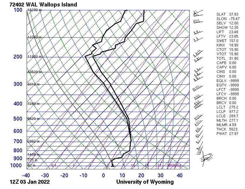 |
| Figure 23: 12z 3 Jan Long Island, NY sounding | Figure 24: 12z 3 Jan Sterling, VA sounding | Figure 25: 12z 3 Jan Wallops Island, VA sounding |
 |
 |
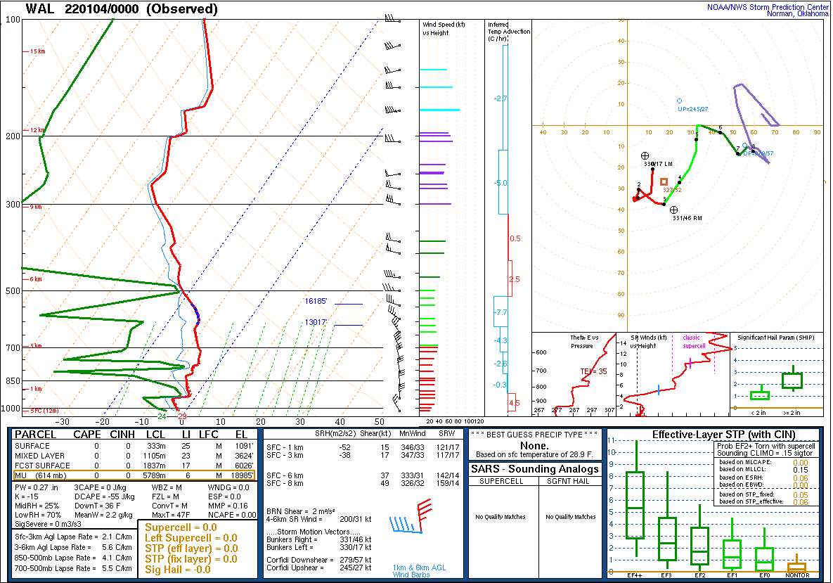 |
| Figure 26: 00z 4 Jan Long Island, NY sounding | Figure 27: 00z 4 Jan Sterling, VA sounding | Figure 28: 00z 4 Jan Wallops Island, VA sounding |
NOUS41 KPHI 032059
PNSPHI
DEZ001>004-MDZ012-015-019-020-NJZ001-007>010-012>027-PAZ054-055-060>062-070-
071-101>106-040859-

Public Information Statement
National Weather Service Mount Holly NJ
359 PM EST Mon Jan 3 2022

...UPDATED SNOWFALL REPORTS FOR MONDAY JANUARY 3RD...

Location                     Amount    Time/Date       Provider

...Delaware...

...Kent County...
Hartly                       13.0 in   0238 PM 01/03   Public
1 SE Woodside                10.5 in   0317 PM 01/03   Trained Spotter
2 WNW Frederica              10.3 in   0312 PM 01/03   Public
Woodside                     10.0 in   0315 PM 01/03   Trained Spotter
1 WSW Dover Air Force Base   10.0 in   0320 PM 01/03   Trained Spotter
3 S Kitts Hummock            7.7 in    0315 PM 01/03   Public
3 SW Magnolia                7.0 in    1145 AM 01/03   Trained Spotter
Dover                        7.0 in    1222 PM 01/03   Public
Smyrna                       7.0 in    1237 PM 01/03   Public
2 WSW Magnolia               6.0 in    0130 PM 01/03   Public

...New Castle County...
Middletown                   6.0 in    0333 PM 01/03   Trained Spotter
Summit Bridge                5.5 in    0204 PM 01/03   Trained Spotter
Middletown                   5.3 in    0156 PM 01/03   Trained Spotter
Middletown                   4.5 in    1130 AM 01/03   Public
2 WSW Summit Bridge          3.0 in    1058 AM 01/03   Public
Bear                         3.0 in    1226 PM 01/03   Trained Spotter
New Castle County Airport    1.0 in    0100 PM 01/03   ASOS

...Sussex County...
Georgetown                   12.0 in   0346 PM 01/03   Trained Spotter
1 WSW Milton                 11.6 in   0213 PM 01/03   Public
Milford                      10.0 in   0230 PM 01/03   Public
2 SW Rehoboth Beach          6.0 in    0330 PM 01/03   Public
3 SW Long Neck               5.0 in    0105 PM 01/03   Public
Greenwood                    4.0 in    1003 AM 01/03   Public
Delmar                       1.5 in    1238 PM 01/03   Cocorahs

...Maryland...

...Caroline County...
Henderson                    11.0 in   0230 PM 01/03   Trained Spotter
Goldsboro                    10.0 in   0307 PM 01/03   Emergency Mngr
Greensboro                   9.8 in    0307 PM 01/03   Emergency Mngr
Henderson                    9.0 in    0307 PM 01/03   Emergency Mngr
2 SSE Templeville            9.0 in    0307 PM 01/03   Emergency Mngr
Preston                      8.0 in    0307 PM 01/03   Emergency Mngr
Denton                       7.0 in    0309 PM 01/03   Emergency Mngr

...Kent County...
Millington                   7.3 in    1230 PM 01/03   Trained Spotter

...Queen Annes County...
Stevensville                 9.0 in    0340 AM 01/03   Trained Spotter
Stevensville                 8.0 in    1230 PM 01/03   Trained Spotter
Kingstown                    7.0 in    0100 PM 01/03   Trained Spotter
2 NNE Starr                  6.9 in    1107 AM 01/03   Trained Spotter
2 SW Stevensville            6.5 in    0300 PM 01/03   Public

...Talbot County...
Royal Oak                    8.0 in    1240 PM 01/03   CO-OP Observer
Easton                       5.5 in    0300 PM 01/03   Public
Easton                       5.0 in    0952 AM 01/03   Public

...New Jersey...

...Atlantic County...
Absecon                      13.0 in   0343 PM 01/03   Trained Spotter
3 NE Hamilton Twp            12.0 in   0300 PM 01/03   Trained Spotter
Northfield                   11.0 in   0300 PM 01/03   Trained Spotter
1 E Mays Landing             10.0 in   0252 PM 01/03   Public
Egg Harbor Twp               10.0 in   0302 PM 01/03   Trained Spotter
1 NNE Somers Point           9.8 in    0205 PM 01/03   Public
Somers Point                 9.7 in    0130 PM 01/03   Public
Egg Harbor Twp               9.5 in    0100 PM 01/03   Trained Spotter
Atlantic City International  9.5 in    0100 PM 01/03   ASOS
Egg Harbor Twp               9.5 in    0130 PM 01/03   Trained Spotter
Northfield                   9.0 in    0200 PM 01/03   Broadcast Media
Egg Harbor Twp               8.6 in    0130 PM 01/03   Public
Hammonton                    8.5 in    0300 PM 01/03   Trained Spotter
Galloway Twp                 8.2 in    0109 PM 01/03   Public
Mays Landing                 8.0 in    1200 PM 01/03   Broadcast Media
Pleasantville                7.3 in    0103 PM 01/03   Broadcast Media
Northfield                   7.0 in    1237 PM 01/03   Public
Brigantine                   6.5 in    0300 PM 01/03   Trained Spotter
3 SW Egg Harbor City         6.0 in    1232 PM 01/03   Trained Spotter
1 NW Somers Point            5.5 in    0946 AM 01/03   Public
1 N Somers Point             5.0 in    1209 PM 01/03   Public
Absecon                      4.5 in    0955 AM 01/03   Trained Spotter
Egg Harbor Twp               4.0 in    1000 AM 01/03   Public
Egg Harbor City              4.0 in    1143 AM 01/03   Public
Buena                        4.0 in    1232 PM 01/03   Trained Spotter
Hammonton                    3.8 in    1238 PM 01/03   CO-OP Observer
Estell Manor                 3.0 in    0823 AM 01/03   CO-OP Observer
Egg Harbor City              1.5 in    0930 AM 01/03   Broadcast Media
Hamilton Twp                  T in     0254 PM 01/03   Trained Spotter

...Burlington County...
1 ESE Leisuretowne           2.8 in    0120 PM 01/03   NWS Employee
2 W Medford Twp.             2.0 in    1121 AM 01/03   Public
Lumberton                    0.8 in    0142 PM 01/03   Trained Spotter
Mount Holly WFO              0.6 in    0100 PM 01/03   Official NWS Obs

...Camden County...
Winslow Twp                  5.5 in    0130 PM 01/03   Public
1 SW Pine Hill               4.0 in    1200 PM 01/03   Public
1 WSW Lindenwold             4.0 in    0300 PM 01/03   Public
Gloucester Twp               3.8 in    0300 PM 01/03   Trained Spotter
Lindenwold                   3.5 in    0215 PM 01/03   Trained Spotter
Cherry Hill                  3.0 in    0103 PM 01/03   Public
Haddon Heights               1.6 in    1227 PM 01/03   Public
Bellmawr                     1.3 in    1200 PM 01/03   Trained Spotter

...Cape May County...
Ocean View                   11.3 in   0147 PM 01/03   Public
North Cape May               10.3 in   0200 PM 01/03   Public
Marmora                      9.7 in    0100 PM 01/03   Public
1 WNW Rio Grande             9.0 in    1232 PM 01/03   Public
1 W Rio Grande               8.5 in    1228 PM 01/03   Amateur Radio
Cape May Court House         8.2 in    1240 PM 01/03   Public
Cape May                     8.2 in    0103 PM 01/03   Public
Seaville                     7.5 in    1157 AM 01/03   Amateur Radio
Petersburg                   7.0 in    1156 AM 01/03   Amateur Radio
North Cape May               7.0 in    1213 PM 01/03   Amateur Radio
Green Creek                  6.0 in    1139 AM 01/03   Amateur Radio
1 SSW Cape May Court House   6.0 in    1210 PM 01/03   Amateur Radio
Eldora                       6.0 in    1225 PM 01/03   Amateur Radio
Villas                       4.8 in    1039 AM 01/03   Amateur Radio
Goshen                       4.0 in    1031 AM 01/03   Amateur Radio
Ocean City                   4.0 in    1232 PM 01/03   Trained Spotter
Cape May Point               3.8 in    1144 AM 01/03   Trained Spotter
1 NE Cape May Court House    3.0 in    1009 AM 01/03   Amateur Radio
1 NNW Erma                   3.0 in    1022 AM 01/03   Amateur Radio
Cape May                     3.0 in    1040 AM 01/03   Amateur Radio
Tuckahoe                     2.0 in    0930 AM 01/03   Broadcast Media

...Cumberland County...
Millville                    6.3 in    0100 PM 01/03   Trained Spotter
Newport                      6.0 in    0330 PM 01/03   Trained Spotter
Millville                    5.8 in    0100 PM 01/03   Public
Cedarville                   5.5 in    0200 PM 01/03   Public
Millville                    5.0 in    0100 PM 01/03   Trained Spotter
2 W Rosenhayn                4.5 in    0100 PM 01/03   Trained Spotter
Vineland                     2.7 in    1122 AM 01/03   Trained Spotter
1 NNW Seabrook Farms         2.5 in    1125 AM 01/03   Trained Spotter
Millville                    2.2 in    1124 AM 01/03   Trained Spotter
Hopewell Twp.                2.2 in    1126 AM 01/03   Trained Spotter

...Gloucester County...
Franklinville                5.5 in    0330 PM 01/03   Public
Williamstown                 5.3 in    0248 PM 01/03   Trained Spotter
Washington Twp               5.0 in    0100 PM 01/03   Public
Greenwich Twp                4.5 in    0250 PM 01/03   Public
Williamstown                 4.0 in    1130 AM 01/03   Trained Spotter
Mantua                       4.0 in    0100 PM 01/03   Public
Glassboro                    3.4 in    1127 AM 01/03   Public
West Deptford Twp            3.4 in    0200 PM 01/03   Public
1 NE Glassboro               2.3 in    1047 AM 01/03   Trained Spotter

...Ocean County...
Barnegat Twp                 9.3 in    0314 PM 01/03   Trained Spotter
Little Egg Harbor Twp        7.2 in    0100 PM 01/03   Public
1 NNE Beach Haven            6.0 in    0200 PM 01/03   Public
Barnegat                     5.8 in    0100 PM 01/03   Public
Waretown                     5.5 in    0230 PM 01/03   Public
1 SSE Stafford Twp.          5.0 in    1230 PM 01/03   Trained Spotter
Forked River                 5.0 in    0317 PM 01/03   Trained Spotter
Stafford Twp.                4.0 in    1111 AM 01/03   Trained Spotter
2 SSE Stafford Twp.          3.5 in    1100 AM 01/03   Public
Forked River                 3.0 in    1144 AM 01/03   Public
1 E Forked River             3.0 in    0100 PM 01/03   Public
Toms River                   2.5 in    0200 PM 01/03   Trained Spotter
Toms River                   2.0 in    0254 PM 01/03   Trained Spotter
Lanoka Harbor                1.7 in    1003 AM 01/03   Public
Harvey Cedars                1.0 in    0920 AM 01/03   Law Enforcement
Lakewood Twp                 0.5 in    0153 PM 01/03   Public
Brick                        0.5 in    0338 PM 01/03   Trained Spotter

...Pennsylvania...

...Chester County...
Glenmoore                     T in     0236 PM 01/03   Trained Spotter
Exton                         T in     0319 PM 01/03   Trained Spotter

...Philadelphia County...
1 SE Point Breeze            1.8 in    0100 PM 01/03   Trained Spotter
Philadelphia International   0.5 in    0100 PM 01/03   ASOS
&&
 |
 |
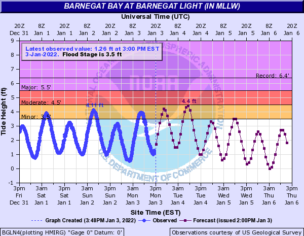 |
| Figure 1: Hydrograph for the New Jersey Atlantic Coast at Sandy Hook tidal gauge (SDHN4) before and during the January 3rd winter storm. The solid blue line represents observed values which have already occurred. The purple line with small square boxes along it represents forecast values. | Figure 2: Same as Fig. 1, for Arthur Kill at Perth Amboy (PABN4). | Figure 3: Same as Fig. 1, for Barnegat Bay at Barnegat Light (BGLN4). |
 |
 |
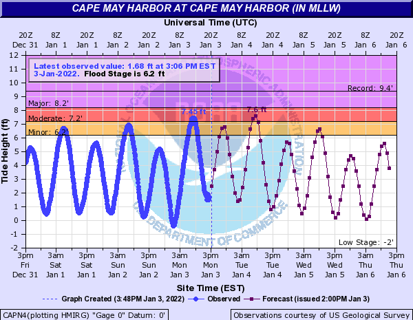 |
| Figure 4: Same as Fig. 1, for the New Jersey Atlantic Coast at Atlantic City (ACYN4). | Figure 5: Same as Fig. 1, for Great Egg Harbor Bay at Ocean City (ONCN4). | Figure 6: Same as Fig. 1, for Cape May Harbor (CAPN4). |
 |
 |
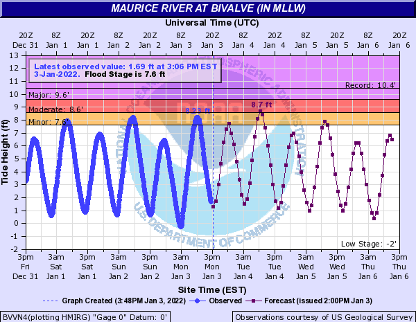 |
| Figure 7: Same as Fig. 1, for Delaware Bay at Lewes (LWSD1). | Figure 8: Same as Fig. 1, for Murderkill River at Bowers Beach (BOWD1). | Figure 9: Same as Fig. 1, for Maurice River at Bivalve (BVVN4). |


 Coastal Flood
 Marine Forecasts
 Text Products
 Climate Information
 Skywarn
 Submit Storm Report
 Weather Event Archives
 Forecast Discussion
 Emergency Managers
 Briefing Page