| Reset Page | Interactive Observations and Hazards | Snow and Ice Forecasts / Probabilities |
 |
|
|
Min Apparent Temp Day 1 Delmarva |
Observations: |
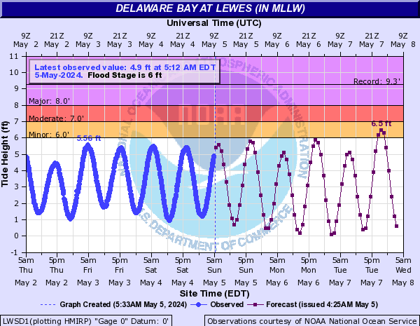
Total Water Level: |
Hourly Weather Graph: |
|
 |
 |
 |
 |
|
Frequently Requested Products |
|
|
Frequently Requested Text Products: (Note: Some links may need to be opened in a new window. Use right-click on mouse to do so)
Mount Holly Decision Support Services:
"Provide decision makers with critical environmental data and forecasts to allow them to better protect life and property."
Questions/Feedback: wfophi.webmaster@noaa.gov
|
|


 Coastal Flood
 Marine Forecasts
 Text Products
 Climate Information
 Skywarn
 Submit Storm Report
 Weather Event Archives
 Forecast Discussion
 Emergency Managers
 Briefing Page