
A major winter storm will produce widespread significant impacts from the central Plains across the Ohio and Tennessee valleys, and into the Mid-Atlantic region this weekend into Monday. Areas between central Kansas and Indiana, especially along and north of Interstate 70, are likely to receive heavy snowfall. Icing is likely from eastern Kansas into the southern Appalachians. Read More >
 |
 |
NWS Mt Holly Weather Briefing Page"Working Toward a Weather-Ready Nation"Suggestions for improvement are welcome. |
 |
|
NWS Mt Holly Tropical Cyclone Impact Graphics
Available Only When a Storm Threatens the Mid Atlantic Region Within 2-3 Days |
|||
 Wind Impact |
 Storm Surge Impact |
 Inland Flooding Impact |
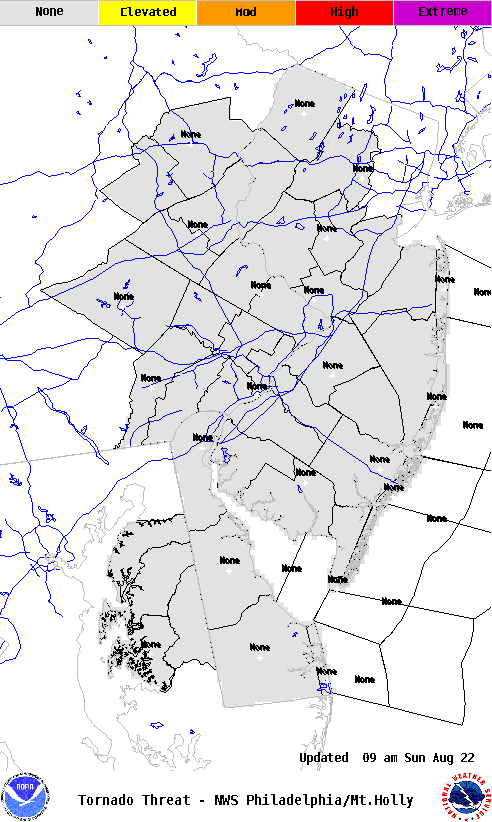 Tornado Impact |
|
NOAA Tropical Satellite Imagery
|
|
Visible Imagery
|
||
|
Infrared Imagery
|
||
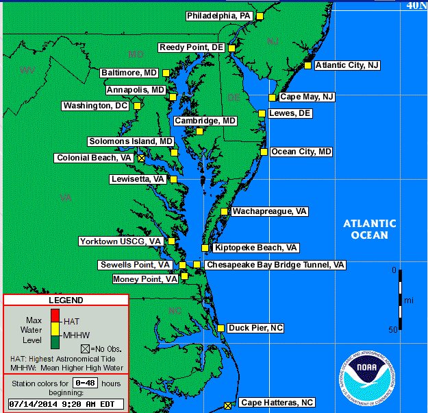
Extra-Tropical Storm Surge Guidance
.png) |
 |
 |
 |
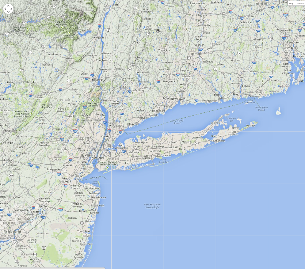 |
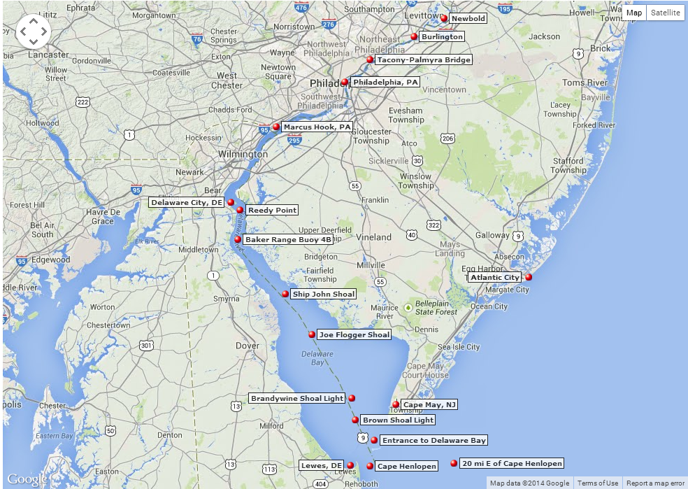
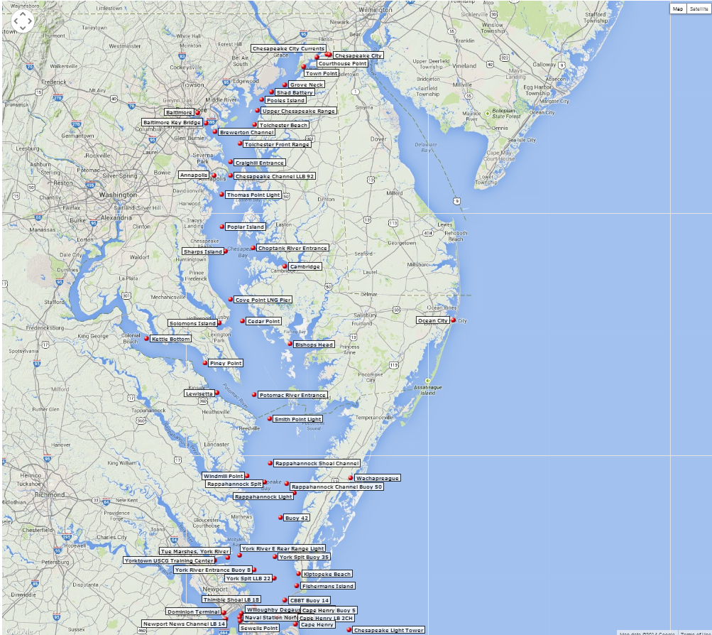
Click here for tide predictions from MD to NJ
|
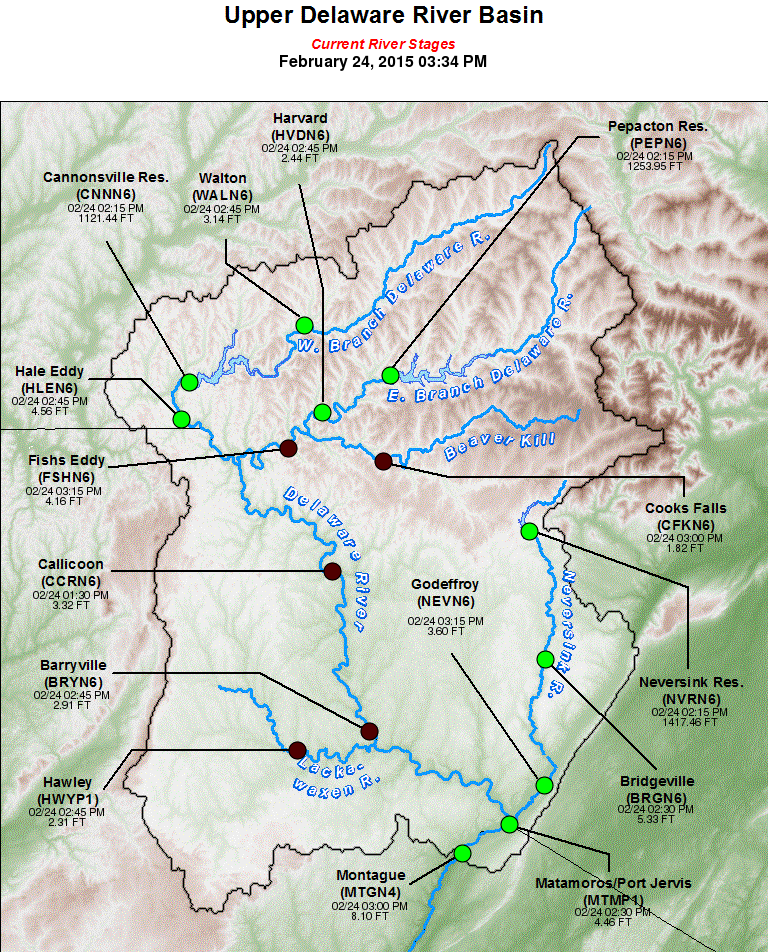
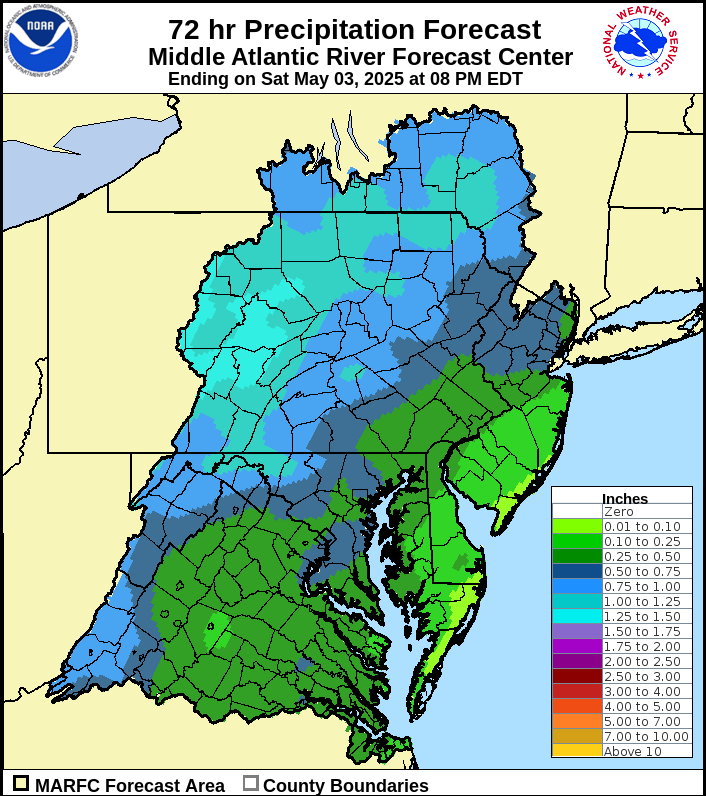
Daily river forecast and statements for the WFO PHI hydrologic service area Mid-Atlantic River Forecast Center (MARFC) Weather Prediction Center Rainfall Forecasts
|
||||||||||||
|
||||||||||||
|
|
|
|
|
|
DAYS 4-5 FORECAST PRECIPITATION |
DAYS 6-7 FORECAST PRECIPITATION |
 |
 |
|
DAYS 6-10 |
|
|
TEMPERATURE |
PRECIPITATION |
 |
 |
|
DAYS 8-14 |
|
|
TEMPERATURE |
PRECIPITATION |
 |
 |
|
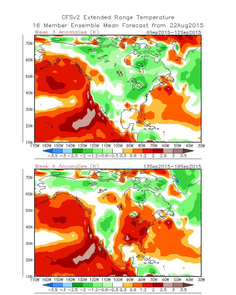
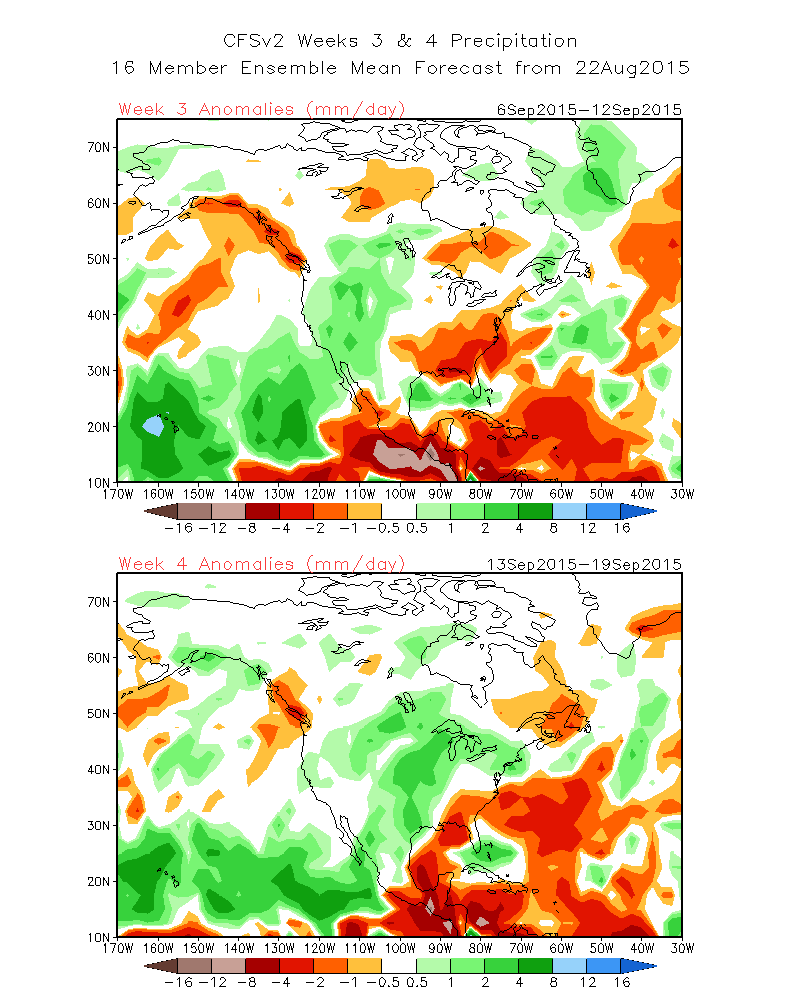
WEEK 3-4 |
|
| What's this? | |
|
TEMPERATURE |
PRECIPITATION |
 |
 |
Updated May 26, 2017


 Coastal Flood
 Marine Forecasts
 Text Products
 Climate Information
 Skywarn
 Submit Storm Report
 Weather Event Archives
 Forecast Discussion
 Briefing Page