Summer Analogs for 2015
Here is our annual look as to how hot, hot, hot the summer will
be based on past performances. (Download PDF version here)
A full-fledged el nino is underway in the tropical pacific. All
dynamical and statistical models keep it going, the differences
that exist are to its strength through this upcoming summer. The
dynamical and statistical models are averaging a moderate el nino
for the combined summer months. Some models, including the cfs2
and ecmwf are predicting a strong el nino. In the CPC monitoring
el nino era starting since 1950, the highest (warmest) summer
anomaly recorded was +1.5C (near or at the threshold for strong el
ninos) during the summer of 1997.
This upcoming week will really seal the deal that this May will
be unseasonably warm in Philadelphia. It "may" even be a top three
warmest. This follows on the heels of an unseasonably warm April.
Since 1872, the combination of both warm (top third of all years)
Aprils and Mays has only occurred twenty-three times. But it has
occurred eleven times since 1990 and six of the last seven
springs.
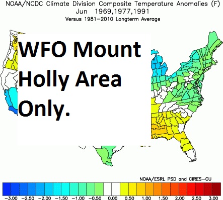
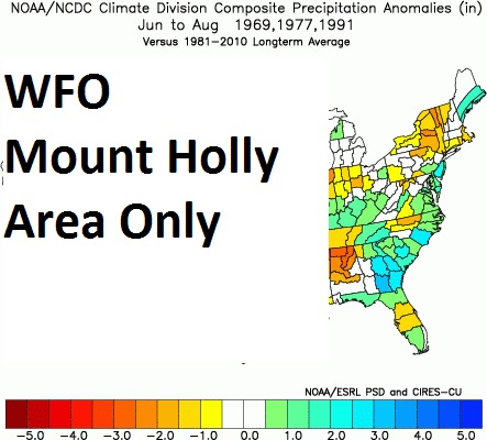
So we scoured the climate records to find budding or in progress
el ninos that coincided with both warm Aprils and Mays locally in
the CPC monitoring era. We found three past summers that met the
criteria. The one sign is that all three analog summers were
wetter than normal, hopefully keeping drought conditions from
intensifying further.
The North American Multi Model Ensemble predictions for this
upcoming summer has warmer and drier than normal weather expected
in our area. The International Multi Model Ensemble forecasts are
slightly more optimistic predicting near normal temperatures and
precipitation.
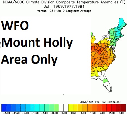
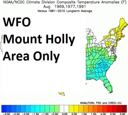
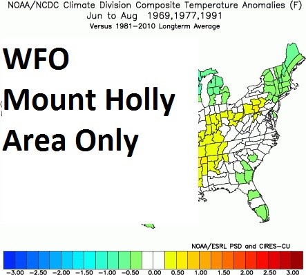
The analogs for Philadelphia are:
Year June avg July avg August avg summer avg summer pcpn
1969 73.4 75.1 75.2 74.6 18.30
1977 68.6 77.8 76.2 74.2 15.50
1991 75.7 79.0 79.0 77.9 12.01
Avg 72.6 77.3 76.8 75.6 15.27
1981-
2010 73.3 78.1 76.6 76.0 11.28
Normal
The official CPC outlook for our forecast area is for equal
chances of above and below normal temperatures as well as equal
chances of above and below normal precipitation.


 Coastal Flood
 Marine Forecasts
 Text Products
 Climate Information
 Skywarn
 Submit Storm Report
 Weather Event Archives
 Forecast Discussion
 Emergency Managers
 Briefing Page