
Scattered to numerous severe thunderstorms are likely across the region on Saturday, July 18th, including a risk of flash flooding for portions of the area. View this briefing for the details regarding these hazards. Read More >
Philadelphia/Mt Holly
Weather Forecast Office
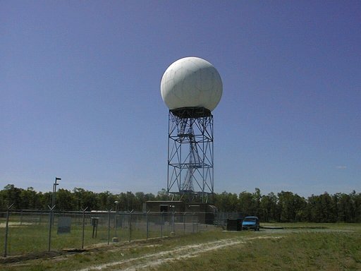

View the latest radar images from the WSR-88D at Fort Dix, NJ, which provides full coverage of the NWS Mount Holly forecast area.
US Dept of Commerce
National Oceanic and Atmospheric Administration
National Weather Service
Philadelphia/Mt Holly
732 Woodlane Rd.
Mount Holly, NJ 08060
609-261-6600
Comments? Questions? Please Contact Us.


 Coastal Flood
 Marine Forecasts
 Text Products
 Climate Information
 Skywarn
 Submit Storm Report
 Weather Event Archives
 Forecast Discussion
 Emergency Managers
 Briefing Page