The Pitcairn Flash Flood - 01 July 1997
National Weather Service Pittsburgh, PA
From approximately 615 pm to 800 pm on July 01 July 1997 excessive rainfall occurred over a relatively small portion of eastern Allegheny County in southwestern Pennsylvania. The subsequent flash flooding affected the four municipalities of Monroeville, Turtle Creek, Wilkins Township and especially the town of Pitcairn. Basin average precipitation was estimated at nearly 2.5 inches with an isolated maximum near 4.5 inches in less than 3 hours. The WSR-88D and the associated software package AMBER (Aerial Mean Basin Estimated Rainfall) allowed for the detection of this very localized rainfall event.

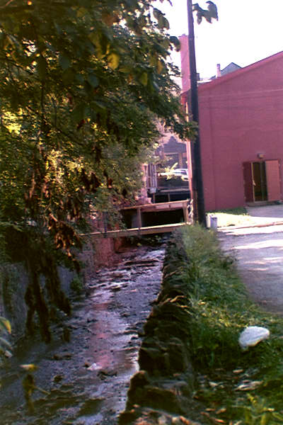
The majority of excessive rainfall occurred over a very localized area encompassing a basin of only about 4 mi2. The basin is positioned north to south and empties into Turtle Creek on its southern end. The municipality of Monroeville is located across the northern and western sections of the basin with the municipality of Pitcairn in the southern portion. The communities of Wilkins Township and Turtle Creek are situated on the periphery of the basin. The basin is heavily urbanized across the southern portion in Pitcairn. The remainder of the basin is moderately urbanized with a mix of forests, housing developments and businesses. There are several small feeder creeks (unnamed) which feed the main creek of Dirty Camp Run. Even Dirty Camp Run is a relatively small creek with an average width of only about 10 feet through Pitcairn. In addition, the flow is normally very low averaging only about 6 inches. Concrete retaining walls (approximately 10 feet high) were constructed for Dirty Camp Run through the most heavily urbanized section of Pitcairn.
Photo from Pittsburgh Post Gazzette.
(Thursday, July 3 1997)
Aloft, a weak upper level low pressure system had been moving eastward from the Midwestern U.S. during the previous two days. By 0000 UTC on 02 July 1997 this system was situated over western Pennsylvania and was manifested by an upper level trough. As a consequence, the region was experiencing a general area of mean tropospheric lift (i.e., upward vertical motion). The general flow over western Pennsylvania was very weak and it was from the northwest. The mean wind through the 0 to 6 km layer was from 287o at only 11 kts. In the lower atmosphere (1000 mb - 850 mb), there was a maximum in low level moisture convergence extending from north-central Pennsylvania southwestward to the Laurel Highlands. In addition to the weak kinematics, the atmosphere at 0000 UTC on 02 July 1997 was very moist. Surface dewpoints ranged from the upper 60s (19C) to near 70F (21C). The mean layer Theta-E from the surface to 650 mb was 341.2K. Dewpoints at 850 mb were around 15C and the Precipitable Water (PW) was 1.74 in. Convectively, the lifted index was -4 with Convective Available Potential Energy (CAPE) of 1190 J/kg (approaching moderate instability).
The Pittsburgh, PA 0000 UTC sounding was particulary interesting. The environmental lapse rate was conditionally unstable through 650 mb. At this point, the sounding became almost isothermal to approximately 597 mb. Above 597 mb, the sounding then became conditionally unstable (lapse rate greater than moist adiabatic) until crossing the freezing level at 583 mb. As a result of this inversion layer (650 mb to 597 mb), the atmosphere continued above freezing for approximately (.34 mile) farther than if the atmosphere had been conditionally unstable through the freezing level. This provided a warm cloud-layer depth of approximately 3.3 km . Greater depths of the warm cloud layer promote higher precipitation efficiency by promoting the coalescence process and subsequently enhancing the precipitation. The depth of the warm cloud layer in the Pitcairn flash flood was equal to or greater than the Big Thompson (31 July 1976), the Rapid City (Black Hills - 9 June 1972), and even the Cheyenne, WY (01 August 1985) flash floods.
Convective cells were widely scattered through the afternoon of 01 July 1997. The very weak wind field was conducive to excessive rain. About 610 pm (2210 UTC) a cell developed over Monroeville in eastern Allegheny county. This particular thunderstorm cell displayed quasi-stationary characteristics and in fact, exhibited a tendency to "back-build" upstream. Additionally, between 730 pm and 800 pm an additional convective cell which developed over the Pittsburgh City limits merged along the southern periphery of the Monroeville-Pitcairn cell. The extreme slow movement, back-building characteristics, and cell merger were all consistent with excessive rainfall-producing storms.
Between 700 am and 1100 am 01 July 1997 an area of showers and thunderstorms crossed portions of eastern Allegheny county. It appears that approximately 0.4 inches (basin average) occurred across the Pitcairn basin. The runoff from these early morning rains are thought to have had little impact on the flooding that ensued later in the day. The excessive rainfall began that evening over eastern Allegheny county about 615 pm. The rain first started in the northern end of the basin when a quasi-stationary thunderstorm cell developed over the Monroeville area. The runoff quickly moved southward (down-stream) and actually "primed" the community of Pitcairn for flooding. The community of Pitcairn is very heavily urbanized. Several blocks of row-homes are situated from east to west as well as alleyways and sidewalks. Dirty Camp Run flows almost directly through the center of this community. In fact, about a 5 to 6 square city block area immediately adjacent to the creek represents the lowest part of the town. 
Photo shows school building built right on top of Dirty Camp Run. It was said that water was flowing through the windows during the peak of the flooding
As the runoff from upstream propagated southward, Dirty Camp Run rose to half bankfull even prior to the onset of any excessive rainfall in Pitcairn. The thunderstorm cell then slowly propagated to the southeast and excessive rainfall reached the Pitcairn area sometime between 700 pm and 730 pm. Several eyewitnesses reported that flooding was minimal as the stream rose during the heaviest rain. However, in a matter of 10 min to 15 min, after the stream overtopped its banks, the water level rose drastically to a level about 4 feet above the streets and rapidly inundated the lowest section of town. This seems very consistent with the failure of a debris dam. Damage assessment after the flooding by the National Weather Service (NWS) team showed a high potential for the development of debris damming. There were several small concrete bridges and walkways. In addition, there were several fences immediately adjacent to the creek. Surprising, the creek actually flowed under the elementary school which sustained significant damage to the first few floors. Once Dirty Camp Run left its banks, and the suspected debris dam failed, the water rose very rapidly and increased in force as it inundated the lowest section of Pitcairn. Several cars were moved about and even some placed on top of others. The foundations of two houses, just adjacent to the creek were compromised as basement walls collapsed and parts of the foundation were undermined.
Unfortunately, a fire-fighter was critically injured the evening of 01 July 1997 on Route 48, just north of Pitcairn. The excessive rainfall inundated part of Route 48 with nearly 4 feet of water. Firefighters attached ropes to themselves as they investigated several stranded vehicles. Mr. Joseph Vagnier (21 years old) was leading an effort to search for motorists in an overturned vehicle. Mr. Vagnier was not tethered as the group made their way to the vehicle. One of the rescuers that was tethered was momentarily swept under, but surfaced and suffered no injuries. However, as the rescue crew focused their attention on the worker that was swept under, Mr. Vagnier disappeared. No one knew exactly how long he was under water. They found him trapped under a vehicle. Emergency medical attention was immediately given to Mr. Vagnier and he was transported in critical condition to the hospital. Tragically, Mr. Vagnier died on Thursday 03 July 1997. Amazingly, there were no injuries in the town of Pitcairn which was actually the hardest hit community.
Approximately 429 homes, 12 businesses, 2 sewer systems, 1 park and 13 roads and bridges were affected by this flash flood. The most intense and concentrated damage occurred in Pitcairn with 256 homes affected. Some homes were also affected in the adjacent communities of Monroeville (101 homes), Turtle Creek (59 homes), and Wilkins township (7 homes). Apparently, about 6 homes suffered major damage as defined by emergency management. However, news articles suggest that at least 110 homes suffered major water damage, undoubtedly, due to water inundation. In Pitcairn there were two business (an auto repair shop and a cleaning company immediately adjacent to the creek) that sustained heavy damage. Also, Pitcairn Elementary school sustained major damage with many walls completely destroyed. Lavatories and the basement were also completely destroyed. However, it must also be remembered that the Pitcairn Elementary school was built atop Dirty Camp Run. That is, seemingly the creek channel had been engineered to flow underneath the structure. As a consequence, the force of the water seriously compromised the bottom floors of the structure and led to major damage.
Farther up-basin, there were many roads flooded in Monroeville. One section of Old Route 22 and William Penn Highway suffered structural damage. There were also a number of basements flooded in the Monroeville area and a retaining wall was toppled along Lynn Avenue. There were also downed trees and power lines.
6) Performance of the Technology
The applied software "AMBER" (Aerial Mean Basin Estimated Rainfall) performed admirably. The urban flash flood guidance for that evening was 1.7 inches in a one-hour period and 2.2 inches in a 3-hour period. The table below represents the AMBER output for the event over the Pitcairn basin (basin average rainfall).
| TIME (UTC) | 6-MIN RAINFALL | TOTAL RAINFALL |
| 2211 | 0 | 0 |
| 2217 | .02 | .02 |
| 2223 | .05 | .07 |
| 2229 | .08 | .15 |
| 2234 | .08 | .23 |
| 2240 | .04 | .27 |
| 2246 | .02 | .29 |
| 2252 | .14 | .43 |
| 2258 | .24 | .67 |
| 2304 | .21 | .88 |
| 2310 | .21 | 1.01 |
| 2316 | .23 | 1.24 |
| 2321 | .21 | 1.45 |
| 2327 | .20 | 1.65 |
| 2333 | .20 | 1.85 |
| 2339 | .15 | 2.00 |
| 2345 | .14 | 2.14 |
| 2351 | .16 | 2.30 |
| 2357 | .12 | 2.42 |
The closest IFLOWS gauge was on the periphery of the heavy rainfall to the northeast in Holiday Park near Murraysville. It totaled 1.4 inches.
The WSR-88D also performed very well. The storm total precipitation (STP) delineated a maximum of 4.5 inches over the Pitcairn basin. A spotter report from near Monroeville reported a total for the day (including the early morning rain) of 4.6 inches. It was difficult to assess the exact timing of the heaviest rain according to eyewitness reports. The NWS survey team polled many witnesses and there was a large range in time. However, the majority of reports centered around the 700 pm to 730 pm time range. This is consistent with data from the WSR-88D which had the greatest one-hourly precipitation rate of 2.9 in/hr occurring around 730 pm. In addition, the greatest 3-hour precipitation amount was detected by the WSR-88D at 800 pm with 3.8 in/3 hrs.
Given the localized nature of this event, the NWS did an excellent job at monitoring the situation and responding in a timely fashion. The area that received the heaviest rainfall was extremely limited. However, it was also very vulnerable to flash flood events, as are many locations in western Pennsylvania. Geographically, Pitcairn sits at the southern end of a small basin (approximately 4 mi2 ) which empties into Turtle Creek. The town is heavily urbanized and Dirty Camp Run runs directly through the heart of this urbanized community. Dirty Camp Run has been altered so that much of it is restrained by retaining walls. This is probably an advantage for most rain events in that it directs water away from the town as rapidly as possible. However, in an extreme event such as this one, once the stream left its banks, there was no vegetation or blockages to slow down the water. Inundation occurred very quickly and forcefully, encompassing those homes inhabiting the lowest area of town. It is also quite likely that a debris dam breached somewhere in the vicinity of the elementary school or farther north. Once released, the water rose at a tremendous rate. The additional fact that the northern portion of this small basin received heavy rainfall amounts initially is of critical importance in this event. The town of Pitcairn was already primed for flooding even before the heavy rain arrived.
Meteorologically, western Pennsylvania was under the influence of an area of mean tropospheric ascent and subsequent upward vertical motion. The atmosphere was very conducive to excessive rain. There were very high PWs, high dewpoints (surface and 850 mb), exceptional potential for deep convection with the surface to 650 mb Theta-E of 341.2K, a very weak wind field, and a large warm-cloud layer depth. All of these factors suggested the potential for excessive rainfall.
We can say with some degree of certainty that the atmosphere contained the potential for excessive rainfall. However, we cannot forecast such localized excessive rainfall events far in advance. Nor can we pinpoint the exact location with a great deal of certainty. In addition, there are many variables to consider in attempting to diagnose and forecast which individual community or town will receive excessive rainfall and if that rainfall will cause flash flooding. The movement of storm cells, soil moisture conditions, local topography, local geography, urbanization, local engineering (how the town is constructed), basin characteristics, and real-time reception of information all contribute to the unpredictability of these localized events. However, with the deployment of the WSR-88D and associated software packages such as AMBER, we can now detect these events and gain at least some lead time over past technologies. The forecastability of such events may only improve when new data sets such as high resolution mesoscale models become available in near real-time mode.

