Overview
|
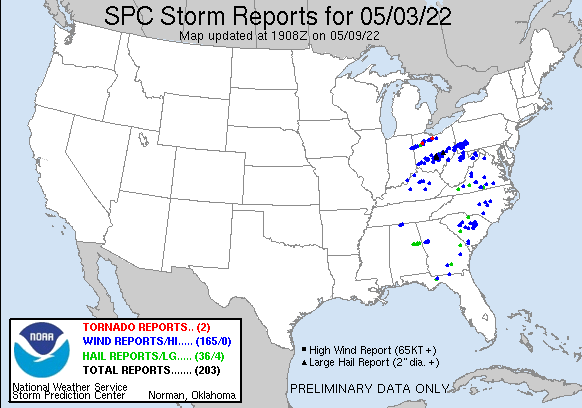
On May 3rd 2022, a strong low pressure system developed over the Mid Mississippi Valley and then tracked northeast up into the Ohio Valley during the afternoon. A well-developed warm front lifted north into northern OH putting the Pittsburgh forecast area well into the warm sector of the synoptic system. Southerly flow through the afternoon allowed ample warm, moist, and unstable air to filter into the region. The destabilization of the air mass and the synoptic set up in place prompted the Storm Prediction Center to issue a Tornado Watch for the forecast area that afternoon. After a shield of precipitation moved through the area during the morning hours associated with the warm front, saturating the boundary layer, the air mass became increasingly moist and unstable through the day and into the afternoon. This prompted the development of strong to severe thunderstorms during the afternoon and into the evening. The main threat from the numerous rounds of convection was damaging winds owing to the strong low level flow through the day and bowing segments within the clusters of thunderstorms. Only several reports contained hail. However, there was a 2 inch diameter hail report during the early stages of the event. The numerous clusters of thunderstorms that developed and moved through the area lasted into the evening setting the stage for dangerous flooding into the evening and overnight. The severe threat ended by 9pm but the flooding impacts lasted into the overnight hours. |
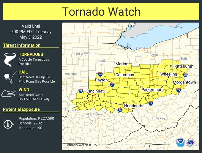 Tornado Watch #175 |
Wind & Hail:
Storm Prediction Center Storm Reports and Local County Warning Area Reports
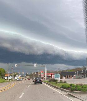
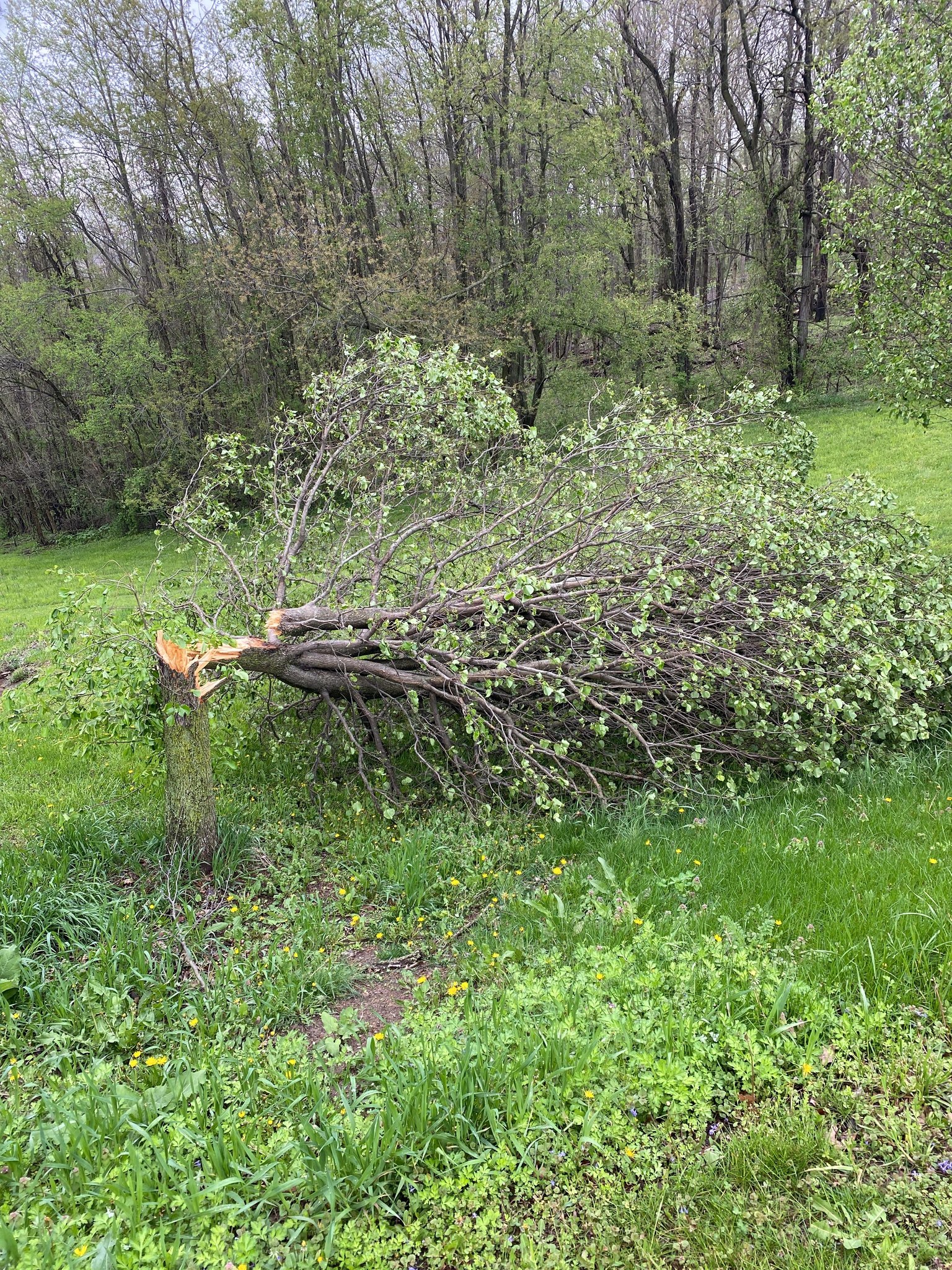
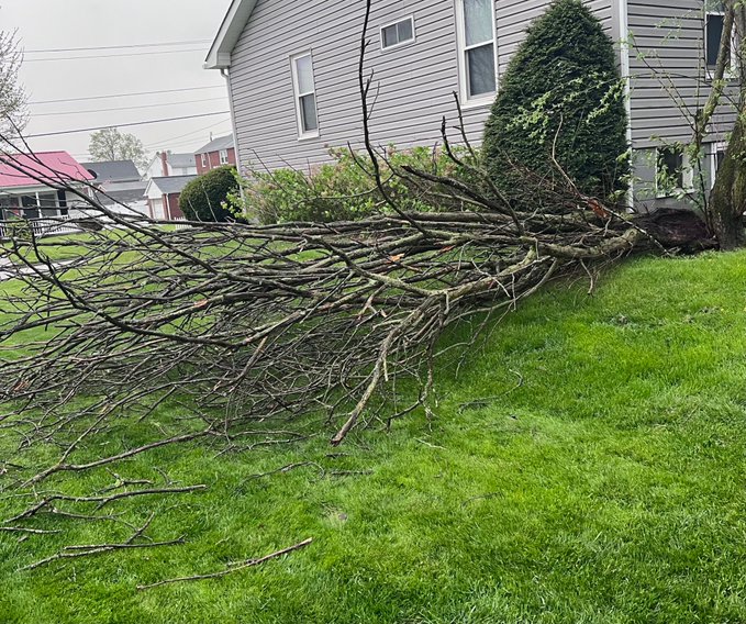
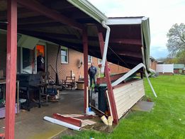
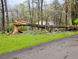
Photos
 |
 |
 |
| Butler, PA (Credit: Kent Somerville) |
Houston, PA (Credit: Lindsey Marshall ) |
Houston, PA (Credit: NWS Pittsburgh) |
 |
 |
 |
| Latrobe, PA (Credit: @SouthernAtHear4) |
Derry Township, PA (Credit: Hope Fannie) |
Nottingham Township, PA (Credit: Lynda Stewart) |
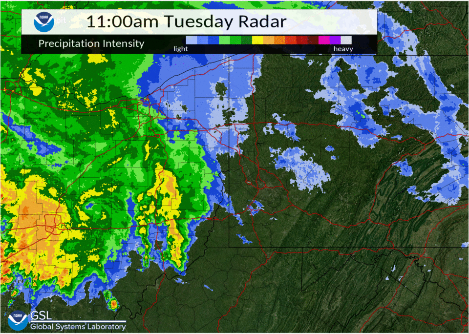
Radar
 |
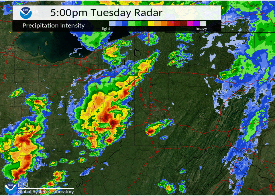 |
| May 3rd 2022 15Z - 21Z Composite Radar Loop | May 3rd 2022 21Z - 03Z Composite Radar Image |
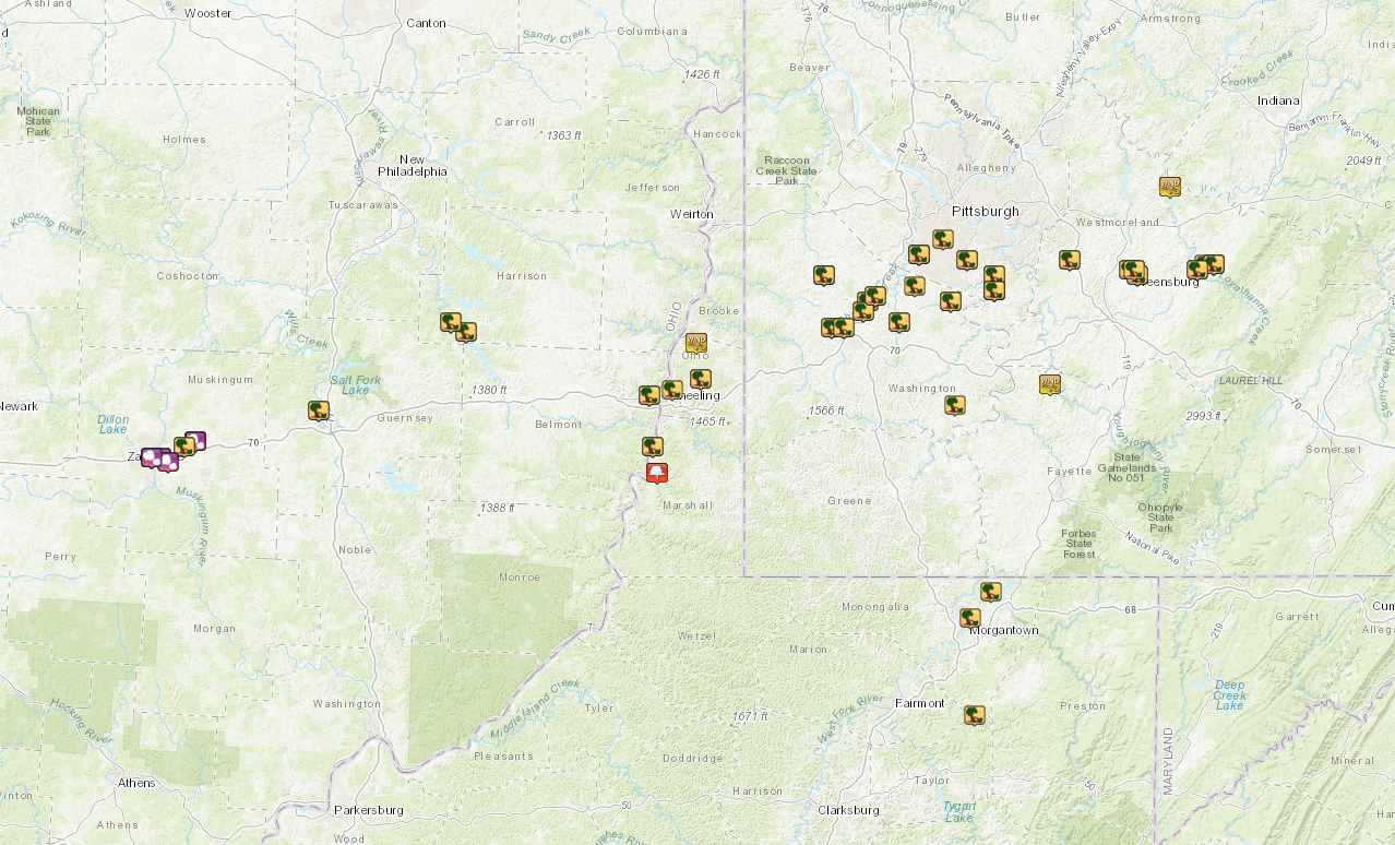
Storm Reports
NWUS51 KPBZ 111424
LSRPBZ
PRELIMINARY LOCAL STORM REPORT...SUMMARY
NATIONAL WEATHER SERVICE PITTSBURGH PA
1023 AM EDT WED MAY 11 2022
..TIME... ...EVENT... ...CITY LOCATION... ...LAT.LON...
..DATE... ....MAG.... ..COUNTY LOCATION..ST.. ...SOURCE....
..REMARKS..
0401 PM HAIL ZANESVILLE 39.95N 82.01W
05/03/2022 E1.00 INCH MUSKINGUM OH PUBLIC
0402 PM HAIL 1 E ZANESVILLE 39.95N 81.99W
05/03/2022 M1.75 INCH MUSKINGUM OH TRAINED SPOTTER
QUARTER TO GOLF BALL SIZE HAIL. HAILED FOR 5 MINUTES,
BREAKING WINDOWS IN A HOUSE.
0402 PM TSTM WND DMG ZANESVILLE 39.95N 82.01W
05/03/2022 MUSKINGUM OH SOCIAL MEDIA
TREE LIMBS BLOWN DOWN
0405 PM HAIL SONORA 39.98N 81.90W
05/03/2022 E2.00 INCH MUSKINGUM OH PUBLIC
0405 PM TSTM WND DMG SONORA 39.98N 81.90W
05/03/2022 MUSKINGUM OH PUBLIC
LARGE TREE LIMB FELL ON A CAR. SEVERAL TREES DOWN.
0406 PM HAIL 1 SW PLEASANT GROVE 39.94N 81.97W
05/03/2022 M1.00 INCH MUSKINGUM OH PUBLIC
0407 PM TSTM WND DMG 2 NE PLEASANT GROVE 39.97N 81.93W
05/03/2022 MUSKINGUM OH PUBLIC
TREE LIMBS AND POWER POLES DOWN
0430 PM TSTM WND DMG 1 N CAMBRIDGE 40.04N 81.59W
05/03/2022 GUERNSEY OH 911 CALL CENTER
POWER LINES DOWN
0450 PM TSTM WND DMG 3 ESE FREEPORT 40.19N 81.22W
05/03/2022 HARRISON OH PUBLIC
TREE LIMBS DOWN
0456 PM TSTM WND DMG 1 ESE FREEPORT 40.21N 81.26W
05/03/2022 HARRISON OH EMERGENCY MNGR
MULTIPLE TREES AND UTILITY POLES DOWN IN THE FREEPORT
AREA.
0510 PM TSTM WND DMG 1 SE RICHEYVILLE 40.05N 79.99W
05/03/2022 WASHINGTON PA PUBLIC
50 FOOT SPRUCE TREE DOWNED. TIME ESTIMATED FROM RADAR.
0520 PM TSTM WND DMG BROOKSIDE 40.07N 80.76W
05/03/2022 BELMONT OH 911 CALL CENTER
TREES DOWN BLOCING ROAD
0528 PM TSTM WND GST 3 W WEST LIBERTY 40.17N 80.64W
05/03/2022 M64 MPH OHIO WV ASOS
MEASURED WIND GUST AT HLG AIRPORT.
0530 PM TSTM WND DMG SHADYSIDE 39.97N 80.75W
05/03/2022 BELMONT OH PUBLIC
NUMEROUS BRANCHES DOWN, AND A LARGE HEALTHY TREE WAS
UPROOTED.
0530 PM FUNNEL CLOUD MOUNDSVILLE 39.92N 80.74W
05/03/2022 MARSHALL WV FIRE DEPT/RESCUE
MULTIPLE REPORTS OF A FUNNEL CLOUD.
0550 PM TSTM WND DMG WOLFDALE 40.20N 80.30W
05/03/2022 WASHINGTON PA PUBLIC
LARGE BARN BLOWN OVER. LARGE PINE TREES UPROOTED.
0550 PM TSTM WND DMG 4 ENE WHEELING 40.10N 80.63W
05/03/2022 OHIO WV LAW ENFORCEMENT
TREES AND POWER LINES REPORTED DOWN ALONG FRAZIERS RUN
ROAD.
0552 PM TSTM WND DMG HICKORY 40.30N 80.32W
05/03/2022 WASHINGTON PA 911 CALL CENTER
MULTIPLE TREES AND WIRES DOWN
0552 PM TSTM WND DMG 1 NNE OAK GROVE 40.20N 80.27W
05/03/2022 WASHINGTON PA 911 CALL CENTER
TREE ON A TRAILER ALONG GALAXY DRIVE AND WINDSOR DRIVE.
0555 PM TSTM WND DMG HOUSTON 40.25N 80.21W
05/03/2022 WASHINGTON PA 911 CALL CENTER
HALF THE ROOF CAME OFF A HOME NEAR NORTH CHERRY AVE AND
EAST PIKE STREET.
0557 PM TSTM WND DMG 1 N MEADOW LANDS 40.23N 80.22W
05/03/2022 WASHINGTON PA SOCIAL MEDIA
TREES DOWN AND MINOR STRUCTURE DAMAGE ALONG GREEN
STREET. PICTURES PROVIDED.
0600 PM TSTM WND DMG GAMBLES 40.21N 80.13W
05/03/2022 WASHINGTON PA 911 CALL CENTER
TREE AND WIRES ON VEHICLE ALONG CARL AVE.
0605 PM TSTM WND DMG UPPER SAINT CLAIR 40.34N 80.08W
05/03/2022 ALLEGHENY PA BROADCAST MEDIA
*** 1 FATAL *** LARGE TREE DOWN ON A GAS STATION NEAR
BETHEL CHURCH ROAD AND EAST MCMURRAY ROAD. TWO CARS WERE
ALSO IMPACTED WITH ONE FATALITY.
0615 PM TSTM WND DMG ELIZABETH 40.27N 79.89W
05/03/2022 ALLEGHENY PA 911 CALL CENTER
ROOF BLOWN OFF HOUSE ON 5TH AVE, NO INJURIES.
0617 PM TSTM WND DMG PLEASANT HILLS 40.33N 79.96W
05/03/2022 ALLEGHENY PA TRAINED SPOTTER
TREES DOWN
0618 PM TSTM WND DMG CLAIRTON 40.30N 79.89W
05/03/2022 ALLEGHENY PA BROADCAST MEDIA
TREE FELL ON GARAGE ON GARY AVE, TREE FELL ON TO SIDE
OF HOME ON MITCHELL AVE.
0620 PM TSTM WND DMG ELIZABETH 40.27N 79.89W
05/03/2022 ALLEGHENY PA PUBLIC
LARGE TREE LIMBS DOWN
0640 PM TSTM WND GST PERRYOPOLIS 40.09N 79.75W
05/03/2022 M58 MPH FAYETTE PA TRAINED SPOTTER
0640 PM TSTM WND DMG GREENSBURG 40.31N 79.54W
05/03/2022 WESTMORELAND PA TRAINED SPOTTER
ROOF BLOWN OFF OF A HOUSE
0640 PM TSTM WND DMG 1 ENE SOUTHWEST GREENSB 40.30N 79.53W
05/03/2022 WESTMORELAND PA TRAINED SPOTTER
ROOF DAMAGE. TREES DOWN ON HOUSES. WIND GUST TO 60 MPH.
0640 PM TSTM WND DMG 1 WSW GREENSBURG 40.31N 79.55W
05/03/2022 WESTMORELAND PA SOCIAL MEDIA
TREES DOWN AROUND SETON HALL CAMPUS.
0652 PM TSTM WND GST 1 S SALTSBURG 40.47N 79.45W
05/03/2022 M59 MPH WESTMORELAND PA TRAINED SPOTTER
0652 PM TSTM WND DMG LOYALHANNA 40.32N 79.36W
05/03/2022 WESTMORELAND PA NWS STORM SURVEY
*** 1 INJ *** A FEW SOFTWOOD AND HARDWOOD TREES WERE
SNAPPED IN THIS AREA, AND A CARPORT ROOF WAS LOFTED AND
DEPOSITED 100 FT DOWNWIND. THIS AREA MARKS THE START OF
A LOCALLY ENHANCED SWATH OF WIND DAMAGE THAT CONTINUED
TO THE BRADENTON AREA
0653 PM TSTM WND DMG BRADENVILLE 40.32N 79.34W
05/03/2022 WESTMORELAND PA NWS STORM SURVEY
SEVERAL HARDWOOD AND SOFTWOOD TREES WERE DAMAGED IN
THIS AREA. A ROOFTOP HVAC UNIT WAS DISPLACED FROM ITS
PERCH ATOP A SINGLE STORY SCHOOL BUILDING. THIS AREA
MARKS THE EASTERN END OF A LOCALLY ENHANCED SWATH OF
WIND DAMAGE THAT BEGAN IN LOYALHANNA.
0656 PM TSTM WND DMG BRADENVILLE 40.32N 79.34W
05/03/2022 WESTMORELAND PA TRAINED SPOTTER
SIDING BLOWN OFF OF A HOUSE
0800 PM TSTM WND DMG MORGANTOWN 39.64N 79.95W
05/03/2022 MONONGALIA WV 911 CALL CENTER
TREE DOWN ON THE 900 BLOCK OF WILLEY STREET
0802 PM TSTM WND DMG 2 S HALLECK 39.45N 79.94W
05/03/2022 MONONGALIA WV 911 CALL CENTER
TREE DOWN ON GRAFTON ROAD NEAR THE TAYLOR COUNTY LINE
0802 PM TSTM WND DMG 1 NNW CANYON 39.69N 79.90W
05/03/2022 MONONGALIA WV 911 CALL CENTER
TREE DOWN ON L CORE ROAD/STATE ROUTE 7
&&
EVENT NUMBER PBZ2202220 PBZ2202218 PBZ2202223 PBZ2202225 PBZ2202226
PBZ2202219 PBZ2202221 PBZ2202222 PBZ2202224 PBZ2202248 PBZ2202250
PBZ2202228 PBZ2202227 PBZ2202230 PBZ2202246 PBZ2202239 PBZ2202249
PBZ2202229 PBZ2202243 PBZ2202244 PBZ2202240 PBZ2202242 PBZ2202232
PBZ2202245 PBZ2202231 PBZ2202247 PBZ2202237 PBZ2202234 PBZ2202235
PBZ2202238 PBZ2202241 PBZ2202233 PBZ2202254 PBZ2202255 PBZ2202236
PBZ2202251 PBZ2202252 PBZ2202253
Environment
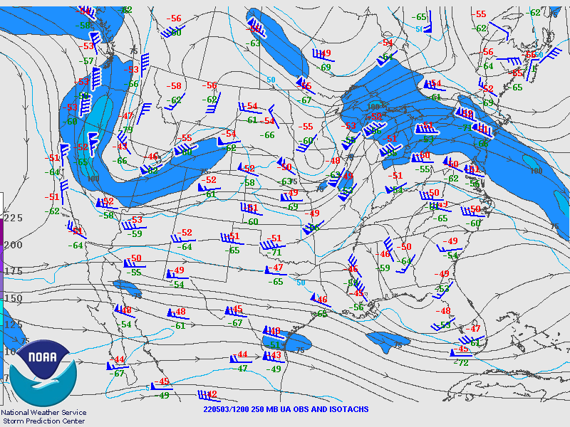
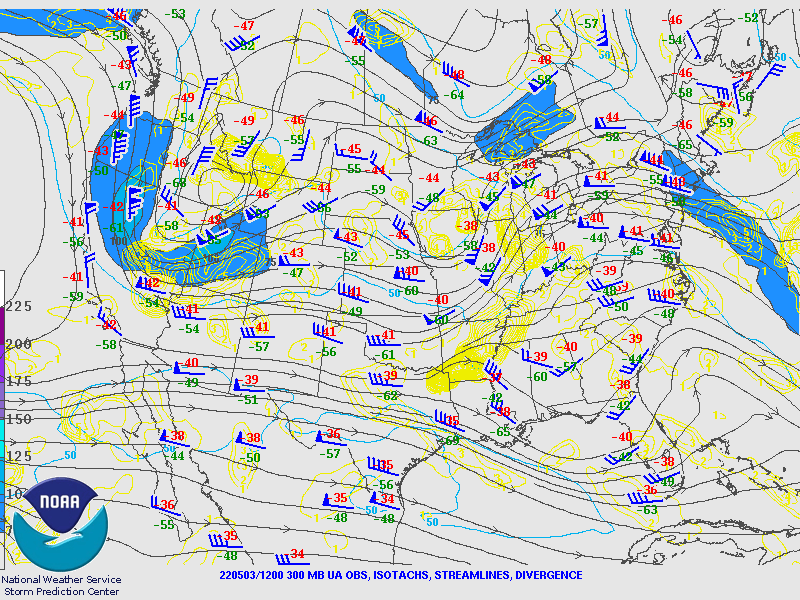
SPC's Upper Air Maps
May 3rd 12Z Upper Air Maps
 |
 |
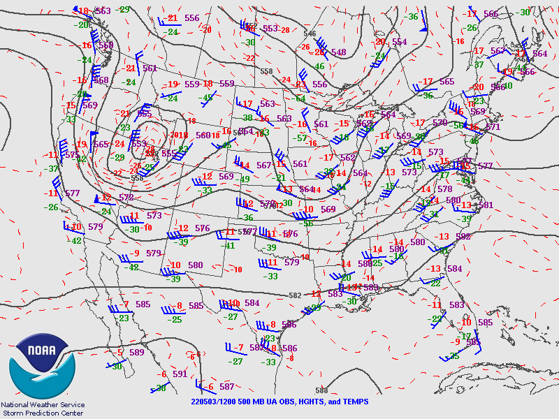 |
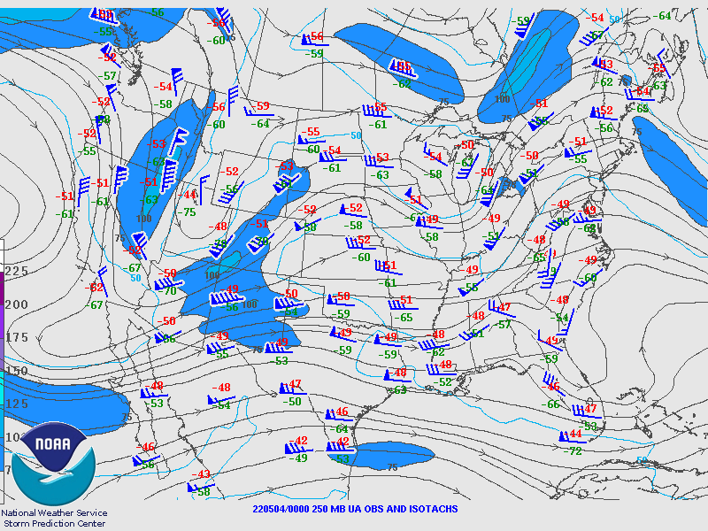
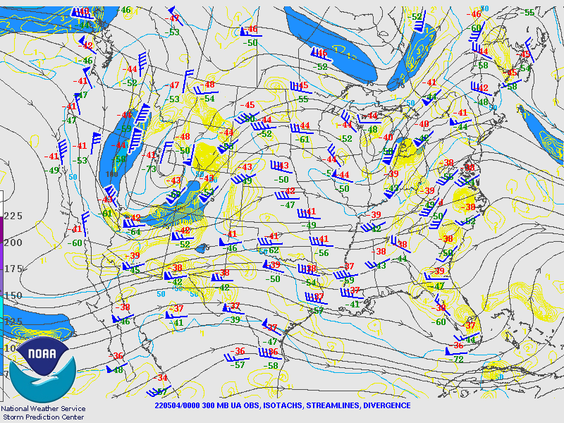
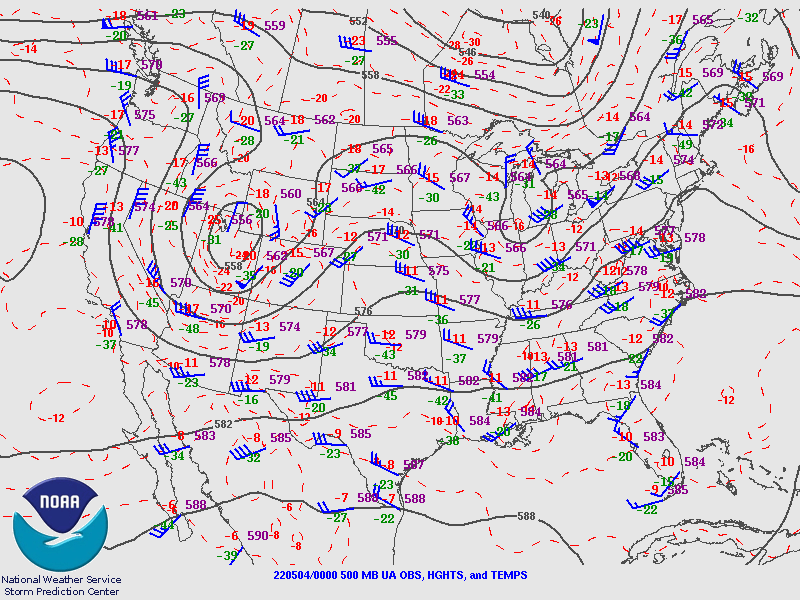
| Figure 1: 250MB | Figure 2: 300MB | Figure 3: 500MB |
 |
 |
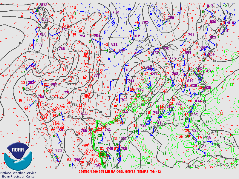 |
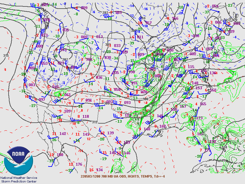
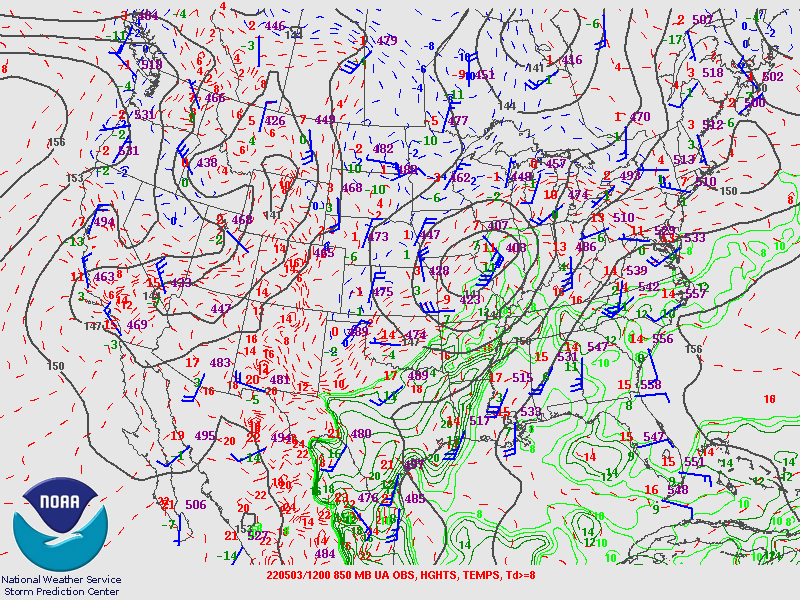
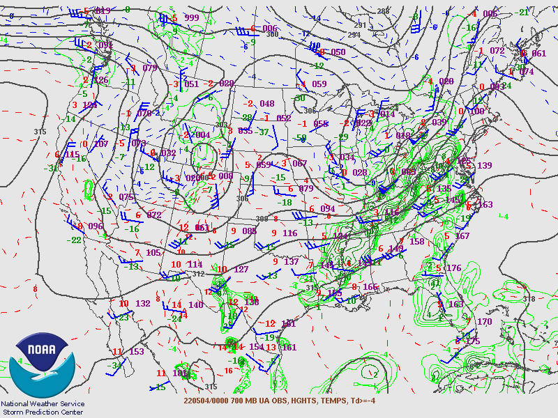
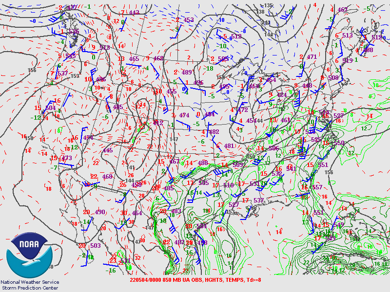
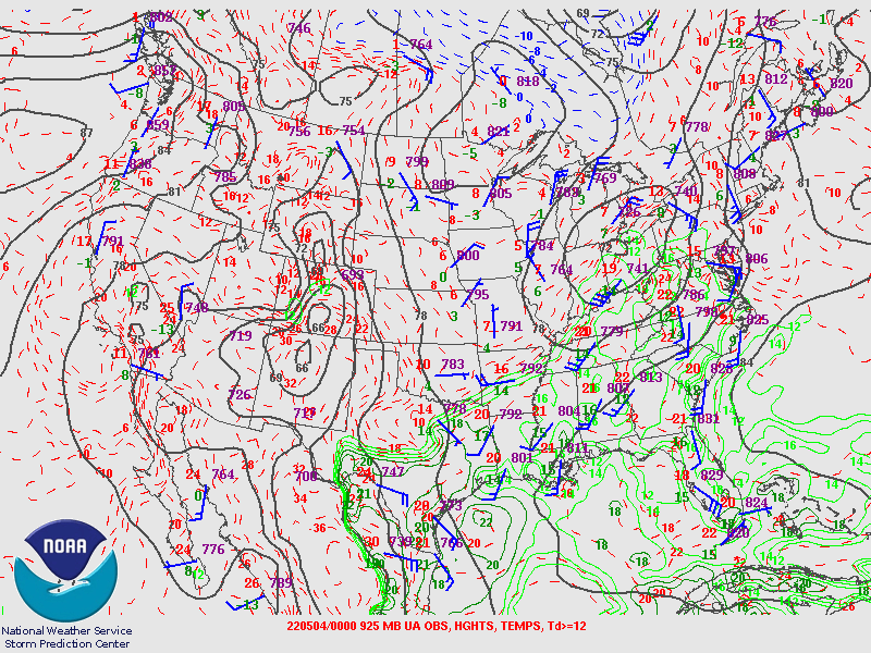
| Figure 4: 700MB | Figure 5: 850MB | Figure 6: 925MB |
May 4th 00Z Upper Air Maps
 |
 |
 |
| Figure 7: 250MB | Figure 8: 300MB | Figure 9: 500MB |
 |
 |
 |
| Figure 10: 700MB | Figure 11: 850MB | Figure 12: 925MB |
WPC's Surface Maps
 |
 |
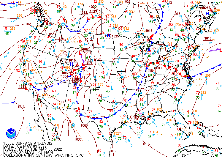 |
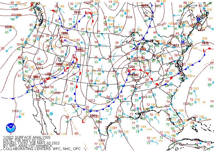
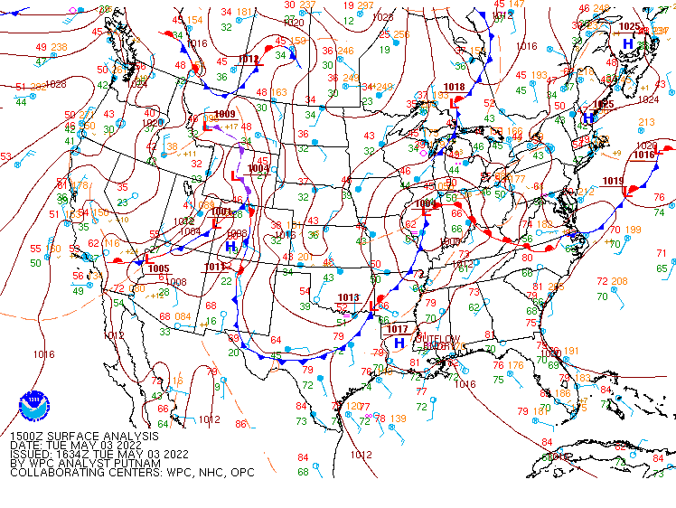
| Figure 13: May 3rd 12Z | Figure 14: May 3rd 15Z | Figure 15: May 3rd 18Z |
 |
 |
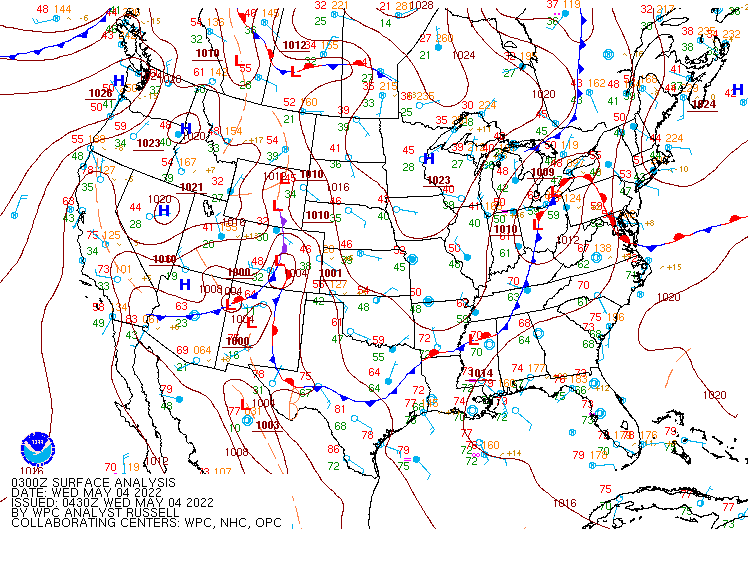 |
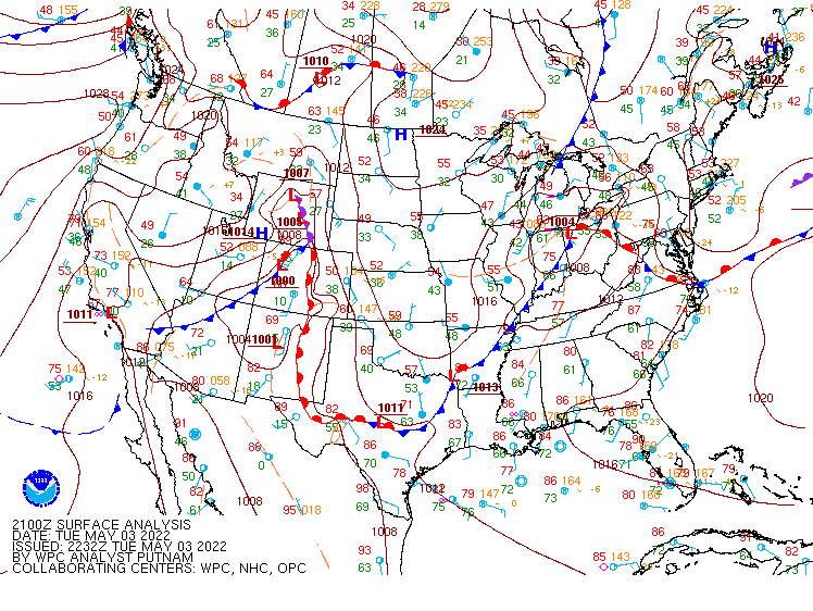
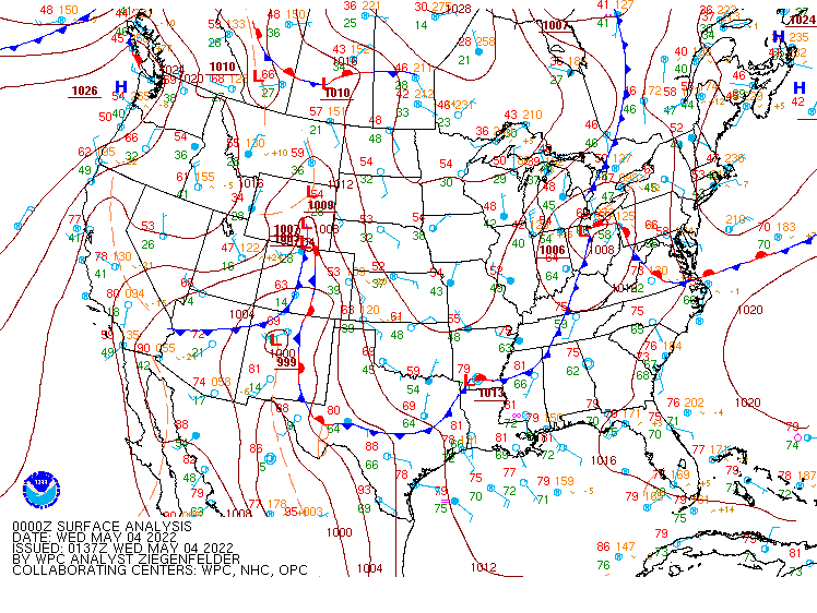
| Figure 16: May 3rd 21Z | Figure 17: May 4th 00Z | Figure 18: May 4th 03Z |
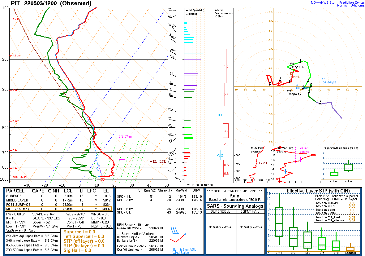
Skew-T Profiles for PBZ
 |
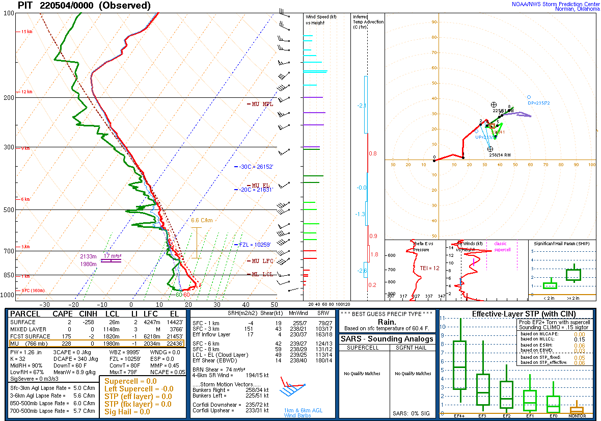 |
| Figure 19: May 3rd 12Z | Figure 20: May 4th 00Z |
Additional Information
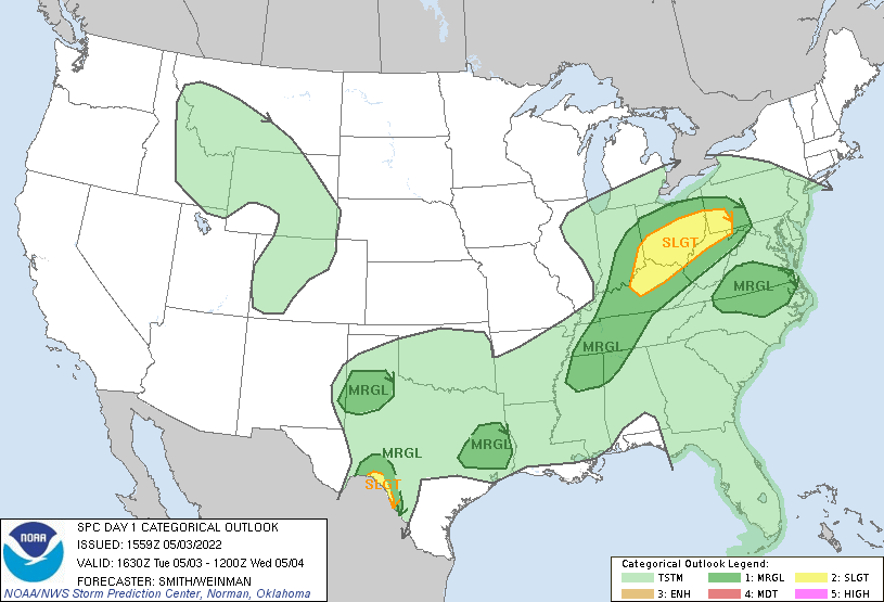
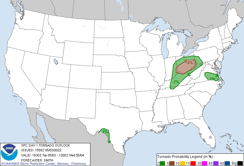
May 3rd 1630Z Day SPC Day 1 Outlook Products
 |
 |
 |
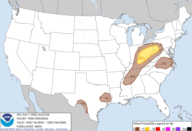 |
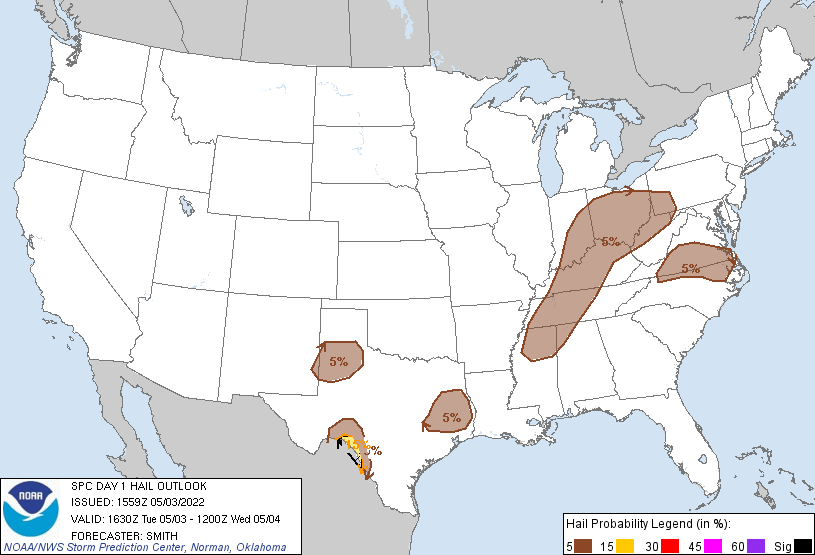
| SPC Day 1 Categorical Outlook | SPC Day 1 Tornado Outlook | SPC Day 1 Hail Outlook | SPC Day 1 Wind Outlook |
Day 1 Convective Outlook
   NWS Storm Prediction Center Norman OK
   1059 AM CDT Tue May 03 2022

   Valid 031630Z - 041200Z

   ...THERE IS A SLIGHT RISK OF SEVERE THUNDERSTORMS FOR PORTIONS OF
   THE OHIO VALLEY AND THE TEXAS RIO GRANDE VALLEY...

   ...SUMMARY...
   Scattered damaging winds and a couple tornadoes are possible across
   parts of the Ohio Valley this afternoon through early evening.
   Isolated very large hail will be possible along a small portion of
   the Rio Grande Valley this evening.

   ...OH Valley...
   Late morning showers/storms over OH will continue to move northeast
   into the upper OH Valley through midday while weakening, as a
   mid-level low/trough moves from the mid MS Valley to the southern
   Great Lakes during the period.  In the wake of this activity, the
   airmass will gradually destabilize amidst some cloud breaks as a
   plume of lower 60s F dewpoints advects north-northeastward into OH
   ahead of a weak convectively aided mid-level wave/MCV located over
   eastern IN.  Model forecast soundings show 500-1000+ J/kg MLCAPE
   across central/southern OH with enlarged hodographs.  Scattered to
   numerous storms will likely evolve during the afternoon with the
   stronger storms being capable of hail/wind and some tornado risk,
   especially with any sustained supercells before storms congeal and
   grow upscale into one or more clusters.

   ...Rio Grande Valley in southwest TX...
   Strong heating across northern Coahuila should contribute to
   convection developing over the higher terrain west of Del Rio where
   return flow remains moist.  Model guidance continues to indicate a
   couple of supercells are possible.  These potential storms would
   pose an attendant threat for significant large hail given large
   buoyancy and rather favorable deep-layer shear.

   ...Elsewhere in TX...
   Near a decaying MCS over the Sabine Valley, residual convective
   outflow intersecting with a slowing cold front may support an
   isolated severe storm or two this afternoon where strong heating
   aids in locally eroding the cap.  Despite weak low-level
   shear, sufficient deep-layer shear will exist for a supercell
   capable of isolated large hail and locally strong gusts.

   Model guidance differs on the possibility for elevated storms to
   develop over the TX South Plains vicinity overnight as robust warm
   theta-e advection occurs well downstream of a shortwave trough
   gradually shifting east from the Great Basin to the central/southern
   Rockies. Other guidance suggest profiles will remain capped in this
   region with highly elevated convection possible farther to the
   northeast near the end of the period. While the threat appears
   conditional, very steep mid-level lapse rates and ample
   cloud-bearing shear would support a threat for severe hail.

   ...VA/NC...
   Isolated severe storms will be possible along and west of a stalled
   front draped across this region. Strong boundary-layer heating is
   expected west/south front and this should allow surface parcels to
   reach their convective temperatures by mid to late afternoon. A few
   thunderstorms should develop along the higher terrain and near the
   frontal zone. 25-30 kts of 500-mb westerly flow could allow a few
   updrafts to briefly organize, mainly posing an isolated hail/wind
   threat before weakening by this evening.

   ..Smith/Weinman.. 05/03/2022

   CLICK TO GET WUUS01 PTSDY1 PRODUCT
Summaries from other NWS Offices
 |
Media use of NWS Web News Stories is encouraged! Please acknowledge the NWS as the source of any news information accessed from this site. |
|

