Overview
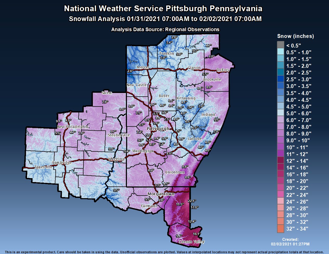
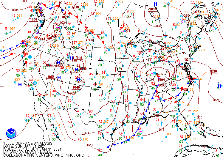
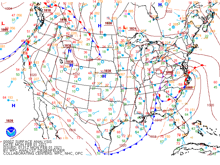
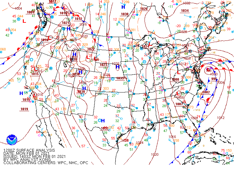
| On late Saturday evening of January 30th, a strong low pressure system developed over the Middle Mississippi River Valley and traveled northeast up into the Lower Ohio River Valley. The warm front lifted north to the Ohio River as a band of moderate to heavy snow developed into central OH and begin to mode into the Zanesville area overnight. This band produced moderate to heavy snow into the Wheeling area as well before weakening. A lull in the snowfall through the day on the 31st occurred due to a slot of dry air along the foothills of the Laurel and Chestnut Ridges. The upper low then moved through later in the day on the 31st bringing another heavier round of snowfall. The heaviest snowfall amounts occurred over the higher terrain in West Virginia and in Westmoreland and Fayette Counties. | Caption |
Snow/Ice
Photos & Video
Header
| Caption (source) |
Caption (source) |
Caption (source) |
Caption (source) |
Storm Reports
Public Information Statement
Spotter Reports
National Weather Service Pittsburgh PA
125 PM EST Tue Feb 02 2021

The following are unofficial observations taken during the past 12
hours for the storm that has been affecting our region. Appreciation
is extended to highway departments, cooperative observers, Skywarn
spotters and media for these reports. This summary also is available
on our home page at weather.gov/pittsburgh

********************STORM TOTAL SNOWFALL********************

LOCATION                TOTAL      TIME/DATE  COMMENTS
                     SNOWFALL       MEASURED
                     (inches)

OHIO

...Columbiana County...
  ENE Hanoverton          7.8   400 AM  2/02  Contains 3 24-hr obs
  4 N Wellsville          6.0   900 AM  2/02  Contains 3 24-hr obs

...Coshocton County...
  2 NNE Fresno            5.5   800 AM  2/02  Contains 3 24-hr obs

...Jefferson County...
  2 WNW Steubenville      7.0   800 AM  2/02  Contains 3 24-hr obs
  1 WNW Wintersville      6.7   800 AM  2/02  Contains 3 24-hr obs
  1 WSW Mount Pleasant    5.9   630 AM  2/02  Contains 3 24-hr obs

...Muskingum County...
  1 SE Norwich            5.6   700 AM  2/02  Contains 2 24-hr obs

...Tuscarawas County...
  WNW Carmichaels         9.1   800 AM  2/02  Contains 3 24-hr obs
  1 NW Dennison           7.0   700 AM  2/02  Contains 3 24-hr obs
  5 WNW Dover             4.9   700 AM  2/02  Contains 3 24-hr obs
  1 N Uhrichsville        4.7   700 AM  2/02  Contains 3 24-hr obs

PENNSYLVANIA

...Allegheny County...
  Bethel Park             9.4   700 AM  2/02  Public
  1 N Carnot-Moon         8.5   700 AM  2/02  Official NWS Obs
  2 NE Moon               8.5   730 AM  2/02  Contains 3 24-hr obs
  2 S McCandless Towns    8.4   700 AM  2/02  Contains 3 24-hr obs
  1 S Acmetonia           7.5   600 AM  2/02  Contains 3 24-hr obs
  Jefferson Hills          5.9   800 AM  2/02  Trained Spotter
  1 NE Gibsonia           5.8   700 AM  2/02  Contains 2 24-hr obs
  6 E Pittsburgh          5.7   800 AM  2/02  Contains 1 24-hr ob
  4 NNW Pittsburgh        5.6   600 AM  2/02  Contains 3 24-hr obs
  Gibsonia                5.5   710 AM  2/02  Trained Spotter
  2 SE South Fayette      5.1   700 AM  2/02  Contains 3 24-hr obs
  1 SW Bridgeville        5.0   700 AM  2/02  Contains 3 24-hr obs
  3 NE Pittsburgh         4.8   852 AM  2/02  Contains 2 24-hr obs

...Armstrong County...
  4 NW Dayton             6.1   630 AM  2/02  Contains 2 24-hr obs
  1 SSW Kittanning        4.1   700 AM  2/02  Contains 2 24-hr obs
  4 S Lenape Heights      3.7   700 AM  2/02  Contains 2 24-hr obs
  3 NNW Shelocta          3.0   700 AM  2/02  Contains 2 24-hr obs
  Schenley                3.0   700 AM  2/02  Contains 2 24-hr obs

...Beaver County...
  Montgomery Dam          7.5   600 AM  2/02  Contains 2 24-hr obs
  6 W Beaver              6.0   700 AM  2/02  Contains 2 24-hr obs

...Butler County...
  2 NNE Fox Run           6.7   600 AM  2/02  Contains 2 24-hr obs
  2 WSW Butler            6.5   700 AM  2/02  Contains 2 24-hr obs
  N Cabot                 6.1   700 AM  2/02  Contains 3 24-hr obs
  2 WNW Cabot             6.1   700 AM  2/02  Contains 3 24-hr obs
  7 SW Butler             4.6   600 AM  2/02  Contains 2 24-hr obs
  2 W Butler              3.9   700 AM  2/02  Contains 2 24-hr obs

...Clarion County...
  7 NE Strattanville      9.0   700 AM  2/02  Public
  4 WNW Summerville       5.5   800 AM  2/02  Contains 2 24-hr obs

...Fayette County...
  4 NW Ohiopyle           9.8   900 AM  2/02  Public
  1 ENE Farmington        8.6   700 AM  2/02  Contains 2 24-hr obs

...Forest County...
  7 SSE Tionesta          5.3   700 AM  2/02  Contains 2 24-hr obs
  5 W Marienville         4.7   620 AM  2/02  Contains 2 24-hr obs

...Greene County...
  1 E Waynesburg          6.2   700 AM  2/02  Contains 3 24-hr obs
  1 SW Point Marion       4.5   600 AM  2/02  Contains 3 24-hr obs

...Indiana County...
  1 SE Brush Valley       5.5   600 AM  2/02  Contains 2 24-hr obs

...Jefferson County...
  S Timblin               8.0   723 AM  2/02  Contains 2 24-hr obs

...Mercer County...
  2 S West Middlesex      2.6   830 AM  2/02  Contains 2 24-hr obs

...Venango County...
  1 NNE Seneca            5.8   700 AM  2/02  Contains 2 24-hr obs
  1 E Franklin            4.3   755 AM  2/02  Contains 3 24-hr obs
  1 SSW Franklin          3.8   600 AM  2/02  Contains 2 24-hr obs
  1 E Cooperstown         3.4   700 AM  2/02  Contains 3 24-hr obs
  6 SW Titusville         2.8   700 AM  2/02  Contains 2 24-hr obs

...Washington County...
  McMurray                8.3   700 AM  2/02  Contains 3 24-hr obs
  SSE Dunlevy             8.0   800 AM  2/02  Contains 3 24-hr obs
  WNW Bulger              7.2   700 AM  2/02  Contains 3 24-hr obs
  1 NNW Finleyville       7.2   700 AM  2/02  Contains 3 24-hr obs
  1 W Canonsburg          6.6   700 AM  2/02  Contains 3 24-hr obs
  4 NW Canonsburg         5.3   700 AM  2/02  Contains 3 24-hr obs

...Westmoreland County...
  1 W New Kensington      4.9   700 AM  2/02  Contains 2 24-hr obs
  1 WNW Greensburg        4.9   748 AM  2/02  Contains 3 24-hr obs
  Level Green             4.5   900 AM  2/02  Public
  SE Ligonier             4.3   700 AM  2/02  Contains 2 24-hr obs
  1 SW Laughlintown       4.0   800 AM  2/02  Contains 1 24-hr ob
  3 E North Washington    4.0   700 AM  2/02  Contains 2 24-hr obs
  1 E Ligonier            4.0   700 AM  2/02  Contains 2 24-hr obs
  1 SW Leechburg          4.0   800 AM  2/02  Contains 2 24-hr obs
  2 S Saltsburg           4.0   700 AM  2/02  Contains 2 24-hr obs
  1 W Herminie            4.0   620 AM  2/02  Public
  ESE New Florence        3.8  1005 AM  2/02  Contains 3 24-hr obs

WEST VIRGINIA

...Marion County...
  2 N Rivesville          5.5   600 AM  2/02  Contains 3 24-hr obs

...Monongalia County...
  1 W Bowlby              7.3   600 AM  2/02  Public
  6 SW Morgantown         6.8   700 AM  2/02  Contains 3 24-hr obs

...Ohio County...
  4 NNE Valley Grove      5.4   700 AM  2/02  Contains 3 24-hr obs

...Preston County...
  5 NNE Terra Alta       22.1   800 AM  2/02  Contains 3 24-hr obs
  3 ENE Terra Alta       17.0   700 AM  2/02  Contains 3 24-hr obs
  7 N Thomas             12.4   700 AM  2/02  Contains 3 24-hr obs
  1 E Kingwood           11.5   700 AM  2/02  Contains 3 24-hr obs

...Tucker County...
  Davis                  16.1   700 AM  2/02  Contains 3 24-hr obs
  3 S Canaan Hgts        14.1   900 AM  2/02  Contains 3 24-hr obs
  3 SE Parsons            5.4   700 AM  2/02  Contains 2 24-hr obs

...Wetzel County...
  7 E New Martinsville    5.5   800 AM  2/02  Contains 3 24-hr obs

&&

*****METADATA*****
:2/02/2021,  400 AM, OH, Columbiana, Hanoverton, , ENE, 40.7570, -80.9292, SNOW, 7.8, Inch, CoCoRaHS, Storm Total Snow, Contains 3 24-hr obs
:2/02/2021,  900 AM, OH, Columbiana, Wellsville, 4, N, 40.6644, -80.6424, SNOW, 6.0, Inch, CoCoRaHS, Storm Total Snow, Contains 3 24-hr obs
:2/02/2021,  800 AM, OH, Coshocton, Fresno, 2, NNE, 40.3583, -81.7193, SNOW, 5.5, Inch, CoCoRaHS, Storm Total Snow, Contains 3 24-hr obs
:2/02/2021,  800 AM, OH, Jefferson, Steubenville, 2, WNW, 40.3760, -80.6820, SNOW, 7.0, Inch, CoCoRaHS, Storm Total Snow, Contains 3 24-hr obs
:2/02/2021,  800 AM, OH, Jefferson, Wintersville, 1, WNW, 40.3843, -80.7176, SNOW, 6.7, Inch, CoCoRaHS, Storm Total Snow, Contains 3 24-hr obs
:2/02/2021,  630 AM, OH, Jefferson, Mount Pleasant, 1, WSW, 40.1650, -80.8229, SNOW, 5.9, Inch, CoCoRaHS, Storm Total Snow, Contains 3 24-hr obs
:2/02/2021,  700 AM, OH, Muskingum, Norwich, 1, SE, 39.9753, -81.7767, SNOW, 5.6, Inch, CoCoRaHS, Storm Total Snow, Contains 2 24-hr obs
:2/02/2021,  800 AM, OH, Tuscarawas, Carmichaels, , WNW, 40.5114, -81.6257, SNOW, 9.1, Inch, CoCoRaHS, Storm Total Snow, Contains 3 24-hr obs
:2/02/2021,  700 AM, OH, Tuscarawas, Dennison, 1, NW, 40.4056, -81.3431, SNOW, 7.0, Inch, Co-Op Observer, Storm Total Snow, Contains 3 24-hr obs
:2/02/2021,  700 AM, OH, Tuscarawas, Dover, 5, WNW, 40.5507, -81.5640, SNOW, 4.9, Inch, CoCoRaHS, Storm Total Snow, Contains 3 24-hr obs
:2/02/2021,  700 AM, OH, Tuscarawas, Uhrichsville, 1, N, 40.4099, -81.3532, SNOW, 4.7, Inch, CoCoRaHS, Storm Total Snow, Contains 3 24-hr obs
:2/02/2021,  700 AM, PA, Allegheny, Bethel Park, , , 40.3000, -80.0650, SNOW, 9.4, Inch, Public, Storm Total Snow,
:2/02/2021,  730 AM, PA, Allegheny, Moon, 2, NE, 40.5319, -80.2172, SNOW, 8.5, Inch, Co-Op Observer, Storm Total Snow, Contains 3 24-hr obs
:2/02/2021,  700 AM, PA, Allegheny, McCandless Township, 2, S, 40.5569, -80.0366, SNOW, 8.4, Inch, CoCoRaHS, Storm Total Snow, Contains 3 24-hr obs
:2/02/2021,  600 AM, PA, Allegheny, Acmetonia, 1, S, 40.5361, -79.8153, SNOW, 7.5, Inch, Co-Op Observer, Storm Total Snow, Contains 3 24-hr obs
:2/02/2021,  800 AM, PA, Allegheny, Jefferson Hills, , , 40.3130, -79.9526, SNOW, 5.9, Inch, Trained Spotter, Storm Total Snow,
:2/02/2021,  700 AM, PA, Allegheny, Gibsonia, 1, NE, 40.6405, -79.9506, SNOW, 5.8, Inch, CoCoRaHS, Storm Total Snow, Contains 2 24-hr obs
:2/02/2021,  800 AM, PA, Allegheny, Pittsburgh, 6, E, 40.4318, -79.8925, SNOW, 5.7, Inch, CoCoRaHS, Storm Total Snow, Contains 1 24-hr ob
:2/02/2021,  600 AM, PA, Allegheny, Pittsburgh, 4, NNW, 40.4888, -80.0006, SNOW, 5.6, Inch, CoCoRaHS, Storm Total Snow, Contains 3 24-hr obs
:2/02/2021,  710 AM, PA, Allegheny, Gibsonia, , , 40.6301, -79.9703, SNOW, 5.5, Inch, Trained Spotter, Storm Total Snow,
:2/02/2021,  700 AM, PA, Allegheny, South Fayette, 2, SE, 40.3381, -80.1159, SNOW, 5.1, Inch, CoCoRaHS, Storm Total Snow, Contains 3 24-hr obs
:2/02/2021,  700 AM, PA, Allegheny, Bridgeville, 1, SW, 40.3417, -80.1229, SNOW, 5.0, Inch, CoCoRaHS, Storm Total Snow, Contains 3 24-hr obs
:2/02/2021,  852 AM, PA, Allegheny, Pittsburgh, 3, NE, 40.4684, -79.9295, SNOW, 4.8, Inch, CoCoRaHS, Storm Total Snow, Contains 2 24-hr obs
:2/02/2021,  700 AM, PA, Allegheny, Carnot-Moon, 1, N, 40.5319, -80.2174, SNOW, 8.5, Inch, Official NWS Obs, Storm Total Snow,
:2/02/2021,  630 AM, PA, Armstrong, Dayton, 4, NW, 40.9250, -79.2825, SNOW, 6.1, Inch, Co-Op Observer, Storm Total Snow, Contains 2 24-hr obs
:2/02/2021,  700 AM, PA, Armstrong, Kittanning, 1, SSW, 40.8095, -79.5306, SNOW, 4.1, Inch, CoCoRaHS, Storm Total Snow, Contains 2 24-hr obs
:2/02/2021,  700 AM, PA, Armstrong, Lenape Heights, 4, S, 40.7136, -79.5150, SNOW, 3.7, Inch, Co-Op Observer, Storm Total Snow, Contains 2 24-hr obs
:2/02/2021,  700 AM, PA, Armstrong, Shelocta, 3, NNW, 40.6981, -79.3228, SNOW, 3.0, Inch, CoCoRaHS, Storm Total Snow, Contains 2 24-hr obs
:2/02/2021,  700 AM, PA, Armstrong, Schenley, , , 40.6842, -79.6681, SNOW, 3.0, Inch, Co-Op Observer, Storm Total Snow, Contains 2 24-hr obs
:2/02/2021,  600 AM, PA, Beaver, Montgomery Dam, , , 40.6483, -80.3850, SNOW, 7.5, Inch, Co-Op Observer, Storm Total Snow, Contains 2 24-hr obs
:2/02/2021,  700 AM, PA, Beaver, Beaver, 6, W, 40.7050, -80.4121, SNOW, 6.0, Inch, CoCoRaHS, Storm Total Snow, Contains 2 24-hr obs
:2/02/2021,  600 AM, PA, Butler, Fox Run, 2, NNE, 40.7239, -80.0706, SNOW, 6.7, Inch, CoCoRaHS, Storm Total Snow, Contains 2 24-hr obs
:2/02/2021,  700 AM, PA, Butler, Butler, 2, WSW, 40.8557, -79.9314, SNOW, 6.5, Inch, CoCoRaHS, Storm Total Snow, Contains 2 24-hr obs
:2/02/2021,  700 AM, PA, Butler, Cabot, , N, 40.7687, -79.7669, SNOW, 6.1, Inch, CoCoRaHS, Storm Total Snow, Contains 3 24-hr obs
:2/02/2021,  700 AM, PA, Butler, Cabot, 2, WNW, 40.7725, -79.7956, SNOW, 6.1, Inch, CoCoRaHS, Storm Total Snow, Contains 3 24-hr obs
:2/02/2021,  600 AM, PA, Butler, Butler, 7, SW, 40.7707, -79.9385, SNOW, 4.6, Inch, CoCoRaHS, Storm Total Snow, Contains 2 24-hr obs
:2/02/2021,  700 AM, PA, Butler, Butler, 2, W, 40.8640, -79.9260, SNOW, 3.9, Inch, CoCoRaHS, Storm Total Snow, Contains 2 24-hr obs
:2/02/2021,  700 AM, PA, Clarion, Strattanville, 7, NE, 41.3253, -79.1348, SNOW, 9.0, Inch, Public, Storm Total Snow,
:2/02/2021,  800 AM, PA, Clarion, Summerville, 4, WNW, 41.1301, -79.2638, SNOW, 5.5, Inch, CoCoRaHS, Storm Total Snow, Contains 2 24-hr obs
:2/02/2021,  900 AM, PA, Fayette, Ohiopyle, 4, NW, 39.9413, -79.6009, SNOW, 9.8, Inch, Public, Storm Total Snow,
:2/02/2021,  700 AM, PA, Fayette, Farmington, 1, ENE, 39.8100, -79.5576, SNOW, 8.6, Inch, CoCoRaHS, Storm Total Snow, Contains 2 24-hr obs
:2/02/2021,  700 AM, PA, Forest, Tionesta, 7, SSE, 41.3940, -79.4131, SNOW, 5.3, Inch, CoCoRaHS, Storm Total Snow, Contains 2 24-hr obs
:2/02/2021,  620 AM, PA, Forest, Marienville, 5, W, 41.4571, -79.1815, SNOW, 4.7, Inch, CoCoRaHS, Storm Total Snow, Contains 2 24-hr obs
:2/02/2021,  700 AM, PA, Greene, Waynesburg, 1, E, 39.8986, -80.1656, SNOW, 6.2, Inch, Co-Op Observer, Storm Total Snow, Contains 3 24-hr obs
:2/02/2021,  600 AM, PA, Greene, Point Marion, 1, SW, 39.7281, -79.9122, SNOW, 4.5, Inch, Co-Op Observer, Storm Total Snow, Contains 3 24-hr obs
:2/02/2021,  600 AM, PA, Indiana, Brush Valley, 1, SE, 40.5238, -79.0616, SNOW, 5.5, Inch, CoCoRaHS, Storm Total Snow, Contains 2 24-hr obs
:2/02/2021,  723 AM, PA, Jefferson, Timblin, , S, 40.9645, -79.1989, SNOW, 8.0, Inch, CoCoRaHS, Storm Total Snow, Contains 2 24-hr obs
:2/02/2021,  830 AM, PA, Mercer, West Middlesex, 2, S, 41.1434, -80.4552, SNOW, 2.6, Inch, CoCoRaHS, Storm Total Snow, Contains 2 24-hr obs
:2/02/2021,  700 AM, PA, Venango, Seneca, 1, NNE, 41.3846, -79.6979, SNOW, 5.8, Inch, CoCoRaHS, Storm Total Snow, Contains 2 24-hr obs
:2/02/2021,  755 AM, PA, Venango, Franklin, 1, E, 41.3903, -79.8217, SNOW, 4.3, Inch, Co-Op Observer, Storm Total Snow, Contains 3 24-hr obs
:2/02/2021,  600 AM, PA, Venango, Franklin, 1, SSW, 41.3728, -79.8501, SNOW, 3.8, Inch, CoCoRaHS, Storm Total Snow, Contains 2 24-hr obs
:2/02/2021,  700 AM, PA, Venango, Cooperstown, 1, E, 41.5007, -79.8497, SNOW, 3.4, Inch, CoCoRaHS, Storm Total Snow, Contains 3 24-hr obs
:2/02/2021,  700 AM, PA, Venango, Titusville, 6, SW, 41.5670, -79.7639, SNOW, 2.8, Inch, CoCoRaHS, Storm Total Snow, Contains 2 24-hr obs
:2/02/2021,  700 AM, PA, Washington, McMurray, , , 40.2831, -80.0857, SNOW, 8.3, Inch, CoCoRaHS, Storm Total Snow, Contains 3 24-hr obs
:2/02/2021,  800 AM, PA, Washington, Dunlevy, , SSE, 40.1107, -79.8578, SNOW, 8.0, Inch, CoCoRaHS, Storm Total Snow, Contains 3 24-hr obs
:2/02/2021,  700 AM, PA, Washington, Bulger, , WNW, 40.3794, -80.3314, SNOW, 7.2, Inch, CoCoRaHS, Storm Total Snow, Contains 3 24-hr obs
:2/02/2021,  700 AM, PA, Washington, Finleyville, 1, NNW, 40.2603, -80.0059, SNOW, 7.2, Inch, CoCoRaHS, Storm Total Snow, Contains 3 24-hr obs
:2/02/2021,  700 AM, PA, Washington, Canonsburg, 1, W, 40.2623, -80.2001, SNOW, 6.6, Inch, CoCoRaHS, Storm Total Snow, Contains 3 24-hr obs
:2/02/2021,  700 AM, PA, Washington, Canonsburg, 4, NW, 40.3005, -80.2385, SNOW, 5.3, Inch, CoCoRaHS, Storm Total Snow, Contains 3 24-hr obs
:2/02/2021,  700 AM, PA, Westmoreland, New Kensington, 1, W, 40.5698, -79.7612, SNOW, 4.9, Inch, CoCoRaHS, Storm Total Snow, Contains 2 24-hr obs
:2/02/2021,  748 AM, PA, Westmoreland, Greensburg, 1, WNW, 40.3136, -79.5543, SNOW, 4.9, Inch, CoCoRaHS, Storm Total Snow, Contains 3 24-hr obs
:2/02/2021,  900 AM, PA, Westmoreland, Level Green, , , 40.3944, -79.7114, SNOW, 4.5, Inch, Public, Storm Total Snow,
:2/02/2021,  700 AM, PA, Westmoreland, Ligonier, , SE, 40.2432, -79.2353, SNOW, 4.3, Inch, CoCoRaHS, Storm Total Snow, Contains 2 24-hr obs
:2/02/2021,  800 AM, PA, Westmoreland, Laughlintown, 1, SW, 40.2039, -79.2171, SNOW, 4.0, Inch, Co-Op Observer, Storm Total Snow, Contains 1 24-hr ob
:2/02/2021,  700 AM, PA, Westmoreland, North Washington, 3, E, 40.5100, -79.5458, SNOW, 4.0, Inch, Co-Op Observer, Storm Total Snow, Contains 2 24-hr obs
:2/02/2021,  700 AM, PA, Westmoreland, Ligonier, 1, E, 40.2468, -79.2154, SNOW, 4.0, Inch, CoCoRaHS, Storm Total Snow, Contains 2 24-hr obs
:2/02/2021,  800 AM, PA, Westmoreland, Leechburg, 1, SW, 40.6153, -79.6214, SNOW, 4.0, Inch, CoCoRaHS, Storm Total Snow, Contains 2 24-hr obs
:2/02/2021,  700 AM, PA, Westmoreland, Saltsburg, 2, S, 40.4586, -79.4503, SNOW, 4.0, Inch, Co-Op Observer, Storm Total Snow, Contains 2 24-hr obs
:2/02/2021,  620 AM, PA, Westmoreland, Herminie, 1, W, 40.2574, -79.7603, SNOW, 4.0, Inch, Public, Storm Total Snow,
:2/02/2021, 1005 AM, PA, Westmoreland, New Florence, , ESE, 40.3773, -79.0709, SNOW, 3.8, Inch, CoCoRaHS, Storm Total Snow, Contains 3 24-hr obs
:2/02/2021,  600 AM, WV, Marion, Rivesville, 2, N, 39.5559, -80.1212, SNOW, 5.5, Inch, CoCoRaHS, Storm Total Snow, Contains 3 24-hr obs
:2/02/2021,  600 AM, WV, Monongalia, Bowlby, 1, W, 39.7115, -80.0356, SNOW, 7.3, Inch, Public, Storm Total Snow,
:2/02/2021,  700 AM, WV, Monongalia, Morgantown, 6, SW, 39.5662, -80.0149, SNOW, 6.8, Inch, CoCoRaHS, Storm Total Snow, Contains 3 24-hr obs
:2/02/2021,  700 AM, WV, Ohio, Valley Grove, 4, NNE, 40.1380, -80.5435, SNOW, 5.4, Inch, CoCoRaHS, Storm Total Snow, Contains 3 24-hr obs
:2/02/2021,  800 AM, WV, Preston, Terra Alta, 5, NNE, 39.5102, -79.5102, SNOW, 22.1, Inch, CoCoRaHS, Storm Total Snow, Contains 3 24-hr obs
:2/02/2021,  700 AM, WV, Preston, Terra Alta, 3, ENE, 39.4593, -79.4847, SNOW, 17.0, Inch, CoCoRaHS, Storm Total Snow, Contains 3 24-hr obs
:2/02/2021,  700 AM, WV, Preston, Thomas, 7, N, 39.2536, -79.5106, SNOW, 12.4, Inch, CoCoRaHS, Storm Total Snow, Contains 3 24-hr obs
:2/02/2021,  700 AM, WV, Preston, Kingwood, 1, E, 39.4720, -79.6716, SNOW, 11.5, Inch, CoCoRaHS, Storm Total Snow, Contains 3 24-hr obs
:2/02/2021,  700 AM, WV, Tucker, Davis, , , 39.0983, -79.4319, SNOW, 16.1, Inch, Co-Op Observer, Storm Total Snow, Contains 3 24-hr obs
:2/02/2021,  900 AM, WV, Tucker, Canaan Hgts, 3, S, 39.0589, -79.4403, SNOW, 14.1, Inch, Co-Op Observer, Storm Total Snow, Contains 3 24-hr obs
:2/02/2021,  700 AM, WV, Tucker, Parsons, 3, SE, 39.0736, -79.6340, SNOW, 5.4, Inch, Co-Op Observer, Storm Total Snow, Contains 2 24-hr obs
:2/02/2021,  800 AM, WV, Wetzel, New Martinsville, 7, E, 39.6490, -80.7382, SNOW, 5.5, Inch, CoCoRaHS, Storm Total Snow, Contains 3 24-hr obs
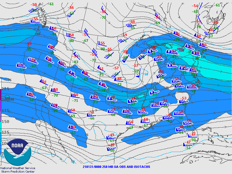
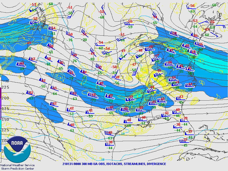
Environment
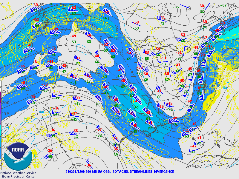
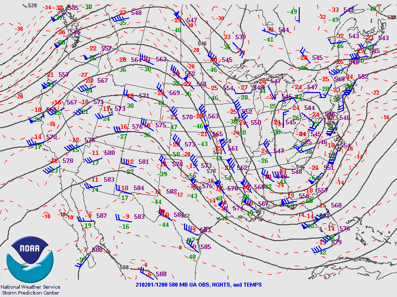
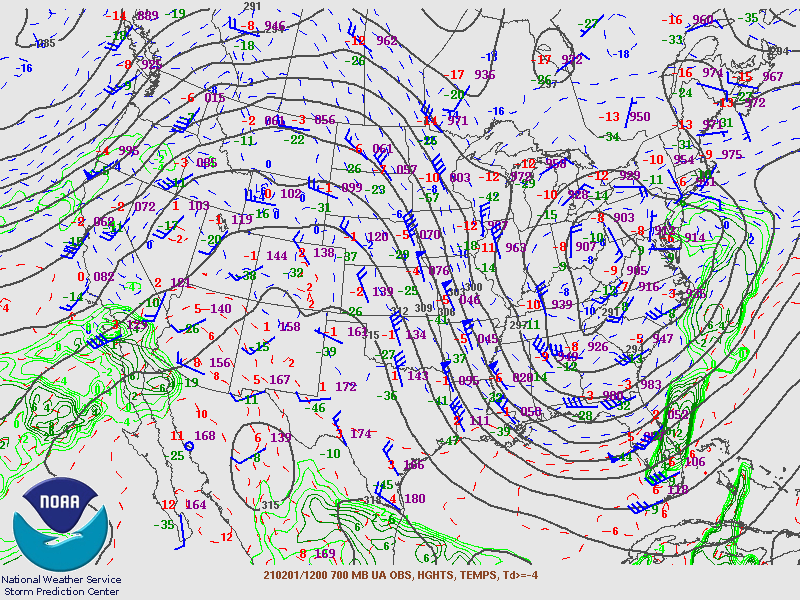
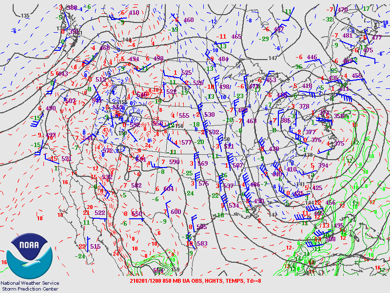
Upper Air Maps from the Storm Prediction Center.
January 31st 00Z 2021 Upper Air Maps
 |
 |
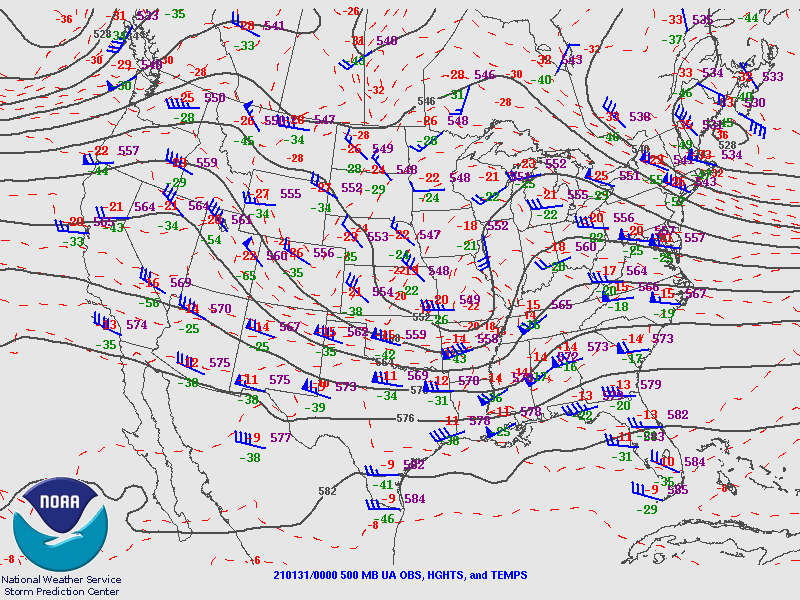 |
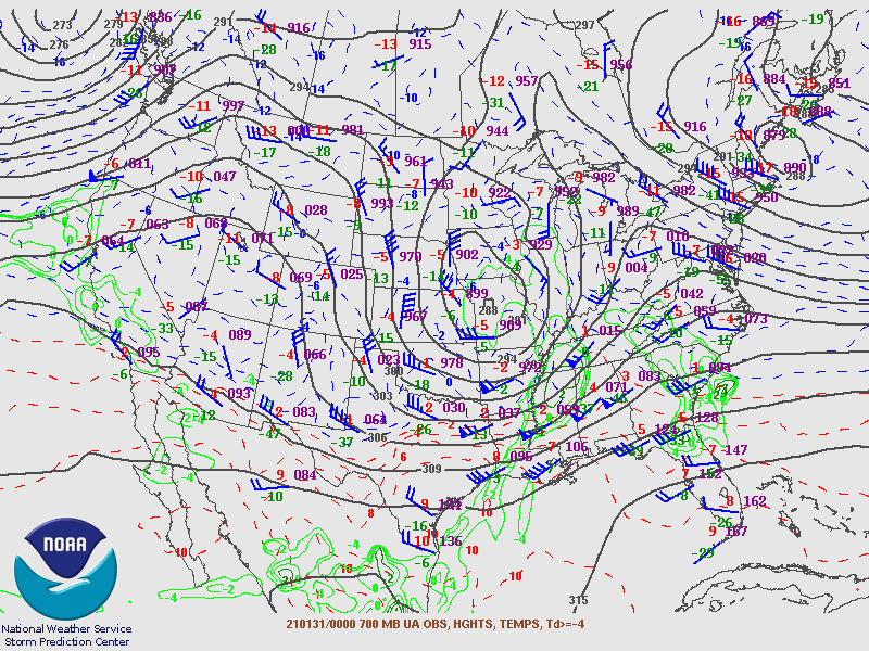
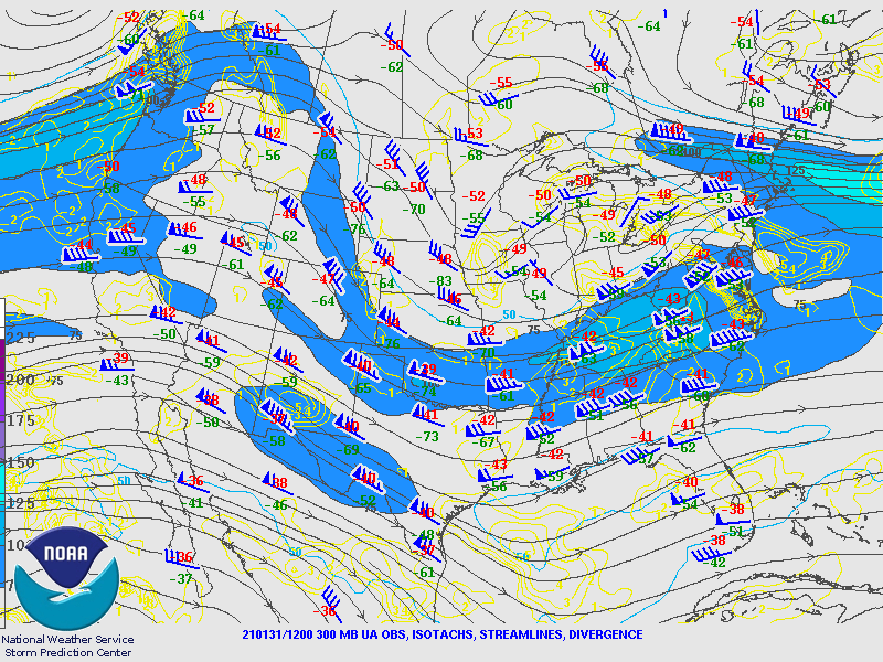
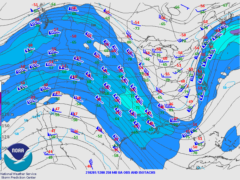
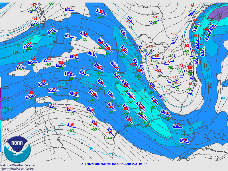
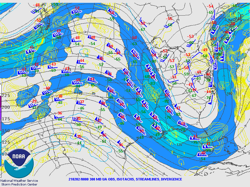
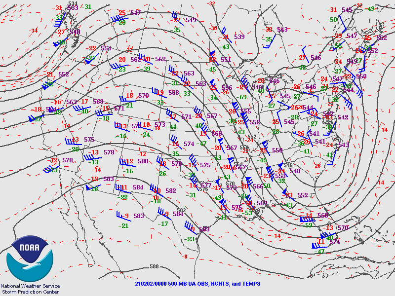
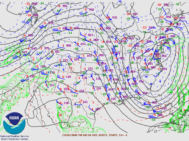
| Figure 1: 250MB | Figure 2: 300MB | Figure 3: 500MB |
 |
 |
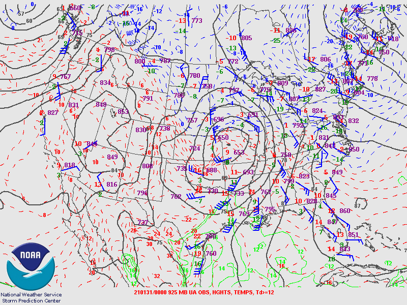 |
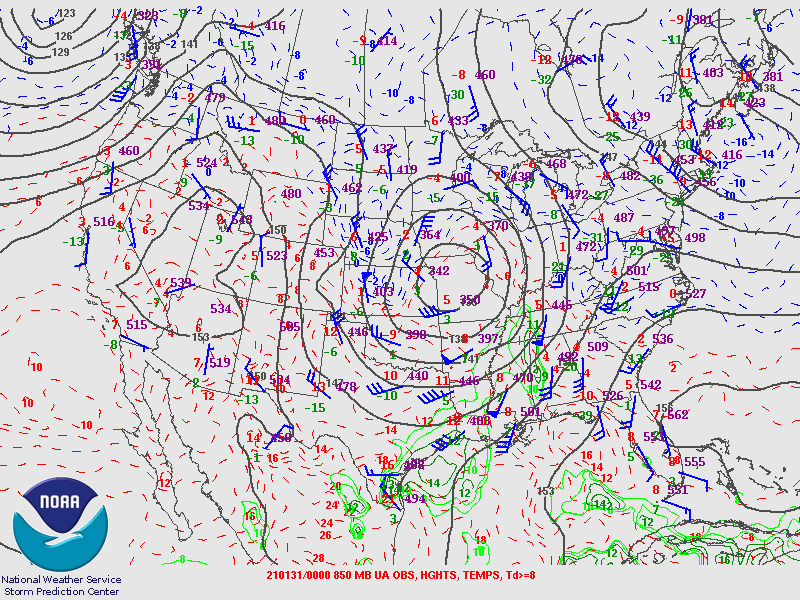
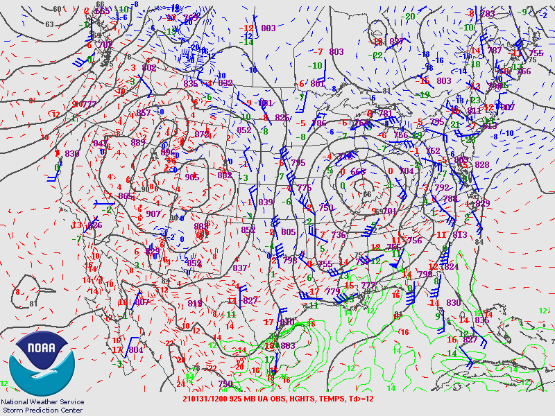
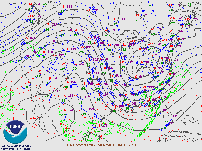
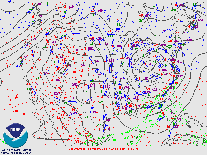
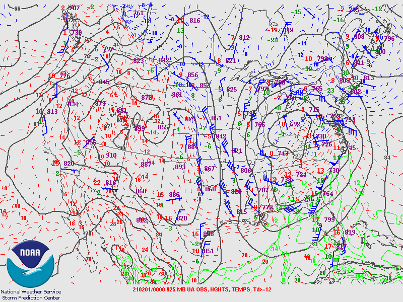
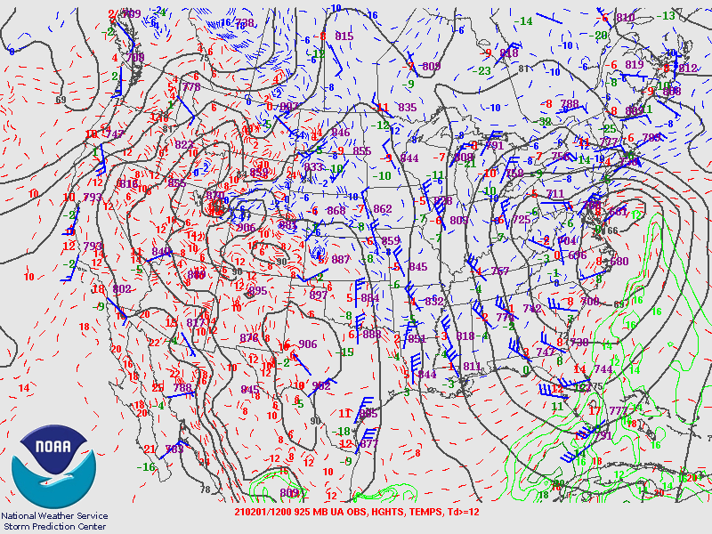
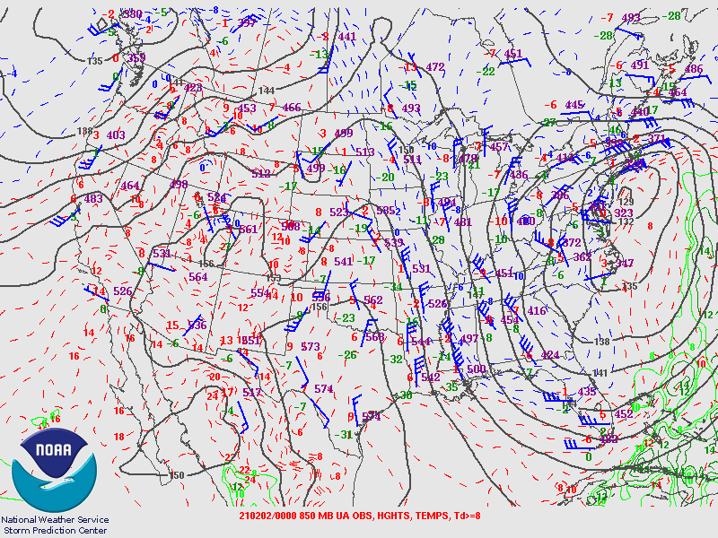
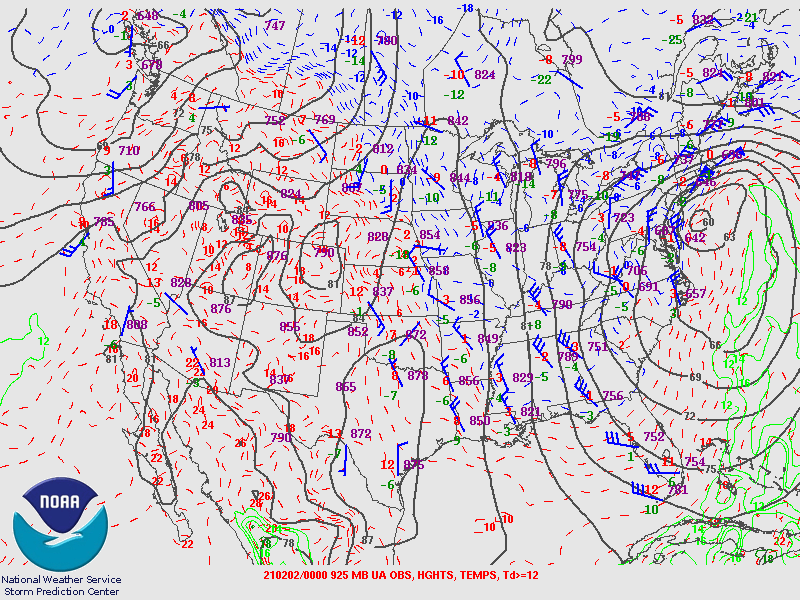
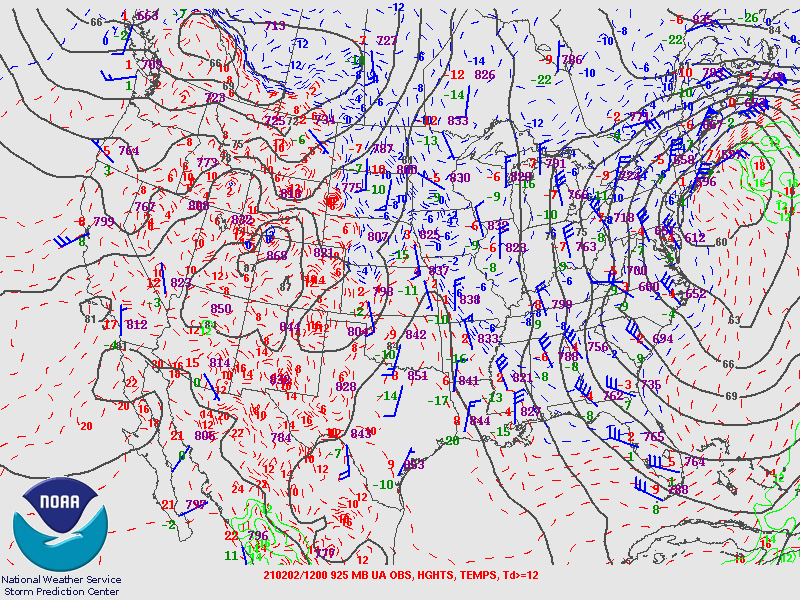
| Figure 4: 700MB | Figure 5: 850MB | Figure 6: 925MB |
January 31st 12Z 2021 Upper Air Maps
 |
 |
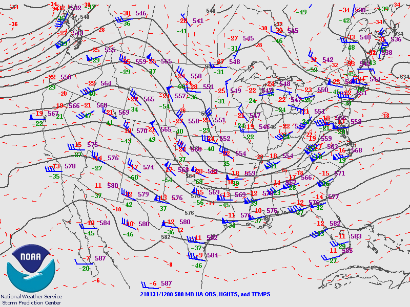 |
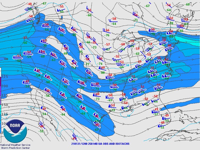
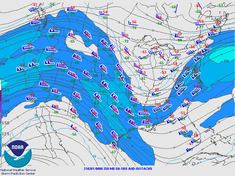
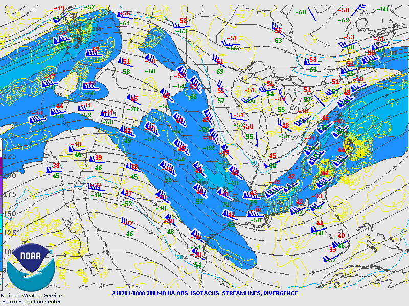
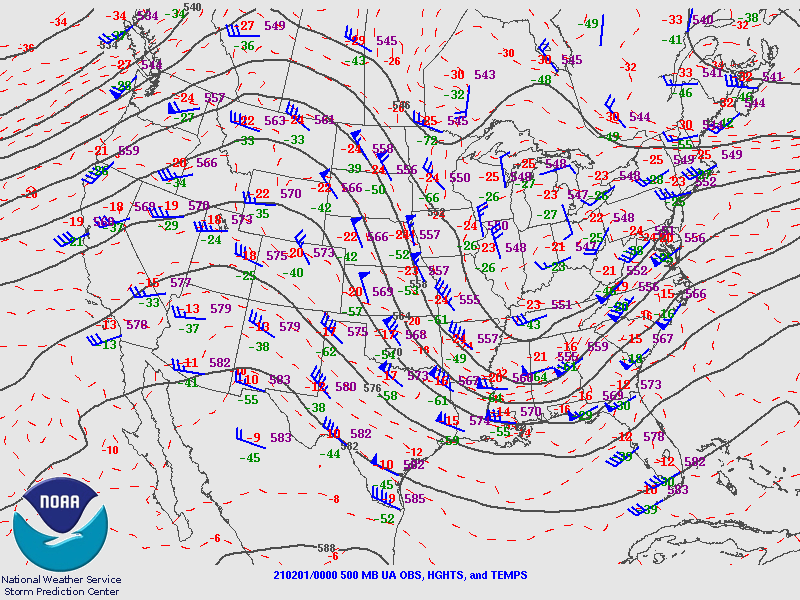
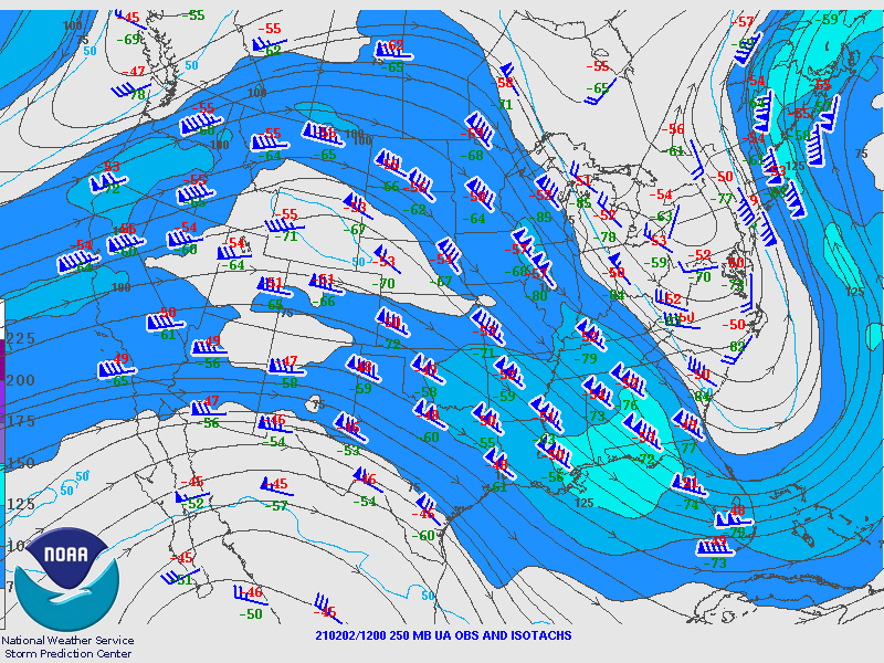
| Figure 7: 250MB | Figure 8: 300MB | Figure 9: 500MB |
 |
 |
 |
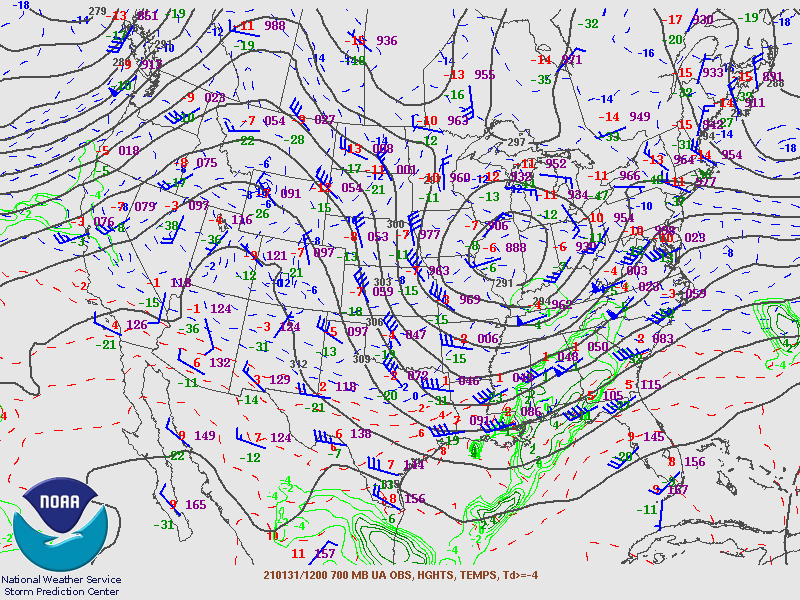
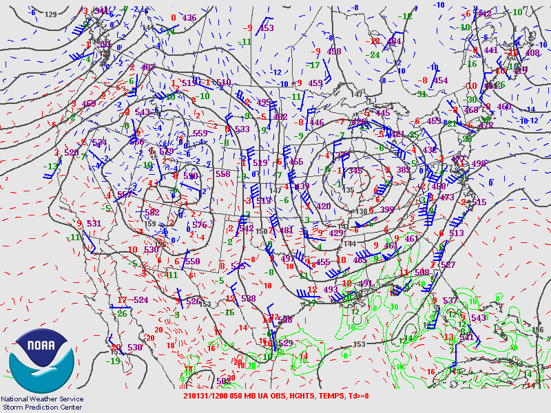
| Figure 10: 700MB | Figure 11: 850MB | Figure 12: 925MB |
February 1st 00Z 2021 Upper Air Maps
 |
 |
 |
| Figure 13: 250MB | Figure 14: 300MB | Figure 15: 500MB |
 |
 |
 |
| Figure 16: 700MB | Figure 17: 850MB | Figure 18: 925MB |
February 1st 12Z 2021 Upper Air Maps
 |
 |
 |
| Figure 19: 250MB | Figure 20: 300MB | Figure 21: 500MB |
 |
 |
 |
| Figure 22: 700MB | Figure 23: 850MB | Figure 24: 925MB |
February 2nd 00Z Upper Air Maps
 |
 |
 |
| Figure 25: 250MB | Figure 26: 300MB | Figure 27: 500MB |
 |
 |
 |
| Figure 28: 700MB | Figure 29: 850MB | Figure 30: 925MB |
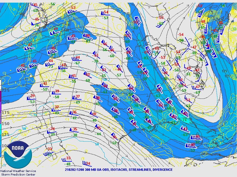
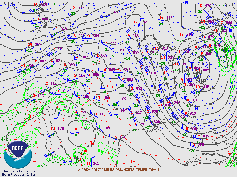
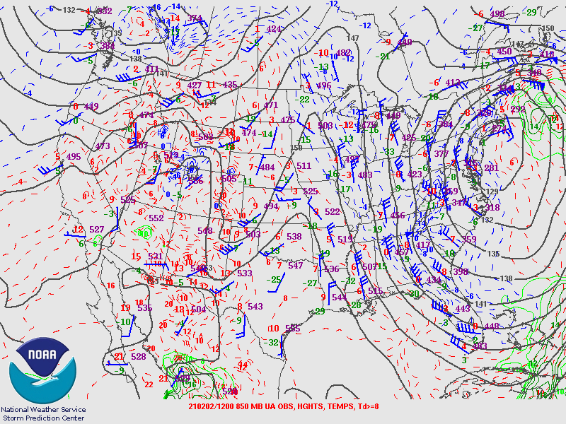
February 2nd 12Z Upper Air Maps
 |
 |
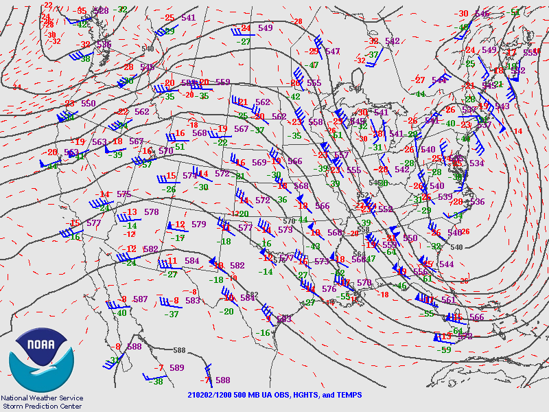 |
| Figure 31: 250MB | Figure 32: 300MB | Figure 33: 500MB |
 |
 |
 |
| Figure 34: 700MB | Figure 35: 850MB | Figure 36: 925MB |
Surface Maps from the Weather Prediction Center.
 |
 |
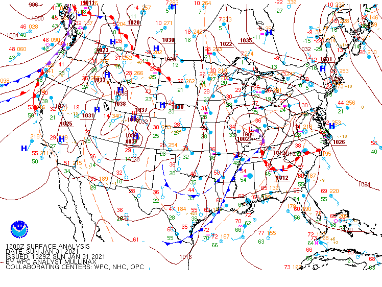 |
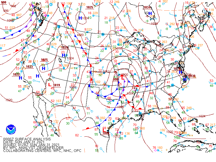
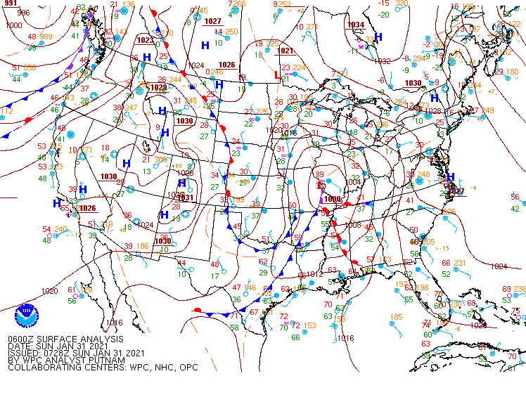
| Figure 1: SFC JAN 31 00Z | Figure 2: SFC JAN 31 06Z | Figure 3: SFC JAN 31 12Z |
 |
 |
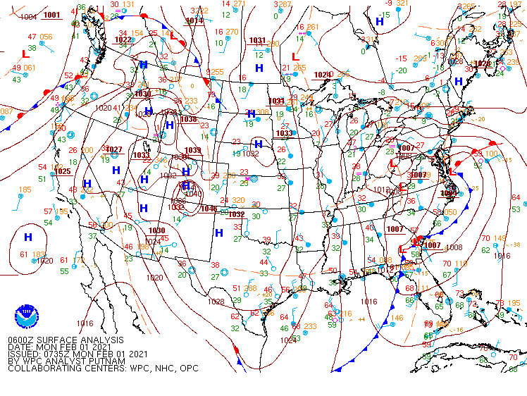 |
| Figure 4: SFC JAN 31 18Z | Figure 5: SFC FEB 01 00Z | Figure 6: SFC FEB 01 06Z |
 |
 |
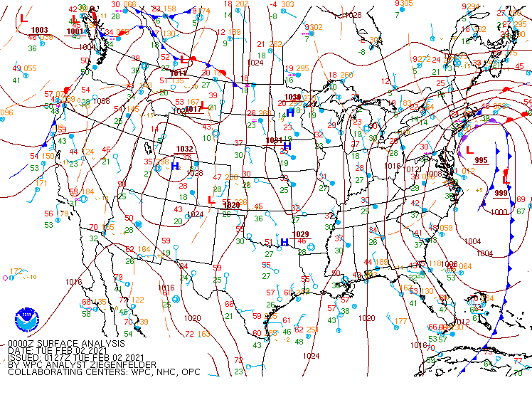 |
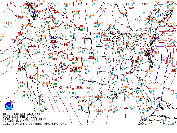
| Figure 7: SFC FEB 01 12Z | Figure 8: SFC FEB 01 18Z | Figure 9: SFC FEB 02 00Z |
2 Hour Pressure Change Maps from SPC.
 |
 |
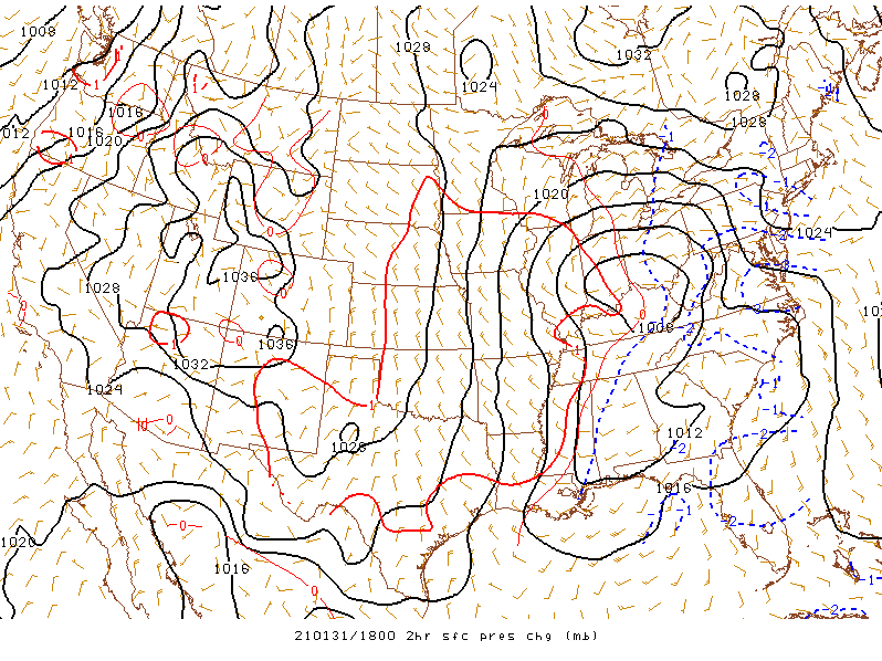 |
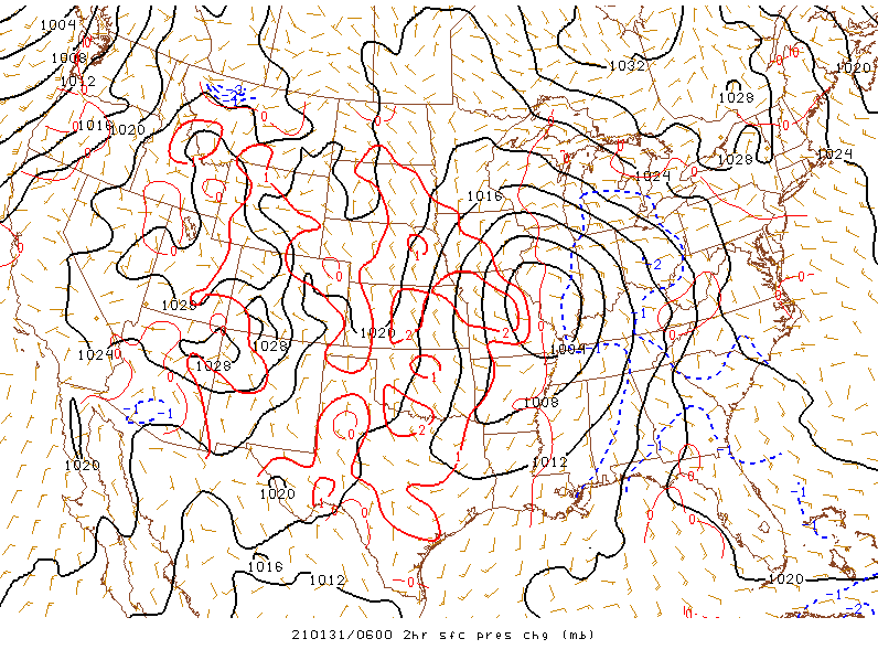
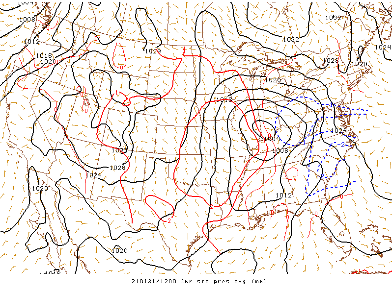
| Figure 1: January 31st 06Z | Figure 2: January 31st 12Z | Figure 3: January 31st 18Z |
 |
Media use of NWS Web News Stories is encouraged! Please acknowledge the NWS as the source of any news information accessed from this site. |
|