Overview
|
During the day on March the 10th 2024, a strong cold front pushed through the area allowing colder air to infiltrate the region from the northwest. The colder air along with a post frontal trough set the stage for lake enhanced snow showers across the region through the evening on the 10th and overnight into the morning of the 11th. The colder air moving over the very warm waters of Lake Erie led to the development of good instability across the region with some strong snow showers developing during the day and evening of the 10th. Some snow squall warnings and special weather statements were issued. The coldest temperatures and best lift were north of Pittsburgh and to the east along the ridges in PA and WV. The snow squall and snow showers produced heavy snow in the mountains and also impactful amounts in the north along I-80. |
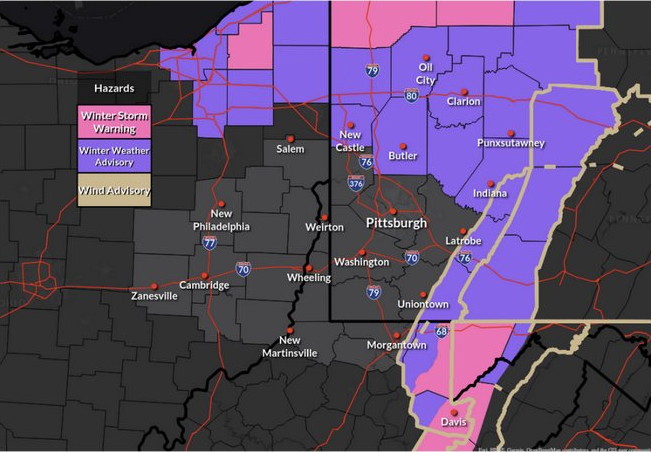 Watch Warning Advisory Map |
Snow
Public Information Statement
Spotter Reports
National Weather Service Pittsburgh PA
1120 AM EDT Mon Mar 11 2024
The following are unofficial observations taken during the past 25
hours for the storm that has been affecting our region. Appreciation
is extended to highway departments, cooperative observers, Skywarn
spotters and media for these reports. This summary also is available
on our home page at weather.gov/pittsburgh
********************STORM TOTAL SNOWFALL********************
LOCATION TOTAL TIME/DATE COMMENTS
SNOWFALL
MEASURED
(inches)
| PENNSYLVANIA | |||||
| ...Allegheny County... | |||||
| O'Hara Township | 0.5 | 940 | PM | 10-Mar | Public |
| ...Clarion County... | |||||
| SW Marble | 2.2 | 1000 | PM | 10-Mar | Public |
| ...Fayette County... | |||||
| 5 SE Champion | 4 | 939 | AM | 11-Mar | Public |
| W Farmington | 2.2 | 200 | PM | 10-Mar | Public |
| ...Forest County... | |||||
| Marienville | 0.5 | 200 | AM | 11-Mar | Public |
| ...Venango County... | |||||
| 1 N Cooperstown | 3 | 725 | PM | 10-Mar | Public |
| ...Westmoreland County.. | . | ||||
| 3 W Lawson Heights | 1.5 | 715 | PM | 10-Mar | Public |
| 1 S Manor | 1.2 | 1045 | PM | 10-Mar | Public |
| WEST VIRGINIA | |||||
| ...Tucker County... | |||||
| Canaan Heights | 4 | 559 | PM | 10-Mar | Still snowing. |
| 7 SSE Canaan Hgts | 4 | 939 | AM | 11-Mar | Public |
| Davis | 3 | 601 | PM | 10-Mar | Still snowing. |
| Parsons | 1 | 600 | PM | 10-Mar | Emergency Mngr |
| **********************24 | HOUR | SNOWF | ALL | ****** | **************** |
| LOCATION 24 | HOUR | TIM | E/DATE | COMMENTS | |
| SNO | WFALL | ME | ASURED | ||
| (in | ches) | ||||
| MARYLAND | |||||
| ...Garrett County... | |||||
| 2 ESE Grantsville | 2 | 700 | AM | 11-Mar | CoCoRaHS |
| OHIO | |||||
| ...Columbiana County... | |||||
| ENE Hanoverton | 0.5 | 400 | AM | 11-Mar | CoCoRaHS |
| PENNSYLVANIA | |||||
| ...Allegheny County... | |||||
| 3 NW Pittsburgh | 1.3 | 600 | AM | 11-Mar | CoCoRaHS |
| 2 SW Pittsburgh | 0.9 | 830 | AM | 11-Mar | CoCoRaHS |
| 2 SE South Fayette | 0.6 | 700 | AM | 11-Mar | CoCoRaHS |
| 1 SW Bridgeville | 0.5 | 700 | AM | 11-Mar | CoCoRaHS |
| 2 NE Moon | 0.4 | 700 | AM | 11-Mar | Co-Op Observer |
| Carnot-Moon | 0.4 | 700 | AM | 11-Mar | CoCoRaHS |
| ENE Harrison Townshi | 0.3 | 502 | AM | 11-Mar | CoCoRaHS |
| 2 WNW Imperial | 0.2 | 800 | AM | 11-Mar | CoCoRaHS |
| ...Armstrong County... | |||||
| 1 SSW Kittanning | 1 | 700 | AM | 11-Mar | CoCoRaHS |
| 6 SW Kittanning | 0.3 | 800 | AM | 11-Mar | CoCoRaHS |
| ...Beaver County... | |||||
| Economy | 0.1 | 700 | AM | 11-Mar | CoCoRaHS |
| ...Butler County... | |||||
| 2 NNE Fox Run | 1 | 600 | AM | 11-Mar | CoCoRaHS |
| 1 SW Meridian | 0.5 | 800 | AM | 11-Mar | CoCoRaHS |
| N Cabot | 0.3 | 700 | AM | 11-Mar | CoCoRaHS |
| ...Forest County... | |||||
| 7 SSE Tionesta | 3.5 | 700 | AM | 11-Mar | CoCoRaHS |
| ...Indiana County... | |||||
| 3 SE Indiana | 2 | 700 | AM | 11-Mar | Co-Op Observer |
| ...Venango County... | |||||
| 6 SW Titusville | 4.1 | 700 | AM | 11-Mar | CoCoRaHS |
| NW Reno | 3.5 | 530 | AM | 11-Mar | CoCoRaHS |
| 1 E Cooperstown | 1.5 | 700 | AM | 11-Mar | CoCoRaHS |
| 1 E Franklin | 1.3 | 800 | AM | 11-Mar | Co-Op Observer |
| 1 SSW Franklin | 1 | 600 | AM | 11-Mar | CoCoRaHS |
| ...Washington County... | |||||
| McMurray | 0.4 | 700 | AM | 11-Mar | CoCoRaHS |
| ...Westmoreland County.. | . | ||||
| 1 SW Laughlintown | 2.5 | 800 | AM | 11-Mar | Co-Op Observer |
| 3 ESE Smithton | 0.3 | 800 | AM | 11-Mar | CoCoRaHS |
| ESE New Florence | 0.2 | 855 | AM | 11-Mar | CoCoRaHS |
| WEST VIRGINIA | |||||
| ...Monongalia County... | |||||
| 6 SW Morgantown | 0.1 | 700 | AM | 11-Mar | CoCoRaHS |
| ...Preston County... | |||||
| 5 NNE Terra Alta | 2.4 | 800 | AM | 11-Mar | CoCoRaHS |
| 7 N Thomas | 1.5 | 700 | AM | 11-Mar | CoCoRaHS |
| E Terra Alta | 1.2 | 700 | AM | 11-Mar | CoCoRaHS |
| 3 S Bruceton Mills | 0.3 | 700 | AM | 11-Mar | CoCoRaHS |
| ...Tucker County... | |||||
| Davis | 8.9 | 700 | AM | 11-Mar | Co-Op Observer |
| 3 S Canaan Hgts | 2.5 | 900 | AM | 11-Mar | Co-Op Observer |
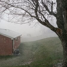
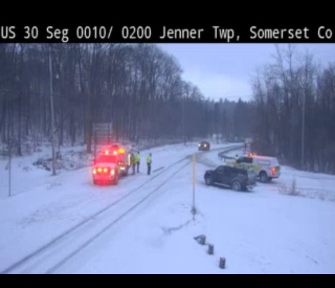
Photos
Header
 |
 |
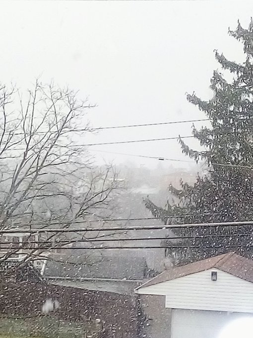 |
| North Huntington, PA Credit: Vicki Sarraino |
Laughlintown, PA Credit: Connor Belak |
Brookline, PA Source: Unknown |
Radar
Storm Prediction Center Mesoscale Discussion
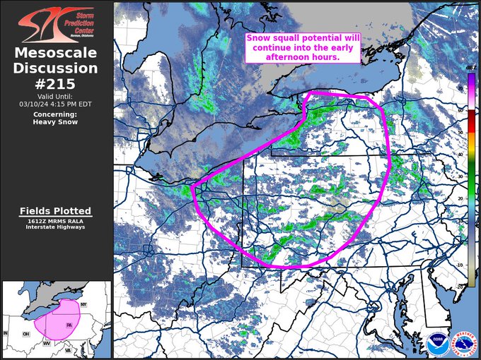 |
| Caption |
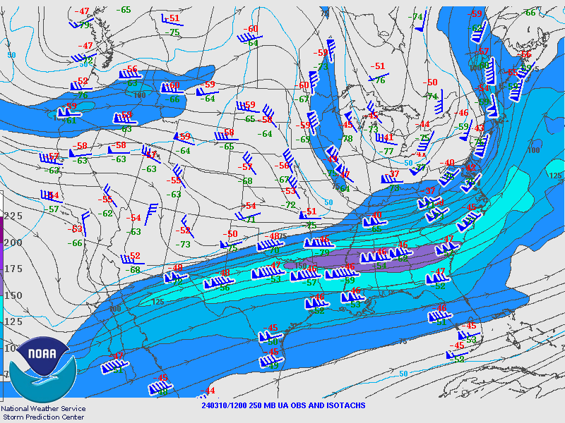
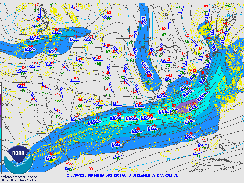
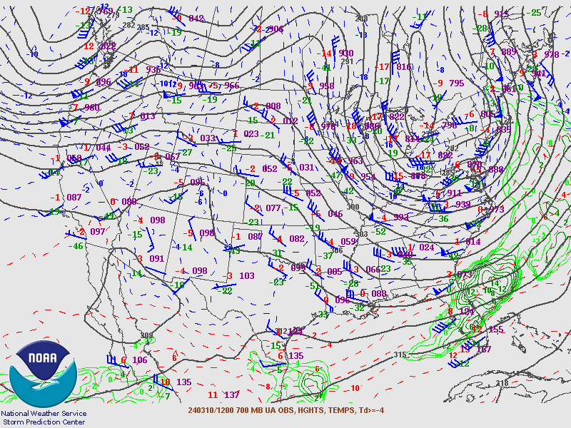
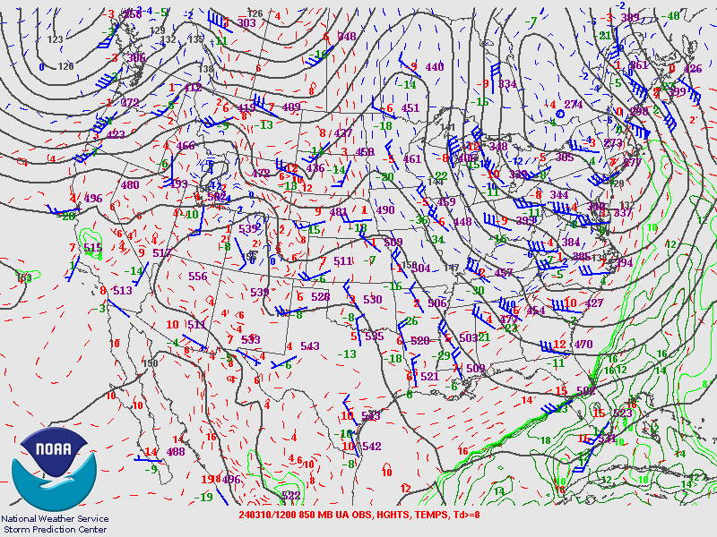
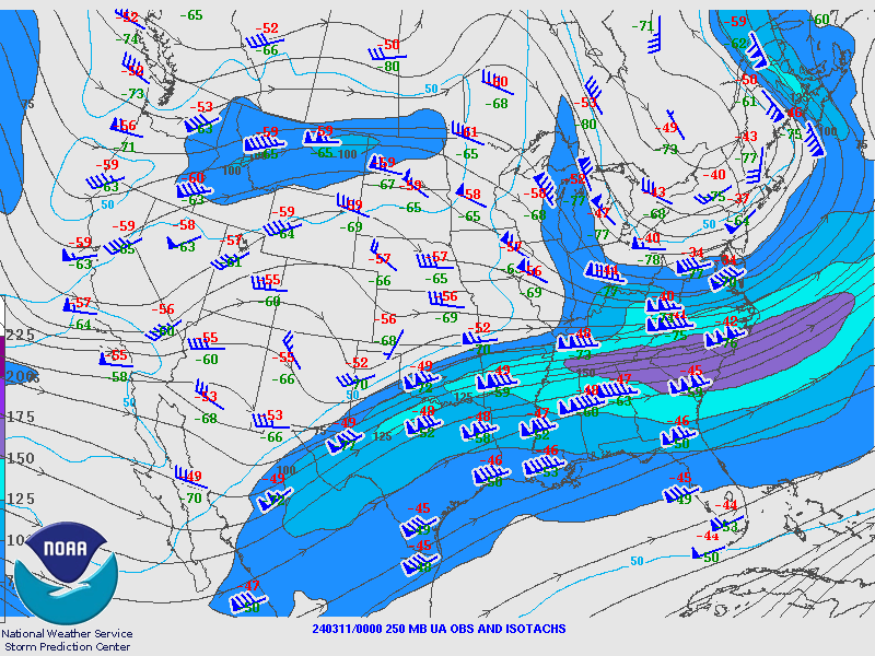
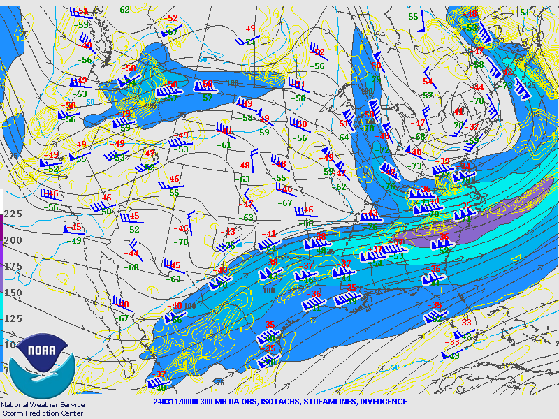
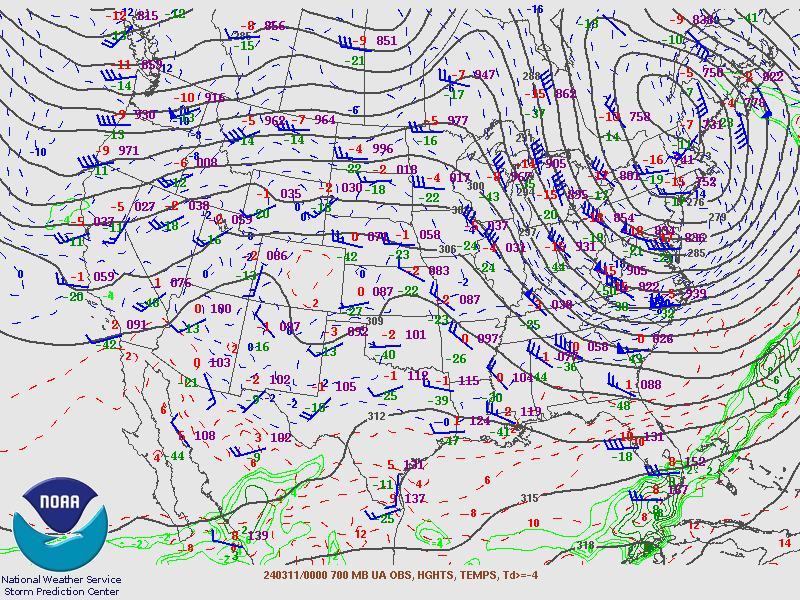
Environment
Upper Air Maps from SPC.
March 10th 2024 12Z Maps
 |
 |
 |
| 250MB | 300MB | 500MB |
 |
 |
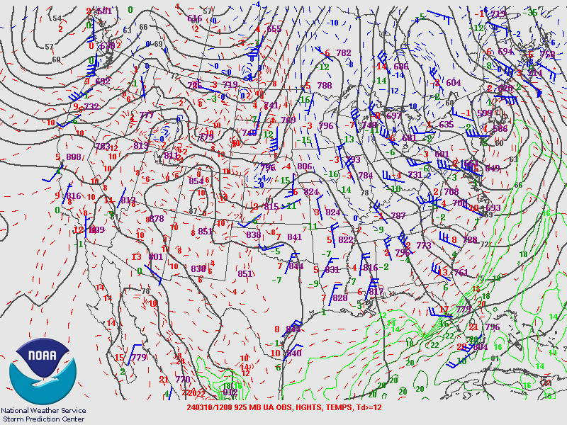 |
| 700MB | 850MB | 925MB |
March 11th 2024 00Z Maps
 |
 |
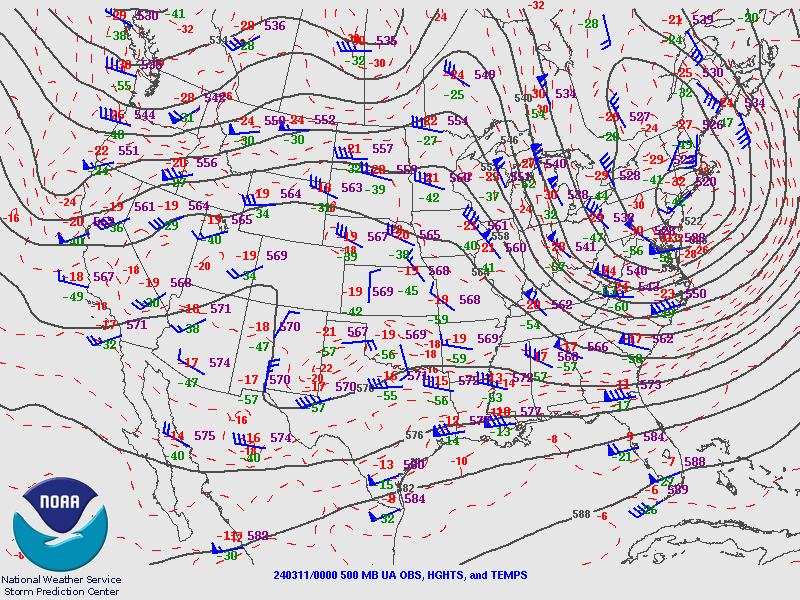 |
| 250MB | 300MB | 500MB |
 |
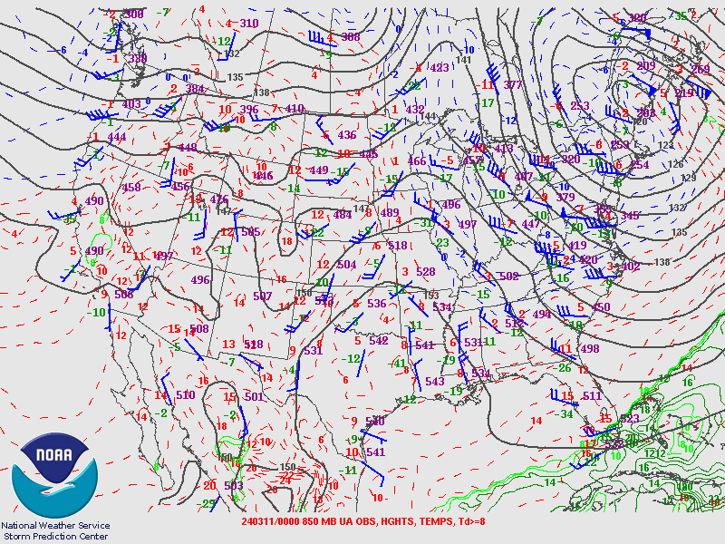 |
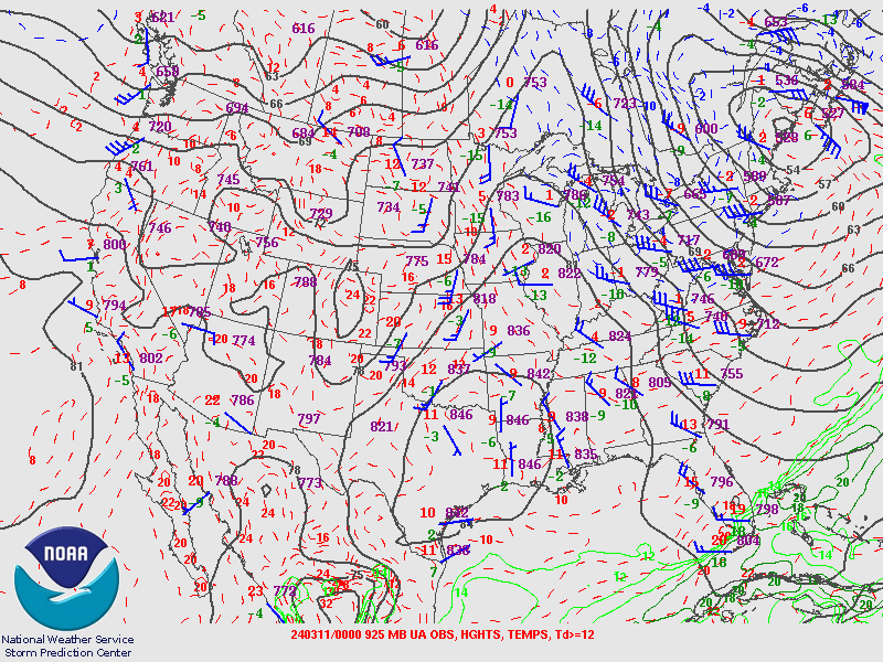 |
| 700MB | 850MB | 925MB |
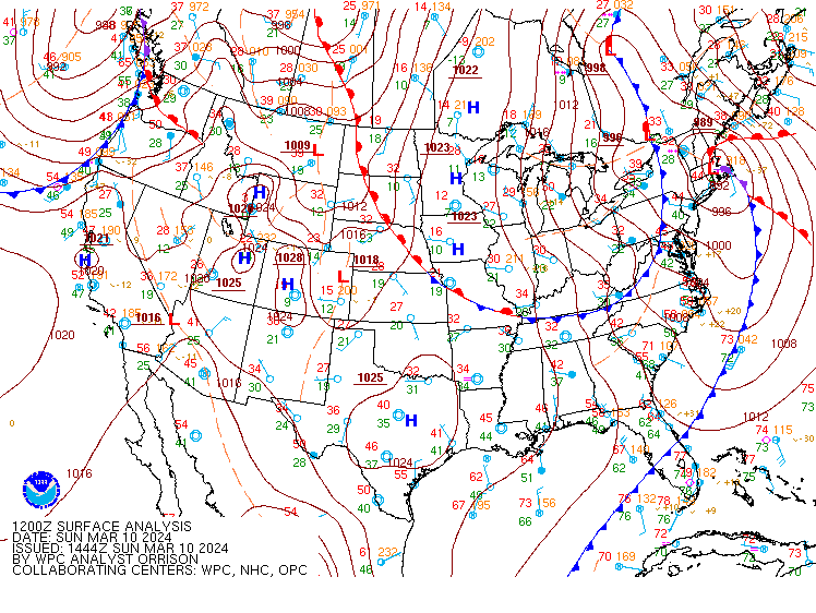
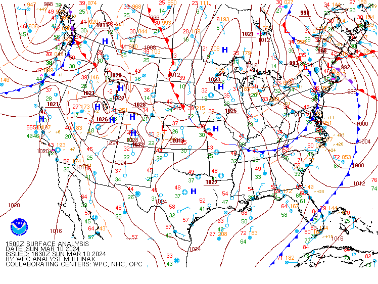
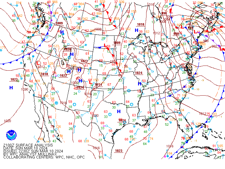
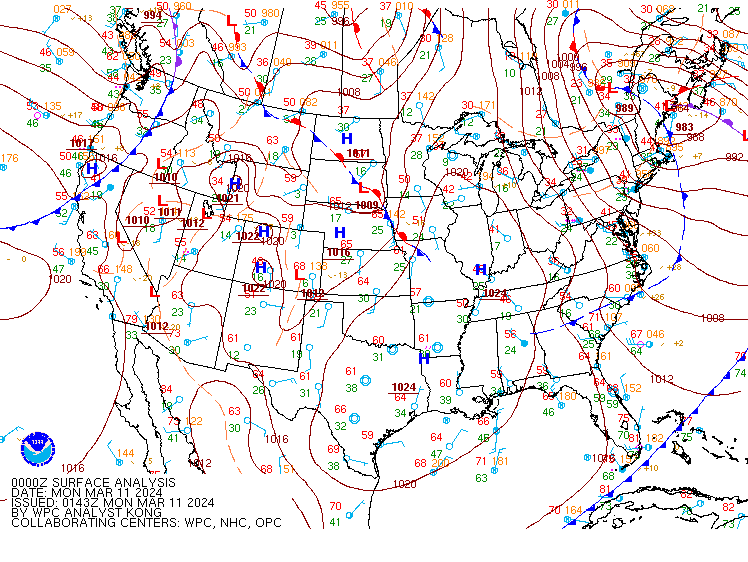
Surface Analyzed Charts from WPC.
 |
 |
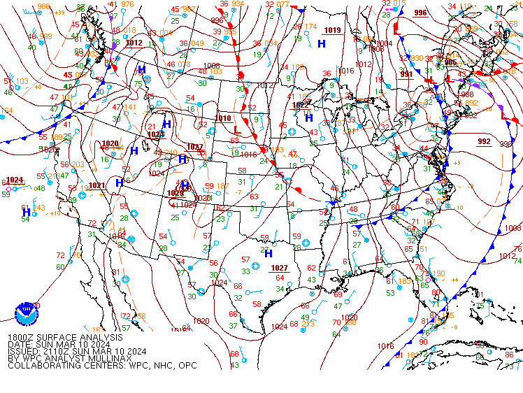 |
| March 10th 2024 12Z | March 10th 2024 15Z | March 10th 2024 18Z |
 |
 |
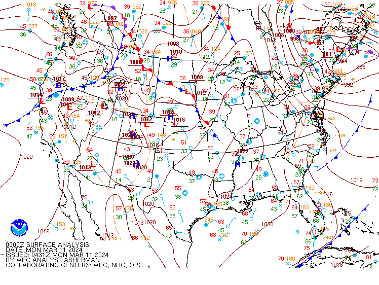 |
| March 10th 2024 21Z | March 11th 2024 00Z | March 11th 2024 03Z |
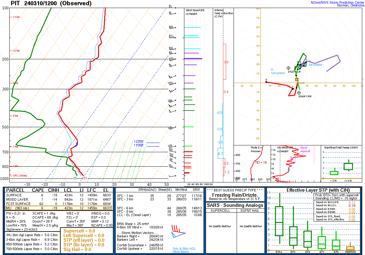
Upper Air Sounding from PIT.
 |
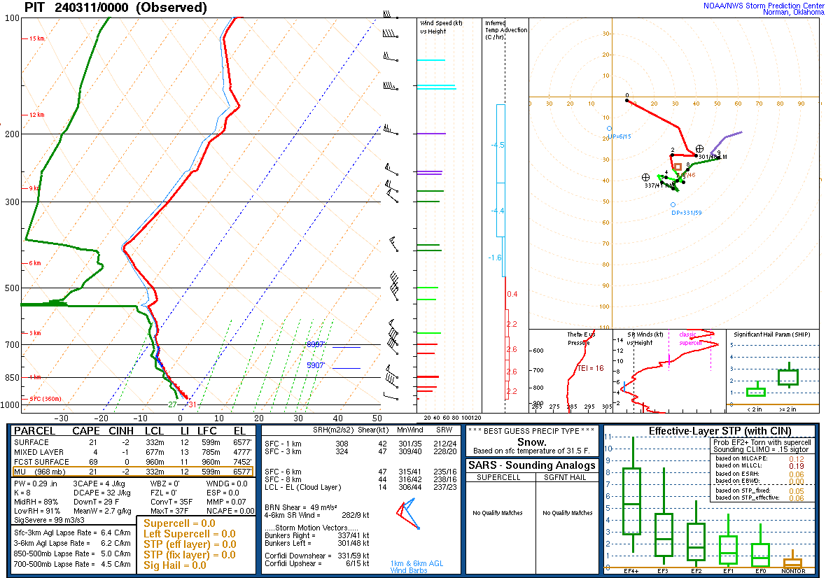 |
| March 10th 2024 12Z | March 11th 2024 00Z |
 |
Media use of NWS Web News Stories is encouraged! Please acknowledge the NWS as the source of any news information accessed from this site. |
|

