Overview
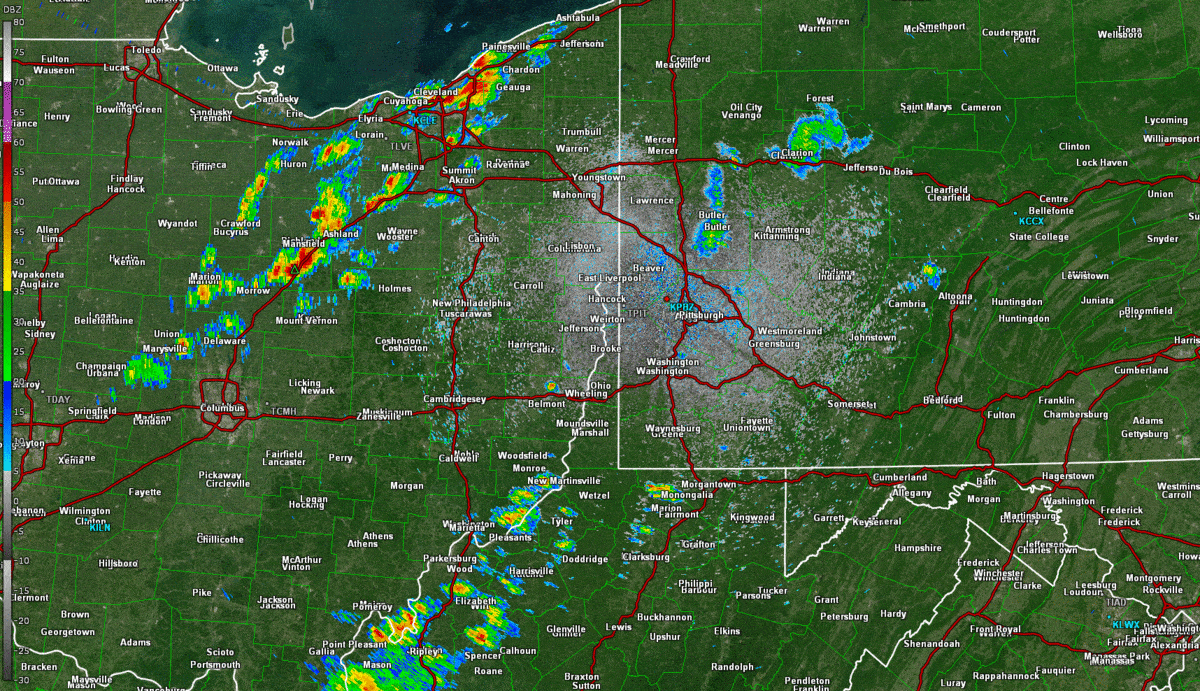
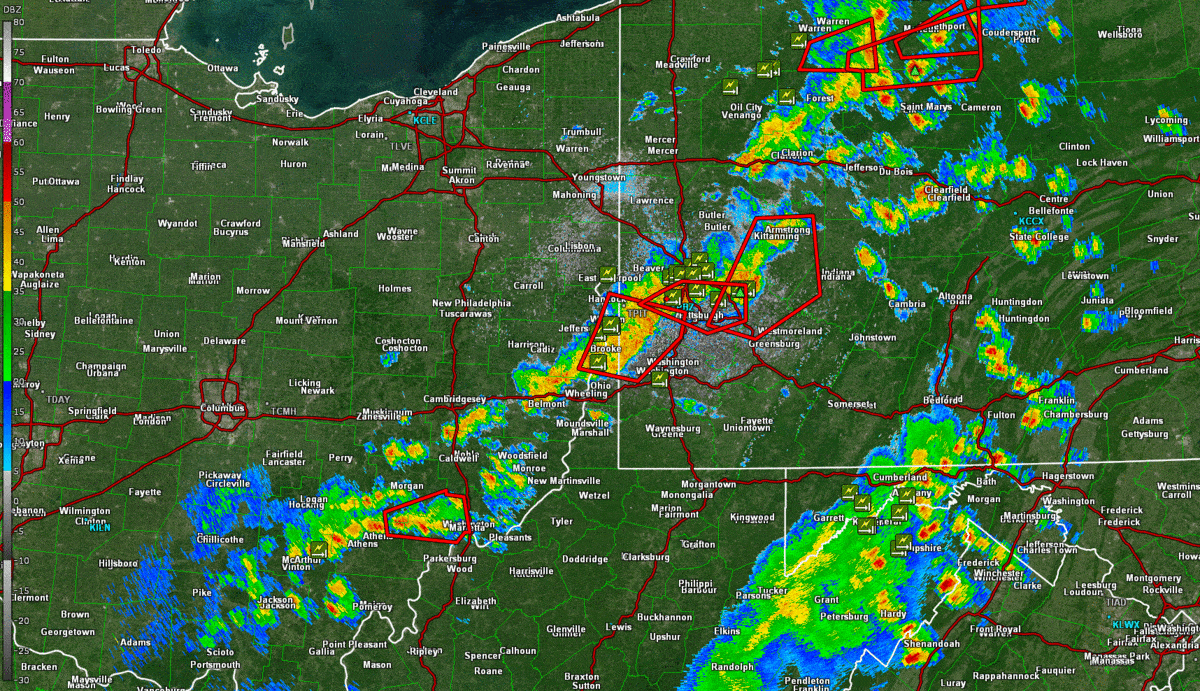
The scenario for this event was set in the early morning hours of Monday June 21st as a weakening mesoscale convective system was tracking across northern OH and into northwestern PA. The line of showers and storms dissipated over northwestern PA laying mesoscale boundary over this area and setting the stage for additional convection later in the day. Aloft, a strong shortwave trough crossed the Great Lakes region with the assist of a strong jet streak for this time of year. This setup began to push a cold front southeast through the area through the coming day. Showers and thunderstorms developed across Ohio by noon and began to push east through the the area. The showers and thunderstorms quickly developed and organized into a strong line of showers and thunderstorms. The line pushed east through the forecast area through the day with certain segments of the line surging eastward with time. Along these surges were enhanced areas of straight line wind damage. The surge in northern Allegheny County went on to produce a short lived tornado with EF-0 damage. The line increased in severity in the north as well as it crossed the aforementioned boundary developed by convection earlier in the day. By the evening that day, storms continued to travel over the same locations in southwest PA and into northern WV. This created some flooding issues and several problems of flooding roadways and homes were reported.
Tornadoes
|
Tornado - LOCATION
Track Map 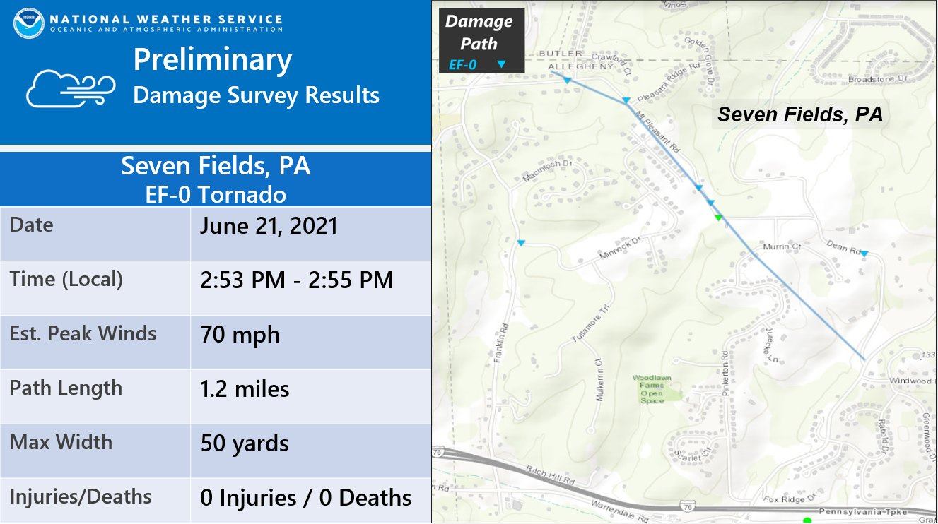 
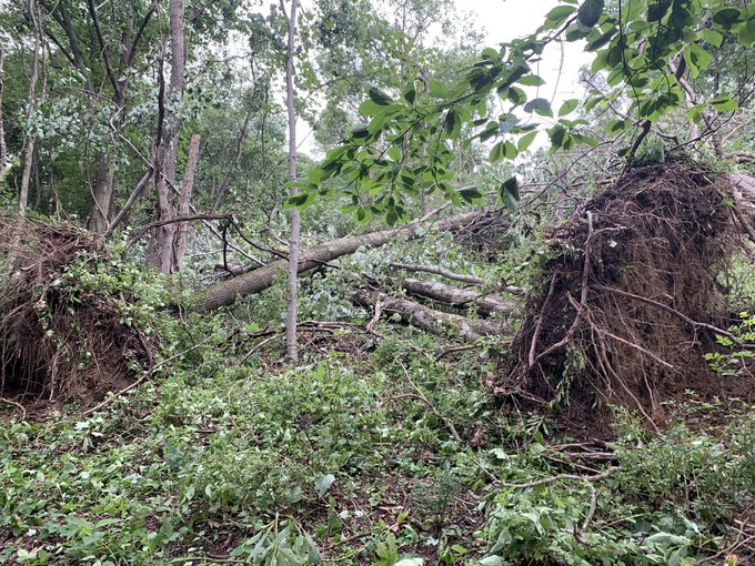
Summary: An EF0 tornado touched down near the border of Allegheny and Butler County on the afternoon of June 21st. The damage was to mostly hardwood trees that started west of the intersection of Freeport and Mt Pleasant roads. The hardest hit area was near a playground by the entrance to the Emerald Fields housing development. This is where six trees were uprooted. Sporadic down large branches were noted as the tornado tracked southeast toward Dean Road. There was a large tree that was knocked down as Mt. Pleasant road turns into Dean Road, but it was rotted. Other damage in the region including the Pine Community Center was a result of straight line wind. The most recent tornado prior to this one for Allegheny County was April 8th 2020. This is the 18th tornado since 1882 that has been documented for Allegheny County. The most recent tornado in this area of the county was EF0 on July 13th 1992. A comprehensive database of severe weather can be found on our web page at weather.gov/pittsburgh/svrclimo |
The Enhanced Fujita (EF) Scale classifies tornadoes into the following categories:
| EF0 Weak 65-85 mph |
EF1 Moderate 86-110 mph |
EF2 Significant 111-135 mph |
EF3 Severe 136-165 mph |
EF4 Extreme 166-200 mph |
EF5 Catastrophic 200+ mph |
 |
|||||
Wind & Hail Map:
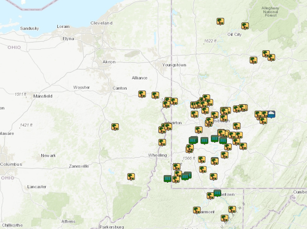 |
| Local Storm Report Summary Map |
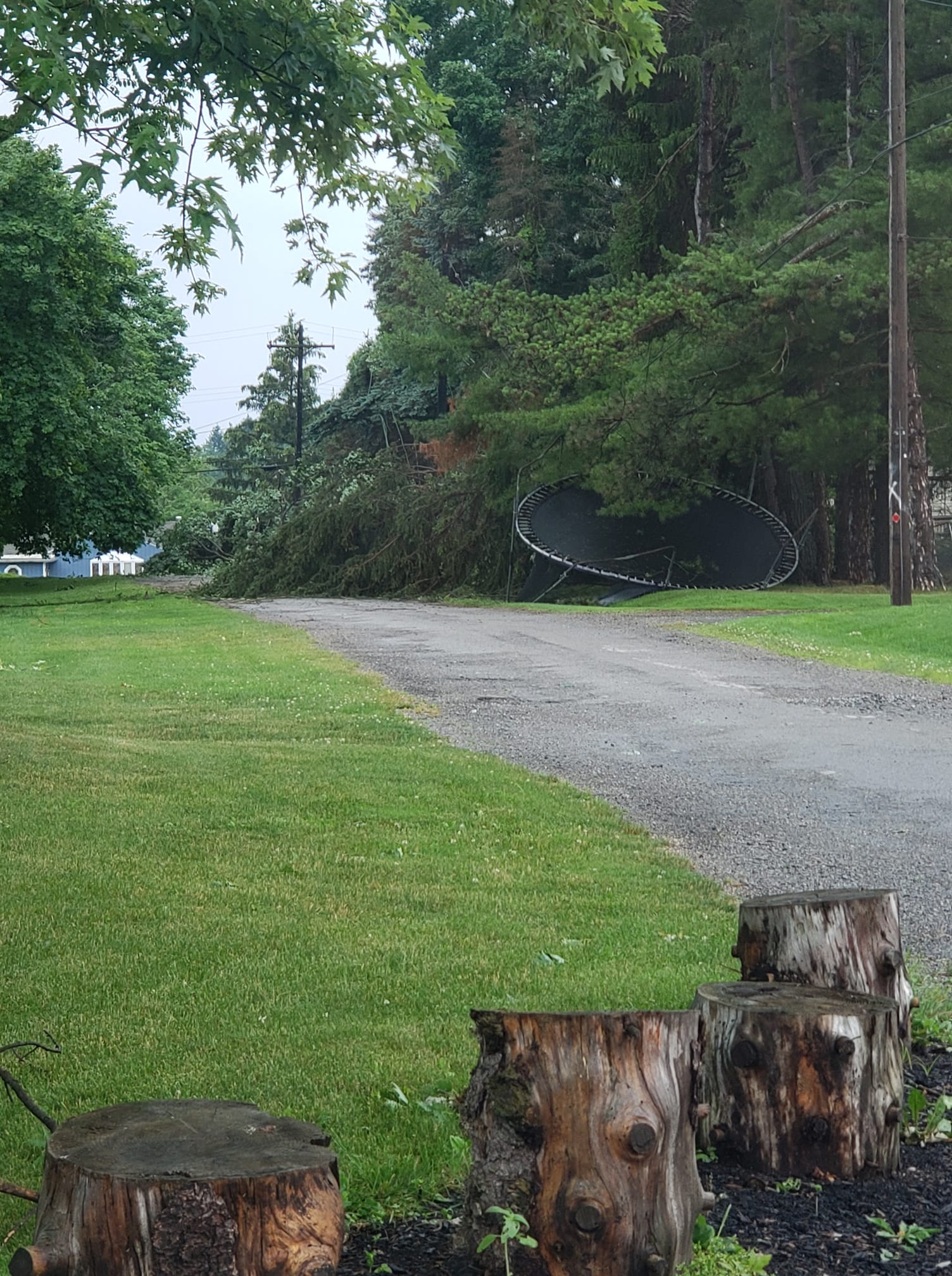
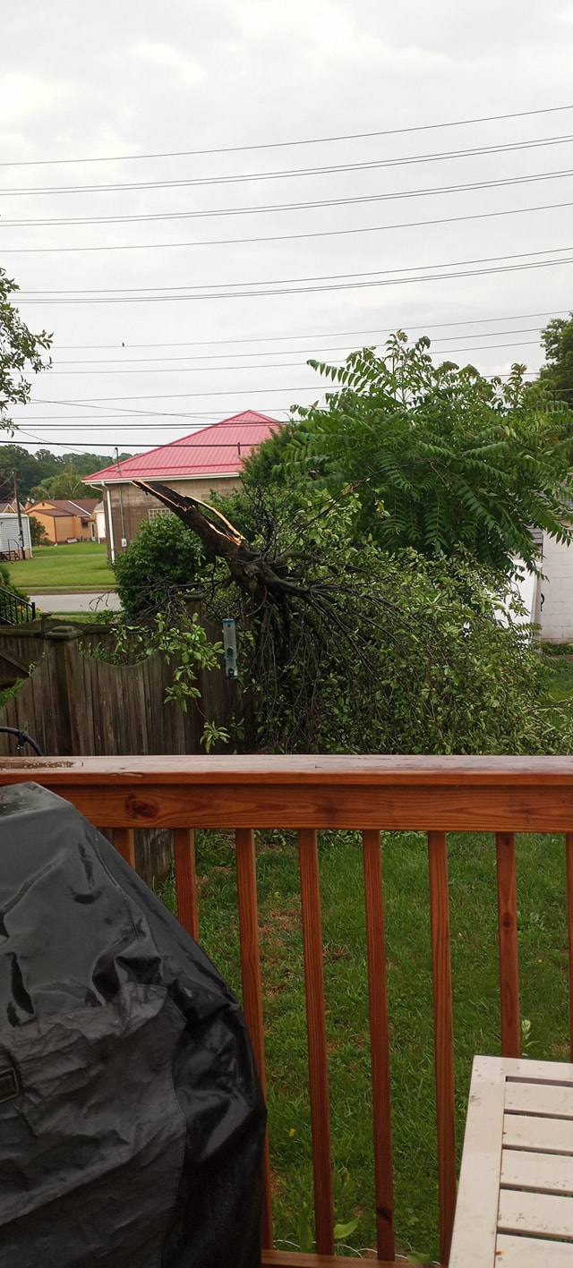
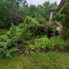
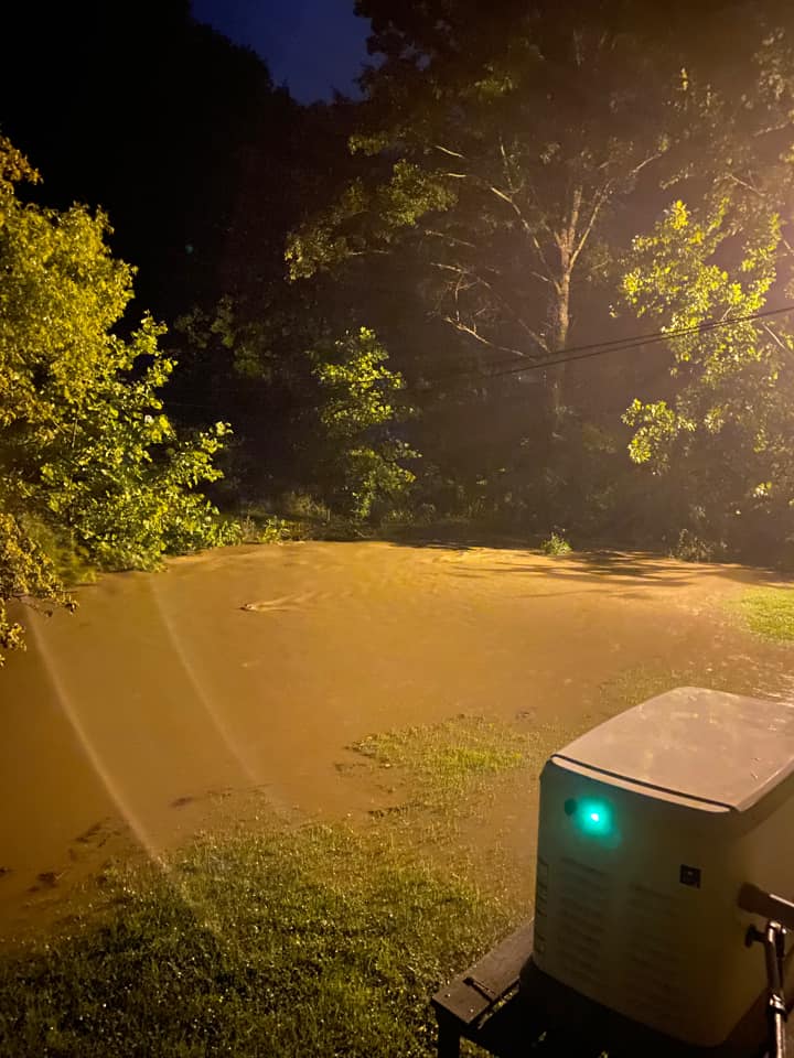
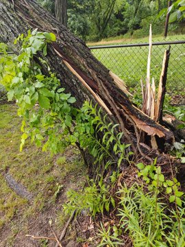
Photos
 |
 |
 |
 |
| Baldwin, PA (credit: Aron M. Lesko) |
Center Township, PA (credit: Britt Massie) |
Cheswick, PA (credit: K. Lynn Ramsey) |
Economy, PA (Cari Ann) |
 |
 |
 |
 |
| Economy, PA (credit: Deborah Viszlay) |
Rivesville, WV (credit: Wendy Bartlett) |
Ross Township, PA (credit: Jason) |
Stuebenville, OH (credit: Tyler Madden) |
 |
 |
| Stuebenville, OH (credit: Tyler Madden) |
Warrendale, PA (credit: John Arnold) |
Radar and Maps
Header
 |
 |
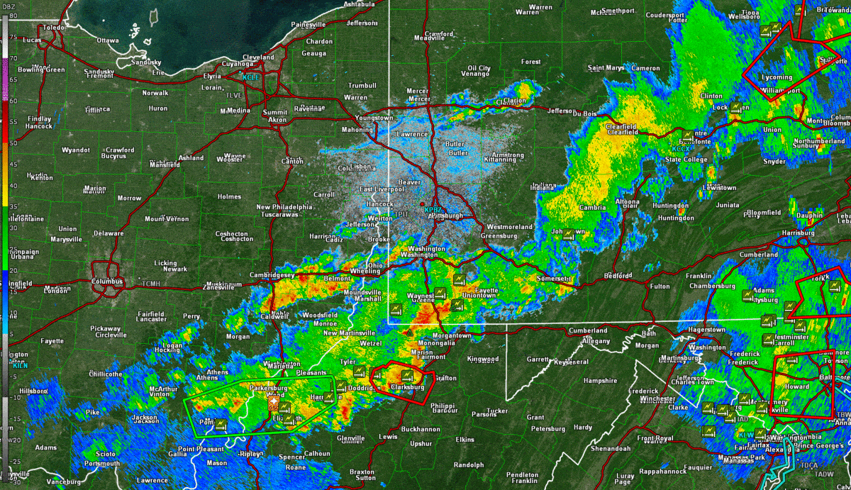 |
| 0.5 Degree Reflectivity 1159am - 320pm | 0.5 Degree Reflectivity 328pm - 544pm | 0.5 Degree Reflectivity 553pm - 1025pm |
Environmental Data
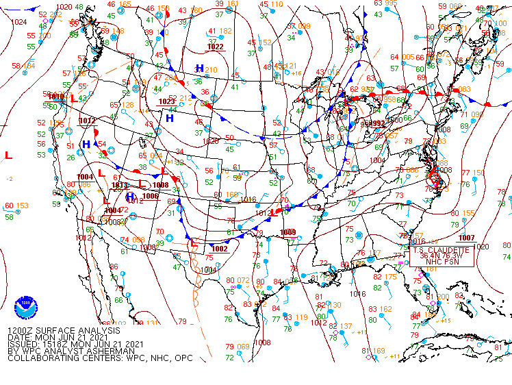
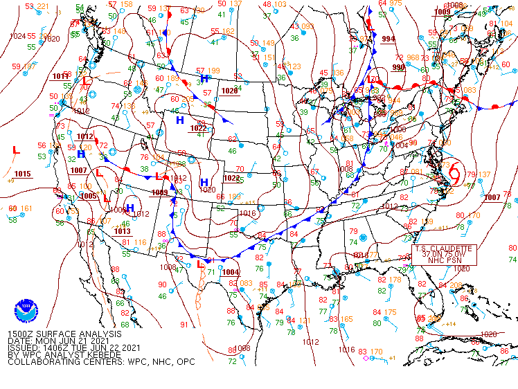
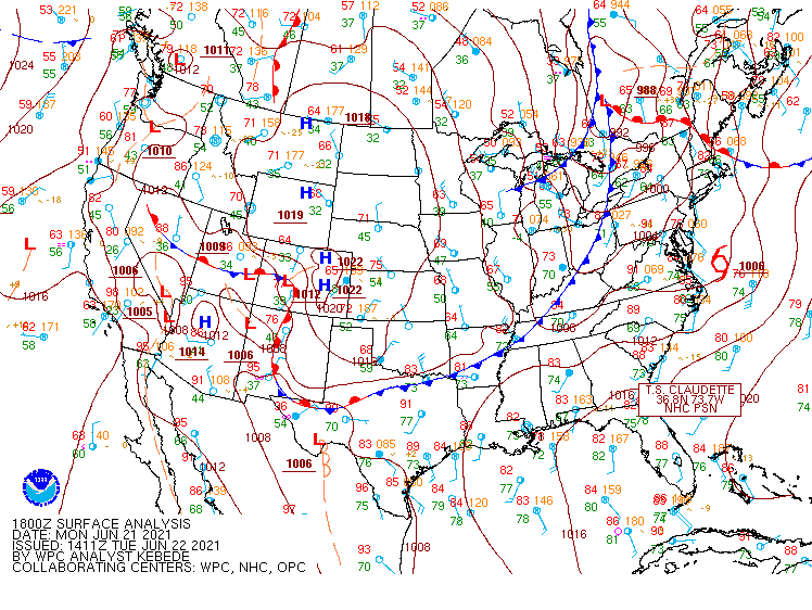
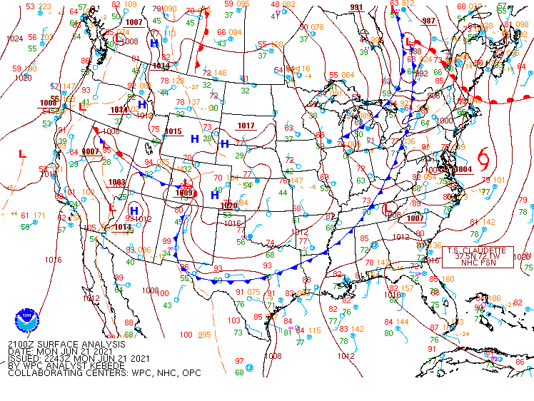
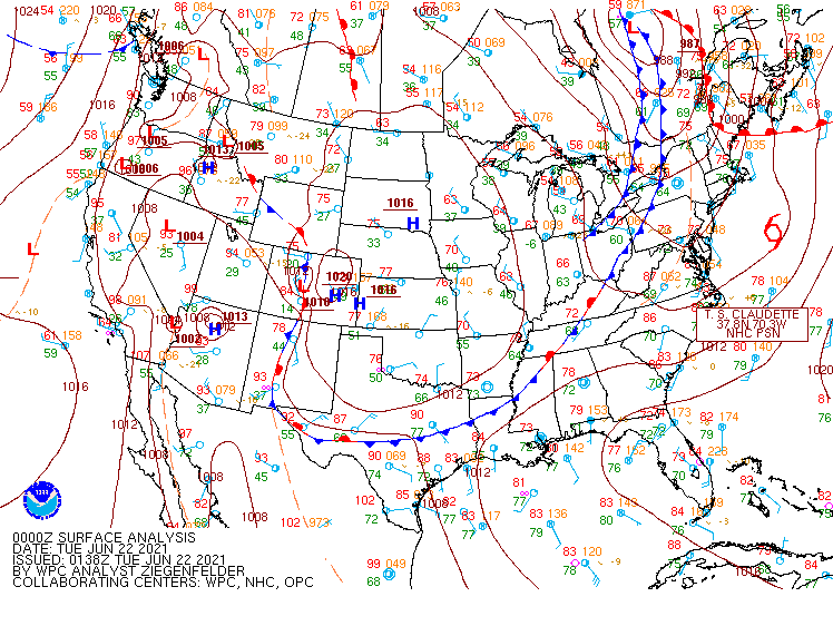
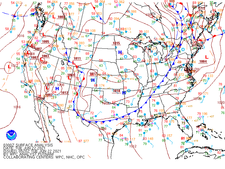
Surface Maps from WPC.
 |
 |
 |
 |
| June 21st 12Z Surface Map | June 21st 15Z Surface Map | June 21st 18Z Surface Map | June 21st 21Z Surface Map |
 |
 |
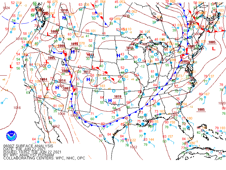 |
| June 22nd 00Z Surface Map | June 22nd 03Z Surface Map | June 22nd 06Z Surface Map |
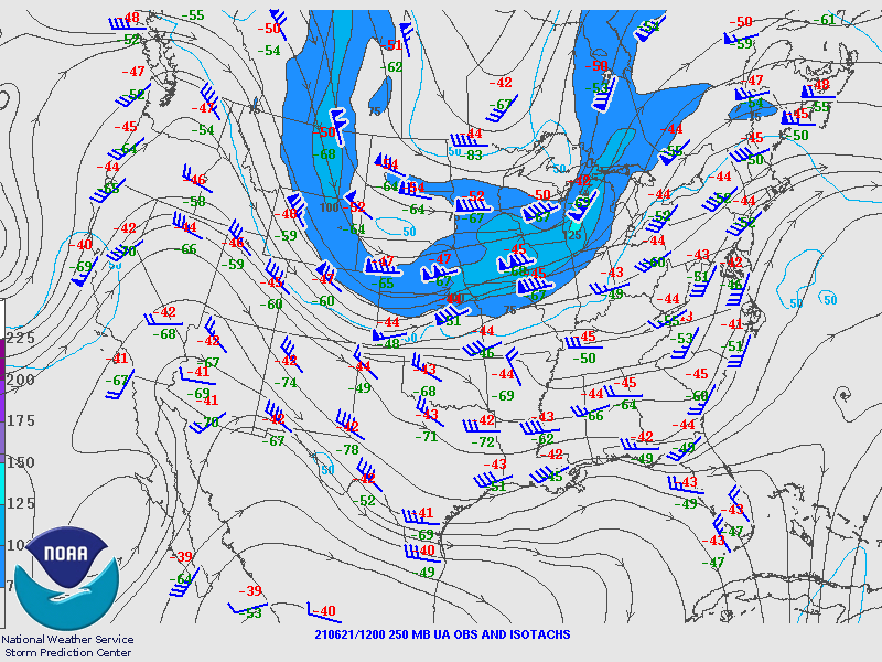
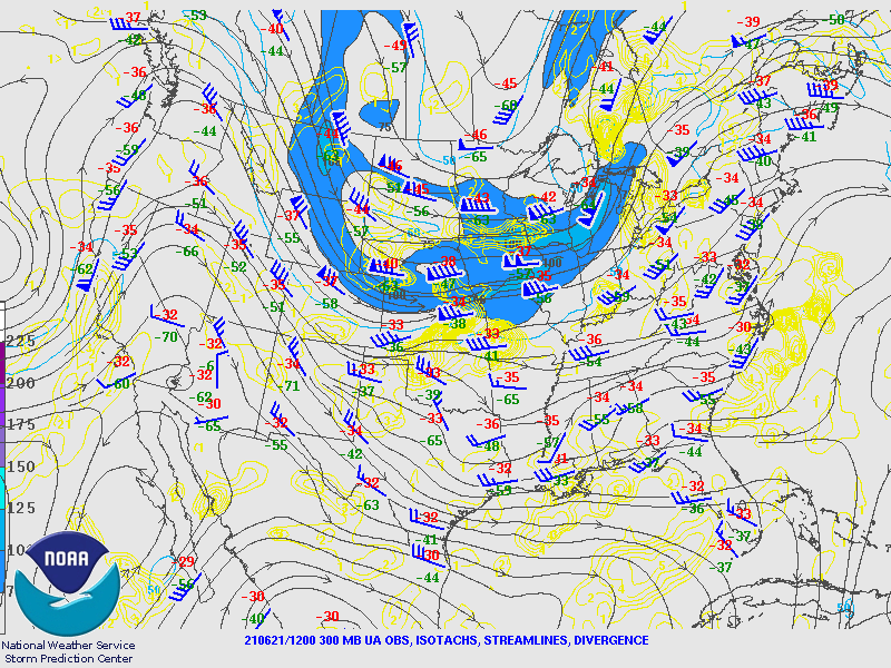
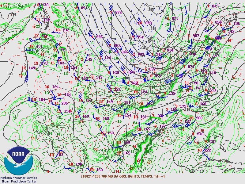
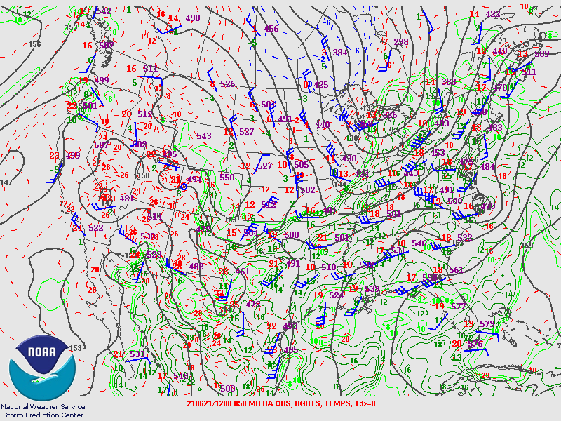
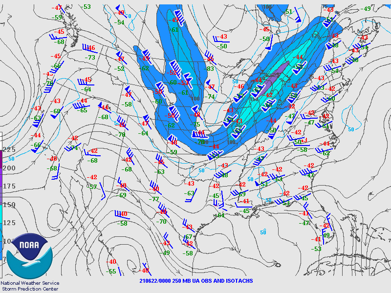
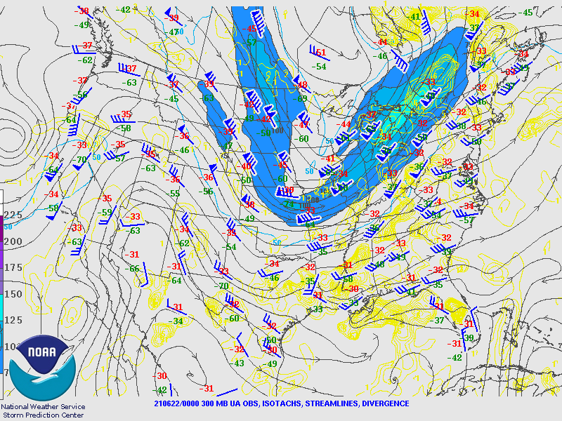
Upper Air Maps from SPC.
June 21st 12Z Maps
 |
 |
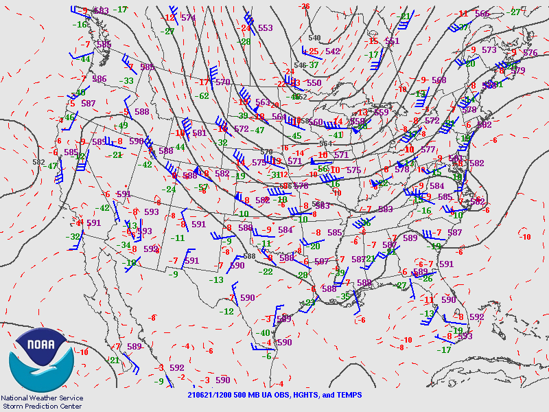 |
| 250MB | 300MB | 500MB |
 |
 |
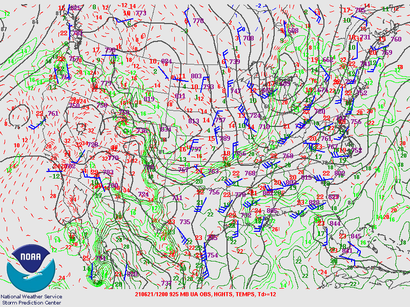 |
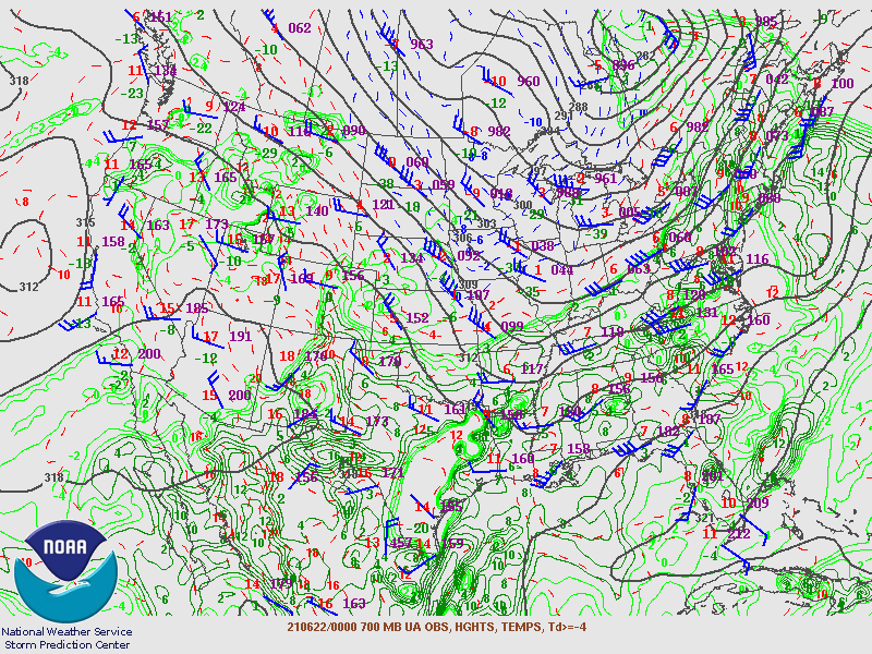
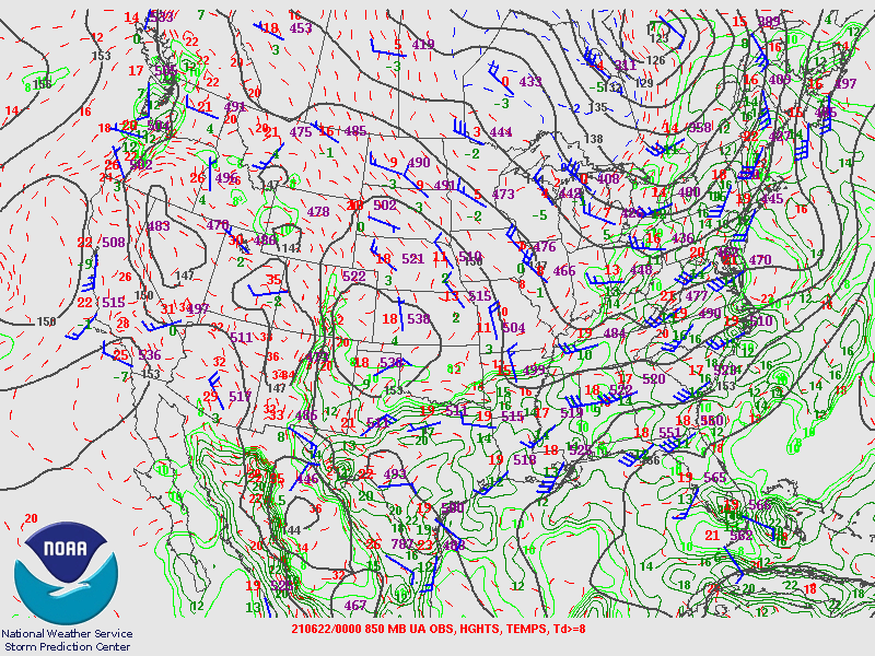
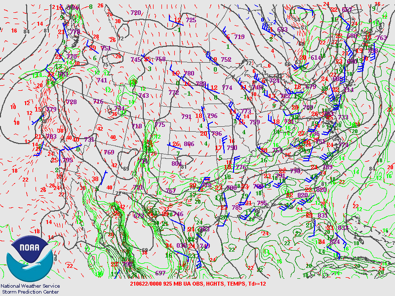
| 700MB | 850MB | 925MB |
June 22nd 00Z Maps
 |
 |
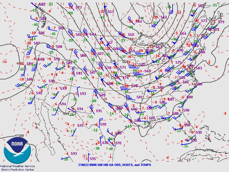 |
| 250MB | 300MB | 500MB |
 |
 |
 |
| 700MB | 850MB | 925MB |
Storm Reports
PRELIMINARY LOCAL STORM REPORT...SUMMARY
NATIONAL WEATHER SERVICE PITTSBURGH PA
1129 AM EDT THU JUN 24 2021
..TIME... ...EVENT... ...CITY LOCATION... ...LAT.LON...
..DATE... ....MAG.... ..COUNTY LOCATION..ST.. ...SOURCE....
..REMARKS..
0158 PM TSTM WND DMG HANOVERTON 40.76N 80.94W
06/21/2021 COLUMBIANA OH 911 CALL CENTER
TREE DOWN ON WIRES.
0208 PM TSTM WND DMG 2 SSE JORDANVILLE 40.75N 80.75W
06/21/2021 COLUMBIANA OH 911 CALL CENTER
WIRES DOWN ON BLACK ROAD IN CENTER TWP.
0213 PM TSTM WND DMG DENNISON 40.40N 81.33W
06/21/2021 TUSCARAWAS OH EMERGENCY MNGR
SEVERAL TREES DOWN
0221 PM TSTM WND DMG 1 NE CALCUTTA 40.69N 80.56W
06/21/2021 COLUMBIANA OH SOCIAL MEDIA
NUMEROUS TREES DOWN
0221 PM TSTM WND DMG ALBRIGHT 39.49N 79.64W
06/21/2021 PRESTON WV LAW ENFORCEMENT
MULTIPLE TREES DOWN ACROSS THE COUNTY.
0224 PM TSTM WND DMG OHIOVILLE 40.68N 80.48W
06/21/2021 BEAVER PA SOCIAL MEDIA
NUMEROUS TREES DOWN AND POWER OUTAGES REPORTED
0230 PM TSTM WND DMG 1 NE LA CROFT 40.65N 80.59W
06/21/2021 COLUMBIANA OH 911 CALL CENTER
TREE FELL ON CAR AND KNOCKED OUT WINDOW ON CONNELL
STREET.
0232 PM TSTM WND DMG 5 NE COOPERSTOWN 41.55N 79.81W
06/21/2021 VENANGO PA 911 CALL CENTER
COUPLE OF TREES DOWN
0246 PM TSTM WND DMG ECONOMY 40.64N 80.19W
06/21/2021 BEAVER PA SOCIAL MEDIA
TREES AND LARGE LIMBS DOWN
0250 PM TSTM WND DMG ECONOMY 40.64N 80.19W
06/21/2021 BEAVER PA SOCIAL MEDIA
SEVERAL TREES DOWN
0251 PM TSTM WND DMG 1 NW WARRENDALE 40.66N 80.09W
06/21/2021 ALLEGHENY PA NWS EMPLOYEE
LARGE LIMBS DOWN ALONG STATE ROUTE 19 NEAR THE
INTERCHANGE OF 79/76
0251 PM TSTM WND DMG WARRENDALE 40.65N 80.08W
06/21/2021 ALLEGHENY PA PUBLIC
OVER 20 LARGE TREES SNAPPED OR UPROOTED.
0252 PM TSTM WND DMG 2 E ECONOMY 40.64N 80.15W
06/21/2021 ALLEGHENY PA PUBLIC
TWO 50 FOOT TREES KNOCKED DOWN
0253 PM TORNADO 1 S SEVEN FIELDS 40.67N 80.06W
06/21/2021 ALLEGHENY PA NWS STORM SURVEY
EF0 CONFIRMED TORNADO
0254 PM TSTM WND DMG SEVEN FIELDS 40.69N 80.06W
06/21/2021 BUTLER PA SOCIAL MEDIA
REPORT OF NUMEROUS SNAPPED TREES IN SEVEN FIELDS. TIME
ESTIMATED BASED ON RADAR.
0257 PM TSTM WND DMG TIONESTA 41.50N 79.45W
06/21/2021 FOREST PA PUBLIC
COUPLE OF TREES DOWN
0258 PM TSTM WND DMG 2 SE CALLERY 40.72N 80.01W
06/21/2021 BUTLER PA PUBLIC
TREE LIMBS DOWN AND SHINGLE BLOWN OFF ROOF.
0258 PM TSTM WND DMG 2 NE ECONOMY 40.66N 80.15W
06/21/2021 BEAVER PA NWS STORM SURVEY
SEVERAL SMALL TREES SNAPPED ONTOP OF AT LEAST THREE
LARGE BRANCHES.
0301 PM TSTM WND DMG 1 NNE BAKERSTOWN STATIO 40.67N 79.97W
06/21/2021 ALLEGHENY PA SOCIAL MEDIA
TREE DOWN ON 2 WIRES; PHOTO PROVIDED.
0301 PM TSTM WND DMG 2 W WARRENDALE 40.65N 80.12W
06/21/2021 ALLEGHENY PA NWS STORM SURVEY
SEVERAL LARGE BRANCHES SNAPPED OFF AT LEAST FOUR TREES.
0305 PM TSTM WND DMG MCCANDLESS TOWNSHIP 40.58N 80.03W
06/21/2021 ALLEGHENY PA 911 CALL CENTER
TREES DOWN ON POWERLINES ON HIGHLAND ROAD.
0305 PM TSTM WND DMG SEWICKLEY 40.54N 80.18W
06/21/2021 ALLEGHENY PA 911 CALL CENTER
TREE AND WIRES DOWN
0305 PM TSTM WND DMG STEUBENVILLE 40.37N 80.65W
06/21/2021 JEFFERSON OH PUBLIC
TREE DOWN ON PARKED CARS ALONG SUNSET BLVD IN
STEUBENVILLE.
0307 PM TSTM WND DMG MARLAND HEIGHTS 40.40N 80.61W
06/21/2021 HANCOCK WV PUBLIC
NUMEROUS TREES SNAPPED AND UPROOTED.
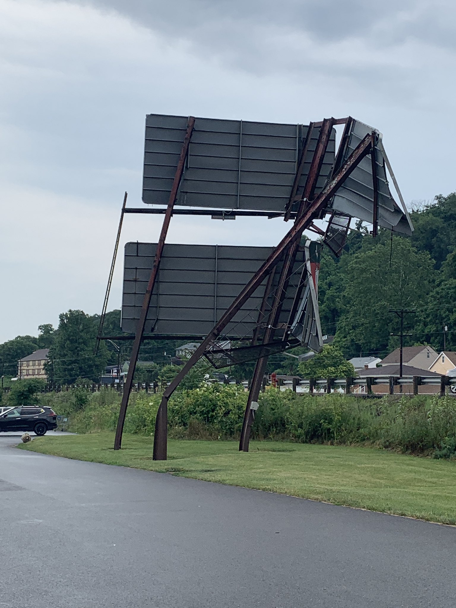
0309 PM TSTM WND DMG STEUBENVILLE 40.37N 80.65W
06/21/2021 JEFFERSON OH BROADCAST MEDIA
TREE FELL ON CAR; DAMAGE WAS DONE TO A BILLBOARD.
0310 PM TSTM WND DMG WEIRTON 40.40N 80.56W
06/21/2021 HANCOCK WV SOCIAL MEDIA
TREE DOWN ON OAK STREET
0310 PM TSTM WND DMG 1 N WEXFORD 40.65N 80.05W
06/21/2021 ALLEGHENY PA NWS EMPLOYEE
TREES DOWN ACROSS WARRENDALE-BANE ROAD
0310 PM TSTM WND DMG 1 N WEIRTON 40.41N 80.57W
06/21/2021 HANCOCK WV LAW ENFORCEMENT
TREES DOWN ON GREENBRIER ROAD
0317 PM TSTM WND DMG BEECH BOTTOM 40.23N 80.65W
06/21/2021 BROOKE WV SOCIAL MEDIA
POWER LINES DOWN ON PARK AVE
0320 PM TSTM WND DMG FOX CHAPEL 40.53N 79.89W
06/21/2021 ALLEGHENY PA 911 CALL CENTER
TREES DOWN
0320 PM TSTM WND DMG ARNOLD 40.58N 79.76W
06/21/2021 WESTMORELAND PA 911 CALL CENTER
TREE DOWN ON A HOUSE
0325 PM TSTM WND DMG LOWER BURRELL 40.58N 79.71W
06/21/2021 WESTMORELAND PA 911 CALL CENTER
NUMEROUS TREES DOWN
0335 PM TSTM WND DMG VANDERGRIFT 40.60N 79.57W
06/21/2021 WESTMORELAND PA 911 CALL CENTER
NUMEROUS TREES DOWN
0338 PM TSTM WND DMG 1 ENE SPRING CHURCH 40.61N 79.47W
06/21/2021 ARMSTRONG PA SOCIAL MEDIA
VIDEO OF TREES COMING DOWN FROM WIND
0338 PM TSTM WND DMG LEECHBURG 40.50N 79.76W
06/21/2021 ALLEGHENY PA 911 CALL CENTER
MULTIPLE TREES DOWN.
0339 PM TSTM WND DMG SPRING CHURCH 40.61N 79.49W
06/21/2021 ARMSTRONG PA SOCIAL MEDIA
TREES DOWN; VIDEO PROVIDED.
0340 PM TSTM WND DMG PITTSBURGH 40.44N 79.98W
06/21/2021 ALLEGHENY PA SOCIAL MEDIA
LARGE TREE BLOCKING THE BOULEVARD OF THE ALLIES
0345 PM TSTM WND DMG LAWRENCEVILLE 40.47N 79.96W
06/21/2021 ALLEGHENY PA PUBLIC
LARGE TREE LIMBS DOWN
0346 PM TSTM WND DMG LAWRENCEVILLE 40.47N 79.96W
06/21/2021 ALLEGHENY PA PUBLIC
LARGE TREE DOWN ON 46TH STREET.
0354 PM TSTM WND DMG 1 WNW PRESTO 40.37N 80.12W
06/21/2021 ALLEGHENY PA 911 CALL CENTER
TREES/WIRES DOWN ON THOMS RUN ROAD AT PINCH ROAD. THOMS
RUN ROAD CLOSED.
0355 PM TSTM WND DMG 2 SSW SMATHERS 40.51N 79.23W
06/21/2021 INDIANA PA 911 CALL CENTER
TREES DOWN ON BLACK LICK ROAD
0358 PM TSTM WND DMG 1 E JACKSONVILLE 40.54N 79.26W
06/21/2021 INDIANA PA 911 CALL CENTER
TREES DOWN ON HUNTER SCHOOL ROAD
0359 PM TSTM WND DMG WASHINGTON 40.17N 80.25W
06/21/2021 WASHINGTON PA 911 CALL CENTER
WIDESPREAD TREES DOWN ACROSS THE COUNTY; ABOUT 20
DIFFERENT CALLS MADE TO 911.
0400 PM TSTM WND DMG HOMER CITY 40.54N 79.16W
06/21/2021 INDIANA PA 911 CALL CENTER
TREES DOWN ON RESIDENCE IN CENTER TOWNSHIP
0400 PM TSTM WND DMG BROOKVILLE 41.16N 79.07W
06/21/2021 JEFFERSON PA 911 CALL CENTER
TREE DOWN ON WATER PLANT RD.
0401 PM TSTM WND DMG LIMESTONE 41.13N 79.33W
06/21/2021 CLARION PA 911 CALL CENTER
TREE DOWN
0404 PM TSTM WND DMG WHITE OAK 40.34N 79.80W
06/21/2021 ALLEGHENY PA 911 CALL CENTER
SOME SIDING BLOWN OFF HOUSE
0407 PM TSTM WND DMG 1 SW CIRCLEVILLE 40.32N 79.75W
06/21/2021 WESTMORELAND PA 911 CALL CENTER
TREES DOWN AT INTERSECTION OF WAINWRIGHT AND ROTH DRIVE
0407 PM TSTM WND DMG JACKTOWN 40.33N 79.73W
06/21/2021 WESTMORELAND PA TRAINED SPOTTER
REPORT OF LARGE TREE BLOWN DOWN AT THE CORNER OF MAUS
AND ROBBINS STATION. TIME ESTIMATED BASED ON RADAR.
0410 PM TSTM WND DMG 2 N ROSEVILLE 41.20N 79.15W
06/21/2021 JEFFERSON PA 911 CALL CENTER
TREE DOWN ON ROSEVILLE SIGEL ROAD.
0410 PM TSTM WND DMG DELMONT 40.41N 79.57W
06/21/2021 WESTMORELAND PA 911 CALL CENTER
MULTIPLE TREES DOWN ACROSS THE COUNTY.
0412 PM TSTM WND DMG 1 E ADAMSBURG 40.31N 79.64W
06/21/2021 WESTMORELAND PA PUBLIC
TREE DOWN.
0421 PM TSTM WND DMG 1 ESE WHITE OAK 40.33N 79.79W
06/21/2021 ALLEGHENY PA PUBLIC
SIDING BLOWN OFF HOME ON STATE STREET.
0422 PM TSTM WND DMG GREENSBURG 40.31N 79.54W
06/21/2021 WESTMORELAND PA TRAINED SPOTTER
REPORT OF LARGE TREE LIMBS DOWN IN GREENSBURG.
0425 PM TSTM WND DMG YOUNGWOOD 40.24N 79.58W
06/21/2021 WESTMORELAND PA FIRE DEPT/RESCUE
LARGE TREE DOWN ON WIRES BLOCKING DEPOT STREET
0428 PM TSTM WND DMG 1 NNE WEST ZOLLARSVILLE 40.04N 80.08W
06/21/2021 WASHINGTON PA 911 CALL CENTER
REPORT OF TREES DOWN ON WIRE. TIME ESTIMATED BASED ON
RADAR.
0431 PM TSTM WND DMG BLACK LICK 40.47N 79.19W
06/21/2021 INDIANA PA 911 CALL CENTER
TREES DOWN
0439 PM TSTM WND DMG 1 N NEBO 39.96N 80.44W
06/21/2021 GREENE PA 911 CALL CENTER
TREES DOWN ACROSS WALKER HILL ROAD
0439 PM TSTM WND DMG BRISTORIA 39.88N 80.42W
06/21/2021 GREENE PA 911 CALL CENTER
UTILITY LINES DOWN ALONG BRISTORIA ROAD
0440 PM TSTM WND DMG 1 S WYANO 40.18N 79.70W
06/21/2021 WESTMORELAND PA 911 CALL CENTER
MULTIPLE REPORTS OF STORM RELATED DAMAGE ACROSS SOUTH
HUNTINGDON TWP.
0440 PM TSTM WND DMG 1 WNW KECKSBURG 40.19N 79.48W
06/21/2021 WESTMORELAND PA 911 CALL CENTER
MULTIPLE REPORTS OF STORM RELATED DAMAGE ACROSS MT
PLEASANT TWP.
0444 PM TSTM WND DMG JERUSALEM 39.85N 81.10W
06/21/2021 MONROE OH PUBLIC
LARGE TREE DOWN.
0448 PM TSTM WND DMG NEW KENSINGTON 40.57N 79.75W
06/21/2021 WESTMORELAND PA 911 CALL CENTER
MULTIPLE TREES DOWN
0450 PM TSTM WND DMG BRUSH VALLEY 40.54N 79.07W
06/21/2021 INDIANA PA 911 CALL CENTER
TREES AND POWER LINES REPORTED DOWN IN BRUWH VALLEY,
ARMAUGH AND HOME CITY.
0452 PM TSTM WND DMG PERRYOPOLIS 40.09N 79.75W
06/21/2021 FAYETTE PA 911 CALL CENTER
TREE DOWN.
0457 PM TSTM WND DMG BROWNSVILLE 40.02N 79.89W
06/21/2021 FAYETTE PA 911 CALL CENTER
TREE DOWN
0503 PM TSTM WND DMG ALEPPO 39.82N 80.45W
06/21/2021 GREENE PA 911 CALL CENTER
MULTIPLE TREES DOWN ACROSS THE COUNTY.
0508 PM TSTM WND DMG MASONTOWN 39.85N 79.91W
06/21/2021 FAYETTE PA 911 CALL CENTER
TREE DOWN.
0515 PM TSTM WND DMG JEFFERSON 39.93N 80.06W
06/21/2021 GREENE PA 911 CALL CENTER
MULTIPLE REPORTS OF TREES AND UTILITY LINES DOWN ACROSS
JEFFERSON TOWNSHIP.
0607 PM TSTM WND DMG FAIRMONT 39.48N 80.15W
06/21/2021 MARION WV BROADCAST MEDIA
TREE DOWN ON LOWELL STREET.
0625 PM TSTM WND DMG MORGANTOWN 39.64N 79.95W
06/21/2021 MONONGALIA WV 911 CALL CENTER
MULTIPLE TREES DOWN.
0639 PM TSTM WND DMG TUNNELTON 39.39N 79.75W
06/21/2021 PRESTON WV 911 CALL CENTER
TREES AND WIRES DOWN.
0730 PM FLASH FLOOD CHEAT LAKE 39.67N 79.85W
06/21/2021 MONONGALIA WV SOCIAL MEDIA
REPORT OF FLOODING OVER I-68 BRIDGE IN CHEAT LAKE.
0748 PM FLASH FLOOD CANONSBURG 40.26N 80.19W
06/21/2021 WASHINGTON PA 911 CALL CENTER
FLOODED ROADWAY- GLENN AVE.
0753 PM FLASH FLOOD VENETIA 40.25N 80.04W
06/21/2021 WASHINGTON PA 911 CALL CENTER
SUGAR CAMP ROAD FLOODED.
0754 PM FLASH FLOOD HOUSTON 40.25N 80.21W
06/21/2021 WASHINGTON PA 911 CALL CENTER
NORTH MAIN STREET FLOODED.
0811 PM FLOOD 1 SSW ROGERSVILLE 39.87N 80.28W
06/21/2021 GREENE PA SOCIAL MEDIA
HARGUS CREEK OUT OF ITS BANKS AND SPILLING INTO THE
FIELD OF WEST GREENE SCHOOL NEAR GOLDEN OAK ROAD.
0844 PM FLASH FLOOD ELIZABETH 40.27N 79.89W
06/21/2021 ALLEGHENY PA DEPT OF HIGHWAYS
FLOODING ALONG BUNOLA RIVER ROAD/GLASSPORT-ELIZABETH
RD/SECOND AVE/CENTER AV/LINCOLN BLVD. ALL LANES CLOSED.
1000 PM FLOOD WOODRUFF 39.85N 80.32W
06/21/2021 GREENE PA 911 CALL CENTER
REPORT OF 18 NORTH ROAD CLOSURE DUE TO HIGH WATER. TIME
ESTIMATED BASED ON RADAR.
1030 PM HEAVY RAIN BRUSH VALLEY 40.54N 79.07W
06/21/2021 M1.45 INCH INDIANA PA TRAINED SPOTTER
TOTAL SINCE 4PM.
1030 PM FLOOD LOWBER 40.25N 79.77W
06/21/2021 WESTMORELAND PA BROADCAST MEDIA
LOWBER ROAD BETWEEN CARNEGIE ROAD AND KANGAROO HILL
ROAD CLOSED DUE TO FLOODING. EMERGENCY CREWS REPORTED
ONE FOOT OF WATER RUNNING ACROSS ROAD.
1045 PM FLOOD CAMERON 39.83N 80.57W
06/21/2021 MARSHALL WV SOCIAL MEDIA
MULTIPLE REPORTS OF FLOODING IN CAMERON, COVERING
STREETS AND OVER FOOTBALL FIELDS.
1250 AM FLOOD WEST BROWNSVILLE 40.03N 79.89W
06/22/2021 WASHINGTON PA 911 CALL CENTER
INTERSECTION OF MEAN STREET AND WATTS STREET FLOODED.
ALSO MUDSLIDE IN SAME AREA.
0105 AM FLOOD MONONGAHELA 40.20N 79.92W
06/22/2021 WASHINGTON PA 911 CALL CENTER
MONONGAHELA FIRE DEPARTMENT PARTIALLY FLOODED.
0110 AM FLOOD WASHINGTON 40.17N 80.25W
06/22/2021 WASHINGTON PA 911 CALL CENTER
340 HENDERSON AVENUE, WASHINGTON STREET AT CHESTNUT
AVENUE ARE BOTH FLOODED.
0111 AM FLOOD CANONSBURG 40.26N 80.19W
06/22/2021 WASHINGTON PA 911 CALL CENTER
LINDEN CREEK RD AT WALKER RD FLOODED IN NORTH STRABANE
FLOODED AND CLOSED.
0704 AM HEAVY RAIN CHALKHILL 39.84N 79.62W
06/22/2021 E1.95 INCH FAYETTE PA TRAINED SPOTTER
&&
EVENT NUMBER PBZ2101773 PBZ2101774 PBZ2101766 PBZ2101748 PBZ2101771
PBZ2101747 PBZ2101776 PBZ2101742 PBZ2101760 PBZ2101772 PBZ2101743
PBZ2101800 PBZ2101826 PBZ2101825 PBZ2101805 PBZ2101762 PBZ2101745
PBZ2101827 PBZ2101778 PBZ2101828 PBZ2101744 PBZ2101757 PBZ2101802
PBZ2101801 PBZ2101777 PBZ2101751 PBZ2101752 PBZ2101754 PBZ2101753
PBZ2101746 PBZ2101764 PBZ2101749 PBZ2101750 PBZ2101755 PBZ2101785
PBZ2101779 PBZ2101756 PBZ2101759 PBZ2101769 PBZ2101819 PBZ2101763
PBZ2101765 PBZ2101780 PBZ2101761 PBZ2101782 PBZ2101781 PBZ2101758
PBZ2101767 PBZ2101824 PBZ2101783 PBZ2101786 PBZ2101770 PBZ2101768
PBZ2101811 PBZ2101775 PBZ2101812 PBZ2101790 PBZ2101820 PBZ2101821
PBZ2101816 PBZ2101817 PBZ2101803 PBZ2101784 PBZ2101823 PBZ2101789
PBZ2101787 PBZ2101792 PBZ2101788 PBZ2101808 PBZ2101794 PBZ2101793
PBZ2101791 PBZ2101806 PBZ2101795 PBZ2101796 PBZ2101797 PBZ2101798
PBZ2101799 PBZ2101809 PBZ2101804 PBZ2101822 PBZ2101807 PBZ2101814
PBZ2101818 PBZ2101813 PBZ2101815 PBZ2101810
 |
Media use of NWS Web News Stories is encouraged! Please acknowledge the NWS as the source of any news information accessed from this site. |
|

