Overview
|
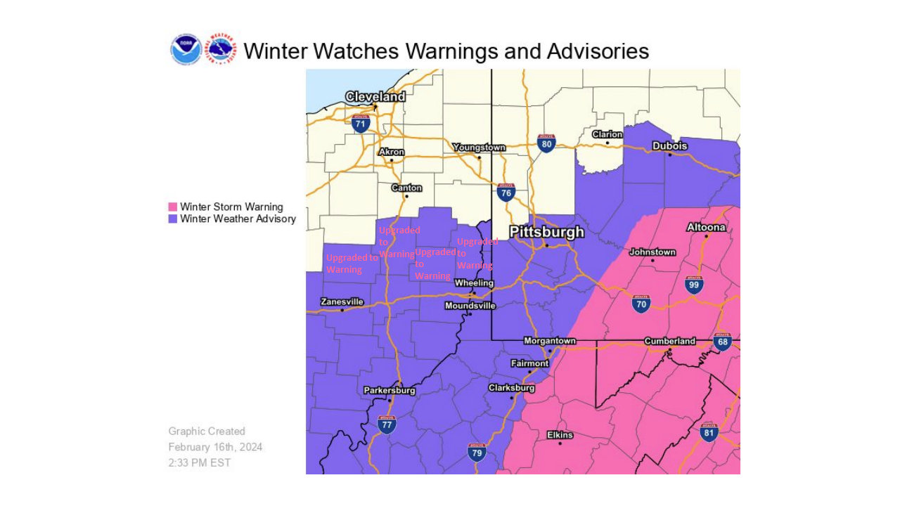
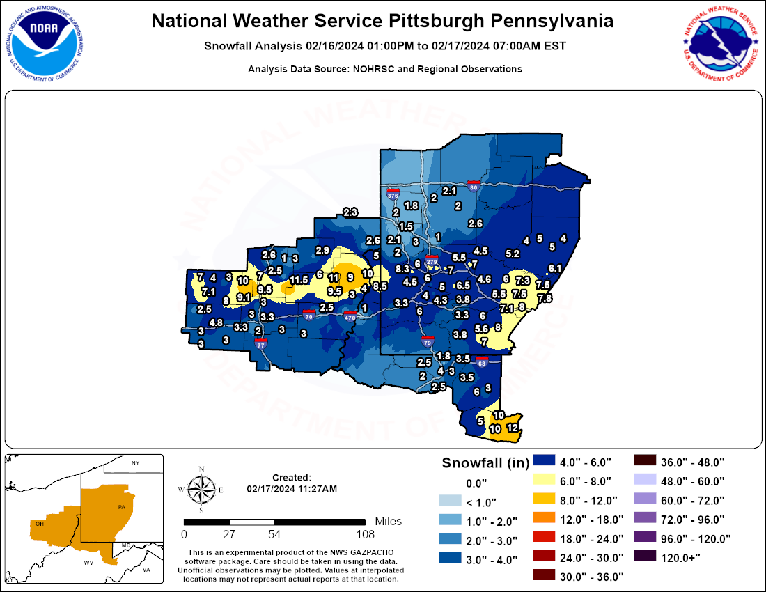
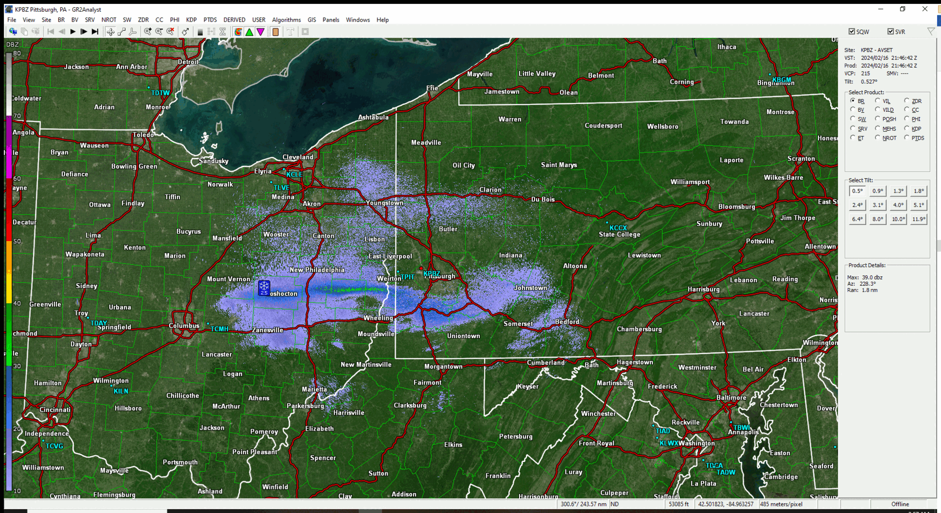
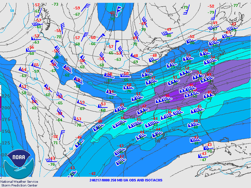
During the midday hours of February 16th, a surface low pressure system began to develop over the Mid-Mississippi Valley region and shift east northeastward into the lower OH Valley region. The main surface low tracked east into the KY/VA border over the mid Appalachian Range by 00Z 2/17. During this time aloft, the upper air maps indicated a well-defined phasing of jet streaks from the Mid- Mississippi Valley into the Middle Atlantic region of the lower CONUS. The upper air winds aloft toped 190 knots in some areas of the jet max. This powerful, but quick hitting system in a progressive pattern showed the upper dynamics translating to the surface with a well-defined 700MB frontogenic band developing as it shifted a bit north. The onset of moderate to at times heavy snowfall began to develop over the central and southern portions of the forecast area. Snow began during the evening of the 16th and persisted through the rest of the evening and began to wind down by 4am across the area in the early morning hours of the 17th. The rates within the band averaged around 2 inches per hour. The band developed along a line from Coshocton, OH to Stillwater, OH, to Deersville, OH, to Wintersville, OH, to Weirton, WV, and finally to Imperial, PA. The band then continued into counties eastward into Westmoreland and the highlands as well. Still, the elevation impacts proved the most important with Davis, WV in Tucker County receiving around a foot. The shift and development of the banded area of this mid-latitude cyclone resulted in a county by county upgrade from the Winter Weather Advisory to a Winter Storm Warning at onset. Certainly a memorable event. |
Coshocton, Tuscarawas, Harrison, and Jefferson Counties in Ohio as well as Hancock and Brooke in West Virginia were upgraded to Winter Storm Warnings as the mesoscale band developed. |
Snow/Ice
Photos
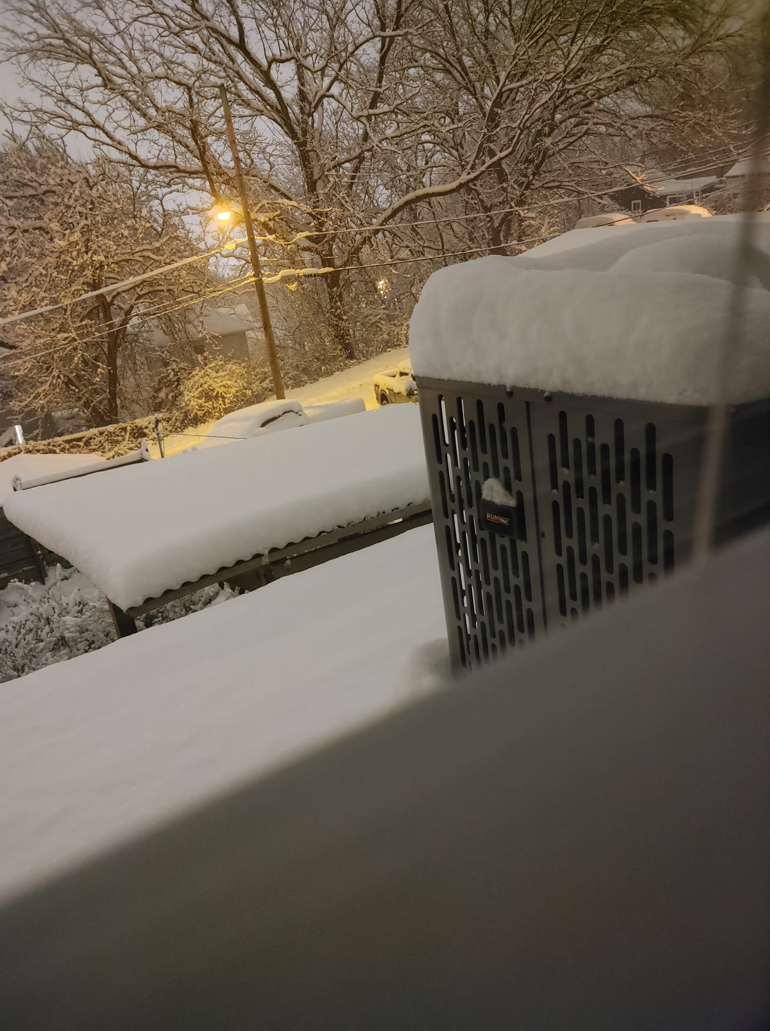
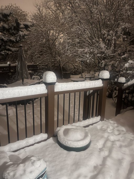
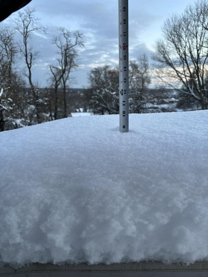
Random Snow Photos
 |
 |
 |
 |
| Nellie, OH Credit: Ashley McMillin |
North Side of Pittsburgh Credit: Paul Laure |
Shadyside, PA Credit: Kevin Heher |
Wintersville, OH Credit: Lacey Spin |
Radar
Header
 |
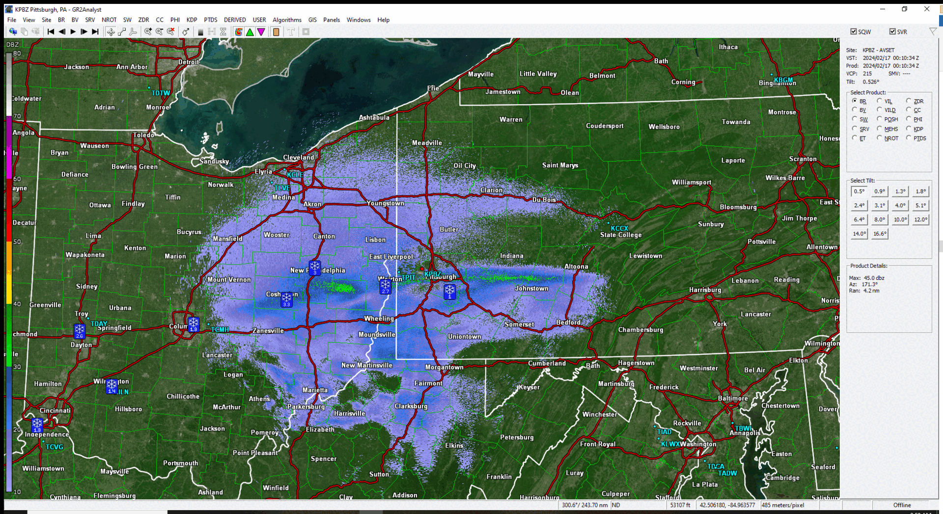 |
| Radar Loop of Mesoscale Band Feb 16th 2146Z - 2358Z | Radar Loop of Mesoscale Band Feb 17th 0010Z - 0214Z |
Storm Reports
Public Information Statement
Spotter Reports
National Weather Service Pittsburgh PA
1203 PM EST Sat Feb 17 2024
The following are unofficial observations taken during the past 26
hours for the storm that has been affecting our region. Appreciation
is extended to highway departments, cooperative observers, Skywarn
spotters and media for these reports. This summary also is available
on our home page at weather.gov/pittsburgh
**********STORM TOTAL SNOWFALL (AT LEAST 1.0 INCH)**********
LOCATION TOTAL TIME DATE COMMENTS
SNOWFALL
MEASURED
(inches)
| OHIO | |||||
| ...Belmont County... | |||||
| Farmington | 2.5 | 1044 | PM | 16-Feb | Still snowing. |
| 2 N Morristown | 2.5 | 830 | AM | 17-Feb | Public |
| ...Carroll County... | |||||
| Carrollton | 2.9 | 300 | AM | 17-Feb | Public |
| Leesville | 2.8 | 1028 | AM | 17-Feb | Public |
| ...Columbiana County... | |||||
| 4 N Wellsville | 2.6 | 753 | AM | 17-Feb | Public |
| Salem | 2.3 | 753 | AM | 17-Feb | Public |
| ...Coshocton County... | |||||
| 4 E Fresno | 10 | 945 | PM | 16-Feb | Public |
| West Lafayette | 8 | 918 | PM | 16-Feb | Public |
| 4 SE Coshocton | 8 | 100 | AM | 17-Feb | Public |
| 2 NW Wakatomika | 7.1 | 1015 | PM | 16-Feb | Public |
| Nellie | 7 | 1011 | PM | 16-Feb | Public |
| Coshocton | 4.5 | 721 | PM | 16-Feb | Trained Spotter |
| Warsaw | 4 | 505 | PM | 16-Feb | Public |
| Keene | 3 | 457 | PM | 16-Feb | Public |
| ...Guernsey County... | |||||
| 1 N Cambridge | 3.3 | 1018 | PM | 16-Feb | Public |
| Kimbolton | 3 | 840 | PM | 16-Feb | Public |
| Cambridge | 3 | 800 | AM | 17-Feb | Trained Spotter |
| 2 N Buckeyeville | 2 | 900 | PM | 16-Feb | Trained Spotter |
| ...Harrison County... | |||||
| Hopedale | 9.5 | 916 | PM | 16-Feb | Broadcast Media |
| 3 N Tappan | 8.2 | 330 | PM | 16-Feb | Trained Spotter |
| Jewett | 6 | 926 | PM | 16-Feb | Public |
| ...Jefferson County... | |||||
| 3 E Bloomingdale | 11 | 950 | PM | 16-Feb | Public |
| 1 W Wintersville | 10.2 | 1100 | PM | 16-Feb | Public |
| Steubenville | 10 | 1005 | PM | 16-Feb | Public |
| Bloomingdale | 9 | 906 | PM | 16-Feb | Public |
| Wintersville | 9 | 700 | AM | 17-Feb | Public |
| 3 W Rayland | 3 | 700 | AM | 17-Feb | Public |
| ...Monroe County... | |||||
| 4 W Malaga | 3 | 1009 | PM | 16-Feb | Trained Spotter |
| ...Muskingum County... | |||||
| Zanesville | 4.8 | 910 | PM | 16-Feb | Public |
| 2 S Norwich | 3.3 | 1011 | PM | 16-Feb | Public |
| Blue Rock | 3 | 952 | PM | 16-Feb | Public |
| White Cottage | 3 | 815 | AM | 17-Feb | Public |
| North Zanesville | 3 | 1105 | AM | 17-Feb | Public |
| SE White Cottage | 3 | 600 | PM | 16-Feb | Public |
| Frazeysburg | 2.5 | 740 | PM | 16-Feb | Public |
| ...Noble County... | |||||
| 2 SW Belle Valley | 3.5 | 800 | AM | 17-Feb | Public |
| 3 W Mount Ephraim | 3 | 1100 | PM | 16-Feb | Public |
| ...Tuscarawas County... | |||||
| Stillwater | 11.5 | 935 | PM | 16-Feb | Public |
| Gilmore | 10.5 | 1053 | AM | 17-Feb | Public |
| 2 N Newcomerstown | 9.5 | 920 | PM | 16-Feb | Public |
| W Newcomerstown | 9.1 | 955 | PM | 16-Feb | Public |
| 2 NNE Wolf | 7 | 935 | PM | 16-Feb | Public |
| W Dover | 3 | 700 | PM | 16-Feb | Public |
| 1 N New Cumberland | 3 | 730 | AM | 17-Feb | Public |
| Dover | 2.6 | 1024 | PM | 16-Feb | Public |
| Uhrichsville | 2.5 | 530 | PM | 16-Feb | Public |
| 8 SE Mineral City | 1 | 800 | PM | 16-Feb | Public |
| PENNSYLVANIA | |||||
| ...Allegheny County... | |||||
| Imperial | 8.3 | 1235 | AM | 17-Feb | Public |
| Lawrenceville | 7 | 1145 | PM | 16-Feb | NWS Employee |
| 2 WNW McKees Rocks | 7 | 1120 | PM | 16-Feb | Public |
| Bethel Park | 7 | 1000 | AM | 17-Feb | Public |
| Plum | 7 | 838 | AM | 17-Feb | Trained Spotter |
| Glassport | 6.5 | 440 | AM | 17-Feb | Public |
| Marshall-Shadeland | 6.5 | 1149 | PM | 16-Feb | Public |
| Penn Hills | 6.3 | 655 | AM | 17-Feb | Public |
| 1 NW Enlow | 6 | 950 | PM | 16-Feb | Public |
| Shadyside | 6 | 1015 | PM | 16-Feb | Public |
| Crafton | 6 | 742 | AM | 17-Feb | Public |
| N Crafton | 5.9 | 827 | AM | 17-Feb | Public |
| Summer Hill | 5.8 | 838 | AM | 17-Feb | Broadcast Media |
| N Castle Shannon | 5.8 | 713 | AM | 17-Feb | Public |
| N Allegheny Center | 5.7 | 1035 | PM | 16-Feb | Public |
| 2 SW Penn Hills | 5.6 | 820 | AM | 17-Feb | Public |
| Verona | 5.5 | 816 | AM | 17-Feb | Public |
| West Homestead | 5.5 | 801 | AM | 17-Feb | Trained Spotter |
| Mount Lebanon | 5.5 | 700 | AM | 17-Feb | Public |
| Pittsburgh | 5.5 | 839 | AM | 17-Feb | Trained Spotter |
| Upper St. Clair | 5.5 | 930 | AM | 17-Feb | Trained Spotter |
| Brookline | 5.2 | 1201 | AM | 17-Feb | Public |
| 1 NW Millvale | 5 | 1029 | PM | 16-Feb | Public |
| Arlington | 5 | 854 | AM | 17-Feb | Public |
| Bellevue | 5 | 900 | AM | 17-Feb | Trained Spotter |
| SE Jefferson Hills | 5 | 623 | AM | 17-Feb | Trained Spotter |
| Carnegie | 5 | 1022 | PM | 16-Feb | Public |
| Brackenridge | 4.8 | 800 | AM | 17-Feb | Public |
| 2 SW Pittsburgh | 4.8 | 1205 | AM | 17-Feb | Public |
| Baldwin | 4.8 | 1042 | PM | 16-Feb | Public |
| Monroeville | 4.7 | 1237 | AM | 17-Feb | Public |
| Heidelberg | 4.6 | 650 | AM | 17-Feb | Trained Spotter |
| Mount Washington | 4.5 | 104 | AM | 17-Feb | Event total. |
| Oakdale | 4.5 | 600 | AM | 17-Feb | Public |
| S Jefferson Hills | 4.5 | 900 | AM | 17-Feb | Trained Spotter |
| 2 NE Imperial | 4 | 944 | PM | 16-Feb | Public |
| Forest Hills | 4 | 1045 | PM | 16-Feb | Public |
| East Liberty | 4 | 1000 | PM | 16-Feb | Public |
| 1 N Imperial | 4 | 914 | PM | 16-Feb | Public |
| Pleasant Hills | 4 | 1245 | AM | 17-Feb | Public |
| 2 W Plum | 4 | 857 | PM | 16-Feb | Public |
| 2 S Greenock | 4 | 1123 | AM | 17-Feb | Public |
| Robinson | 4 | 1100 | PM | 16-Feb | Public |
| Jefferson Hills | 4 | 700 | AM | 17-Feb | Public |
| Regent Square | 3.7 | 300 | AM | 17-Feb | Public |
| Franklin Park | 3.7 | 912 | AM | 17-Feb | Trained Spotter |
| 1 N Carnot-Moon | 3.6 | 400 | AM | 17-Feb | Official NWS Obs |
| 1 W McCandless | 3.5 | 1130 | PM | 16-Feb | Public |
| McCandless Township | 3.5 | 842 | AM | 17-Feb | Public |
| 2 E Pittsburgh | 2 | 800 | PM | 16-Feb | Trained Spotter |
| ...Armstrong County... | |||||
| Spring Church | 5.2 | 205 | AM | 17-Feb | Public |
| ...Beaver County... | |||||
| N Beaver | 4.2 | 1100 | AM | 17-Feb | Public |
| 2 N Aliquippa | 3 | 1115 | PM | 16-Feb | Public |
| Ohioville | 2.5 | 1037 | AM | 17-Feb | Public |
| 1 W Beaver | 2.1 | 922 | PM | 16-Feb | Public |
| Industry | 2 | 100 | AM | 17-Feb | Trained Spotter |
| Ambridge | 2 | 1000 | AM | 17-Feb | Public |
| 2 W West Mayfield | 1.5 | 1158 | PM | 16-Feb | Public |
| ...Butler County... | |||||
| 2 E Moniteau | 3.5 | 1015 | AM | 17-Feb | Public |
| 3 N Cabot | 2.6 | 600 | PM | 16-Feb | Public |
| Nixon | 2.5 | 1102 | AM | 17-Feb | Public |
| 1 S Forestville | 2.1 | 730 | AM | 17-Feb | Public |
| 3 Slippery Rock | 2 | 630 | AM | 17-Feb | Trained Spotter |
| West Sunbury | 2 | 730 | AM | 17-Feb | Public |
| Seven Fields | 1 | 1100 | PM | 16-Feb | Trained Spotter |
| ...Clarion County... | |||||
| NW Marble | 2 | 900 | AM | 17-Feb | Public |
| 4 N Shannondale | 1 | 1201 | AM | 17-Feb | Public |
| ...Fayette County... | |||||
| 4 NW Ohiopyle | 8 | 800 | AM | 17-Feb | Trained Spotter |
| 2 E Hopwood | 7 | 505 | AM | 17-Feb | Trained Spotter |
| Lemont Furnace | 7 | 1106 | AM | 17-Feb | Public |
| W Uniontown | 6.7 | 800 | AM | 17-Feb | Trained Spotter |
| NE Connellsville | 6 | 700 | AM | 17-Feb | Public |
| Uniontown | 5.6 | 830 | PM | 16-Feb | Public |
| Masontown | 3.8 | 325 | AM | 17-Feb | Public |
| Brownsville | 3.3 | 1112 | PM | 16-Feb | Public |
| Smithfield | 3.3 | 1114 | PM | 16-Feb | Public |
| Connellsville | 3 | 113 | AM | 17-Feb | Public |
| Belle Vernon | 2.5 | 1043 | PM | 16-Feb | Still snowing. |
| ...Indiana County... | |||||
| Robinson | 6.1 | 730 | AM | 17-Feb | Trained Spotter |
| 2 W Pikes Peak | 5 | 615 | AM | 17-Feb | Public |
| Brush Valley | 5 | 700 | AM | 17-Feb | Trained Spotter |
| 4 N Indiana | 5 | 830 | AM | 17-Feb | Public |
| Shelocta | 4 | 700 | AM | 17-Feb | Public |
| 2 NE Clymer | 4 | 730 | AM | 17-Feb | Trained Spotter |
| S Blairsville | 4 | 830 | AM | 17-Feb | Public |
| ...Lawrence County... | |||||
| Enon Valley | 2 | 610 | AM | 17-Feb | Public |
| 1 N New Castle | 1.8 | 715 | AM | 17-Feb | Trained Spotter |
| Ellwood City | 1.7 | 1015 | AM | 17-Feb | Trained Spotter |
| ...Mercer County... | |||||
| Greenville | 2.3 | 1015 | AM | 17-Feb | Trained Spotter |
| N Sharon | 2 | 1000 | AM | 17-Feb | Public |
| ...Washington County... | |||||
| Braddock | 6 | 821 | AM | 17-Feb | Public |
| 2 N Hickory | 4.6 | 900 | AM | 17-Feb | Trained Spotter |
| 1 W McMurray | 4.5 | 700 | AM | 17-Feb | Public |
| Finleyville | 4.5 | 849 | AM | 17-Feb | Public |
| 1 NE Finleyville | 4.3 | 700 | AM | 17-Feb | Public |
| McMurray | 4 | 1054 | PM | 16-Feb | Still snowing. |
| E Avella | 4 | 300 | AM | 17-Feb | Trained Spotter |
| Bower Hill | 3.9 | 930 | AM | 17-Feb | Trained Spotter |
| 3 NE Amity | 3.9 | 1000 | AM | 17-Feb | Trained Spotter |
| Claysville | 3.3 | 1030 | PM | 16-Feb | Amateur Radio |
| Gastonville | 3 | 952 | AM | 17-Feb | Public |
| 1 S California | 2.7 | 1045 | AM | 17-Feb | Trained Spotter |
| ...Westmoreland County.. | . | ||||
| Jones Mills | 8 | 700 | AM | 17-Feb | Public |
| Laurel Mountain | 7.8 | 845 | AM | 17-Feb | Public |
| Ligonier | 7.5 | 752 | AM | 17-Feb | Public |
| Wilpen | 7.5 | 1130 | PM | 16-Feb | Public |
| Latrobe | 7.3 | 820 | AM | 17-Feb | Public |
| Acme | 7.1 | 849 | AM | 17-Feb | Public |
| 4 N Ligonier | 7 | 900 | AM | 17-Feb | Trained Spotter |
| 3 W Latrobe | 6 | 600 | AM | 17-Feb | Public |
| Youngwood | 5.5 | 800 | AM | 17-Feb | Public |
| 1 S Saltsburg | 5.5 | 934 | AM | 17-Feb | Public |
| Trafford | 5.5 | 1221 | AM | 17-Feb | Public |
| Greensburg | 5.3 | 952 | AM | 17-Feb | Public |
| 3 SW Latrobe | 5.2 | 1000 | AM | 17-Feb | Public |
| Irwin | 5.1 | 943 | AM | 17-Feb | Public |
| 1 S Irwin | 5.1 | 950 | AM | 17-Feb | Public |
| 6 E New Kensington | 5 | 100 | AM | 17-Feb | Public |
| W Markle | 4.9 | 1049 | AM | 17-Feb | Public |
| 1 SW New Alexandria | 4.7 | 900 | AM | 17-Feb | Public |
| Lower Burrell | 4.5 | 745 | AM | 17-Feb | Public |
| 2 SE Adamsburg | 4.3 | 852 | AM | 17-Feb | Trained Spotter |
| 1 SE Jeannette | 4.2 | 900 | PM | 16-Feb | Public |
| Scottdale | 4 | 842 | AM | 17-Feb | Public |
| 1 E Trafford | 4 | 1010 | PM | 16-Feb | Public |
| New Florence | 3.9 | 1118 | PM | 16-Feb | Trained Spotter |
| Monessen | 3.8 | 734 | AM | 17-Feb | Public |
| 1 W New Kensington | 3.8 | 855 | AM | 17-Feb | Trained Spotter |
| SE Monessen | 3.5 | 600 | PM | 16-Feb | Public |
| WEST VIRGINIA | |||||
| ...Brooke County... | |||||
| East Steubenville | 8.5 | 246 | AM | 17-Feb | Public |
| Colliers | 7 | 1140 | PM | 16-Feb | Public |
| Archer Heights | 6.2 | 906 | PM | 16-Feb | Public |
| 1 N Wellsburg | 4 | 614 | AM | 17-Feb | Dept of Highways |
| ...Hancock County... | |||||
| 2 E Stratton | 5 | 615 | AM | 17-Feb | Dept of Highways |
| New Cumberland | 3.1 | 800 | AM | 17-Feb | Public |
| ...Marion County... | |||||
| Meadowdale | 2.5 | 700 | AM | 17-Feb | Trained Spotter |
| E Colfax | 2.2 | 930 | AM | 17-Feb | Public |
| Fairmont | 2 | 720 | AM | 17-Feb | Public |
| ...Monongalia County... | |||||
| Morgantown | 4 | 845 | AM | 17-Feb | Public |
| 4 E Morgantown | 3.5 | 710 | AM | 17-Feb | Trained Spotter |
| 1 SE Morgantown | 3 | 700 | AM | 17-Feb | Public |
| Laurel Point | 2.5 | 700 | AM | 17-Feb | Public |
| Suncrest | 1.8 | 630 | AM | 17-Feb | Trained Spotter |
| ...Ohio County... | |||||
| Wheeling | 1 | 1104 | PM | 16-Feb | Broadcast Media |
| ...Preston County... | |||||
| Rowlesburg | 6 | 536 | AM | 17-Feb | Trained Spotter |
| 2 S Bruceton Mills | 5.8 | 1032 | AM | 17-Feb | Public |
| Amblersburg | 5.3 | 1202 | AM | 17-Feb | Public |
| Gladesville | 3.5 | 830 | AM | 17-Feb | Public |
| ...Tucker County... | |||||
| Canaan Valley-Nature | 12 | 849 | AM | 17-Feb | Emergency Mngr |
| Davis | 10 | 849 | AM | 17-Feb | Emergency Mngr |
| Thomas | 10 | 849 | AM | 17-Feb | Emergency Mngr |
| 1 NW Hambleton | 5 | 200 | AM | 17-Feb | Dept of Highways |
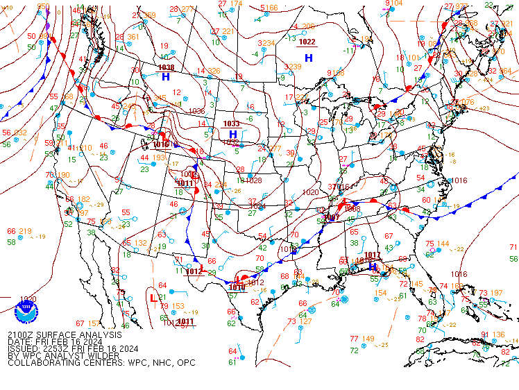
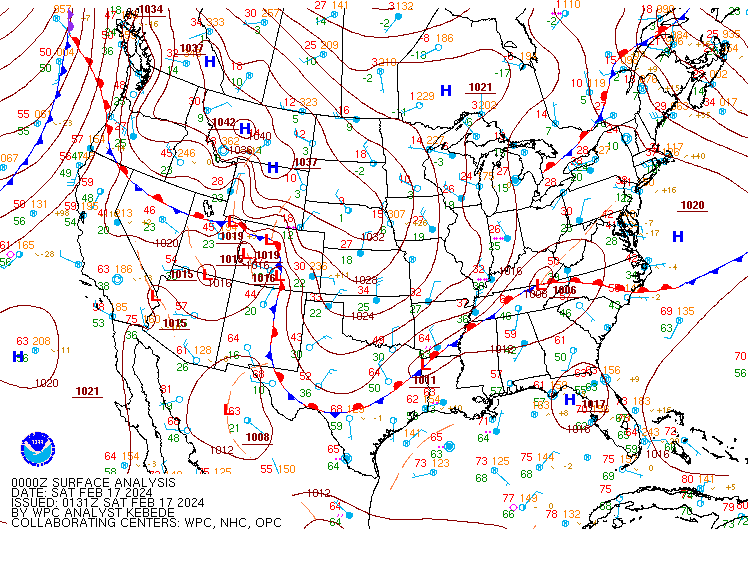
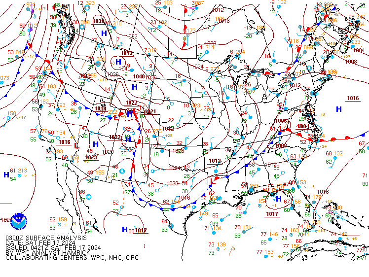
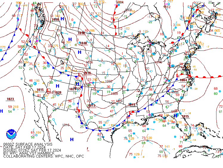
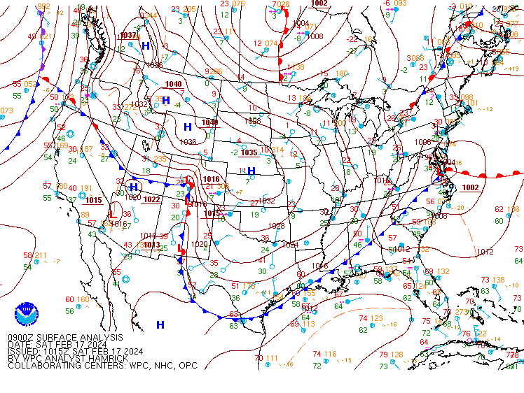
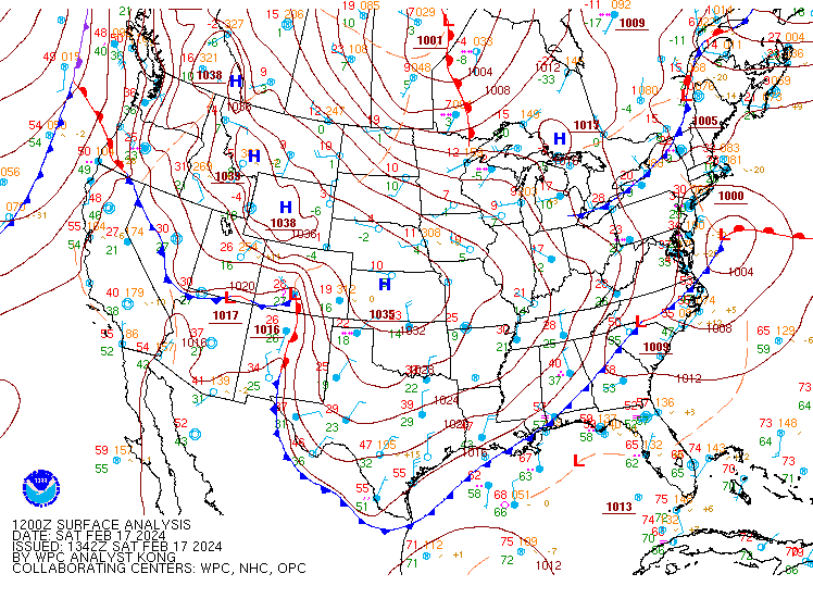
Environment
Surface Analysis from WPC.
 |
 |
 |
| Figure 1: Feb 16 21Z | Figure 2: Feb 17 00Z | Figure 3: Feb 17 03Z |
 |
 |
 |
| Figure 4: Feb 17 06Z | Figure 5: Feb 17 09Z | Figure 6: Feb 17 12Z |
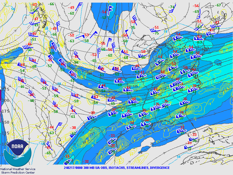
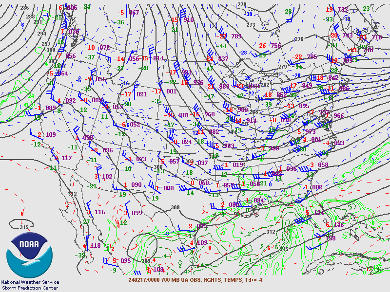
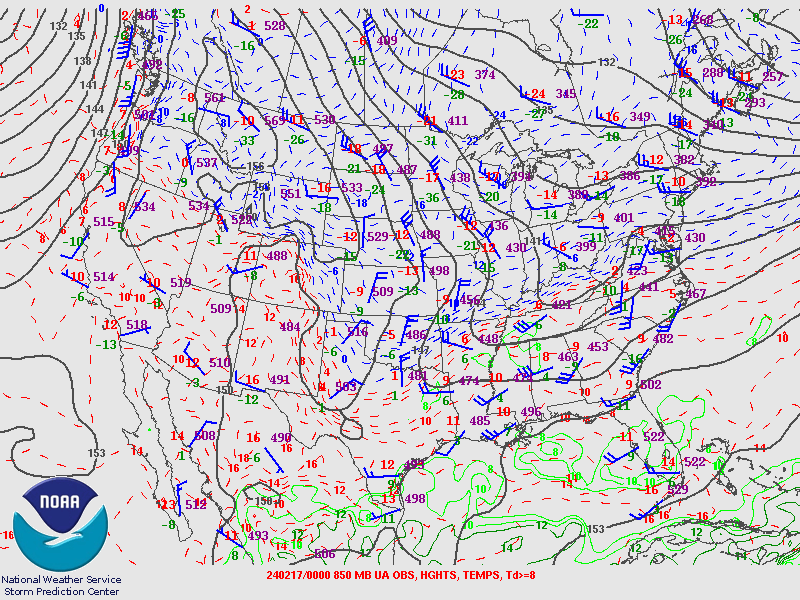
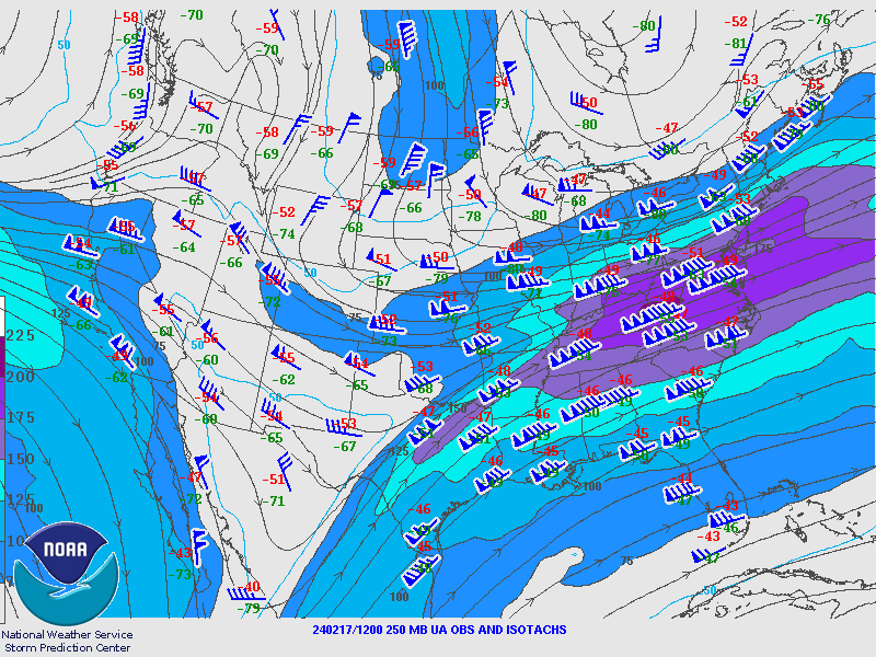
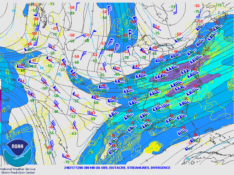
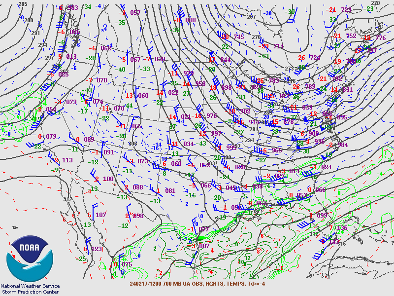
Upper Air Maps from SPC.
 |
 |
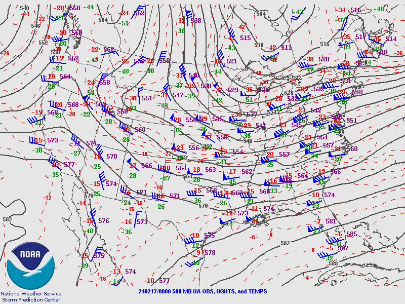 |
| Figure 7: 250MB 240217 00Z | Figure 8: 300MB 240217 00Z | Figure 9: 500MB 240217 00Z |
 |
 |
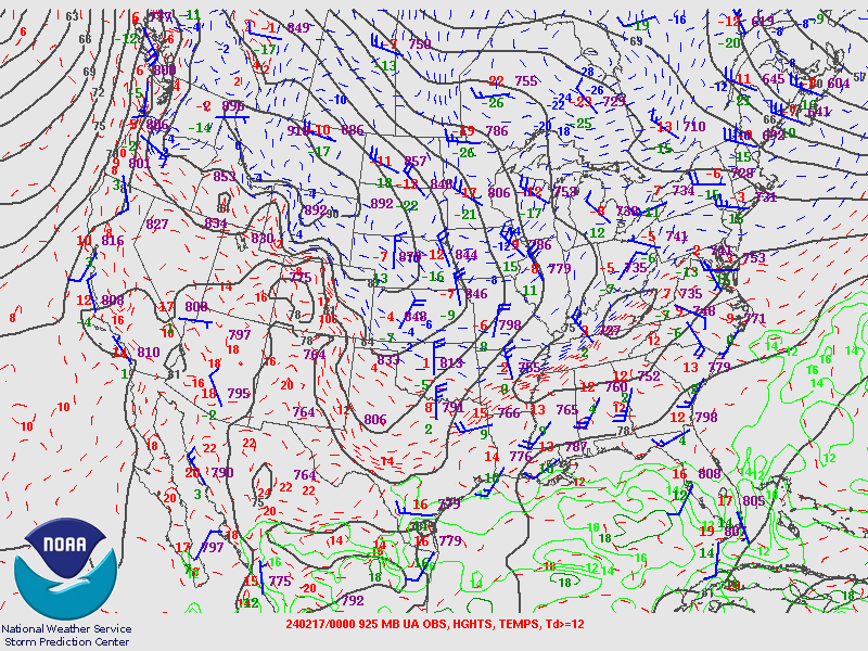 |
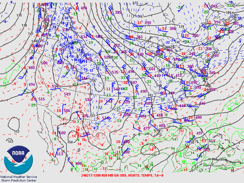
| Figure 10: 700MB 240217 00Z | Figure 11: 850MB 240217 00Z | Figure 12: 925MB 240217 00Z |
 |
 |
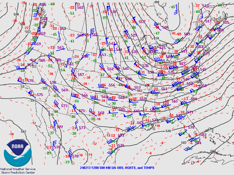 |
| Figure 13: 250MB 240217 12Z | Figure 14: 300MB 240117 12Z | Figure 15: 500MB 240217 12Z |
 |
 |
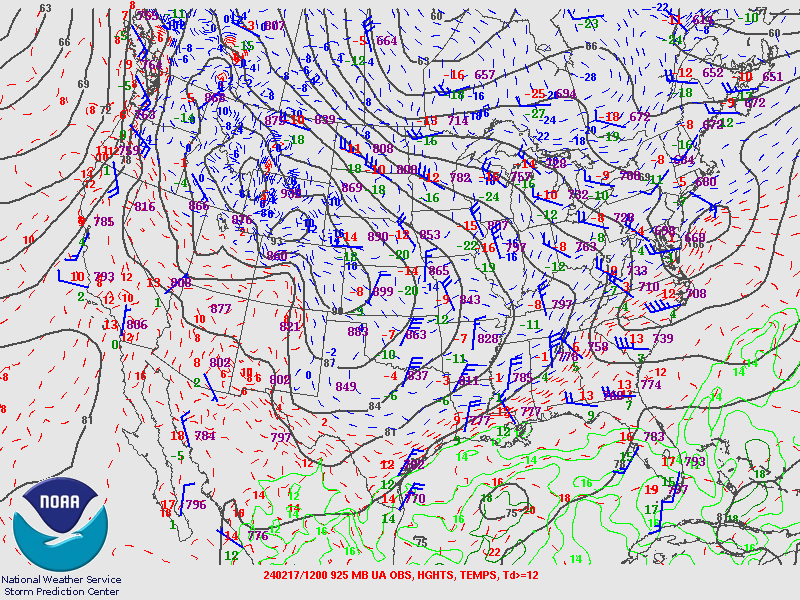 |
| Figure 16: 700MB 240217 12Z | Figure 17: 850MB 240217 12Z | Figure 18: 925MB 240217 12Z |
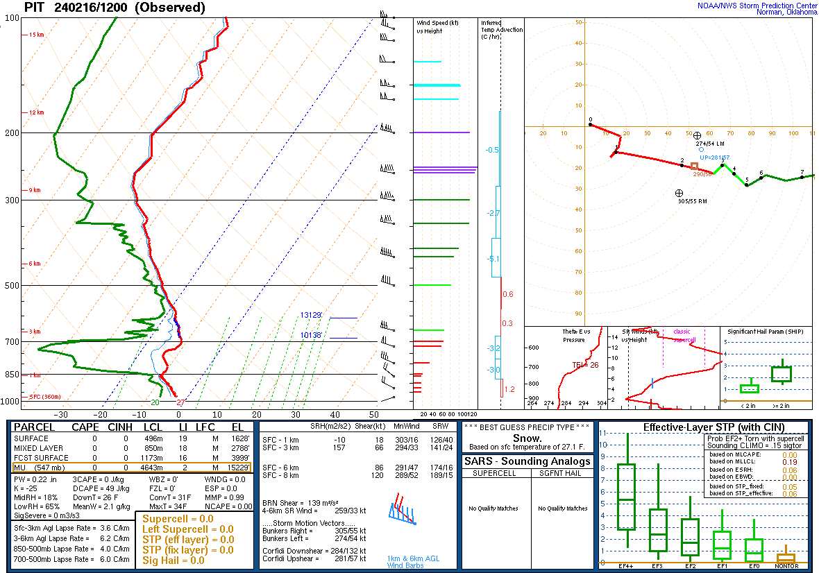
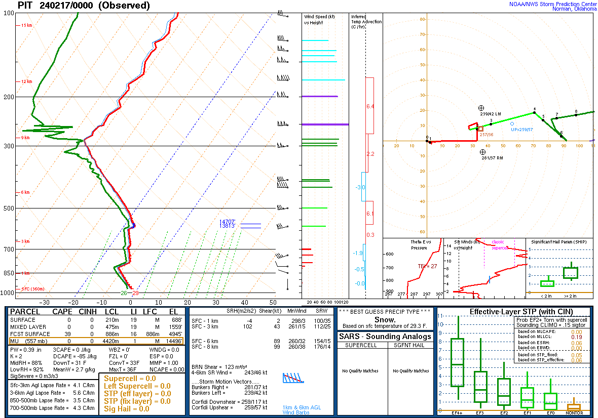
Skew-T Soundings from KPIT.
 |
 |
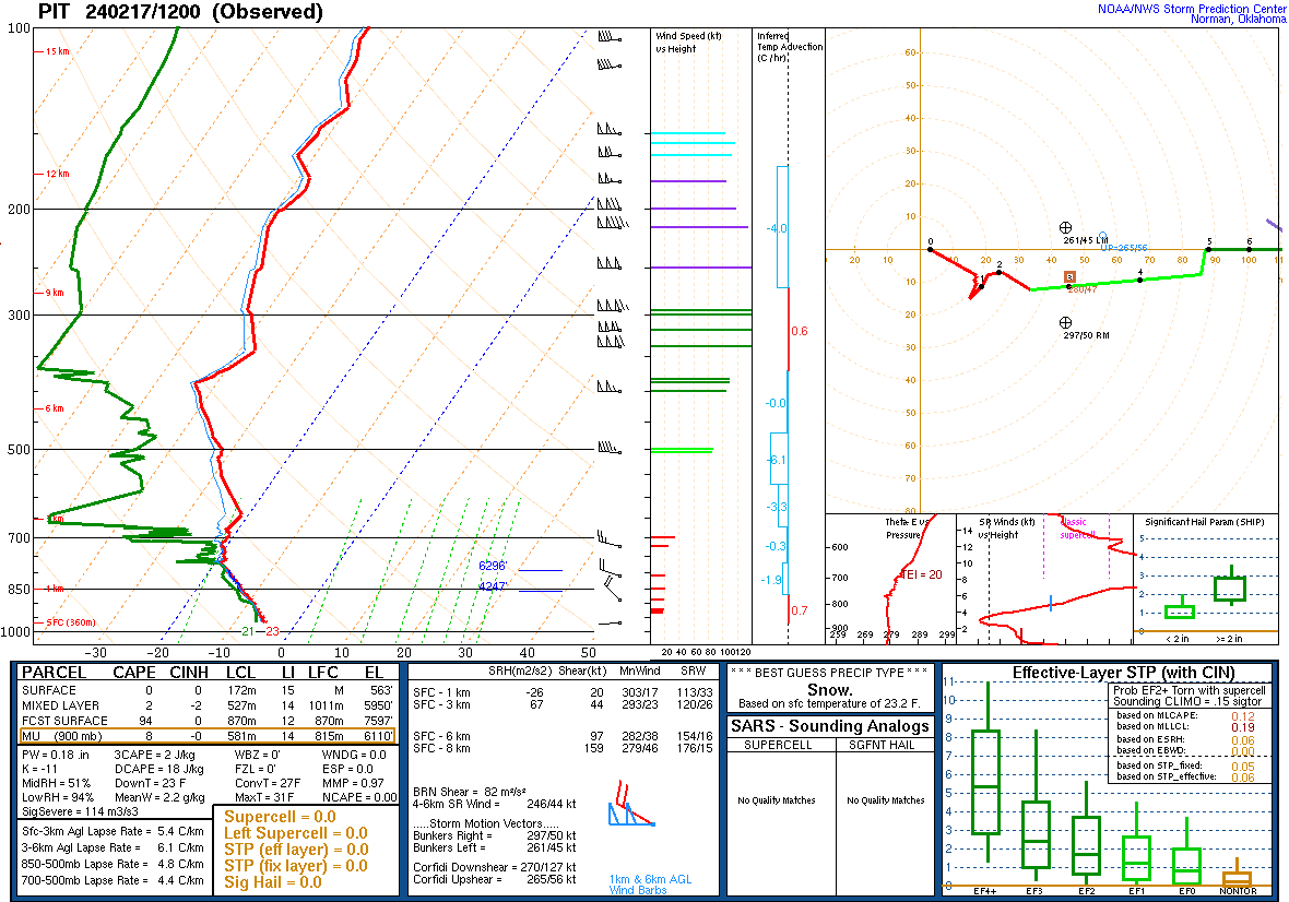 |
| Figure 19: 240216 12Z | Figure 20: 240217 00Z | Figure 21: 240217 12Z |
 |
Media use of NWS Web News Stories is encouraged! Please acknowledge the NWS as the source of any news information accessed from this site. |
|