Overview
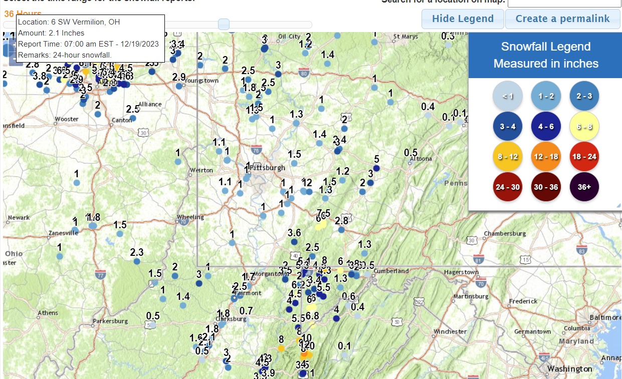
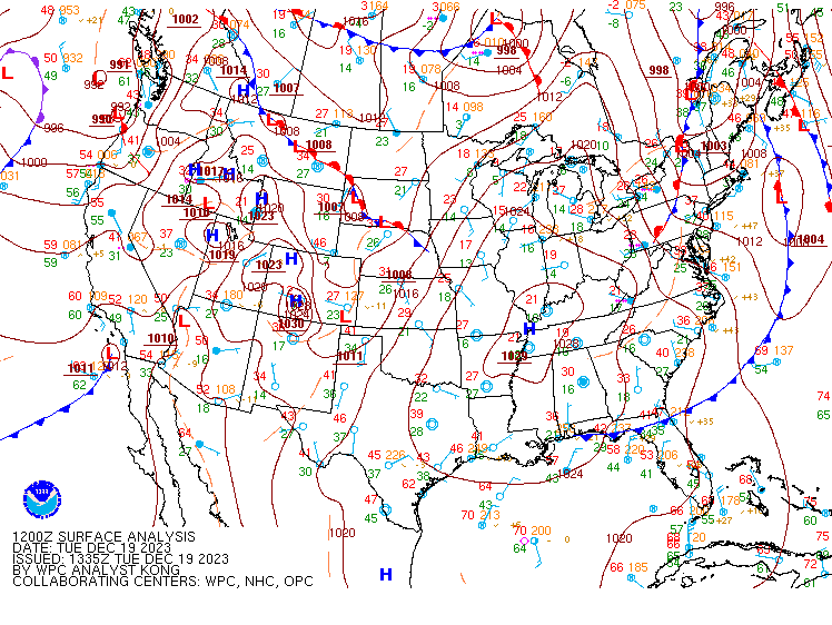
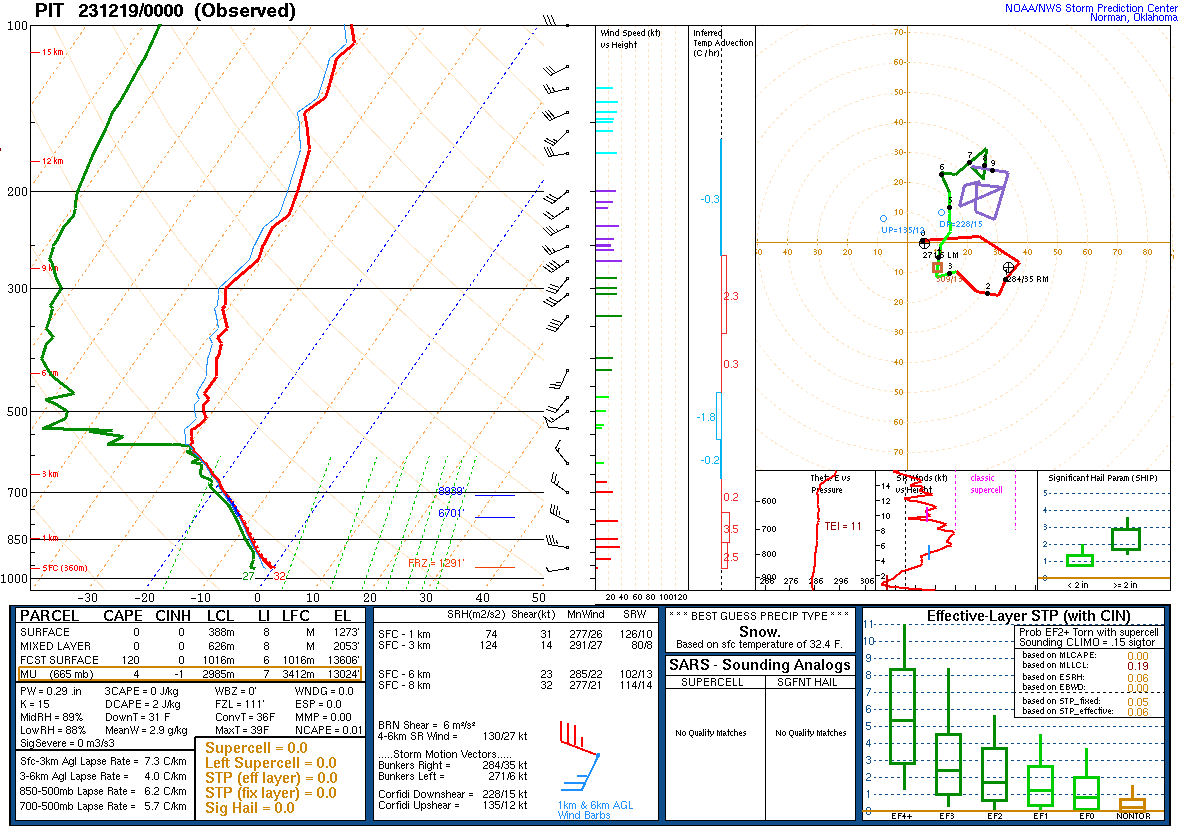
A winter weather event impacted the Pittsburgh forecast area on December 17th through the 19th with rain impacting the area during the onset of the event followed by snow showers behind the system. The heaviest rainfall fell to the east of the area with the PBZ forecast area getting around 1.00” inch or less. The low pressure system ended up being a coastal low as it tracked north along the coast during the 17th. At the same time, a strong disturbance along the northern jet stream was crossing the Great Lakes as the surface low tracked up the coast. During the evening of the 17th and overnight through the 18th, rain changed over to snow showers as the passing mentioned disturbance provided some strong cold air advection allow for the favorable wind shift to the northwest and the development of snow showers and snow squalls. The PIT sounding at 00Z on the 19th indicated quite a bit of instability for this event. The higher terrain in PA and WV needed Winter Storm Warnings to address the potential snowfall and Winter Weather Advisories were need for the northern counties and some elevated areas.Snowfall Total Map and WWA Map
 |
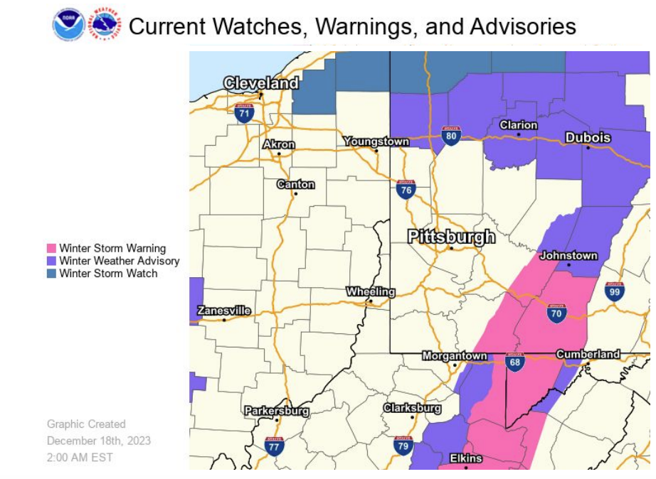 |
| Snowfall Total Map | Watch Warning Advisory Map |
Storm Reports
********************STORM TOTAL SNOWFALL********************
LOCATION TOTAL TIME/DATE COMMENTS
SNOWFALL MEASURED
(inches)
OHIO
...Belmont County...
1 N Morristown 0.6 830 AM 12/18 Public
...Columbiana County...
4 N Wellsville 0.8 800 AM 12/19 CoCoRaHS
ENE Hanoverton 0.8 400 AM 12/19 CoCoRaHS
2 N Wellsville 0.8 800 AM 12/19 CoCoRaHS
...Coshocton County...
2 NNE Fresno 1.0 800 AM 12/19 CoCoRaHS
...Guernsey County...
1 E Cambridge 1.8 800 AM 12/19 CoCoRaHS
Quaker City 1.5 900 AM 12/19 Trained Spotter
Cambridge 1.4 800 AM 12/19 CoCoRaHS
3 NE Cambridge 0.5 600 AM 12/19 CoCoRaHS
...Jefferson County...
New Somerset 1.0 830 AM 12/19 Broadcast Media
3 W Rayland 0.9 847 AM 12/19 Public
Adena 0.8 828 AM 12/19 Broadcast Media
1 WSW Mount Pleasant 0.6 700 AM 12/19 CoCoRaHS
2 WNW Steubenville 0.5 800 AM 12/19 CoCoRaHS
Mingo Junction 0.5 829 AM 12/19 Broadcast Media
...Monroe County...
Woodsfield 2.3 830 AM 12/19 Broadcast Media
...Muskingum County...
New Concord 1.0 125 AM 12/19 Public
Blue Rock 1.0 749 PM 12/18 Still snowing.
5 SSW Concord 0.3 700 AM 12/19 CoCoRaHS
1 SE Norwich 0.2 700 AM 12/19 CoCoRaHS
S White Cottage 0.1 400 PM 12/18 Public
...Tuscarawas County...
WNW Carmichaels 0.5 700 AM 12/19 CoCoRaHS
6 WSW New Philedelphia 0.3 800 AM 12/19 CoCoRaHS
1 N Uhrichsville 0.2 700 AM 12/19 CoCoRaHS
1 NW Dennison 0.1 700 AM 12/19 Co-Op Observer
PENNSYLVANIA
...Allegheny County...
1 N Carnot-Moon 1.0 700 AM 12/19 24 Hour Snowfall Total.
2 SW Pittsburgh 1.0 830 AM 12/19 CoCoRaHS
2 NE Moon 1.0 700 AM 12/19 Co-Op Observer
Dormont 1.0 800 AM 12/19 Public
Carnot-Moon 1.0 700 AM 12/19 CoCoRaHS
2 N Shaler Township 0.8 900 AM 12/19 Public
1 SW Bridgeville 0.8 700 AM 12/19 CoCoRaHS
Springdale 0.7 630 AM 12/19 Public
2 WNW Imperial 0.5 800 AM 12/19 CoCoRaHS
2 S McCandless Towns 0.5 600 AM 12/19 CoCoRaHS
Hampton Township 0.5 755 AM 12/19 Public
2 NW Jefferson 0.5 1000 PM 12/18 CoCoRaHS
1 W McCandless 0.5 945 PM 12/18 Public
2 SE South Fayette 0.5 700 AM 12/19 CoCoRaHS
SW Imperial 0.5 739 PM 12/18 Public
3 NE Pittsburgh 0.4 811 AM 12/19 CoCoRaHS
2 NNE Pittsburgh 0.4 700 AM 12/19 CoCoRaHS
4 NNW Pittsburgh 0.3 600 AM 12/19 CoCoRaHS
1 NE Gibsonia 0.3 645 AM 12/19 CoCoRaHS
1 S Acmetonia 0.2 700 AM 12/19 Co-Op Observer
ENE Harrison Townshi 0.2 500 AM 12/19 CoCoRaHS
3 NW Pittsburgh 0.2 600 AM 12/19 CoCoRaHS
NW Aspinwall 0.1 700 AM 12/19 CoCoRaHS
2 S Greenock T 344 PM 12/18 Public
...Armstrong County...
West Kittanning 1.3 653 AM 12/19 CoCoRaHS
1 SSW Kittanning 1.3 700 AM 12/19 CoCoRaHS
4 NW Dayton 1.0 700 AM 12/19 Co-Op Observer
6 SW Kittanning 0.9 745 AM 12/19 CoCoRaHS
...Beaver County...
2 NW Aliquippa 1.1 800 AM 12/19 Public
6 W Beaver 0.5 700 AM 12/19 CoCoRaHS
Montgomery Dam 0.1 600 AM 12/19 Co-Op Observer
Economy 0.1 700 AM 12/19 CoCoRaHS
...Butler County...
Harrisville 2.5 427 AM 12/19 Public
North Washington 2.5 600 AM 12/19 Public
3 NNE Shanor-Northvu 2.0 700 AM 12/19 CoCoRaHS
5 SE Slippery Rock 1.8 800 AM 12/19 CoCoRaHS
West Sunbury 1.5 751 PM 12/18 Still snowing.
2 W Butler 1.5 700 AM 12/19 CoCoRaHS
1 SW Meridian 1.3 800 AM 12/19 CoCoRaHS
N Cabot 1.0 700 AM 12/19 CoCoRaHS
1 S Slippery Rock 1.0 630 AM 12/19 Co-Op Observer
2 NE Sarver 0.7 514 AM 12/19 CoCoRaHS
Nixon 0.2 719 AM 12/19 Public
...Clarion County...
7 NE Strattanville 1.4 700 AM 12/19 CoCoRaHS
Marble 1.2 900 AM 12/19 Trained Spotter
...Fayette County...
5 SE Champion 6.0 713 AM 12/19 24 hour snowfall total.
4 NW Ohiopyle 3.6 800 AM 12/19 Public
...Forest County...
7 SSE Tionesta 2.0 700 AM 12/19 CoCoRaHS
2 N Strobleton 2.0 700 AM 12/19 CoCoRaHS
Marienville 1.0 800 AM 12/19 Public
5 ENE Tionesta 0.9 700 AM 12/19 CoCoRaHS
5 W Marienville 0.5 620 AM 12/19 CoCoRaHS
1 NW Starr T 1215 PM 12/18 Public
...Greene County...
1 E Waynesburg 1.0 700 AM 12/19 Co-Op Observer
1 SW Point Marion 0.1 600 AM 12/19 Co-Op Observer
...Indiana County...
3 SE Indiana 3.0 700 AM 12/19 Co-Op Observer
2 ESE Chevy Chase He 2.4 700 AM 12/19 CoCoRaHS
Marion Center 2.0 925 AM 12/19 Public
Shelocta 1.4 800 AM 12/19 Public
...Mercer County...
1 NNE Sharon 2.0 930 AM 12/19 Trained Spotter
SE Mercer 2.0 800 AM 12/19 Public
...Venango County...
6 SW Titusville 3.2 700 AM 12/19 CoCoRaHS
1 S Franklin 3.0 700 AM 12/19 CoCoRaHS
1 SSW Franklin 3.0 600 AM 12/19 CoCoRaHS
1 S Uniontown 3.0 600 AM 12/19 CoCoRaHS
Emlenton 3.0 648 AM 12/19 Still snowing.
NW Reno 0.9 530 AM 12/19 CoCoRaHS
...Washington County...
4 NW Canonsburg 1.1 700 AM 12/19 CoCoRaHS
Finleyville 1.1 700 AM 12/19 Public
SSE Dunlevy 1.0 800 AM 12/19 CoCoRaHS
McMurray 1.0 339 PM 12/18 In 30 minutes
5 E Avella 0.9 800 AM 12/19 CoCoRaHS
1 NNW Finleyville 0.5 800 AM 12/19 CoCoRaHS
S Meadow Lands T 300 PM 12/18 Public
...Westmoreland County...
3 S Latrobe 2.0 840 AM 12/19 Public
4 N Ligonier 1.5 854 AM 12/19 Public
3 E North Washington 1.5 700 AM 12/19 Co-Op Observer
SE Ligonier 1.3 800 AM 12/19 CoCoRaHS
ESE New Florence 1.2 825 AM 12/19 CoCoRaHS
3 ESE Smithton 1.0 700 AM 12/19 CoCoRaHS
3 W Lawson Heights 1.0 803 PM 12/18 Still snowing.
NW Youngwood 1.0 918 AM 12/19 Public
1 N Arona 1.0 900 AM 12/19 Trained Spotter
1 SW New Stanton 1.0 724 AM 12/19 Co-Op Observer
Ringertown 0.9 722 AM 12/19 Trained Spotter
1 W Delmont 0.9 645 AM 12/19 Public
1 SW Leechburg 0.7 800 AM 12/19 CoCoRaHS
3 WSW Smithton 0.6 739 AM 12/19 CoCoRaHS
1 W New Kensington 0.5 830 AM 12/19 Trained Spotter
1 E Ligonier 0.5 650 AM 12/19 CoCoRaHS
2 S Saltsburg 0.5 800 AM 12/19 Co-Op Observer
WEST VIRGINIA
...Marion County...
3 ENE Fairmont 2.5 700 AM 12/19 CoCoRaHS
Meadowdale 2.5 700 AM 12/19 Public
Fairmont 2.0 455 AM 12/19 Public
...Monongalia County...
6 SW Morgantown 1.7 700 AM 12/19 CoCoRaHS
1 NW Little Falls 1.2 1115 PM 12/18 CoCoRaHS
NW Morgantown 0.9 1120 AM 12/18 Public
Morgantown Dam 0.1 700 AM 12/19 Co-Op Observer
...Preston County...
5 NNE Terra Alta 6.2 830 AM 12/19 CoCoRaHS
7 N Thomas 5.5 700 AM 12/19 CoCoRaHS
E Terra Alta 4.5 700 AM 12/19 CoCoRaHS
Salt Lick 4.0 1231 AM 12/19 Public
3 S Bruceton Mills 3.5 700 AM 12/19 CoCoRaHS
Bruceton Mills 2.0 324 AM 12/19 County Official
9 SE Bruceton Mills 2.0 900 AM 12/19 CoCoRaHS
...Tucker County...
Canaan Valley-Nature 12.0 615 AM 12/19 Emergency Mngr
Davis 10.0 700 AM 12/19 Co-Op Observer
7 SSE Canaan Hgts 10.0 900 AM 12/19 Public
3 S Canaan Hgts 9.5 900 AM 12/19 Co-Op Observer
Parsons 8.0 730 AM 12/19 Public
7 S Davis 8.0 800 AM 12/19 Public
Thomas 8.0 711 AM 12/19 Public
...Wetzel County...
Coburn 3.0 847 AM 12/19 Broadcast Media
7 E New Martinsville 2.0 800 AM 12/19 CoCoRaHS
Paden City 1.5 830 AM 12/19 Broadcast Media
2 N Glover Gap 1.0 730 AM 12/19 Co-Op Observer
Environment
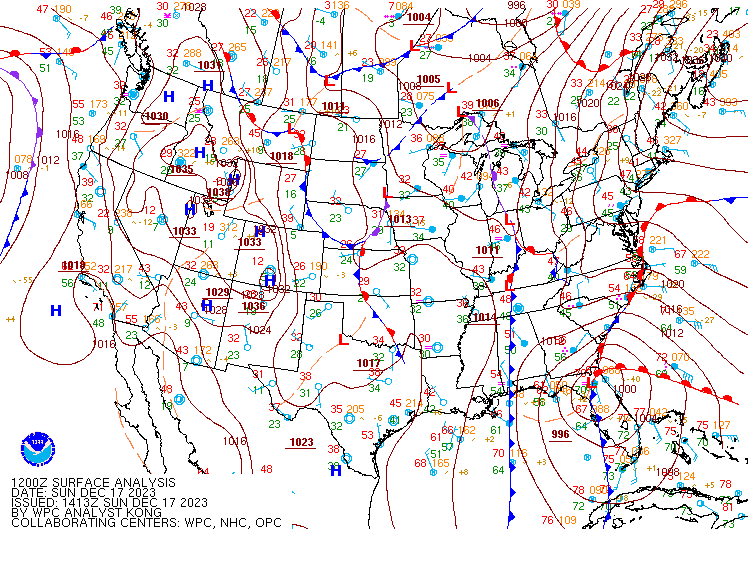
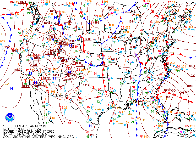
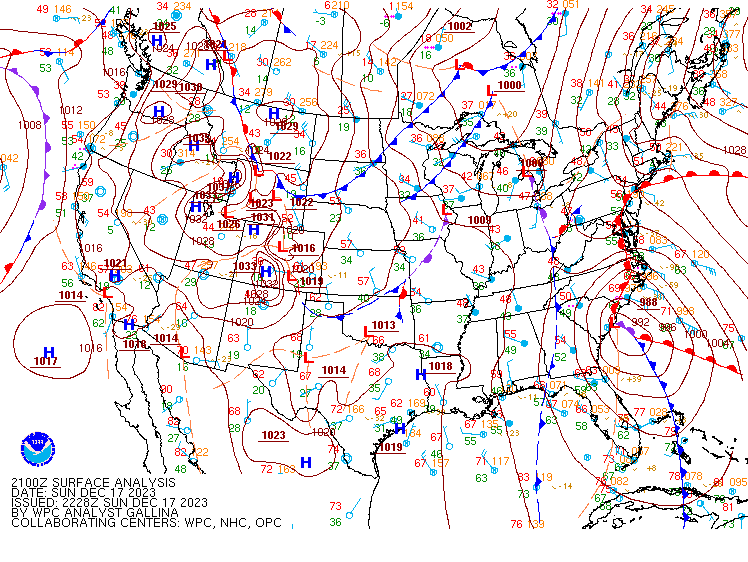
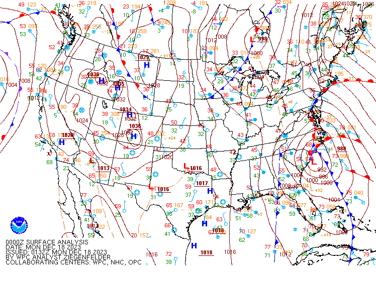
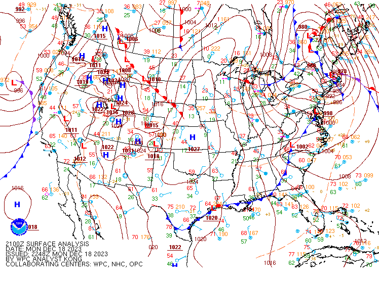
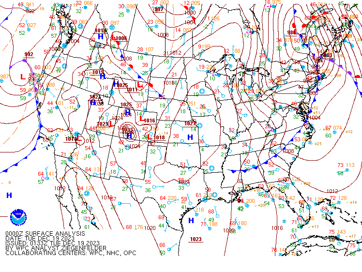
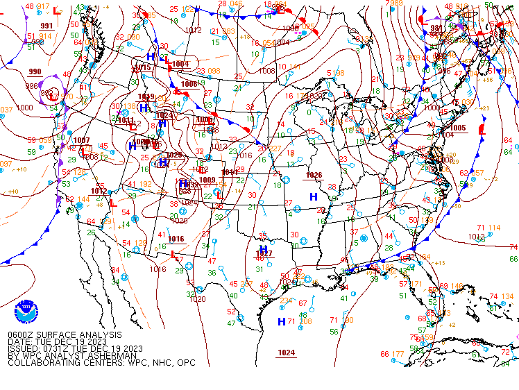
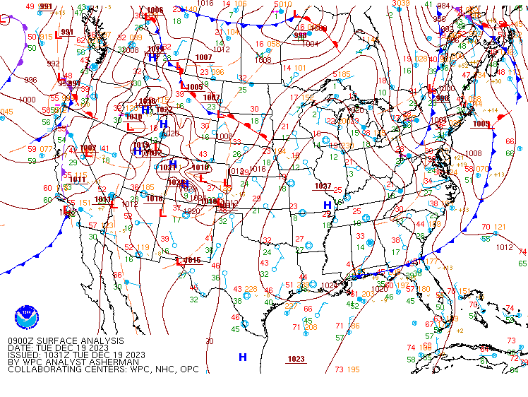
WPC Surface Charts.
 |
 |
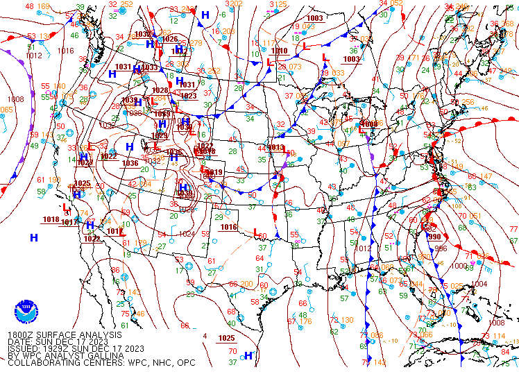 |
| December 17 12Z | December 17 15Z | December 17 18Z |
 |
 |
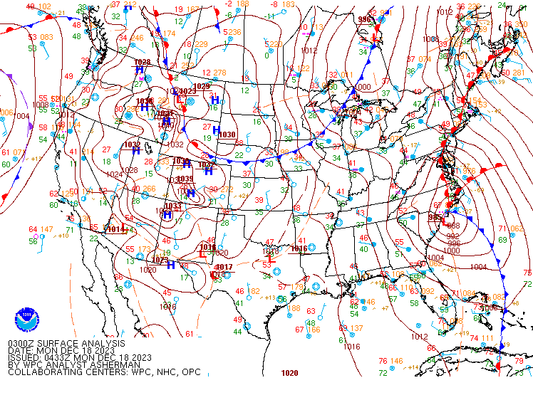 |
| December 17 21Z | December 18 00Z | December 18 03Z |
 |
 |
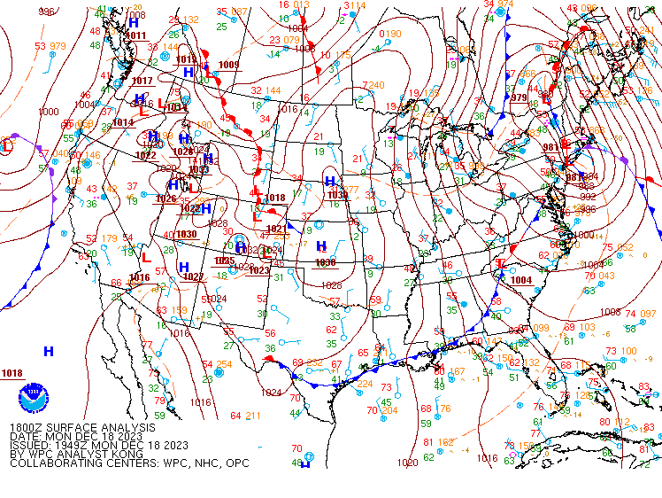 |
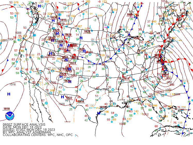
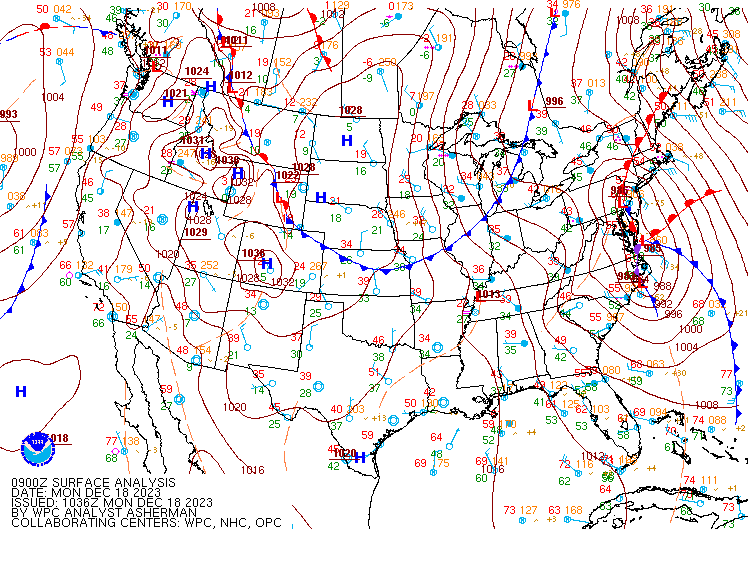
| December 18 06Z | December 18 09Z | December 18 18Z |
 |
 |
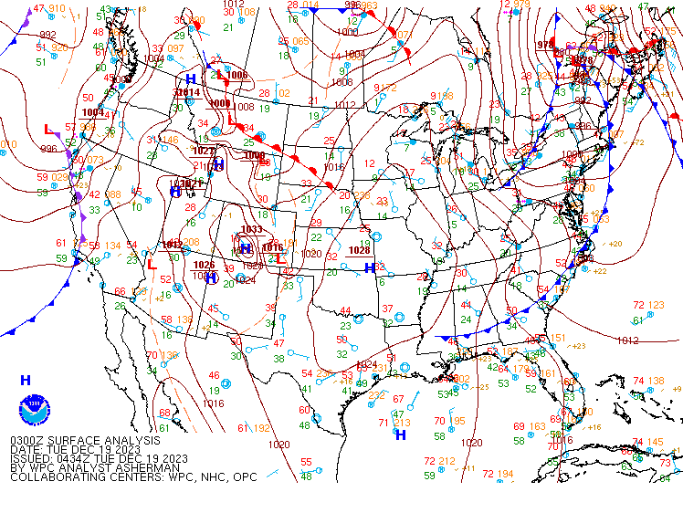 |
| December 18 21Z | December 19 00Z | December 19 03Z |
 |
 |
 |
| December 19 06Z | December 19 09Z | December 19 12Z |
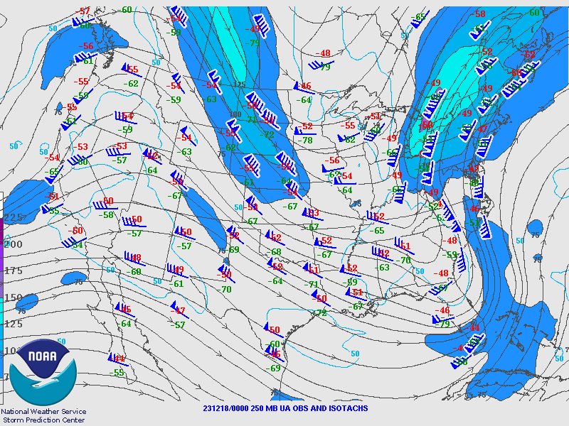
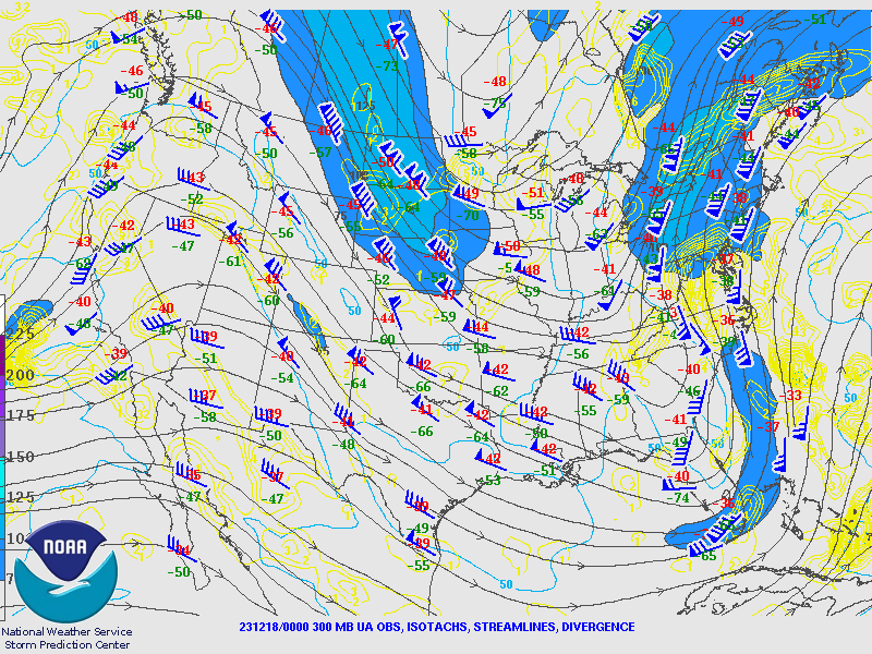
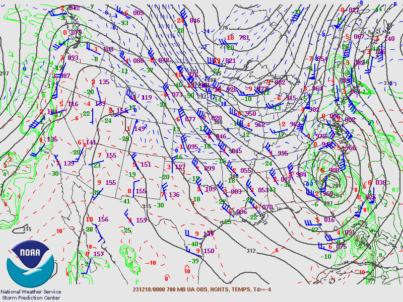
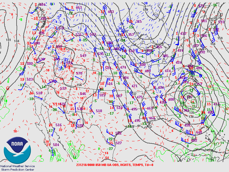
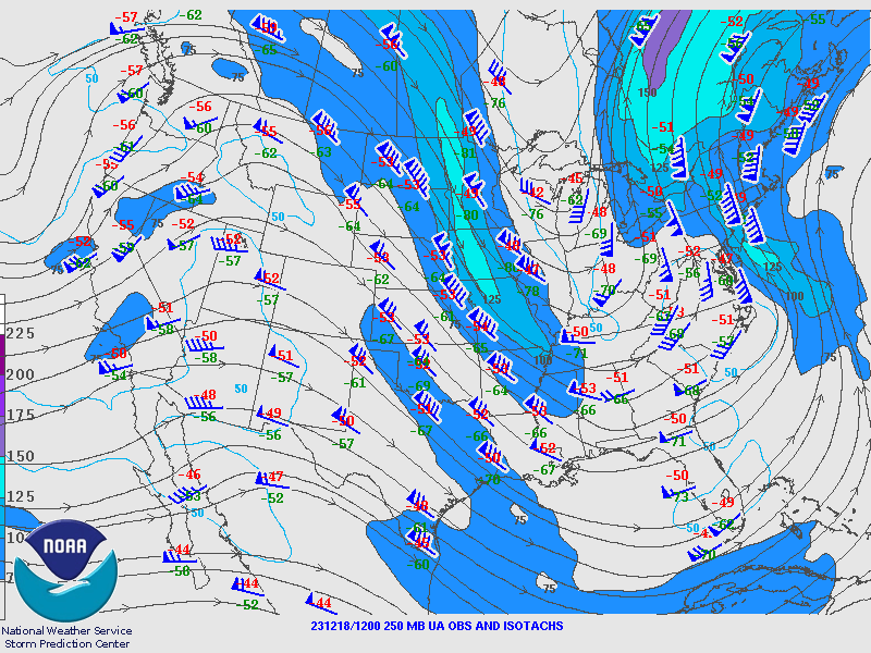
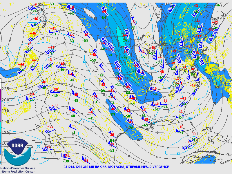
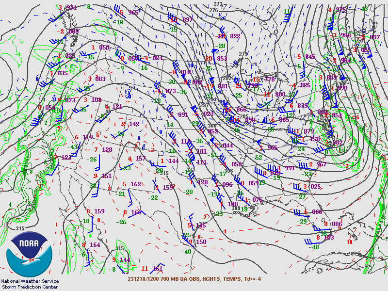
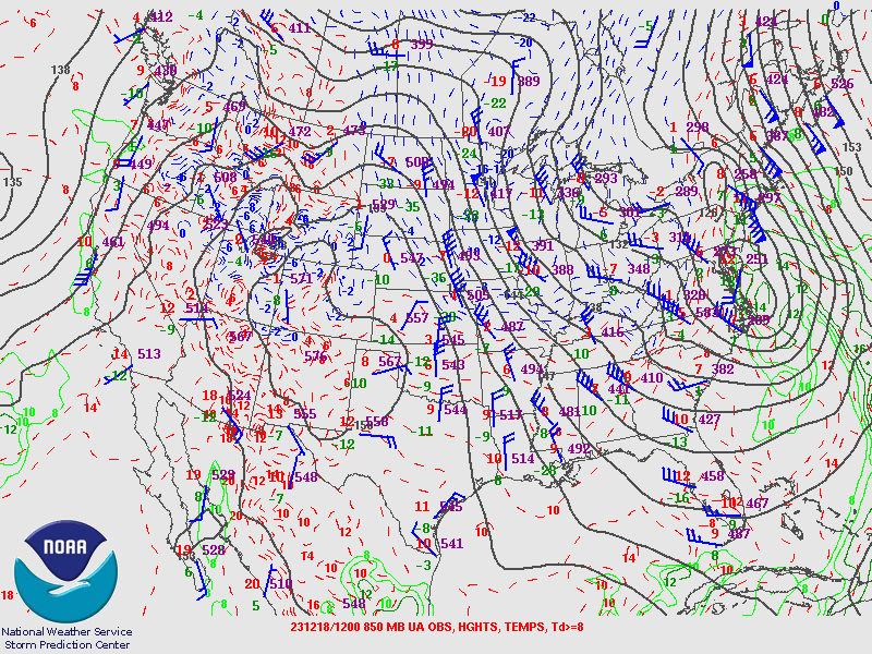
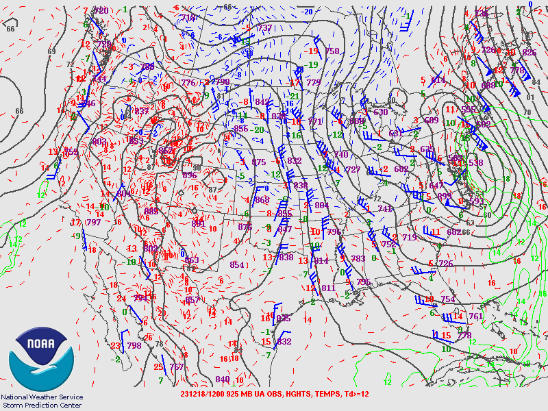
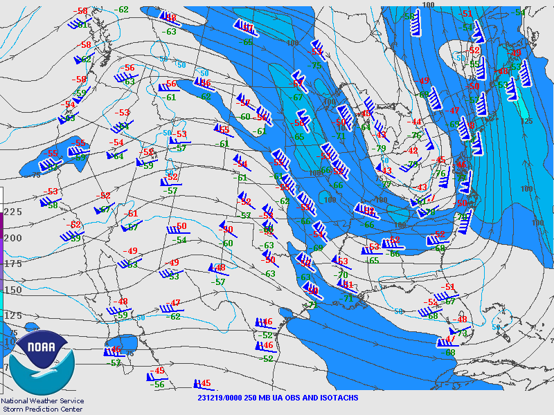
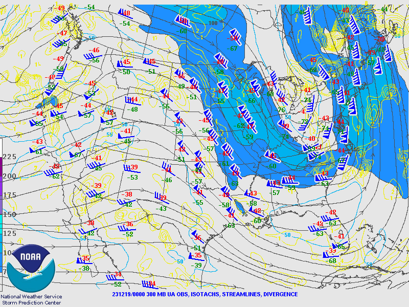
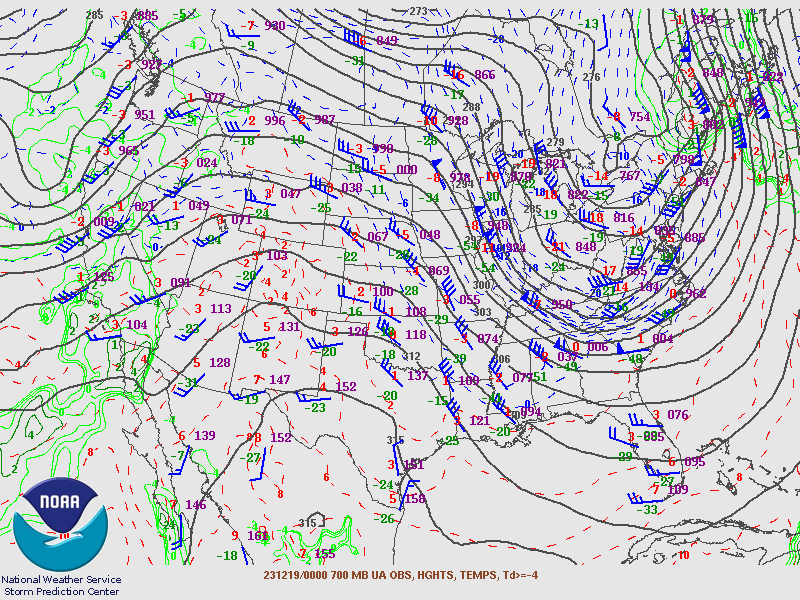
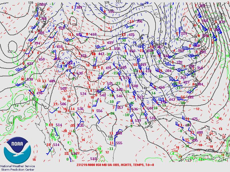
Upper Air Charts from SPC.
 |
 |
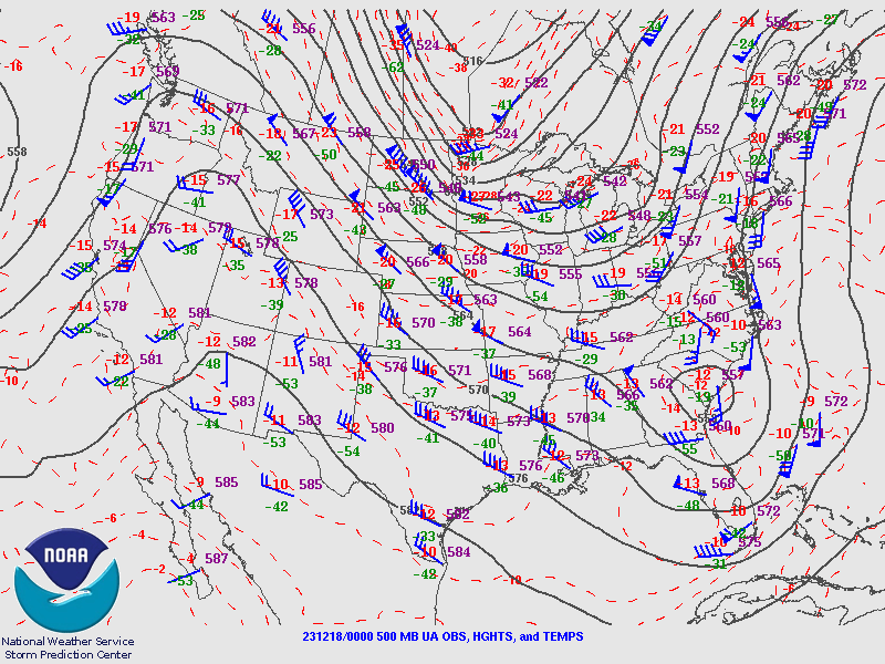 |
| 18th 00Z 250MB | 18th 00Z 300MB | 18th 00Z 500MB |
 |
 |
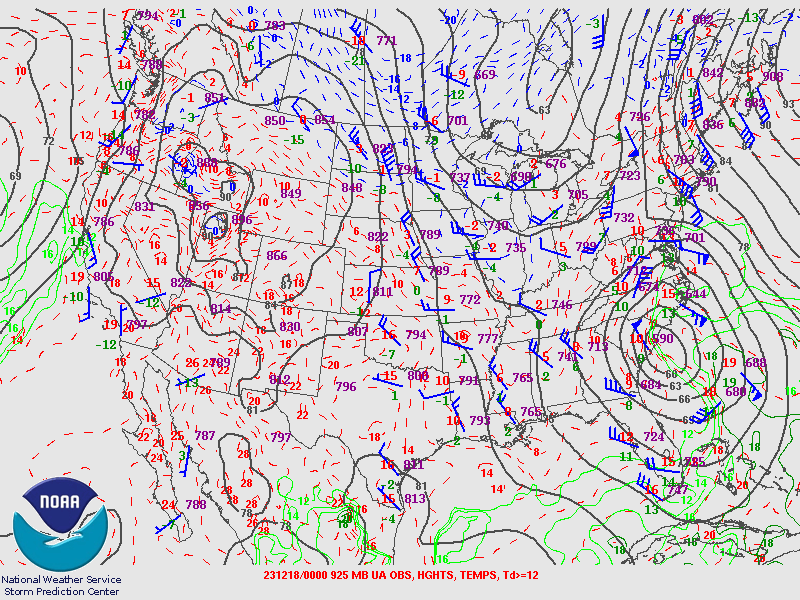 |
| 18th 00Z 700MB | 18th 00Z 850mb | 18th 00Z 925MB |
 |
 |
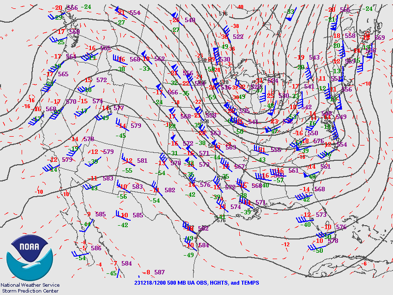 |
| 18th 12Z 250MB | 18th 12Z 300MB | 18th 12Z 500MB |
 |
 |
 |
| 18th 12Z 700MB | 18th 12Z 850MB | 18th 12Z 925MB |
 |
 |
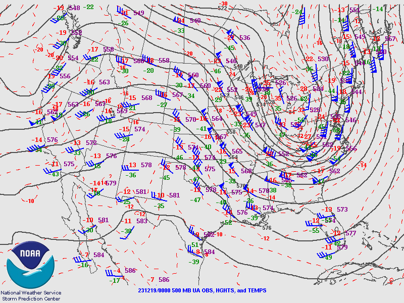 |
| 19th 00Z 250MB | 19th 00Z 300MB | 19th 00Z 500MB |
 |
 |
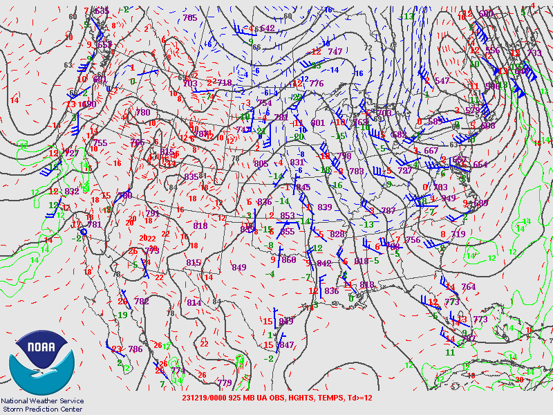 |
| 19th 00Z 700MB | 19th 00Z 850MB | 19th 00Z 925MB |
PIT Sounding Data from SPC.
 |
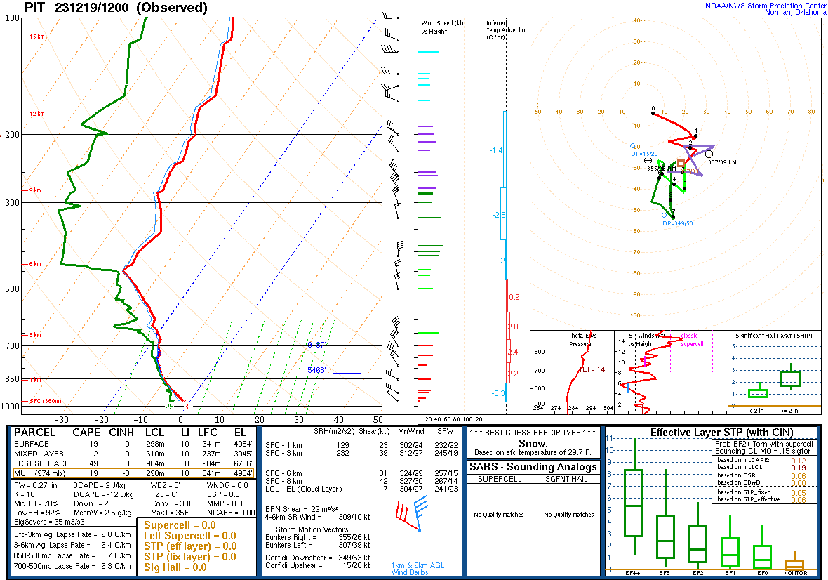 |
| 19th 00Z | 19th 12Z |
 |
Media use of NWS Web News Stories is encouraged! Please acknowledge the NWS as the source of any news information accessed from this site. |
|

