Overview
|
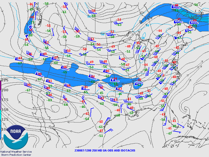
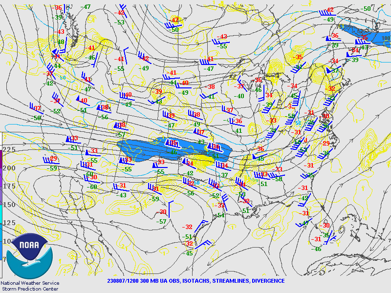
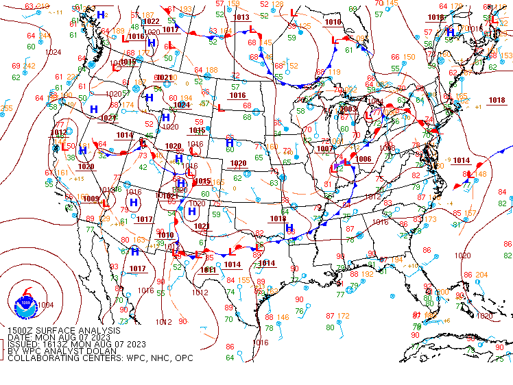
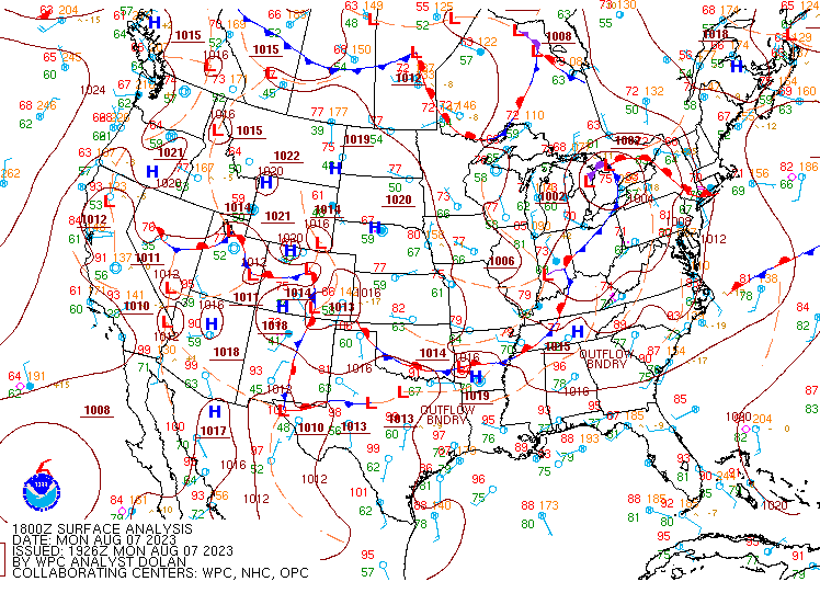
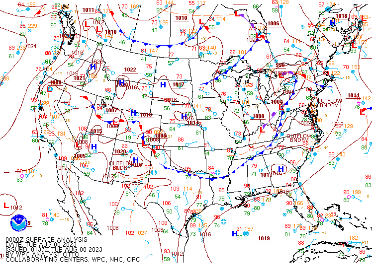
The event on August 7th 2023 featured a period during the morning hours, when a decaying MCS passed through the area during the early morning hours and likely changed the environment to the point where it impacted the convective event later in the day. A warm front positioned over the north during the day kept the forecast area in the warm sector for the event with a stout cold to the west over the Midwest states. Aloft, a distinct 500MB trough over the OH Valley with a strong 50 to 60 knot jet streak rounding the base of the trough through KY and into WV. The axis of the trough was swinging through western OH at the time with ingredients coming together shortly after 10-11am. With the MCS earlier in the morning priming the environment for a midday convective initiation. Numerous cells began to develop across northern WV and slowly creeped into our forecast area. Towards the end of the event, a well developed supercell formed in Preston County WV. The cell produced ping pong sized hail and in isolated reports, there was golf ball and hen egg sized hail. |
Credit: Deb Hemler |
Wind & Hail:
Wind
 |
 |
|
Thunderstorm Wind Damage near Kingwood, WV Credit: Unknown Public Report |
Wind Blown Hail Damage Preston County Credit: Unknown Public Report |
Hail
 |
 |
 |
|
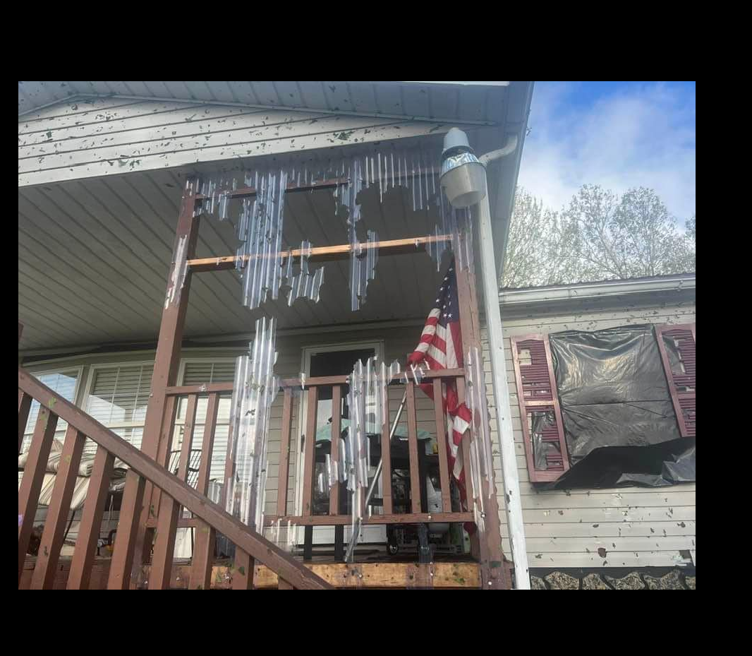
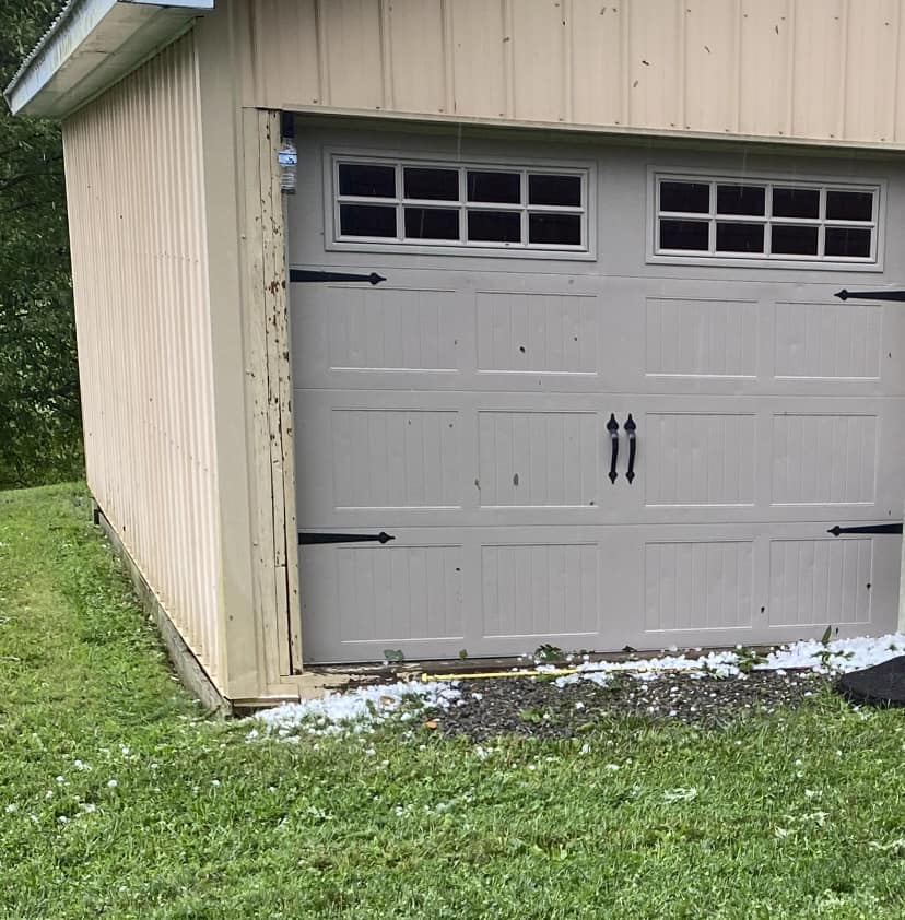
Hail Damage near Albirght, WV Credit: Unknown Public Report |
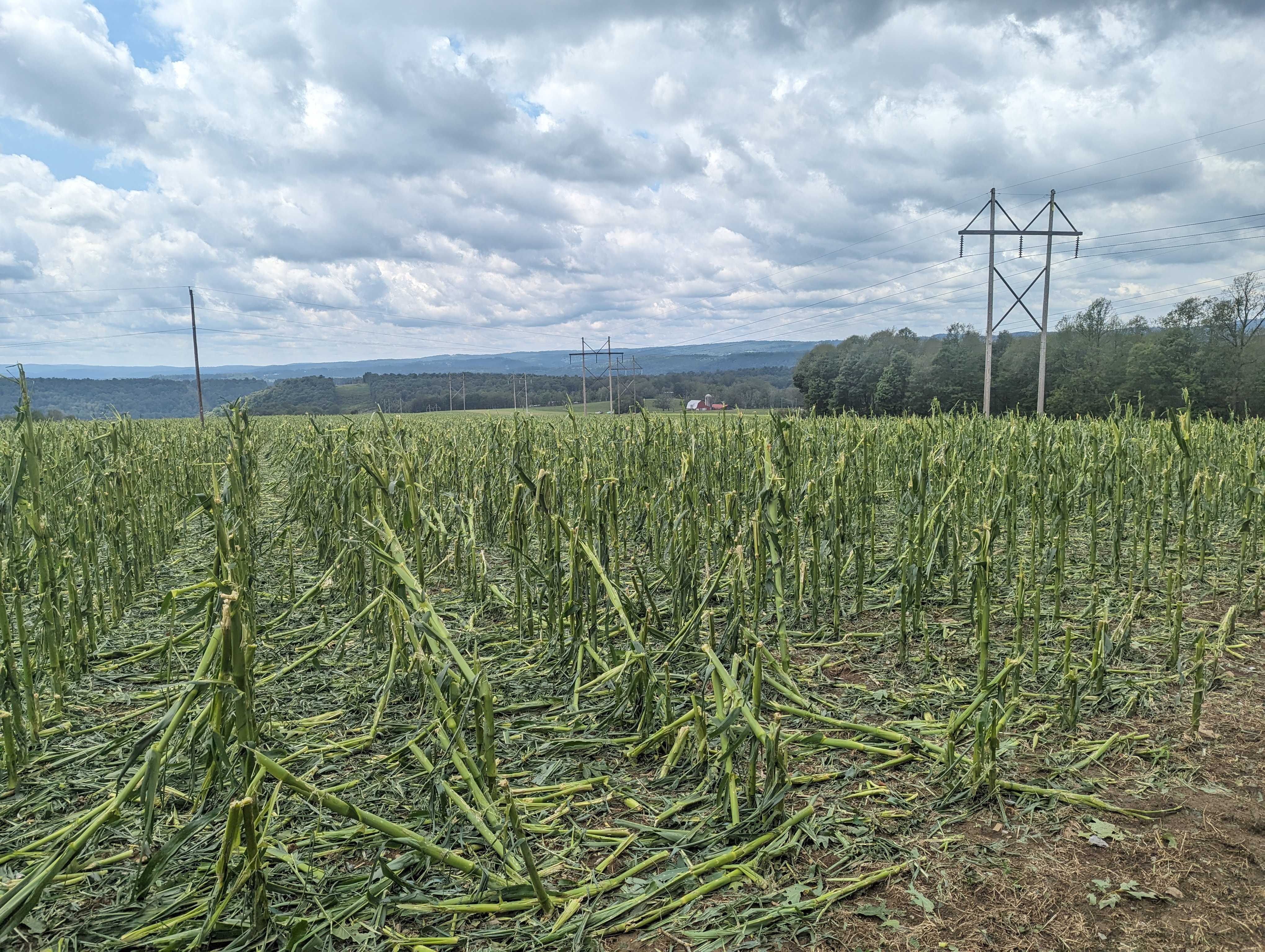
Hail Damage to Corn in Albright, WV Credit: Jared Rackley |
Ping Pong Sized Hail near Albright, WV Credit: Cheryl Conner |
Radar
Header
.gif) |
| Caption |
Storm Reports

Rain Reports
Public Information Statement
Spotter Reports
National Weather Service Pittsburgh PA
852 PM EDT Mon Aug 07 2023

The following are unofficial observations taken during the past 12
hours for the storm that has been affecting our region. Appreciation
is extended to highway departments, cooperative observers, Skywarn
spotters and media for these reports. This summary also is available
on our home page at weather.gov/pittsburgh

*********STORM TOTAL RAINFALL (AT LEAST 0.25 INCH)**********

LOCATION                TOTAL      TIME/DATE  COMMENTS
                     RAINFALL       MEASURED
                     (inches)

OHIO

...Belmont County...
  St. Clairsville        0.62   733 PM  8/07  CWOP
  6 SE Belmont           0.44   500 PM  8/07  IFLOWS
  3 SW Mount Pleasant    0.40   805 PM  8/07  IFLOWS

...Columbiana County...
  3 SE Salem             0.40   700 PM  8/07  IFLOWS

...Coshocton County...
  Woodbury Wildlife Ar   0.60   700 PM  8/07  IFLOWS

...Guernsey County...
  1 NE Pleasant City     1.02   800 PM  8/07  HADS
  Quaker City            0.88   700 PM  8/07  IFLOWS
  1 N Cambridge          0.83   900 AM  8/07  CoCoRaHS

...Harrison County...
  1 N New Athens         0.56   700 PM  8/07  IFLOWS

...Jefferson County...
  2 W Brentwood          0.40   800 PM  8/07  IFLOWS

...Monroe County...
  Antioch                0.44   800 PM  8/07  IFLOWS
  1 W Beallsville        0.32   800 PM  8/07  IFLOWS
  Merrell Ridge          0.28   732 PM  8/07  RAWS

...Noble County...
  3 W Caldwell           1.71   700 PM  8/07  IFLOWS
  Jackson Township       1.27   800 PM  8/07  IFLOWS
  Summerfield            0.84   800 PM  8/07  IFLOWS

...Tuscarawas County...
  New Philadelphia       0.27   750 PM  8/07  CWOP

PENNSYLVANIA

...Allegheny County...
  Dawson                 0.43   756 PM  8/07  CWOP
  PITTSBURGH             0.31   757 PM  8/07  CWOP
  2 N Carnot-Moon        0.30   600 PM  8/07  IFLOWS
  Pittsburgh             0.28   745 PM  8/07  CWOP
  Pittsburgh Intl Airp   0.26   751 PM  8/07  ASOS

...Armstrong County...
  4 SE East Brady        0.25   700 PM  8/07  HADS

...Beaver County...
  Freedom                1.03   756 PM  8/07  CWOP
  FOMBELL                0.87   758 PM  8/07  CWOP
  Baden                  0.57   758 PM  8/07  CWOP
  Eastvale               0.35   715 PM  8/07  HADS

...Butler County...
  Karns City             0.82   756 PM  8/07  CWOP
  Moraine State Park     0.77   750 PM  8/07  RAWS
  Butler County Airpor   0.38   802 PM  8/07  AWOS

...Fayette County...
  6 SW Ohiopyle          0.40   700 PM  8/07  HADS
  2 W Juniata            0.36   745 PM  8/07  HADS

...Greene County...
  Waynesburg             0.31   759 PM  8/07  CWOP
  1 ESE Graysville       0.26   700 PM  8/07  HADS

...Indiana County...
  Marion Center          0.30   700 PM  8/07  HADS

...Jefferson County...
  Punxsutawney           0.26   755 PM  8/07  CWOP

...Westmoreland County...
  Irwin                  0.35   800 PM  8/07  CWOP
  3 NNW New Stanton      0.30   900 AM  8/07  CoCoRaHS

WEST VIRGINIA

...Brooke County...
  Archer Heights         0.32   800 PM  8/07  IFLOWS

...Hancock County...
  2 E New Cumberland     1.20   800 PM  8/07  IFLOWS
  1 E Chester            0.60   800 PM  8/07  IFLOWS
  Kings Creek            0.52   800 PM  8/07  IFLOWS

...Marion County...
  5 N Grafton            2.76   700 PM  8/07  IFLOWS
  4 W Mannington         1.31   500 PM  8/07  IFLOWS
  2 SW Fairview          1.11   500 PM  8/07  IFLOWS
  2 W Mannington         0.83   745 PM  8/07  HADS

...Marshall County...
  2 NE Moundsville       0.36   600 PM  8/07  IFLOWS
  3 N Lynn Camp          0.28   800 PM  8/07  IFLOWS

...Monongalia County...
  Morgantown             1.48   758 PM  8/07  CWOP
  6 SW Morgantown        1.29   300 PM  8/07  CoCoRaHS
  4 NE Rivesville        1.17   700 PM  8/07  IFLOWS
  1 SE Westover          1.11   715 PM  8/07  HADS
  4 NE Fairview          1.03   500 PM  8/07  IFLOWS
  Morgantown Airport     0.96   753 PM  8/07  ASOS
  3 S Wadestown          0.40   800 PM  8/07  IFLOWS

...Ohio County...
  Wheeling               0.35   800 PM  8/07  CWOP
  Yorkville              0.35   800 PM  8/07  HADS

...Preston County...
  3 N Tunnelton          2.52   500 PM  8/07  IFLOWS
  7 SE Brandonville      2.07   600 PM  8/07  IFLOWS
  2 S Tunnelton          1.95   500 PM  8/07  IFLOWS
  4 N Bruceton Mills     1.84   500 PM  8/07  IFLOWS
  5 NE Brandonville      1.48   500 PM  8/07  IFLOWS
  Bruceton Mills         1.20   715 PM  8/07  HADS
  Cheat River            0.92   745 PM  8/07  HADS
  Afton                  0.71   145 PM  8/07  IFLOWS

...Tucker County...
  7 S Rowlesburg         2.63   600 PM  8/07  IFLOWS
  3 NE Hendricks         2.04   800 PM  8/07  IFLOWS
  Canaan Heights         0.97   700 PM  8/07  RAWS
  Parsons                0.81   756 PM  8/07  CWOP
  4 S Canaan Valley      0.68   745 PM  8/07  HADS
  3 S Canaan Hgts        0.64   600 PM  8/07  IFLOWS
  Hendricks              0.33   730 PM  8/07  HADS
  Davis                  0.31   730 PM  8/07  HADS

...Wetzel County...
  1 SE Hundred           0.27   715 PM  8/07  HADS

&&

*****METADATA*****
:8/07/2023,  733 PM, OH, Belmont, St. Clairsville, , , 40.0428, -80.9197, RAIN, 0.62, Inch, CWOP, Storm Total Rainfall,
:8/07/2023,  500 PM, OH, Belmont, Belmont, 6, SE, 39.9753, -80.9617, RAIN, 0.44, Inch, IFLOWS, Storm Total Rainfall,
:8/07/2023,  805 PM, OH, Belmont, Mount Pleasant, 3, SW, 40.1372, -80.8231, RAIN, 0.40, Inch, IFLOWS, Storm Total Rainfall,
:8/07/2023,  700 PM, OH, Columbiana, Salem, 3, SE, 40.8667, -80.8361, RAIN, 0.40, Inch, IFLOWS, Storm Total Rainfall,
:8/07/2023,  700 PM, OH, Coshocton, Woodbury Wildlife Area, , , 40.2536, -81.9869, RAIN, 0.60, Inch, IFLOWS, Storm Total Rainfall,
:8/07/2023,  800 PM, OH, Guernsey, Pleasant City, 1, NE, 39.9189, -81.5311, RAIN, 1.02, Inch, HADS, Storm Total Rainfall,
:8/07/2023,  700 PM, OH, Guernsey, Quaker City, , , 39.9697, -81.3036, RAIN, 0.88, Inch, IFLOWS, Storm Total Rainfall,
:8/07/2023,  900 AM, OH, Guernsey, Cambridge, 1, N, 40.0435, -81.5836, RAIN, 0.83, Inch, CoCoRaHS, Storm Total Rainfall,
:8/07/2023,  700 PM, OH, Harrison, New Athens, 1, N, 40.1933, -80.9964, RAIN, 0.56, Inch, IFLOWS, Storm Total Rainfall,
:8/07/2023,  800 PM, OH, Jefferson, Brentwood, 2, W, 40.3600, -80.7606, RAIN, 0.40, Inch, IFLOWS, Storm Total Rainfall,
:8/07/2023,  800 PM, OH, Monroe, Antioch, , , 39.6556, -81.0778, RAIN, 0.44, Inch, IFLOWS, Storm Total Rainfall,
:8/07/2023,  800 PM, OH, Monroe, Beallsville, 1, W, 39.8458, -81.0444, RAIN, 0.32, Inch, IFLOWS, Storm Total Rainfall,
:8/07/2023,  732 PM, OH, Monroe, Merrell Ridge, , , 39.6093, -81.1671, RAIN, 0.28, Inch, RAWS, Storm Total Rainfall,
:8/07/2023,  700 PM, OH, Noble, Caldwell, 3, W, 39.7328, -81.5644, RAIN, 1.71, Inch, IFLOWS, Storm Total Rainfall,
:8/07/2023,  800 PM, OH, Noble, Jackson Township, , , 39.6353, -81.5036, RAIN, 1.27, Inch, IFLOWS, Storm Total Rainfall,
:8/07/2023,  800 PM, OH, Noble, Summerfield, , , 39.7967, -81.3350, RAIN, 0.84, Inch, IFLOWS, Storm Total Rainfall,
:8/07/2023,  750 PM, OH, Tuscarawas, New Philadelphia, , , 40.4800, -81.4795, RAIN, 0.27, Inch, CWOP, Storm Total Rainfall,
:8/07/2023,  756 PM, PA, Allegheny, Dawson, , , 40.4638, -79.9467, RAIN, 0.43, Inch, CWOP, Storm Total Rainfall,
:8/07/2023,  757 PM, PA, Allegheny, PITTSBURGH, , , 40.5853, -80.0522, RAIN, 0.31, Inch, CWOP, Storm Total Rainfall,
:8/07/2023,  600 PM, PA, Allegheny, Carnot-Moon, 2, N, 40.5428, -80.2167, RAIN, 0.30, Inch, IFLOWS, Storm Total Rainfall,
:8/07/2023,  745 PM, PA, Allegheny, Pittsburgh, , , 40.5758, -80.0505, RAIN, 0.28, Inch, CWOP, Storm Total Rainfall,
:8/07/2023,  751 PM, PA, Allegheny, Pittsburgh Intl Airport, , , 40.5000, -80.2667, RAIN, 0.26, Inch, ASOS, Storm Total Rainfall,
:8/07/2023,  700 PM, PA, Armstrong, East Brady, 4, SE, 40.9561, -79.5472, RAIN, 0.25, Inch, HADS, Storm Total Rainfall,
:8/07/2023,  756 PM, PA, Beaver, Freedom, , , 40.7083, -80.2160, RAIN, 1.03, Inch, CWOP, Storm Total Rainfall,
:8/07/2023,  758 PM, PA, Beaver, FOMBELL, , , 40.7983, -80.1960, RAIN, 0.87, Inch, CWOP, Storm Total Rainfall,
:8/07/2023,  758 PM, PA, Beaver, Baden, , , 40.6618, -80.1777, RAIN, 0.57, Inch, CWOP, Storm Total Rainfall,
:8/07/2023,  715 PM, PA, Beaver, Eastvale, , , 40.7628, -80.3133, RAIN, 0.35, Inch, HADS, Storm Total Rainfall,
:8/07/2023,  756 PM, PA, Butler, Karns City, , , 40.9920, -79.7263, RAIN, 0.82, Inch, CWOP, Storm Total Rainfall,
:8/07/2023,  750 PM, PA, Butler, Moraine State Park, , , 40.9352, -80.1004, RAIN, 0.77, Inch, RAWS, Storm Total Rainfall,
:8/07/2023,  802 PM, PA, Butler, Butler County Airport, , , 40.7667, -79.9500, RAIN, 0.38, Inch, AWOS, Storm Total Rainfall,
:8/07/2023,  700 PM, PA, Fayette, Ohiopyle, 6, SW, 39.8150, -79.5867, RAIN, 0.40, Inch, HADS, Storm Total Rainfall,
:8/07/2023,  745 PM, PA, Fayette, Juniata, 2, W, 39.9800, -79.7644, RAIN, 0.36, Inch, HADS, Storm Total Rainfall,
:8/07/2023,  759 PM, PA, Greene, Waynesburg, , , 39.9276, -80.1700, RAIN, 0.31, Inch, CWOP, Storm Total Rainfall,
:8/07/2023,  700 PM, PA, Greene, Graysville, 1, ESE, 39.9244, -80.3608, RAIN, 0.26, Inch, HADS, Storm Total Rainfall,
:8/07/2023,  700 PM, PA, Indiana, Marion Center, , , 40.7675, -79.0547, RAIN, 0.30, Inch, HADS, Storm Total Rainfall,
:8/07/2023,  755 PM, PA, Jefferson, Punxsutawney, , , 40.9447, -78.9905, RAIN, 0.26, Inch, CWOP, Storm Total Rainfall,
:8/07/2023,  800 PM, PA, Westmoreland, Irwin, , , 40.3371, -79.7043, RAIN, 0.35, Inch, CWOP, Storm Total Rainfall,
:8/07/2023,  900 AM, PA, Westmoreland, New Stanton, 3, NNW, 40.2614, -79.6430, RAIN, 0.30, Inch, CoCoRaHS, Storm Total Rainfall,
:8/07/2023,  800 PM, WV, Brooke, Archer Heights, , , 40.3675, -80.5900, RAIN, 0.32, Inch, IFLOWS, Storm Total Rainfall,
:8/07/2023,  800 PM, WV, Hancock, New Cumberland, 2, E, 40.5075, -80.5591, RAIN, 1.20, Inch, IFLOWS, Storm Total Rainfall,
:8/07/2023,  800 PM, WV, Hancock, Chester, 1, E, 40.6169, -80.5455, RAIN, 0.60, Inch, IFLOWS, Storm Total Rainfall,
:8/07/2023,  800 PM, WV, Hancock, Kings Creek, , , 40.4252, -80.5258, RAIN, 0.52, Inch, IFLOWS, Storm Total Rainfall,
:8/07/2023,  700 PM, WV, Marion, Grafton, 5, N, 39.4100, -80.0353, RAIN, 2.76, Inch, IFLOWS, Storm Total Rainfall,
:8/07/2023,  500 PM, WV, Marion, Mannington, 4, W, 39.5369, -80.4144, RAIN, 1.31, Inch, IFLOWS, Storm Total Rainfall,
:8/07/2023,  500 PM, WV, Marion, Fairview, 2, SW, 39.5756, -80.2731, RAIN, 1.11, Inch, IFLOWS, Storm Total Rainfall,
:8/07/2023,  745 PM, WV, Marion, Mannington, 2, W, 39.5175, -80.3714, RAIN, 0.83, Inch, HADS, Storm Total Rainfall,
:8/07/2023,  600 PM, WV, Marshall, Moundsville, 2, NE, 39.9433, -80.7280, RAIN, 0.36, Inch, IFLOWS, Storm Total Rainfall,
:8/07/2023,  800 PM, WV, Marshall, Lynn Camp, 3, N, 39.8078, -80.7064, RAIN, 0.28, Inch, IFLOWS, Storm Total Rainfall,
:8/07/2023,  758 PM, WV, Monongalia, Morgantown, , , 39.6597, -79.9487, RAIN, 1.48, Inch, CWOP, Storm Total Rainfall,
:8/07/2023,  300 PM, WV, Monongalia, Morgantown, 6, SW, 39.5752, -80.0282, RAIN, 1.29, Inch, CoCoRaHS, Storm Total Rainfall,
:8/07/2023,  700 PM, WV, Monongalia, Rivesville, 4, NE, 39.5639, -80.0494, RAIN, 1.17, Inch, IFLOWS, Storm Total Rainfall,
:8/07/2023,  715 PM, WV, Monongalia, Westover, 1, SE, 39.6200, -79.9694, RAIN, 1.11, Inch, HADS, Storm Total Rainfall,
:8/07/2023,  500 PM, WV, Monongalia, Fairview, 4, NE, 39.6425, -80.2050, RAIN, 1.03, Inch, IFLOWS, Storm Total Rainfall,
:8/07/2023,  753 PM, WV, Monongalia, Morgantown Airport, , , 39.6500, -79.9167, RAIN, 0.96, Inch, ASOS, Storm Total Rainfall,
:8/07/2023,  800 PM, WV, Monongalia, Wadestown, 3, S, 39.6372, -80.3267, RAIN, 0.40, Inch, IFLOWS, Storm Total Rainfall,
:8/07/2023,  800 PM, WV, Ohio, Wheeling, , , 40.0730, -80.6824, RAIN, 0.35, Inch, CWOP, Storm Total Rainfall,
:8/07/2023,  800 PM, WV, Ohio, Yorkville, , , 40.1497, -80.7017, RAIN, 0.35, Inch, HADS, Storm Total Rainfall,
:8/07/2023,  500 PM, WV, Preston, Tunnelton, 3, N, 39.4389, -79.7533, RAIN, 2.52, Inch, IFLOWS, Storm Total Rainfall,
:8/07/2023,  600 PM, WV, Preston, Brandonville, 7, SE, 39.6183, -79.5181, RAIN, 2.07, Inch, IFLOWS, Storm Total Rainfall,
:8/07/2023,  500 PM, WV, Preston, Tunnelton, 2, S, 39.3592, -79.7378, RAIN, 1.95, Inch, IFLOWS, Storm Total Rainfall,
:8/07/2023,  500 PM, WV, Preston, Bruceton Mills, 4, N, 39.7144, -79.6603, RAIN, 1.84, Inch, IFLOWS, Storm Total Rainfall,
:8/07/2023,  500 PM, WV, Preston, Brandonville, 5, NE, 39.7069, -79.5442, RAIN, 1.48, Inch, IFLOWS, Storm Total Rainfall,
:8/07/2023,  715 PM, WV, Preston, Bruceton Mills, , , 39.6614, -79.6386, RAIN, 1.20, Inch, HADS, Storm Total Rainfall,
:8/07/2023,  745 PM, WV, Preston, Cheat River, , , 39.4947, -79.6450, RAIN, 0.92, Inch, HADS, Storm Total Rainfall,
:8/07/2023,  145 PM, WV, Preston, Afton, , , 39.5356, -79.5306, RAIN, 0.71, Inch, IFLOWS, Storm Total Rainfall,
:8/07/2023,  600 PM, WV, Tucker, Rowlesburg, 7, S, 39.2467, -79.6417, RAIN, 2.63, Inch, IFLOWS, Storm Total Rainfall,
:8/07/2023,  800 PM, WV, Tucker, Hendricks, 3, NE, 39.1067, -79.6022, RAIN, 2.04, Inch, IFLOWS, Storm Total Rainfall,
:8/07/2023,  700 PM, WV, Tucker, Canaan Heights, , , 39.1050, -79.4261, RAIN, 0.97, Inch, RAWS, Storm Total Rainfall,
:8/07/2023,  756 PM, WV, Tucker, Parsons, , , 39.1150, -79.6635, RAIN, 0.81, Inch, CWOP, Storm Total Rainfall,
:8/07/2023,  745 PM, WV, Tucker, Canaan Valley, 4, S, 39.0106, -79.4494, RAIN, 0.68, Inch, HADS, Storm Total Rainfall,
:8/07/2023,  600 PM, WV, Tucker, Canaan Hgts, 3, S, 39.0592, -79.4133, RAIN, 0.64, Inch, IFLOWS, Storm Total Rainfall,
:8/07/2023,  730 PM, WV, Tucker, Hendricks, , , 39.0722, -79.6222, RAIN, 0.33, Inch, HADS, Storm Total Rainfall,
:8/07/2023,  730 PM, WV, Tucker, Davis, , , 39.1294, -79.4694, RAIN, 0.31, Inch, HADS, Storm Total Rainfall,
:8/07/2023,  715 PM, WV, Wetzel, Hundred, 1, SE, 39.6711, -80.4439, RAIN, 0.27, Inch, HADS, Storm Total Rainfall,
Environment
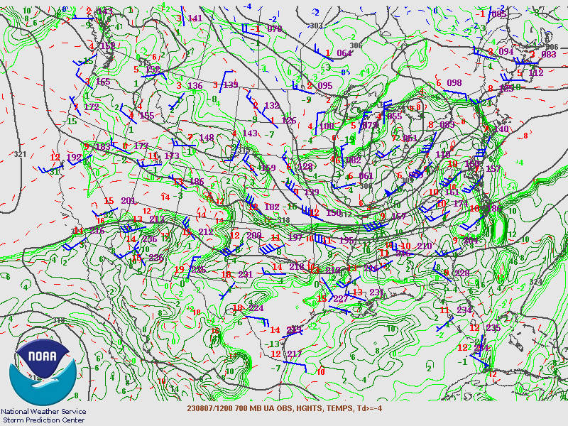
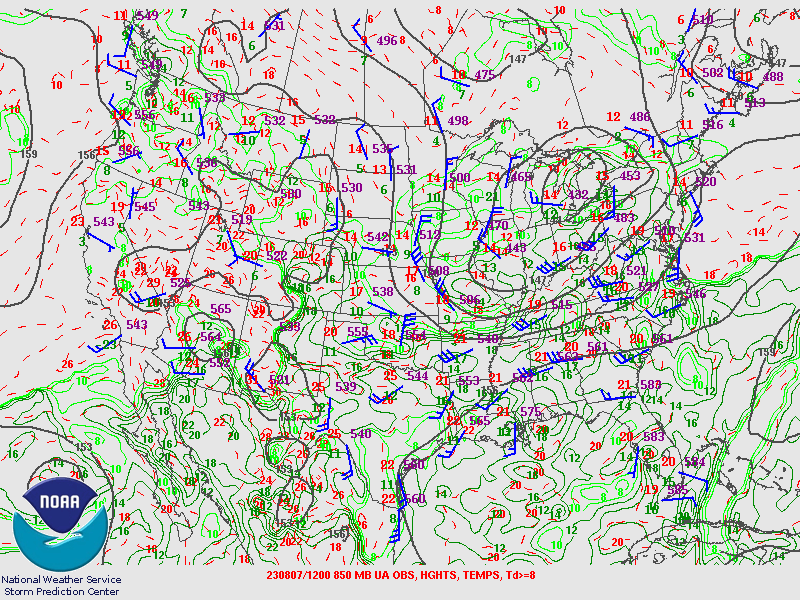
SPC Upper Air Maps for August 7th 2023 12Z.
.
 |
 |
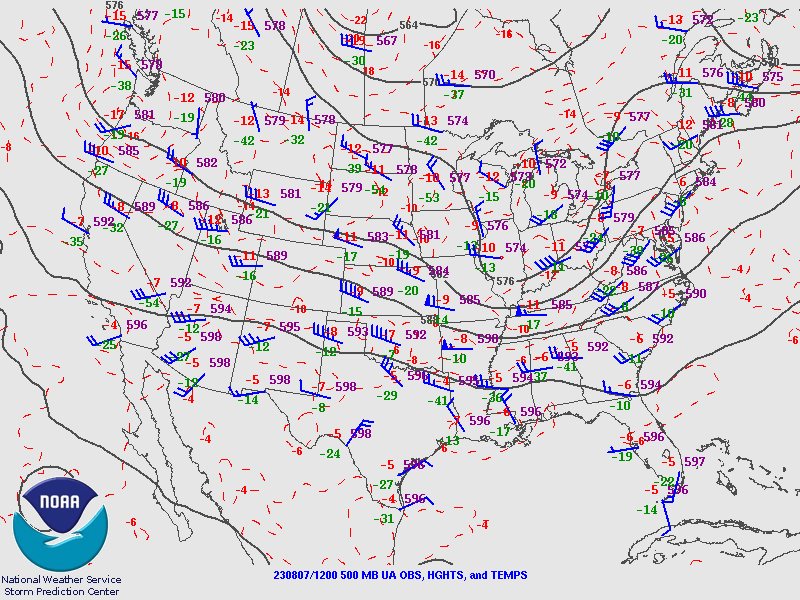 |
| 250MB | 300MB | 500MB |
 |
 |
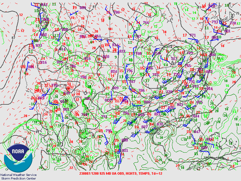 |
| 700MB | 850MB | 925MB |
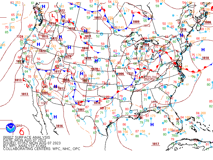
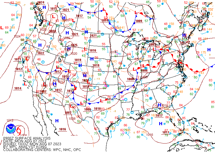
WPC Surface Analysis from .
 |
 |
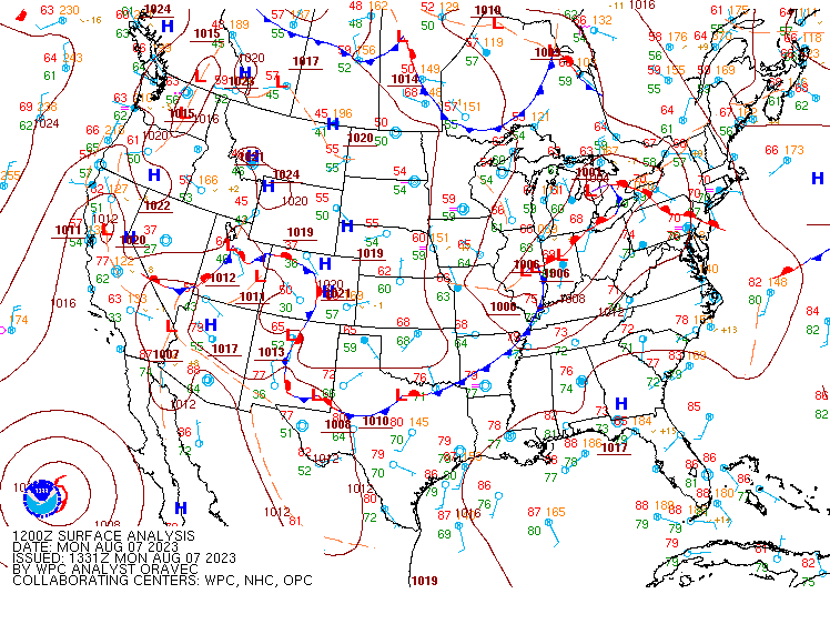 |
| SFC Aug 7th 2023 06Z | SFC Aug 7th 2023 09Z | SFC Aug 7th 2023 12Z |
 |
 |
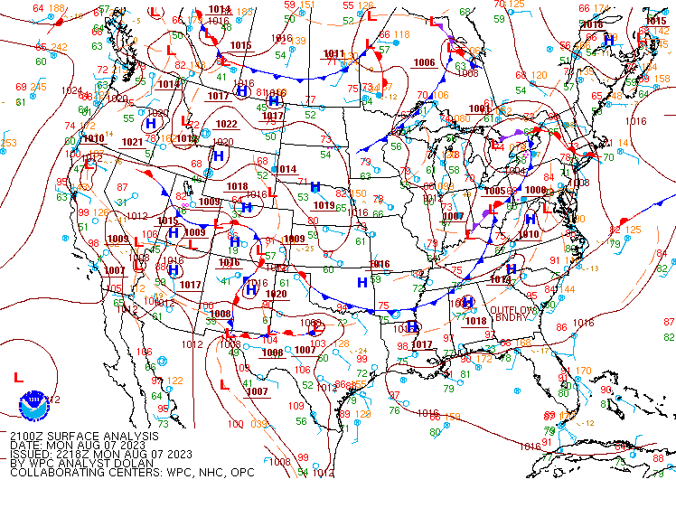 |
| SFC Aug 7th 2023 15Z | SFC Aug 7th 2023 18Z | SFC Aug 7th 2023 21Z |
 |
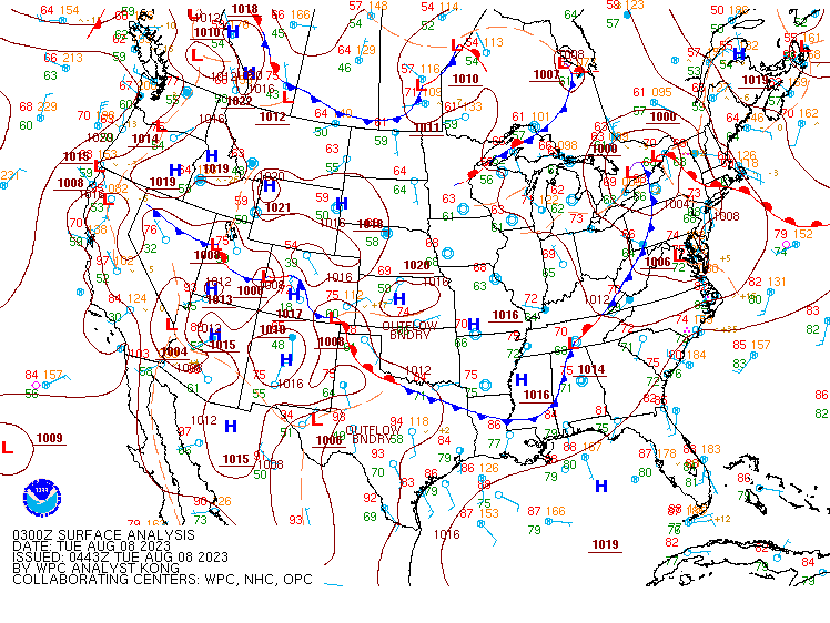 |
| SFC Aug 8th 2023 00Z | SFC Aug 8th 2023 03Z |
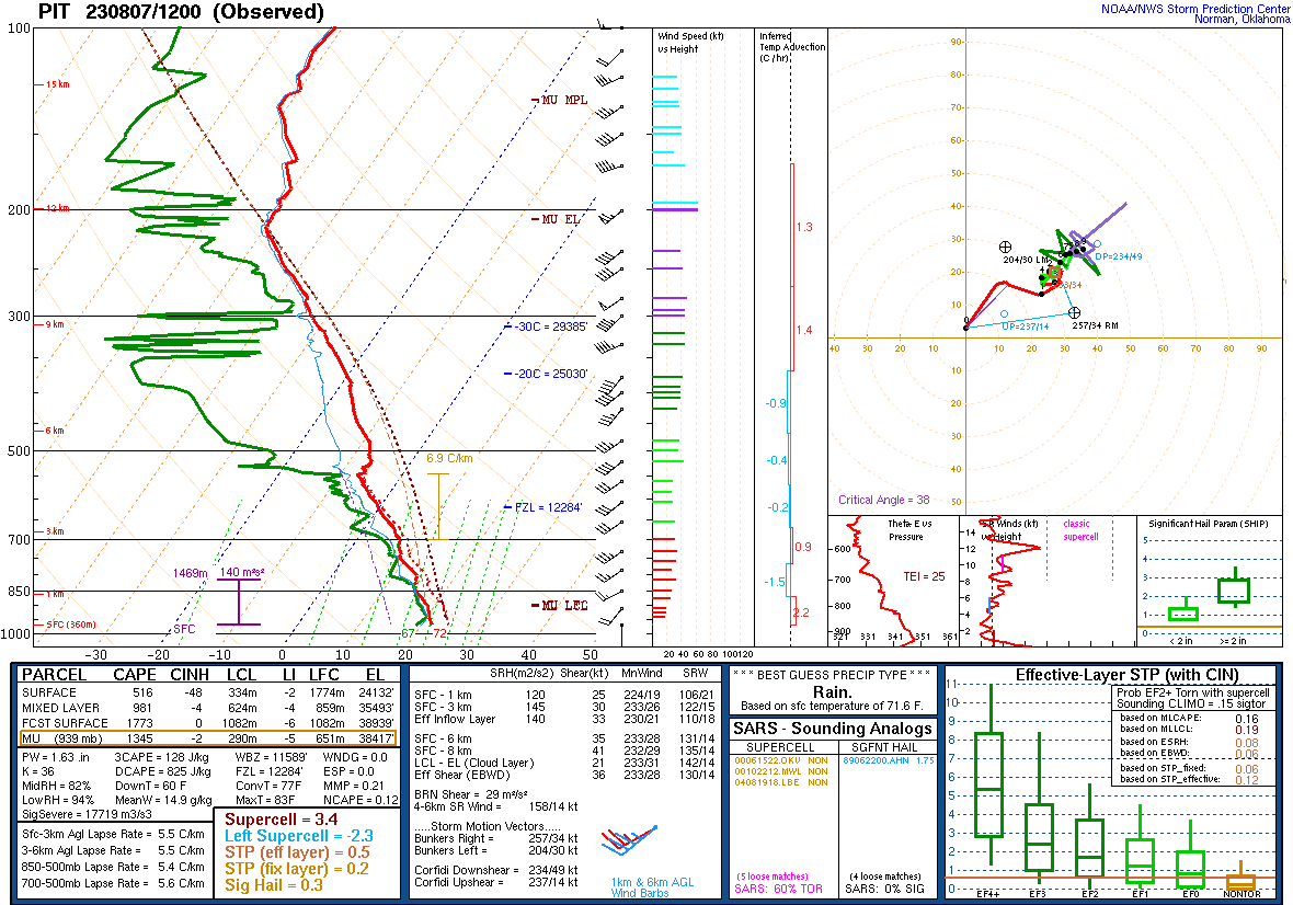
Pittsburgh Soundings.
 |
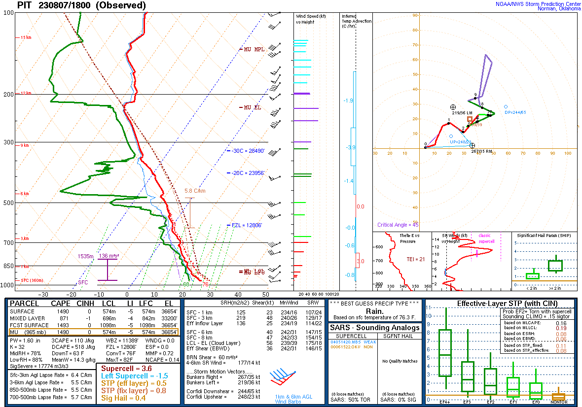 |
| Aug 7th 2023 12Z | Aug 7th 2023 18Z |
 |
Media use of NWS Web News Stories is encouraged! Please acknowledge the NWS as the source of any news information accessed from this site. |
|