Overview
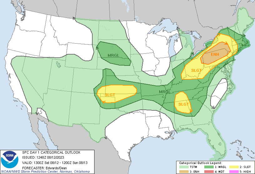
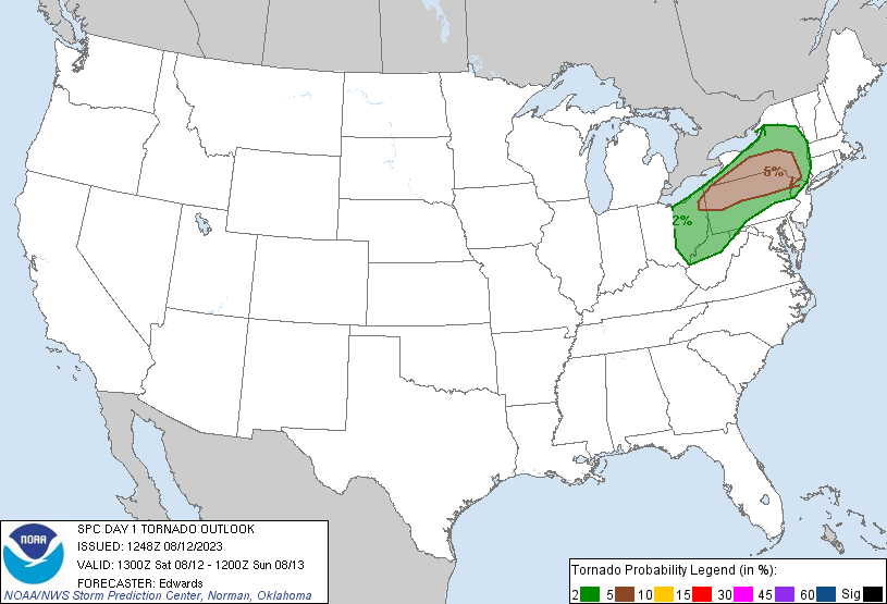
Day 1 Convective Outlook NWS Storm Prediction Center Norman OK 1123 AM CDT Sat Aug 12 2023 Valid 121630Z - 131200Z ...THERE IS AN ENHANCED RISK OF SEVERE THUNDERSTORMS FROM NORTHEAST OHIO INTO THE NORTHERN HALF OF PENNSYLVANIA AND SOUTHERN NEW YORK... ...SUMMARY... The most concentrated area of severe-thunderstorm threats this afternoon extends from northeast Ohio across parts of Pennsylvania and into central New York, with damaging to severe wind expected, along with large hail and a tornado or two possible. ...Southern Great Lakes into the Northeast... Water-vapor imagery this morning shows a mid-level shortwave trough moving across the northern Great Lakes with a belt of stronger flow moving through the southern Great Lakes. Scattered thunderstorms will likely continue to develop through midday into the afternoon with the stronger storms becoming capable of a hail/wind threat. Forecast soundings show some low-level hodograph curvature, especially with northeast extent from northeast OH into PA and NY. Supercells will likely evolve from the stronger updrafts and pose a large to very large hail threat. It is with the supercells from the northern half of PA/northeast OH into southern NY where a tornado risk will seemingly focus this afternoon. As a surface cold front pushes east, additional storms are possible along the front and some of these will probably have an attendant hail/wind risk before weakening this evening. |
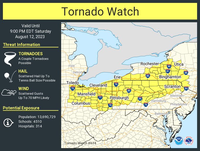 August 12th 2023 Tornado Watch |
Tornadoes
|
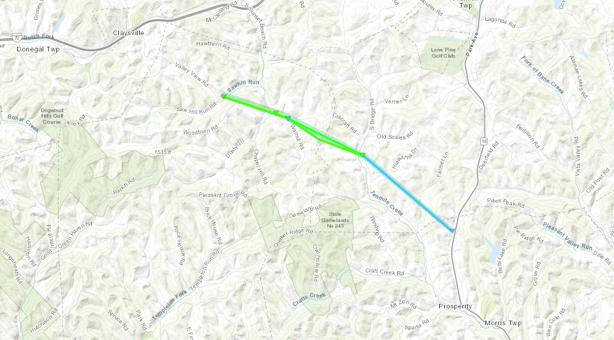
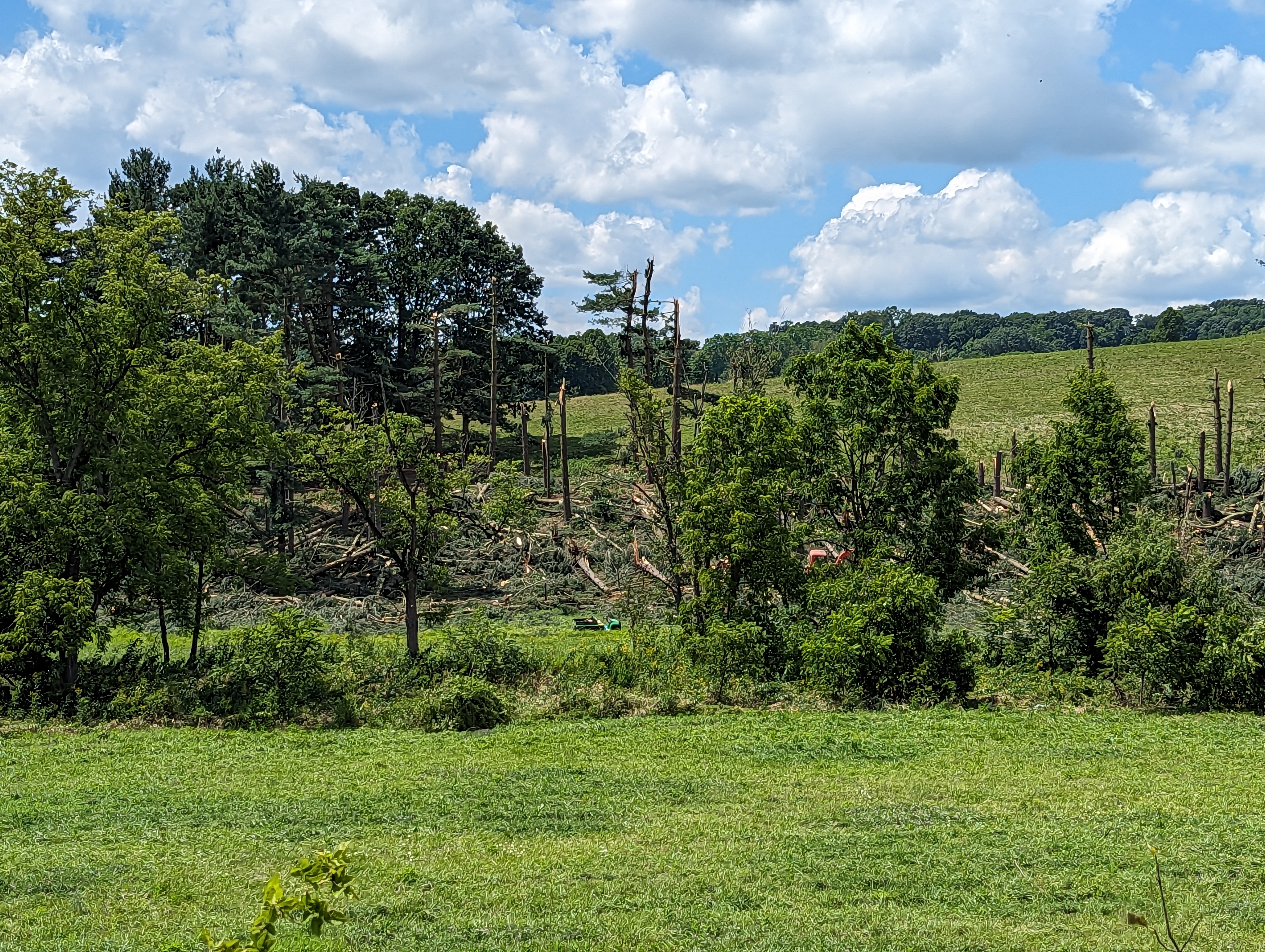
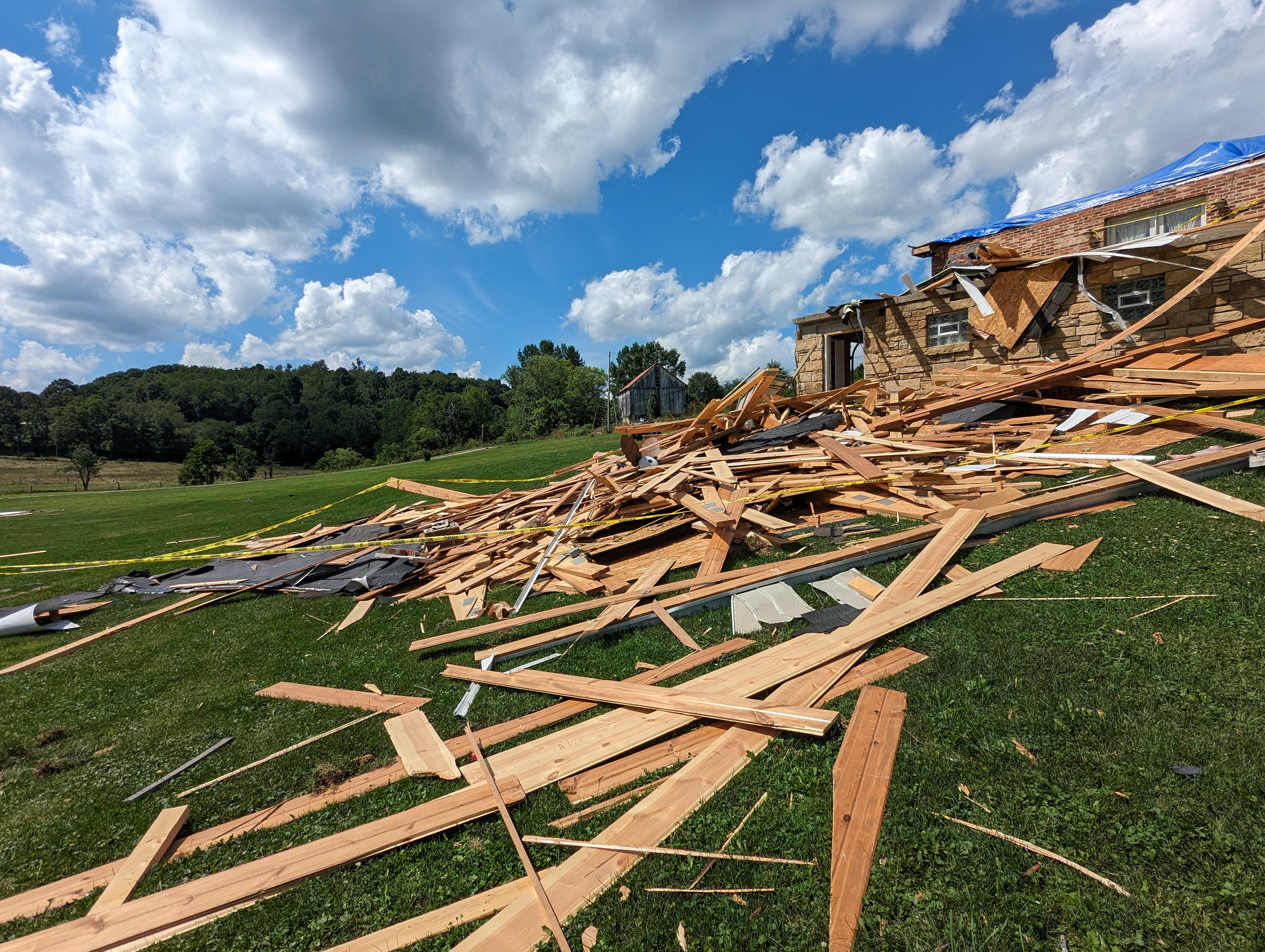
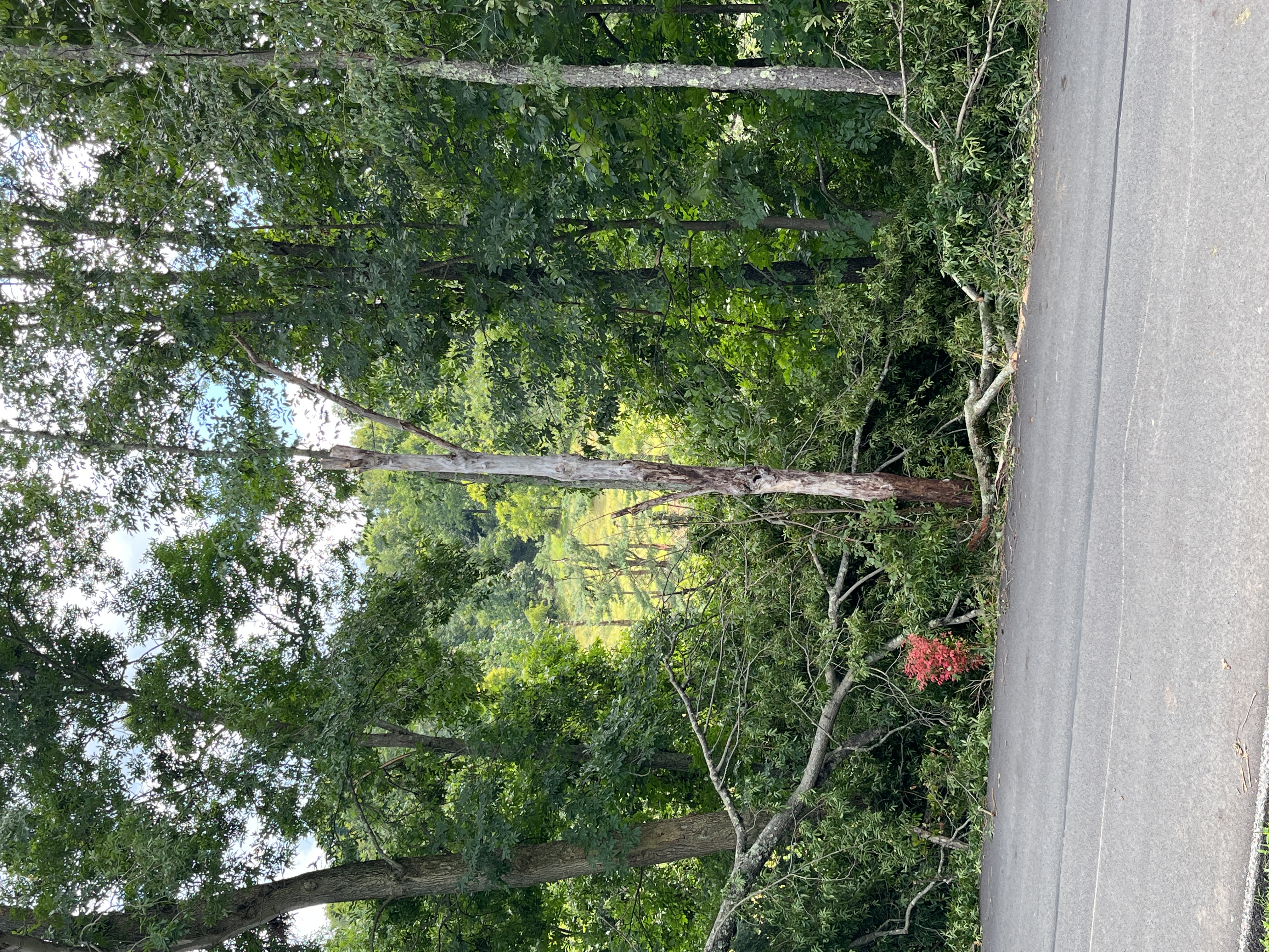
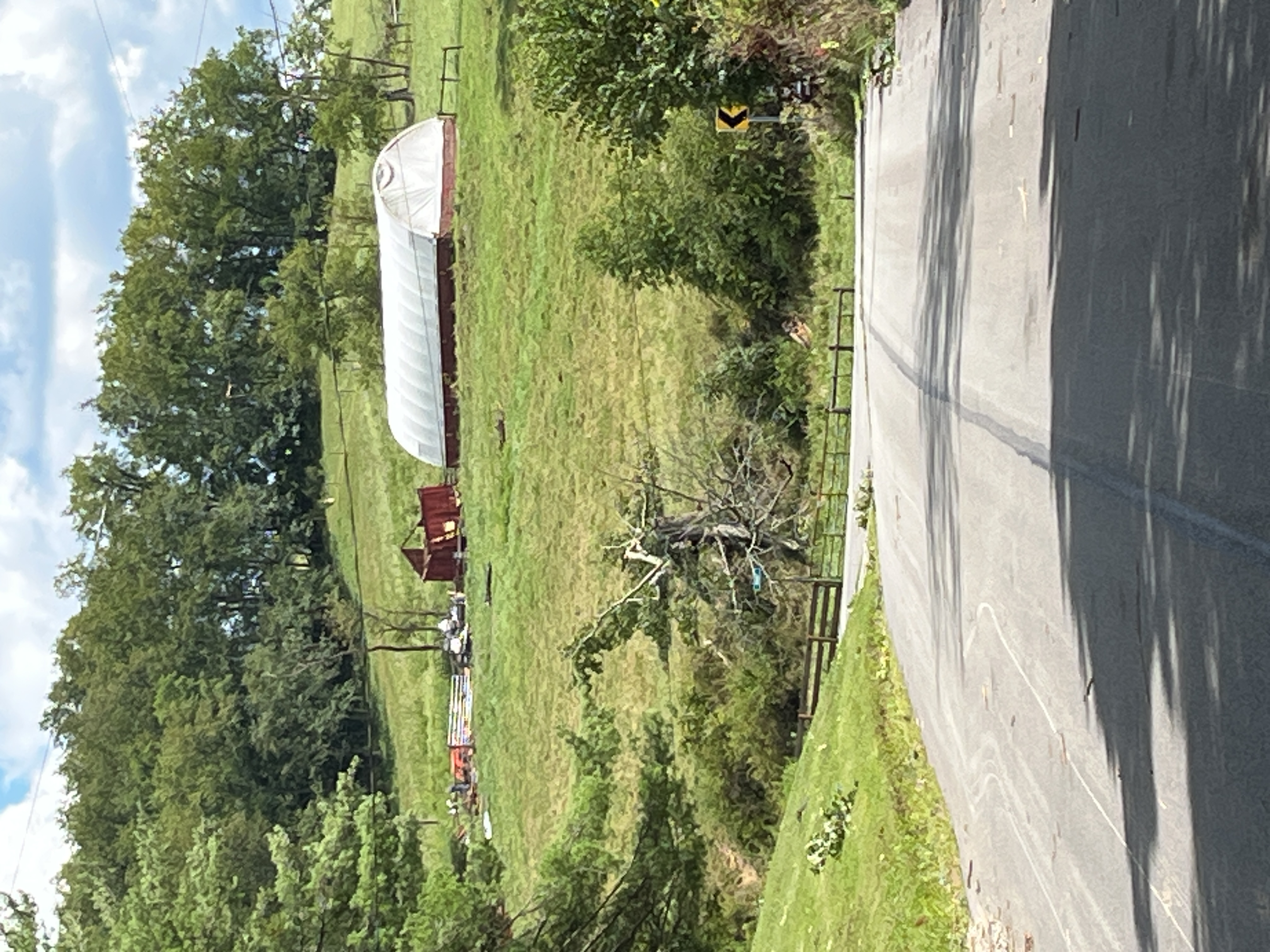
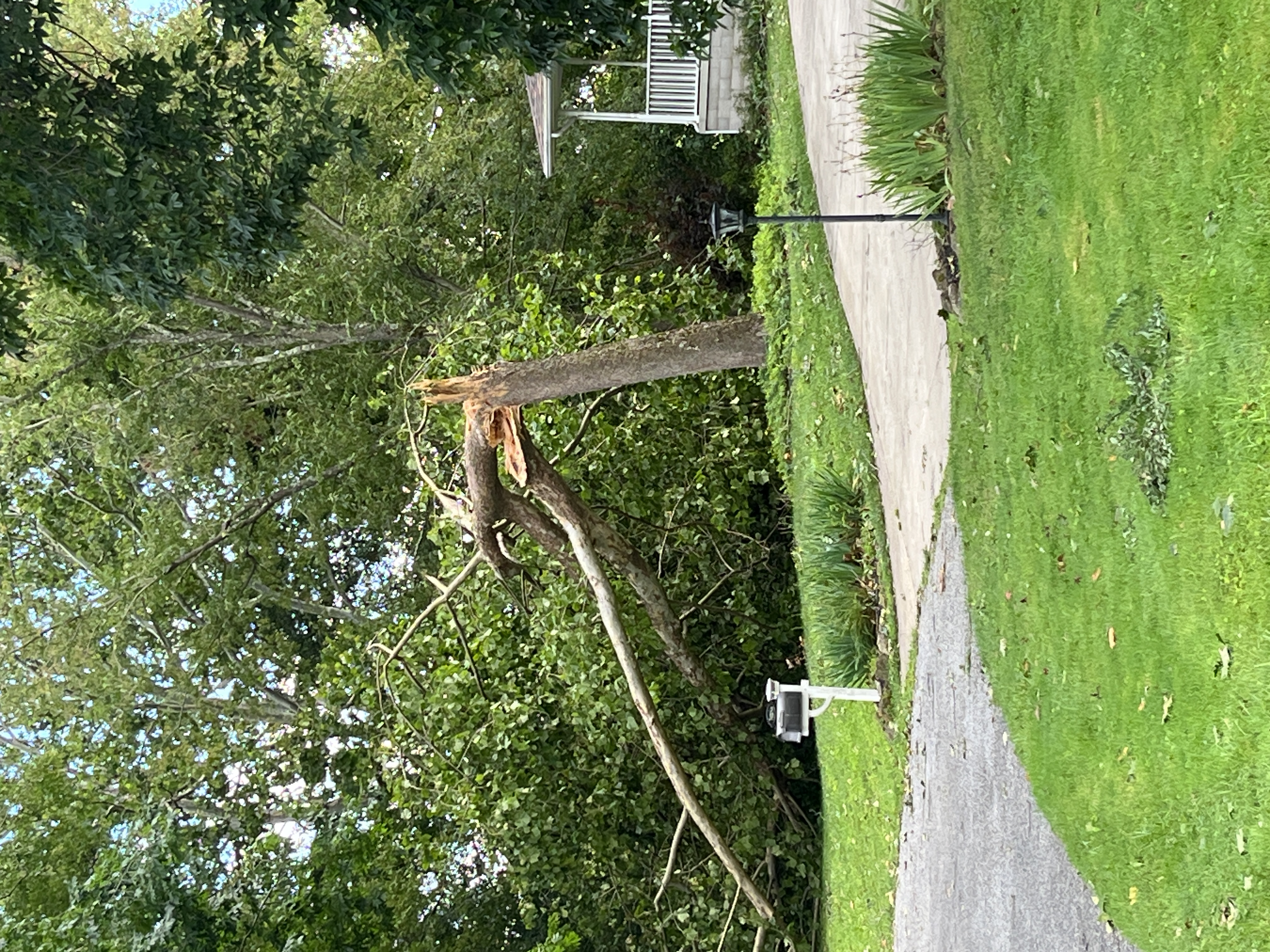
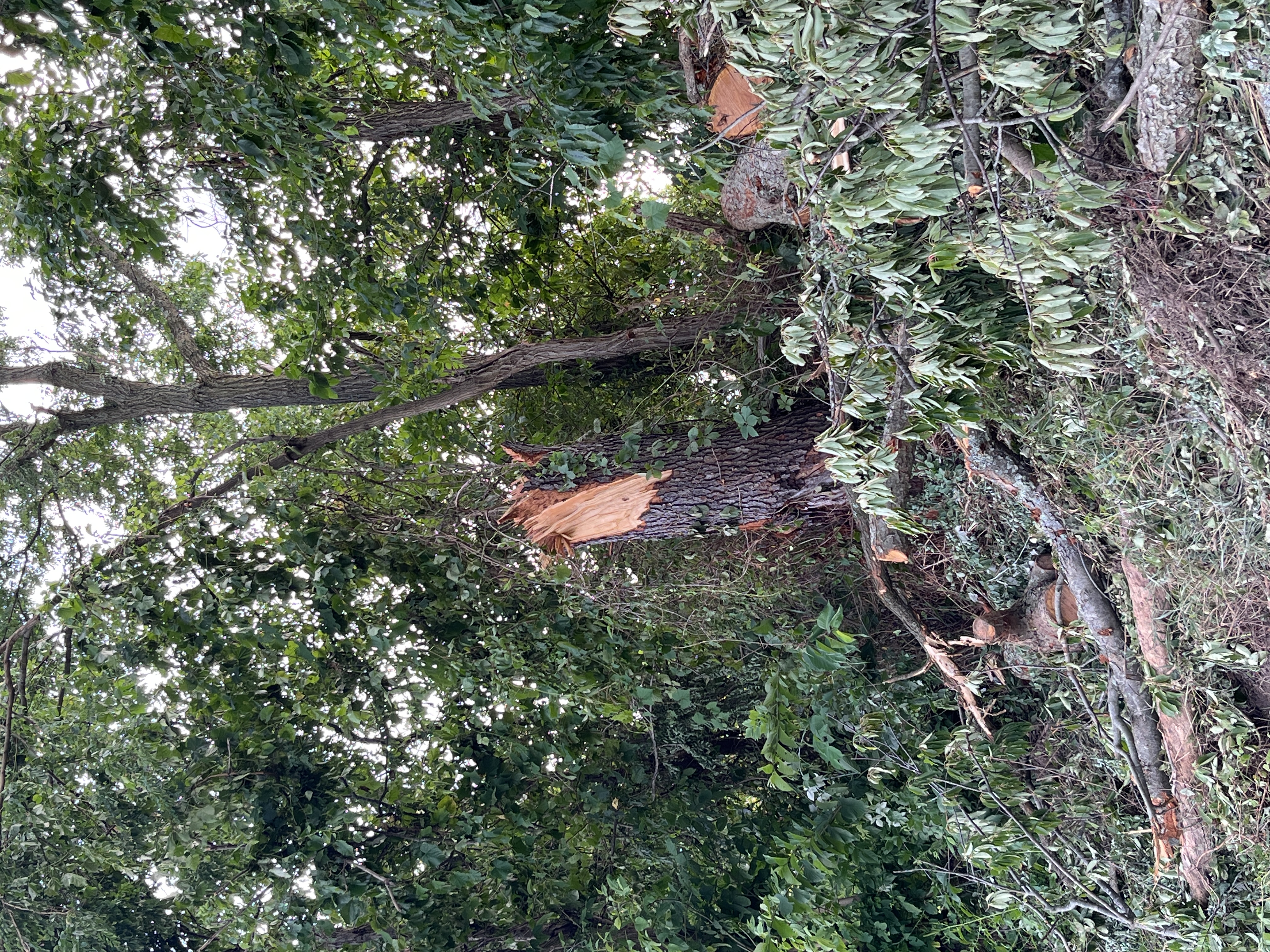
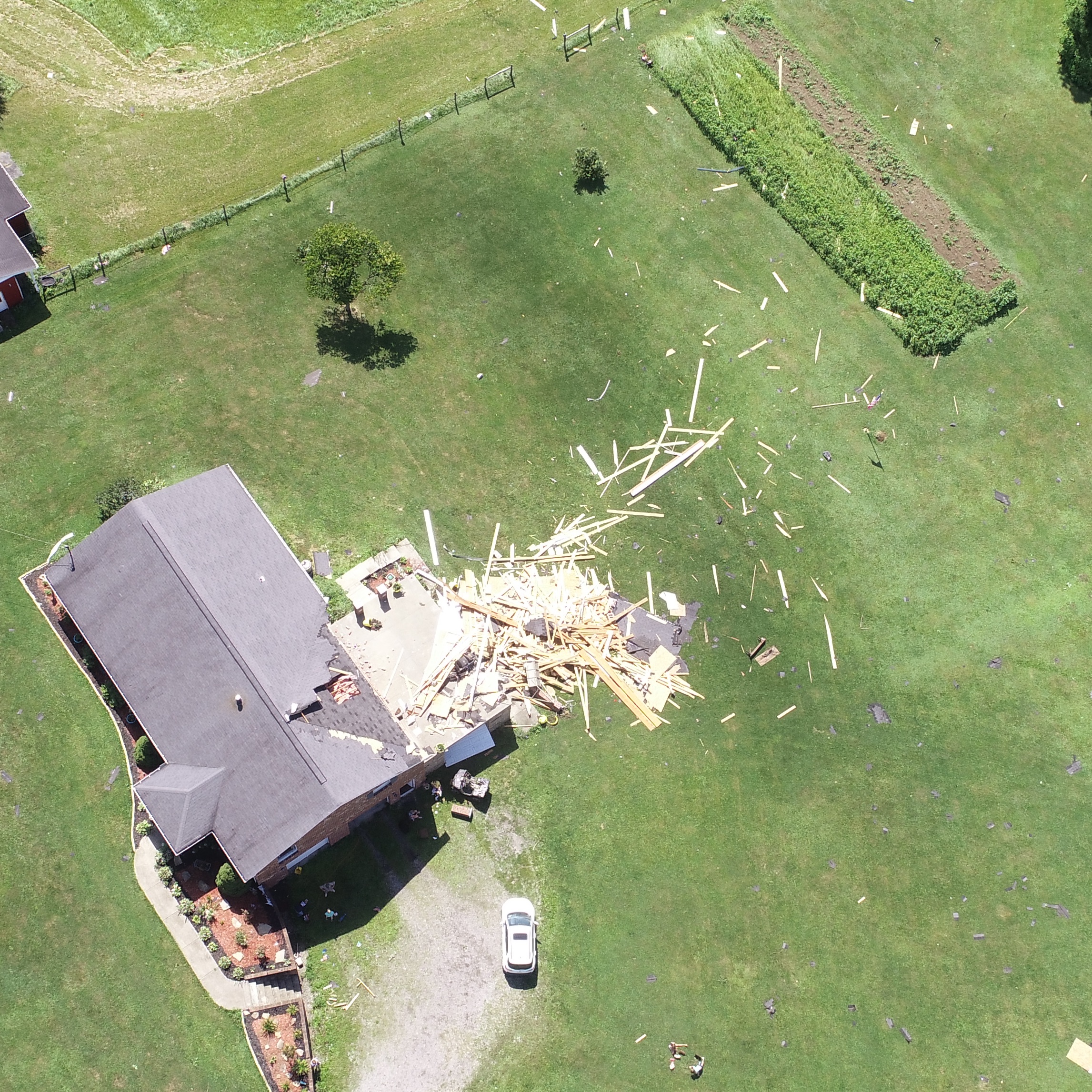
Tornado - 1 N Pleasant Grove
Track Map
|
||||||||||||||||
|
||||||||||||||||
|
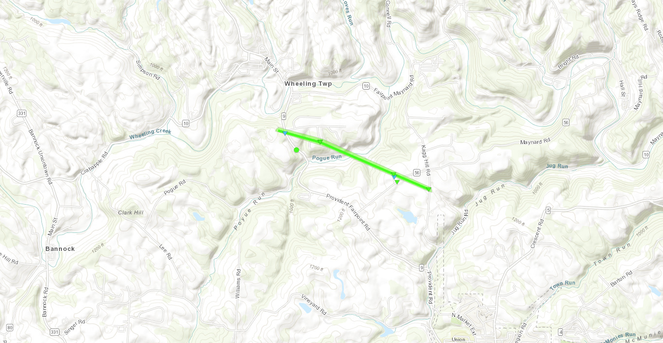
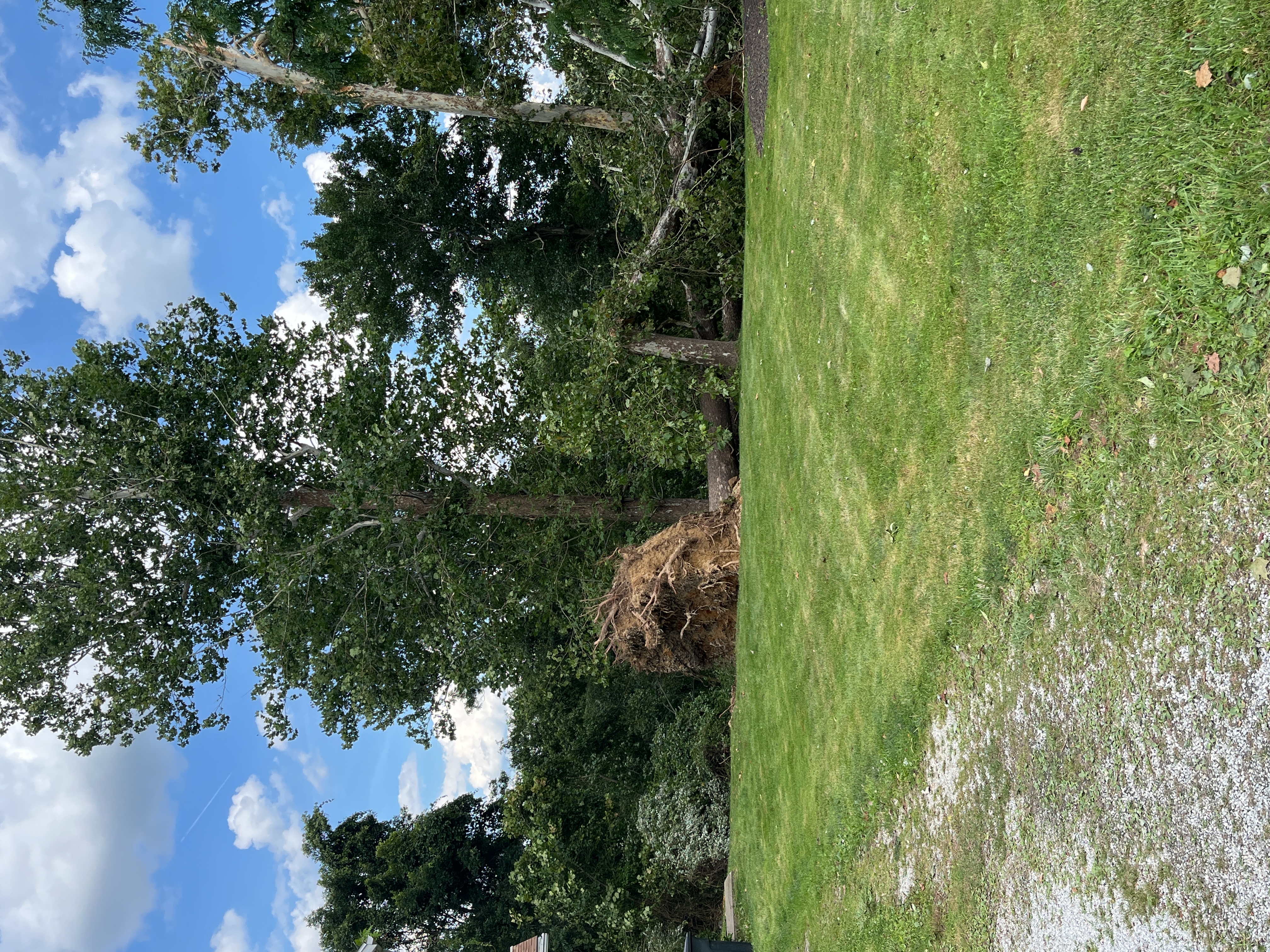
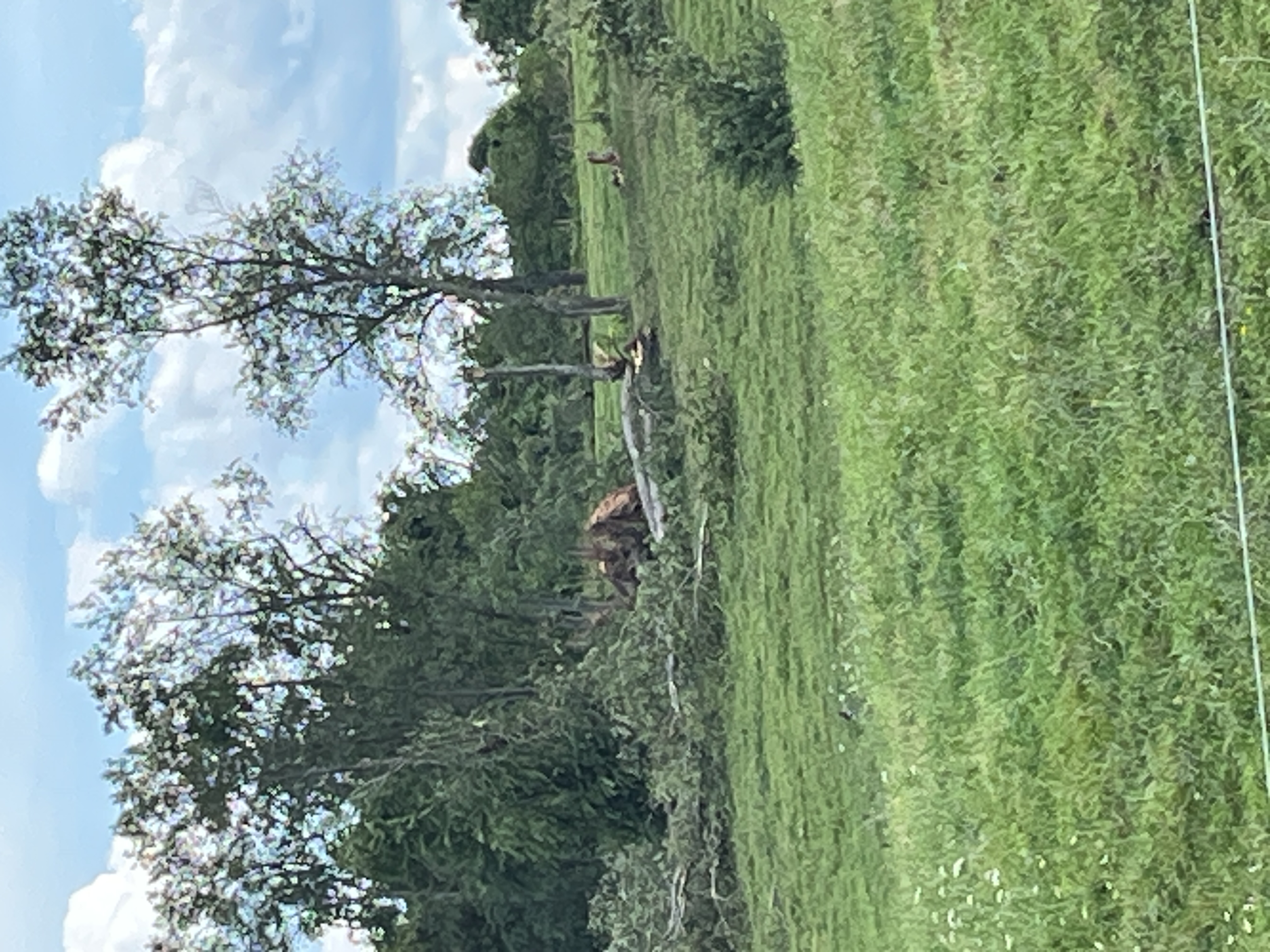
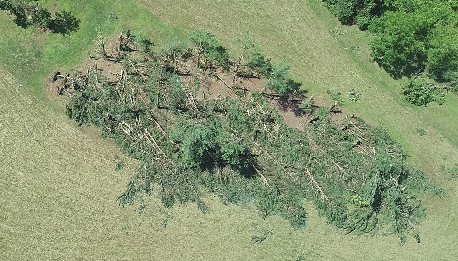
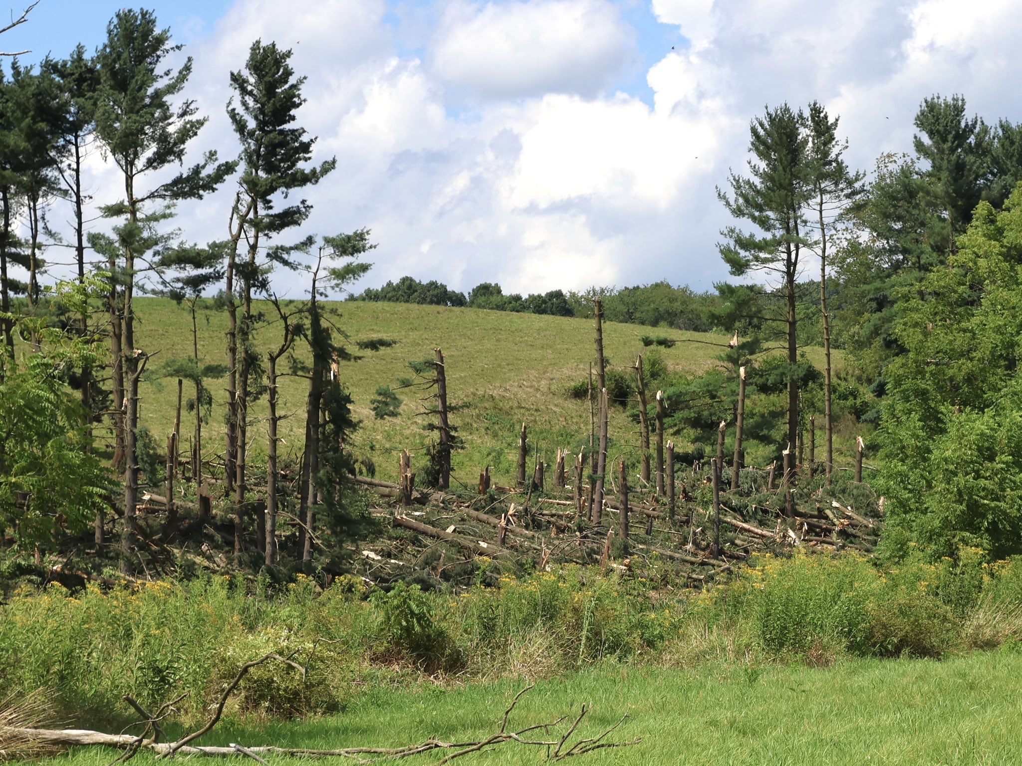
Tornado - 3 NW Saint Clairsville
Track Map
|
||||||||||||||||
 |
 |
 |
 |
| Credit: Bookbinder/McMullen | Credit: Bookbinder/McMullen | Credit: Bookbinder/McMullen | Credit: Bookbinder/McMullen |
The Enhanced Fujita (EF) Scale classifies tornadoes into the following categories:
| EF0 Weak 65-85 mph |
EF1 Moderate 86-110 mph |
EF2 Significant 111-135 mph |
EF3 Severe 136-165 mph |
EF4 Extreme 166-200 mph |
EF5 Catastrophic 200+ mph |
 |
|||||
Wind & Hail:

Wind
| WFO | Report Time | County | Location | State | Event Type | Magnitude | |
|---|---|---|---|---|---|---|---|
| PBZ | 8/12 8:57 AM | Washington | 3 WNW Fredericktown-Mil | PA | TSTM WND DMG | ||
| PBZ | 8/12 3:40 PM | Venango | Dempseytown | PA | TSTM WND DMG | ||
| PBZ | 8/12 3:58 PM | Venango | 1 SW Cherrytree | PA | TSTM WND DMG | ||
| PBZ | 8/12 4:23 PM | Jefferson | 1 E Foxburg | PA | TSTM WND DMG | ||
| PBZ | 8/12 4:30 PM | Tuscarawas | 1 WNW Schoenbrunn | OH | TSTM WND DMG | ||
| PBZ | 8/12 4:42 PM | Tuscarawas | 1 NE Dover | OH | TSTM WND DMG | ||
| PBZ | 8/12 4:45 PM | Tuscarawas | 1 W Roswell | OH | TSTM WND DMG | ||
| PBZ | 8/12 5:02 PM | Carroll | 1 SSW Sherrodsville | OH | TSTM WND DMG | ||
| PBZ | 8/12 5:03 PM | Carroll | 1 SW Sherrodsville | OH | TSTM WND DMG | ||
| PBZ | 8/12 5:04 PM | Carroll | 1 NW Leesville | OH | TSTM WND DMG | ||
| PBZ | 8/12 5:07 PM | Carroll | Leesville | OH | TSTM WND DMG | ||
| PBZ | 8/12 5:12 PM | Carroll | 5 NE Bowerston | OH | TSTM WND DMG | ||
| PBZ | 8/12 5:24 PM | Harrison | 1 SSE Scio | OH | TSTM WND DMG | ||
| PBZ | 8/12 5:30 PM | Lawrence | 3 SW Portersville | PA | TSTM WND DMG | ||
| PBZ | 8/12 5:40 PM | Mercer | Jackson Center | PA | TSTM WND DMG | ||
| PBZ | 8/12 5:44 PM | Mercer | Sharon | PA | TSTM WND DMG | ||
| PBZ | 8/12 6:15 PM | Allegheny | 3 W Curtisville | PA | TSTM WND DMG | ||
| PBZ | 8/12 6:16 PM | Allegheny | 1 ENE Bakerstown Statio | PA | TSTM WND DMG | ||
| PBZ | 8/12 6:42 PM | Allegheny | 1 ENE Bairdford | PA | TSTM WND DMG | ||
| PBZ | 8/12 6:50 PM | Tuscarawas | Sugarcreek | OH | TSTM WND DMG | ||
| PBZ | 8/12 6:52 PM | Washington | 1 WNW Hickory | PA | TSTM WND DMG | ||
| PBZ | 8/12 6:56 PM | Westmoreland | 1 ESE North Washington | PA | TSTM WND DMG | ||
| PBZ | 8/12 6:57 PM | Tuscarawas | 4 ESE Sugarcreek | OH | TSTM WND DMG | ||
| PBZ | 8/12 6:59 PM | Armstrong | Brownstown | PA | TSTM WND DMG | ||
| PBZ | 8/12 7:00 PM | Westmoreland | 1 E North Washington | PA | TSTM WND DMG | ||
| PBZ | 8/12 7:01 PM | Westmoreland | 1 SSE Salina | PA | TSTM WND DMG | ||
| PBZ | 8/12 7:03 PM | Tuscarawas | 2 S Stone Creek | OH | TSTM WND DMG | ||
| PBZ | 8/12 7:04 PM | Tuscarawas | 1 S Stone Creek | OH | TSTM WND DMG | ||
| PBZ | 8/12 7:05 PM | Tuscarawas | 2 SE Stone Creek | OH | TSTM WND DMG | ||
| PBZ | 8/12 7:05 PM | Tuscarawas | 3 NE Stone Creek | OH | TSTM WND DMG | ||
| PBZ | 8/12 7:09 PM | Tuscarawas | 1 S South Side | OH | TSTM WND DMG | ||
| PBZ | 8/12 7:10 PM | Tuscarawas | 2 E Port Washington | OH | TSTM WND DMG | ||
| PBZ | 8/12 7:41 PM | Brooke | Bethany | WV | TSTM WND DMG | ||
| PBZ | 8/12 7:46 PM | Indiana | 1 N Boltz | PA | TSTM WND DMG | ||
| PBZ | 8/12 7:58 PM | Washington | 2 WNW Rural Valley | PA | TSTM WND DMG | ||
| PBZ | 8/12 8:01 PM | Belmont | Stewartsville | OH | TSTM WND DMG | ||
| PBZ | 8/12 8:03 PM | Belmont | 1 NW Highland Terrace | OH | TSTM WND DMG | ||
| PBZ | 8/12 8:03 PM | Belmont | Fairpoint | OH | TSTM WND DMG | ||
| PBZ | 8/12 8:06 PM | Belmont | Highland Terrace | OH | TSTM WND DMG | ||
| PBZ | 8/12 8:06 PM | Belmont | St. Clairsville | OH | TSTM WND DMG | ||
| PBZ | 8/12 8:10 PM | Belmont | 1 NNE Claremont | OH | TSTM WND DMG | ||
| PBZ | 8/12 8:11 PM | Noble | 2 WNW Middleburg | OH | TSTM WND DMG | ||
| PBZ | 8/12 8:32 PM | Allegheny | 2 NW Sturgeon | PA | TSTM WND DMG | ||
| PBZ | 8/12 8:34 PM | Indiana | 1 N Manor | PA | TSTM WND DMG | ||
| PBZ | 8/12 8:35 PM | Washington | 1 WSW Lone Pine | PA | TSTM WND DMG | ||
| PBZ | 8/12 8:40 PM | Westmoreland | Mount Pleasant | PA | TSTM WND DMG | ||
| PBZ | 8/12 8:40 PM | Washington | 2 NE Amity | PA | TSTM WND DMG | ||
| PBZ | 8/12 8:48 PM | Washington | 6 WSW Ellsworth | PA | TSTM WND DMG | ||
| PBZ | 8/12 8:52 PM | Greene | Wind Ridge | PA | TSTM WND DMG | ||
| PBZ | 8/12 8:57 PM | Wetzel | Pine Grove | WV | TSTM WND DMG | ||
| PBZ | 8/12 8:59 PM | Wetzel | Reader | WV | TSTM WND DMG | ||
| PBZ | 8/12 9:00 PM | Washington | Deemston | PA | TSTM WND DMG | ||
| PBZ | 8/12 9:03 PM | Washington | 2 WNW Fredericktown-Mil | PA | TSTM WND DMG | ||
| PBZ | 8/12 9:03 PM | Washington | 1 NNW Sandy Plains | PA | TSTM WND DMG | ||
| PBZ | 8/12 9:04 PM | Washington | 1 NNW Fredericktown-Mil | PA | TSTM WND DMG | ||
| PBZ | 8/12 9:10 PM | Greene | Rices Landing | PA | TSTM WND DMG | ||
| PBZ | 8/12 9:14 PM | Monongalia | Blacksville | WV | TSTM WND DMG | ||
| PBZ | 8/12 9:16 PM | Greene | Carmichaels | PA | TSTM WND DMG | ||
| PBZ | 8/12 9:21 PM | Fayette | Church Hill | PA | TSTM WND DMG | ||
| PBZ | 8/12 9:24 PM | Fayette | 3 WNW Leith-Hatfield | PA | TSTM WND DMG | ||
| PBZ | 8/12 9:26 PM | Fayette | Continental Number 2 | PA | TSTM WND DMG | ||
| PBZ | 8/12 9:26 PM | Greene | Greensboro | PA | TSTM WND DMG | ||
| PBZ | 8/12 9:28 PM | Fayette | Uniontown | PA | TSTM WND DMG | ||
| PBZ | 8/12 9:28 PM | Fayette | 1 ENE Smithfield | PA | TSTM WND DMG | ||
| PBZ | 8/12 9:28 PM | Fayette | Hatfield | PA | TSTM WND DMG | ||
| PBZ | 8/12 9:28 PM | Monongalia | Cassville | WV | TSTM WND DMG | ||
| PBZ | 8/12 9:30 PM | Fayette | Fairchance | PA | TSTM WND DMG | ||
| PBZ | 8/12 9:30 PM | Monongalia | Daybrook | WV | TSTM WND DMG | ||
| PBZ | 8/12 9:32 PM | Greene | Dilliner | PA | TSTM WND DMG | ||
| PBZ | 8/12 9:37 PM | Monongalia | Morgantown | WV | TSTM WND DMG | ||
| PBZ | 8/12 9:37 PM | Marion | 1 SE Festus | WV | TSTM WND DMG | ||
| PBZ | 8/12 9:40 PM | Marion | 1 SSE Everson | WV | TSTM WND DMG | ||
| PBZ | 8/12 9:41 PM | Marion | Norway | WV | TSTM WND DMG | ||
| PBZ | 8/12 9:44 PM | Monongalia | 1 E Little Falls | WV | TSTM WND DMG | ||
| PBZ | 8/12 10:10 PM | Preston | Kingwood | WV | TSTM WND DMG | ||
| PBZ | 8/12 10:14 PM | Preston | Newburg | WV | TSTM WND DMG | ||
| PBZ | 8/12 10:23 PM | Preston | Rowlesburg | WV | TSTM WND DMG |
 |
 |
 |
 |
|
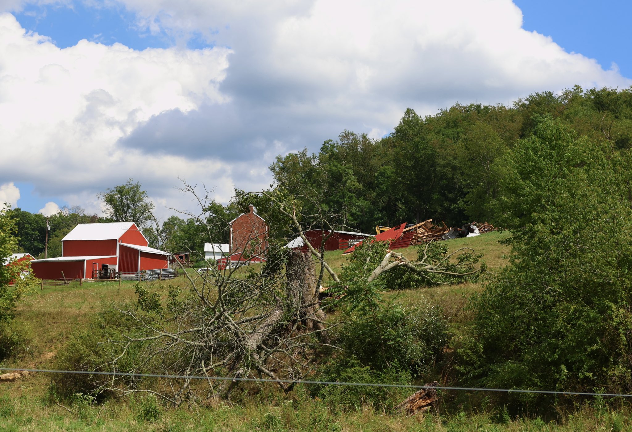
Wind Damage in Claysville, PA Credit: Nick Wilkes |
Wind Damage in Claysville, PA Credit: Nick Wilkes |
Wind Damage in Fairpoint, OH Credit: Nelson Tucker |
Wind Damage in Fairpoint, OH Credit: Nelson Tucker |
Hail
| WFO | Report Time | County | Location | State | Event Type | Magnitude | |
|---|---|---|---|---|---|---|---|
| PBZ | 8/12 3:46 PM | Venango | 5 E Cooperstown | PA | HAIL | 1 | |
| PBZ | 8/12 3:48 PM | Venango | Kaneville | PA | HAIL | 1 | |
| PBZ | 8/12 4:01 PM | Venango | 2 NNW Rouseville | PA | HAIL | 1 | |
| PBZ | 8/12 4:28 PM | Tuscarawas | 1 W Dover | OH | HAIL | 1 | |
| PBZ | 8/12 4:58 PM | Carroll | Sherrodsville | OH | HAIL | 1.75 | |
| PBZ | 8/12 5:05 PM | Carroll | 1 SE Hazelton | OH | HAIL | 1.25 | |
| PBZ | 8/12 5:50 PM | Jefferson | 2 W Brentwood | OH | HAIL | 1 | |
| PBZ | 8/12 6:33 PM | Allegheny | Springdale | PA | HAIL | 1 | |
| PBZ | 8/12 6:45 PM | Westmoreland | 1 NW Alcoa Center | PA | HAIL | 1.25 | |
| PBZ | 8/12 6:48 PM | Westmoreland | 3 W North Washington | PA | HAIL | 1.25 | |
| PBZ | 8/12 6:48 PM | Washington | 3 NW Hickory | PA | HAIL | 1 | |
| PBZ | 8/12 6:55 PM | Westmoreland | 1 NW North Washington | PA | HAIL | 1 | |
| PBZ | 8/12 6:55 PM | Westmoreland | 1 E North Washington | PA | HAIL | 1 | |
| PBZ | 8/12 6:56 PM | Westmoreland | 1 ESE North Washington | PA | HAIL | 1 | |
| PBZ | 8/12 7:01 PM | Westmoreland | 1 W Salina | PA | HAIL | 0.88 | |
| PBZ | 8/12 7:41 PM | Brooke | 1 SW Bethany | WV | HAIL | 1.75 | |
| PBZ | 8/12 8:00 PM | Washington | 3 NW Claysville | PA | HAIL | 1.25 | |
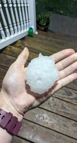
| PBZ | 8/12 8:08 PM | Washington | 1 N Claysville | PA | HAIL | 2.5 | |
| PBZ | 8/12 8:08 PM | Washington | 1 SSE Taylorstown | PA | HAIL | 2 | |
| PBZ | 8/12 8:10 PM | Washington | 1 N Washington | PA | HAIL | 0.75 | |
| PBZ | 8/12 8:12 PM | Washington | 2 ESE Claysville | PA | HAIL | 2 | |
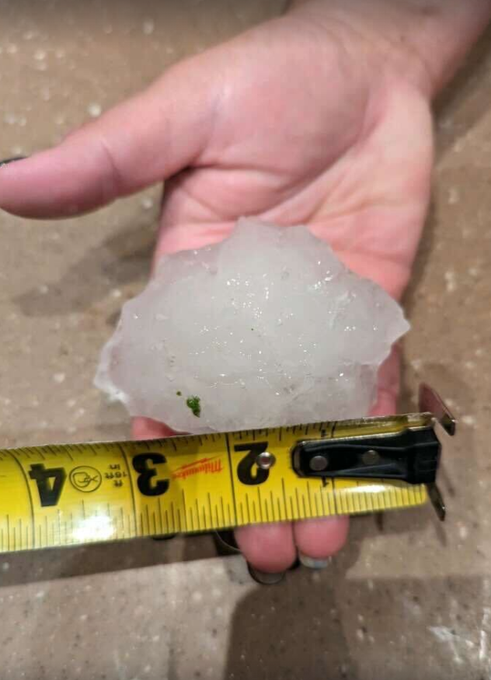
| PBZ | 8/12 8:14 PM | Washington | 2 ESE Claysville | PA | HAIL | 3 | |
| PBZ | 8/12 8:15 PM | Washington | 1 WNW Green Hills | PA | HAIL | 1.25 | |
| PBZ | 8/12 8:18 PM | Washington | 1 NNE Lagonda | PA | HAIL | 1.75 |
 |
 |
|
Large Hail in Claysville, PA Credit: Lance |
Large Hail in Linden, PA Credit: NWS Pittsburgh |
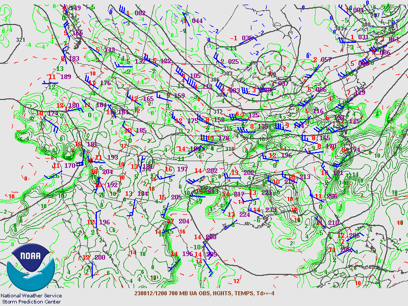
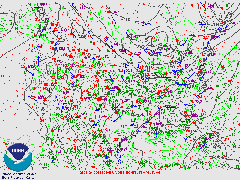
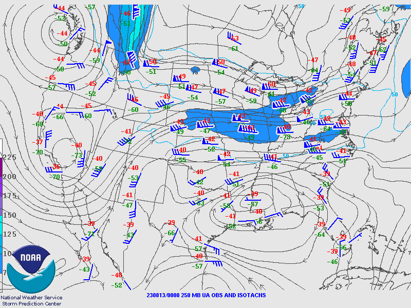
Environment
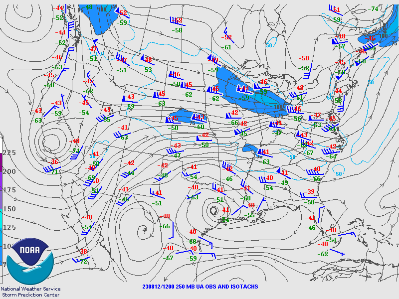
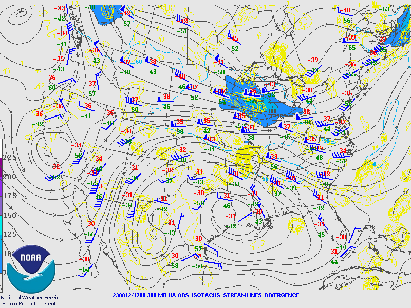
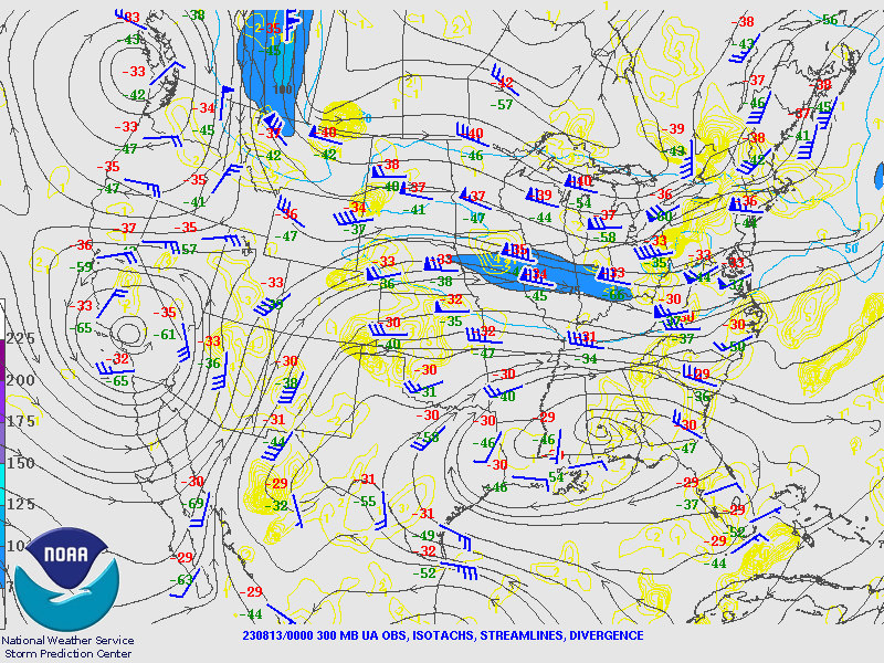
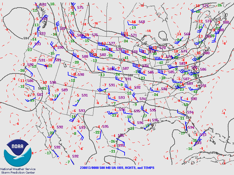
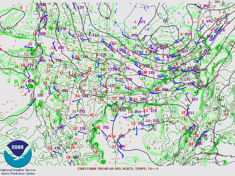
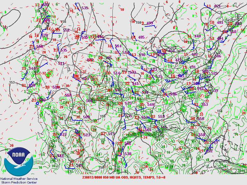
SPC Upper Air Maps 12Z
 |
 |
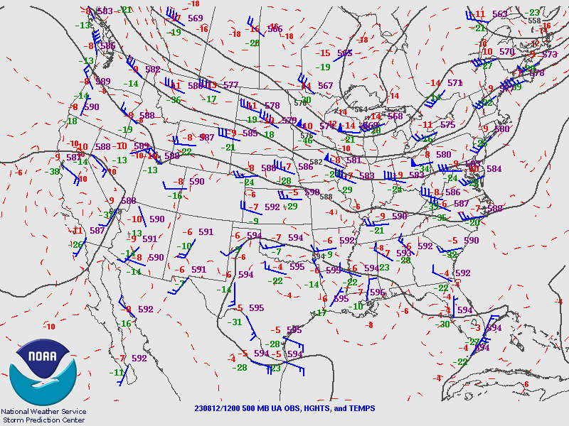 |
| 250MB | 300MB | 500MB |
 |
 |
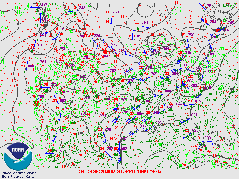 |
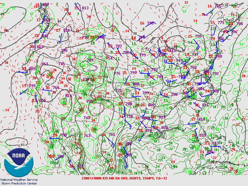
| 700MB | 850MB | 925MB |
SPC Upper Air Maps 00Z
 |
 |
 |
| 250MB | 300MB | 500MB |
 |
 |
 |
| 700MB | 850MB | 925MB |
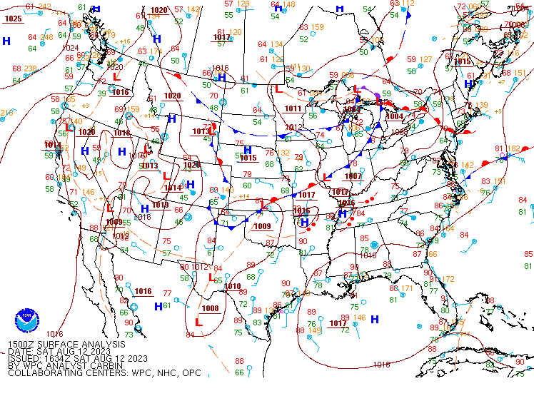
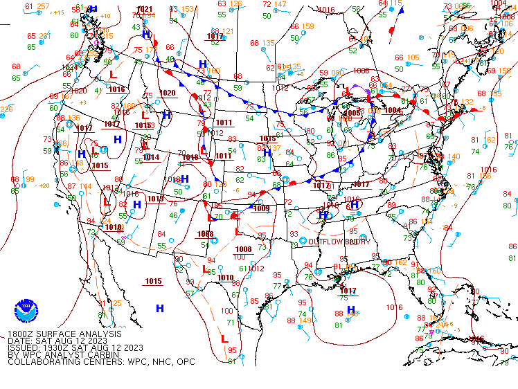
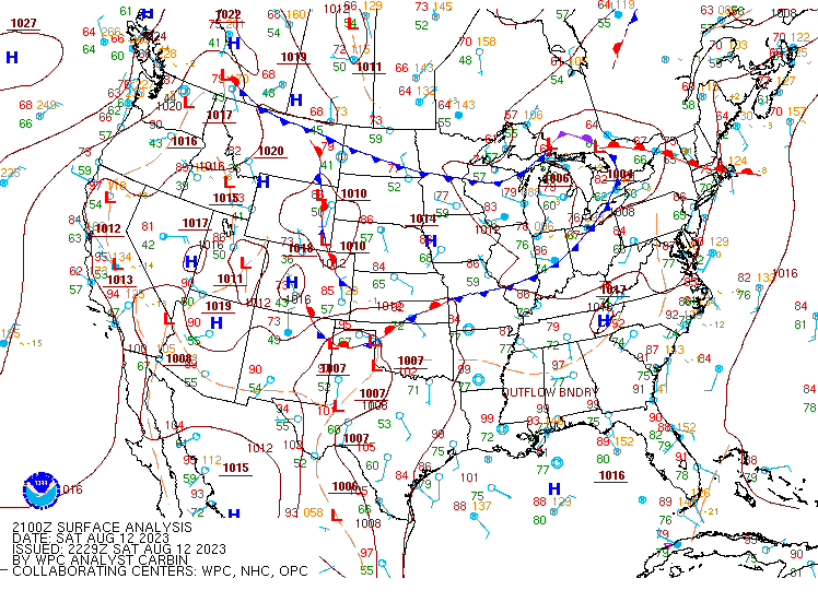
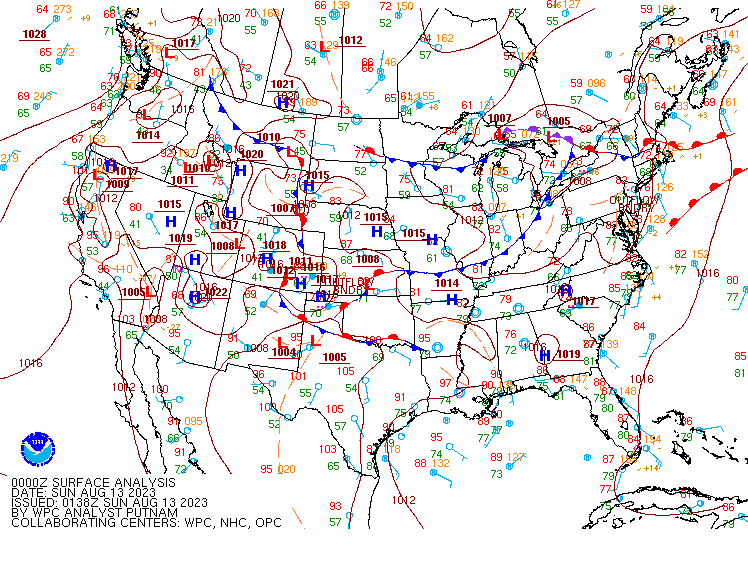
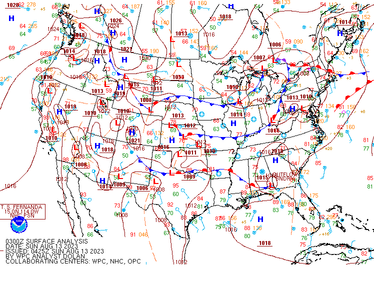
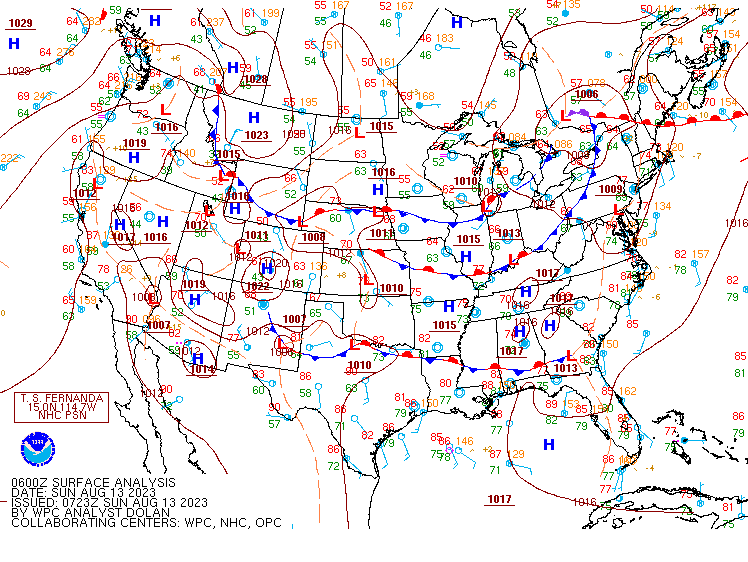
WPC Surface Analysis.
 |
 |
 |
| Figure 4: Caption | Figure 5: Caption | Figure 6: Caption |
 |
 |
 |
| Figure 1: Caption | Figure 2: Caption | Figure 3: Caption |
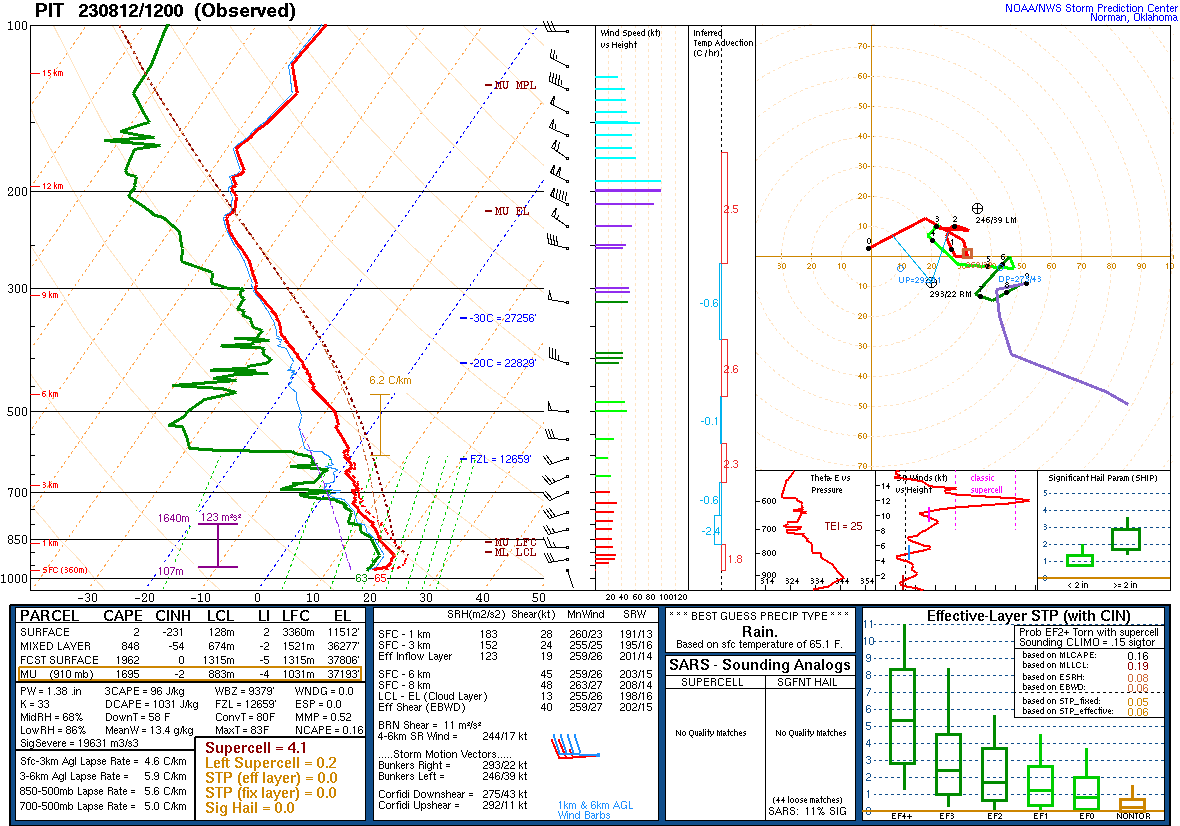
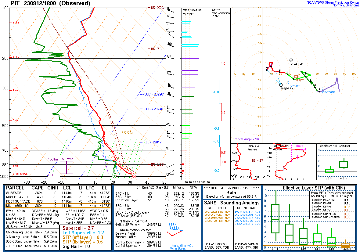
Pittsburgh Soundings from Aug 12th 2023.
 |
 |
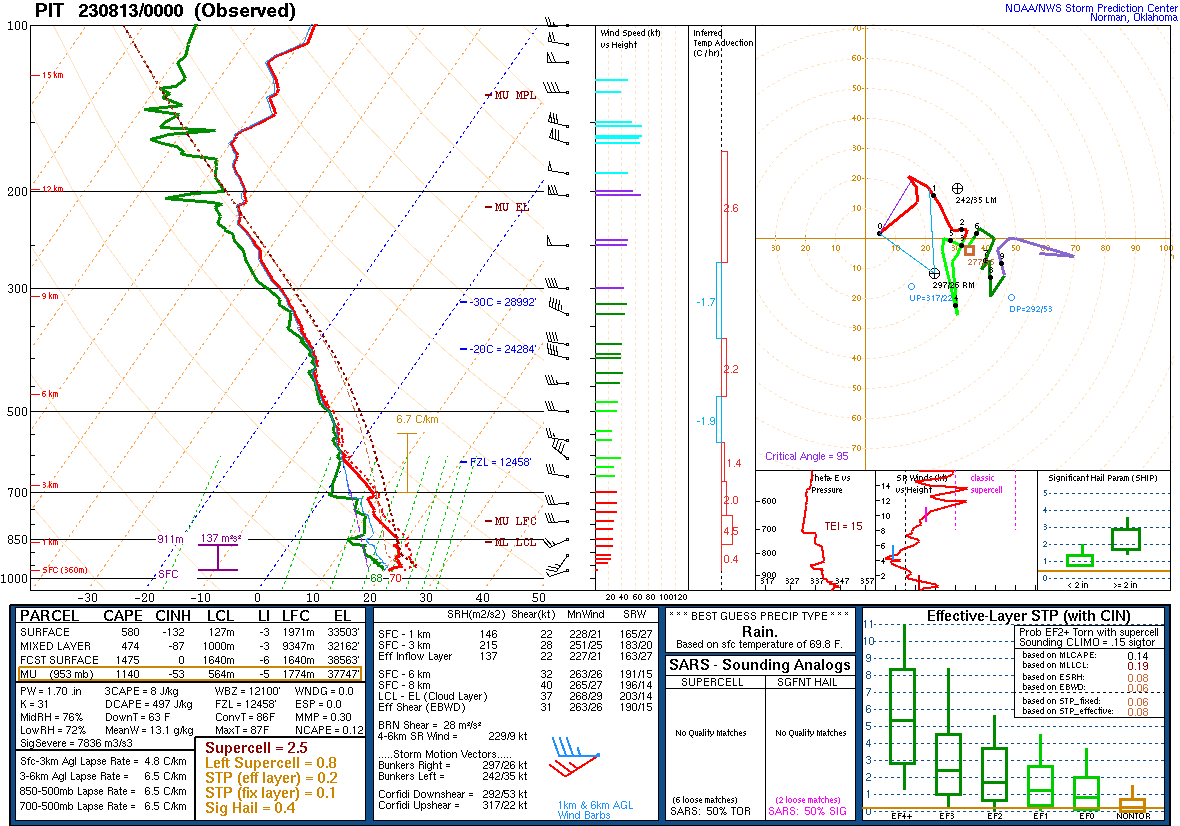 |
| August 12th 2023 12Z | August 12th 2023 18Z | August 13th 2023 00Z |
Additional Information
SPC Products
 |
 |
 |
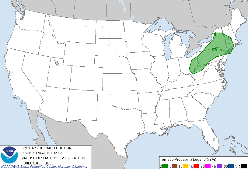 |
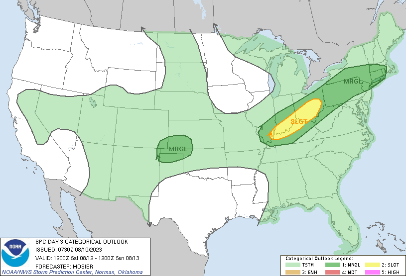
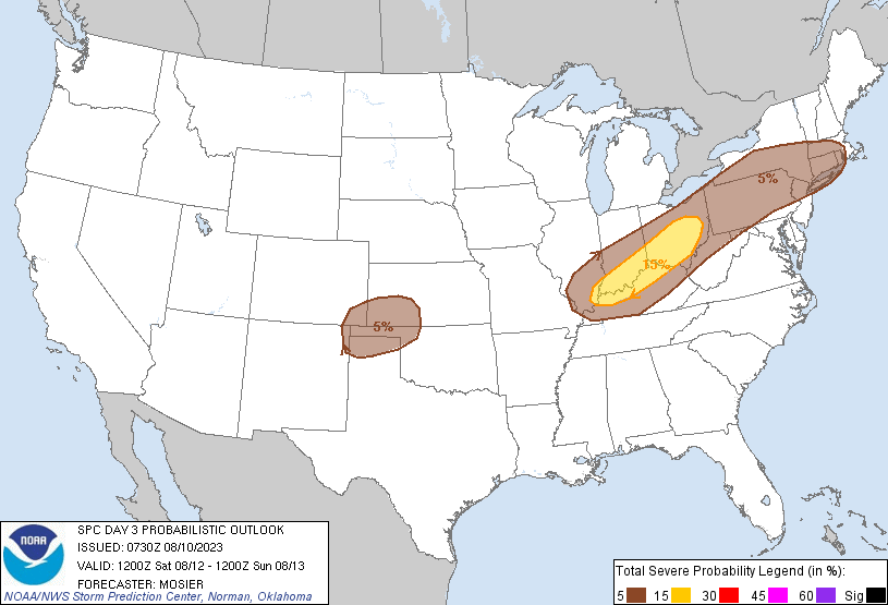
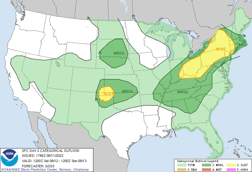
| SPC Day 3 Categorical Outlook | SPC Day 3 Probabilistic Outlook | SPC Day 2 Categorical Outlook | SPC Day 2 Probabilistic Outlook |
 |
 |
 |
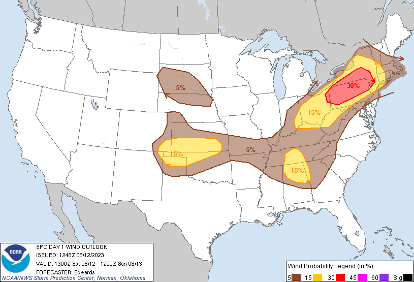 |
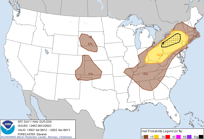
| SPC Day 1 Categorical Outlook | SPC Day 1 Tornado Outlook | SPC Day 1 Hail Outlook | SPC Day 1 Wind Outlook |
 |
Media use of NWS Web News Stories is encouraged! Please acknowledge the NWS as the source of any news information accessed from this site. |
|