Winter 2024-2025 Climate Summary:
Temperatures ranged from near normal to around 1 degree below normal. We started the winter with a warmer than normal December, which was then followed by a colder than normal January, and we finished with a near to slightly below normal February. None of the months finished in the top 10 warmest or coldest though. February saw the greatest temperature swings from single digits and below zero readings mid month to 70s early and late in the month. 70 to 75 degree swings were common in many communities.
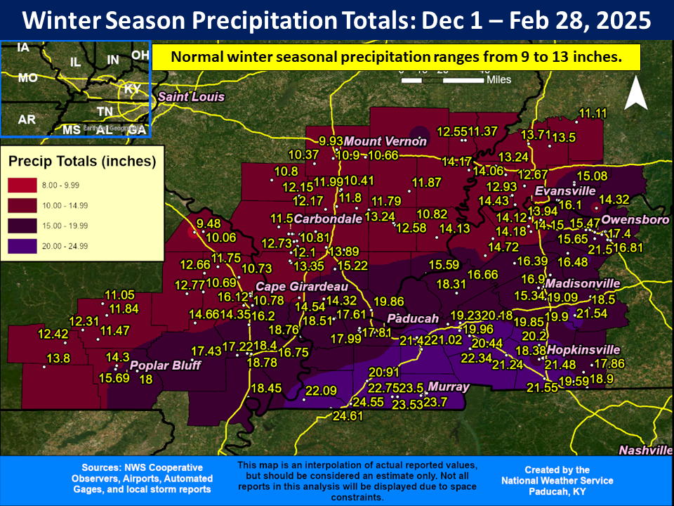
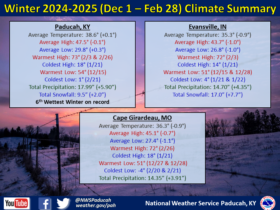
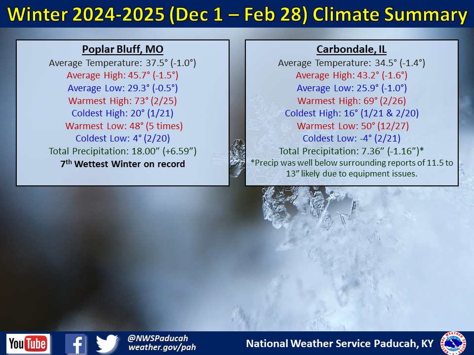
Precipitation finished wetter than normal across essentially the entire area. Amounts ranged from 10 to 25 inches, with the highest amounts focused near the Kentucky/Tennessee border. Most areas received amounts that were anywhere from 2 to 10 inches above normal. The only exception was across portions of Wayne and Carter Counties in Missouri along with Jefferson and Wayne Counties in Illinois which finished near to slightly drier than normal. The highest observed amount was 24.61” at a CoCoRaHS station 5 miles west of Fulton, KY. Paducah ended up with our 6th wettest winter on record while Poplar Bluff finished 7th wettest.
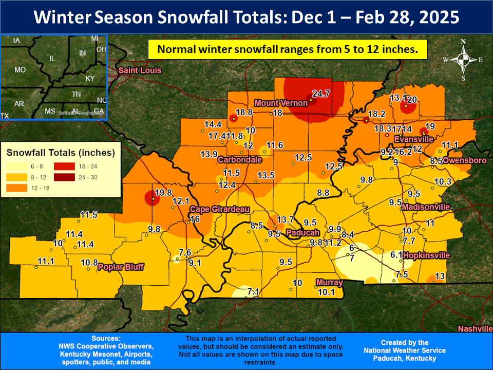
Snowfall averaged above normal across much of the region with amounts ranging from 8 to 18 inches. Some higher amounts in excess of 20” were observed up along and north of I-64 in southern Illinois and southwest Indiana. The highest observed total was 24.7” at a COOP station in Fairfield, IL (Wayne County). Evansville received 17” which was well above their normal of 9” for a winter season.
The graphic below is an interpolated rainfall map using actual observations. Please note that there are likely discrepancies in between observations, since the values are estimated based on nearest reports.
|
Winter 2024-2025 Review: Precipitation and Temperature Maps (Click on image to enlarge) |
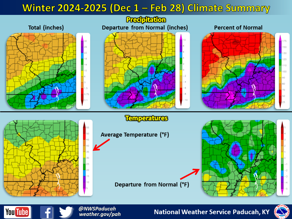 |
| Climate Maps are from the Northeast Regional Climate Center |
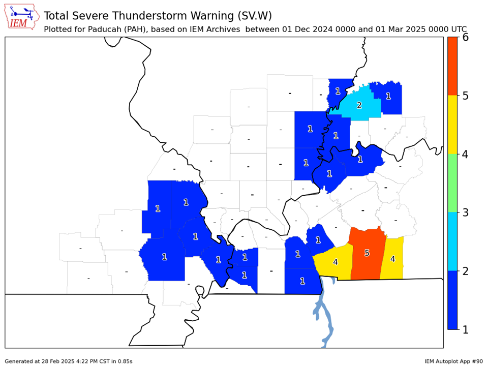
| Severe Thunderstorm Warnings - County Based | Severe Thunderstorm Warnings - Polygon Based |
 |
.PNG) |
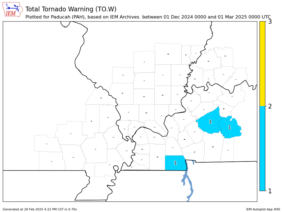
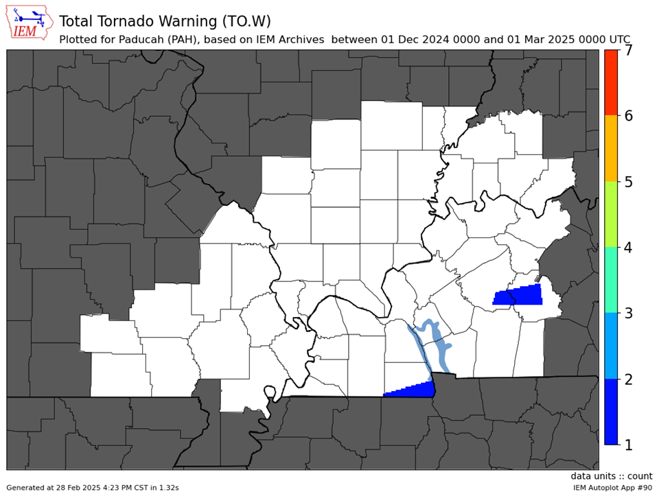
| Tornado Warnings - County Based | Tornado Warnings - Polygon Based |
|
|
|