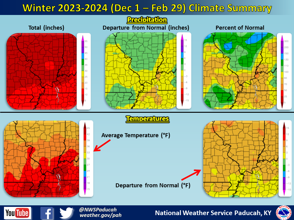
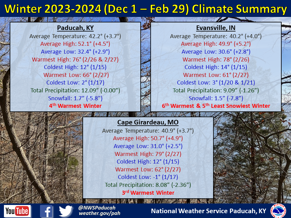
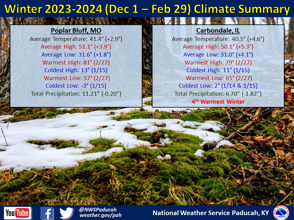
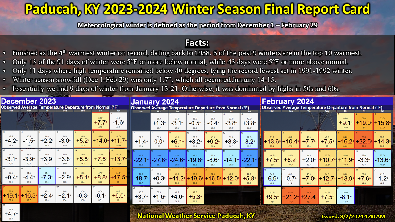
Temperatures were well above normal by 3 to 5 degrees. Cape Girardeau finished as their 3rd warmest winter, while Paducah and Carbondale observed their 4th warmest, and Evansville 6th warmest. December and February finished much warmer than normal, especially February which ranked amongst our warmest on record. January actually finished below normal by around 1 to 3 degrees, largely due to an arctic blast that impacted the area between January 13th and 21st. We basically had 9 days of winter while the rest of the season was quite mild with only a few other brief cold shots. Paducah registered 28 days reaching 60 degrees, which was the 3rd most on record (record is 31 days set in 2021-2022 winter).
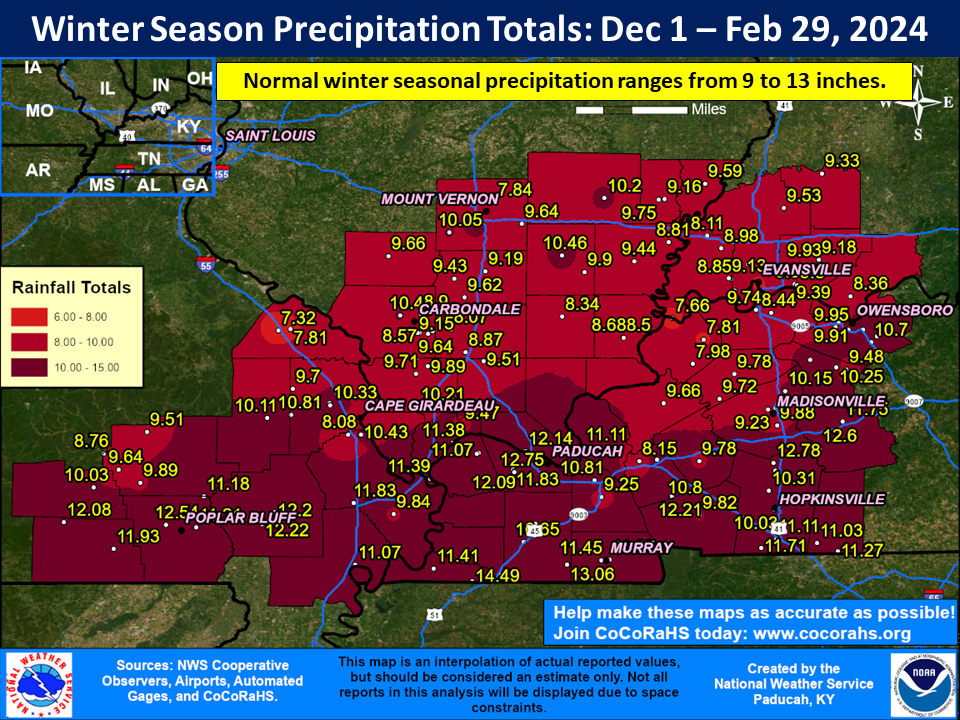
The winter season finished near normal or drier than normal across much of the region. Most locations received anywhere from 8 to 12” of precipitation, which was anywhere from right near normal to 1 or 2” drier than normal. The highest reported amount was 14.49” at a CoCoRaHS station 5 miles west of Fulton, KY. Generally the southern portions of southeast Missouri and western Kentucky, closer to the Arkansas and Tennessee borders, received the heaviest amounts.
Snowfall was well below normal, with most areas only receiving amounts of 0.5” to 3”. The exception was a corridor of southern Illinois from Pinckneyville to Mount Vernon to Fairfield and Mount Carmel which picked up 4 to 7” thanks to thundersnow on February 16th. Evansville only picked up 1.5” for the winter season, ranking as their 5th least snowy winter on record.
The graphic below is an interpolated rainfall map using actual observations. Please note that there are likely discrepancies in between observations, since the values are estimated based on nearest reports.
| Winter 2023-2024 Review: Precipitation and Temperature Maps (Click on image to enlarge) |
 |
| Climate Maps are from the Northeast Regional Climate Center |
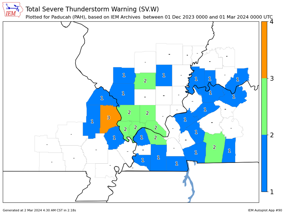
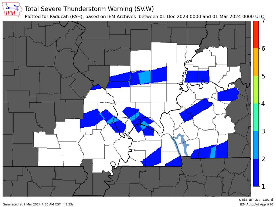
| Severe Thunderstorm Warnings - County Based | Severe Thunderstorm Warnings - Polygon Based |
 |
 |
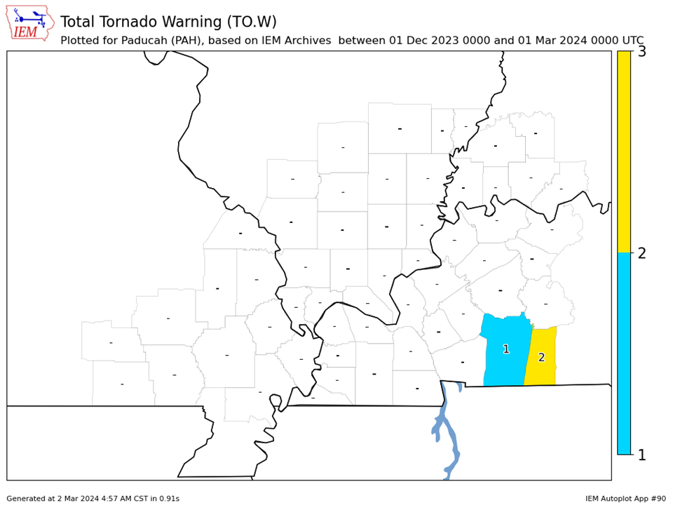
| Tornado Warnings - County Based | Tornado Warnings - Polygon Based |
|
|
|