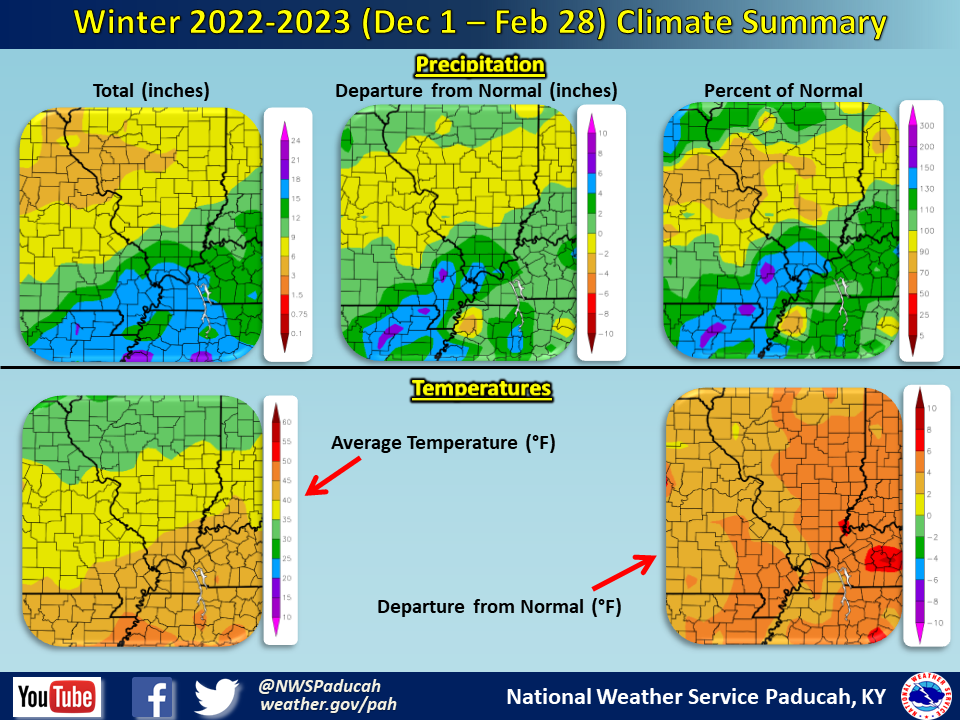
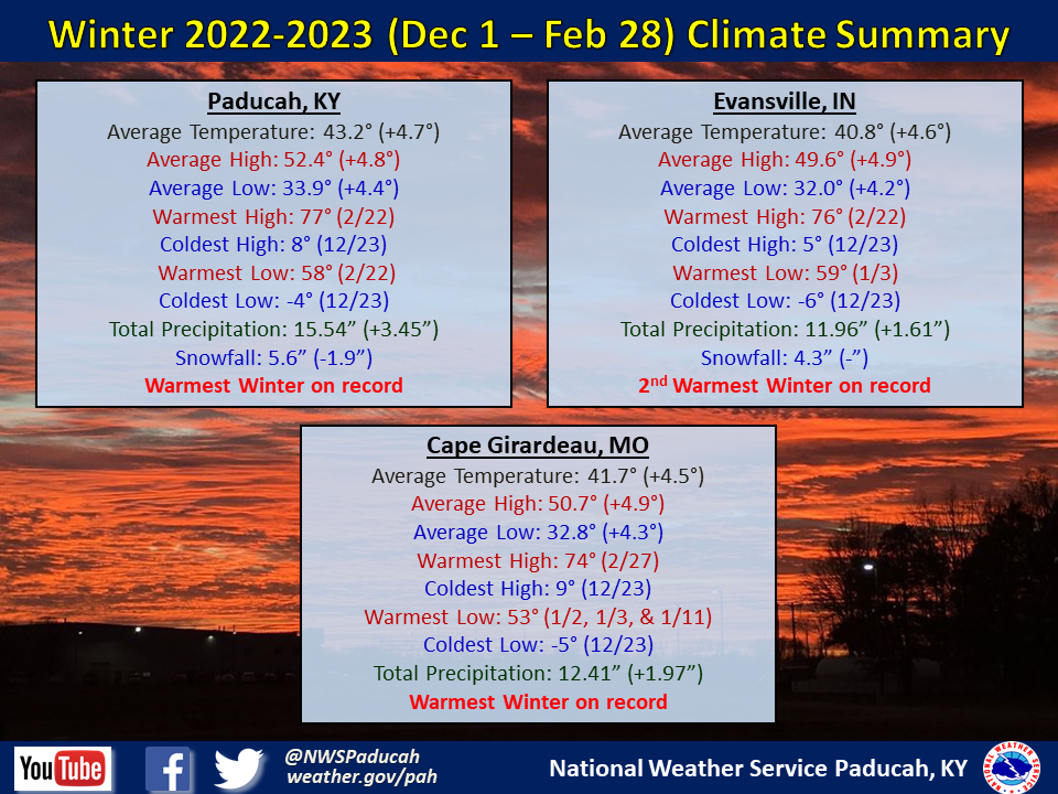
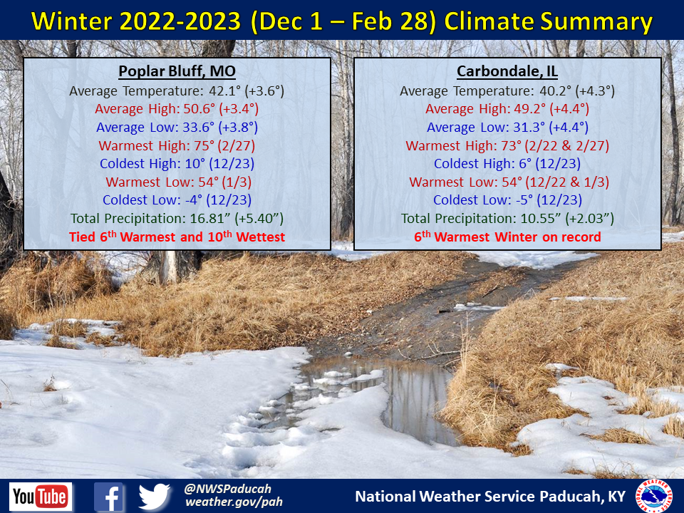
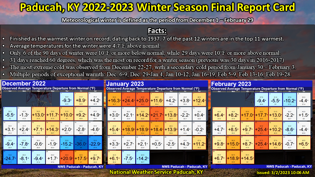
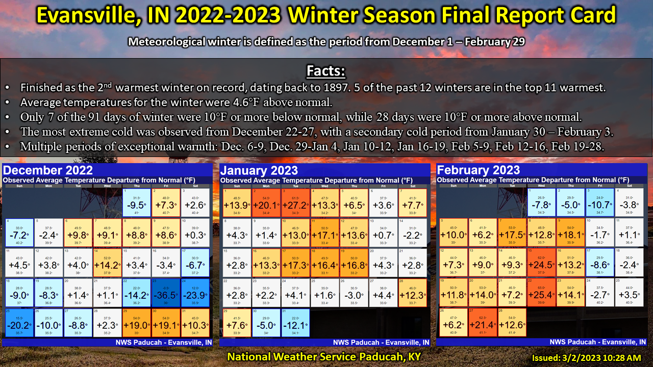
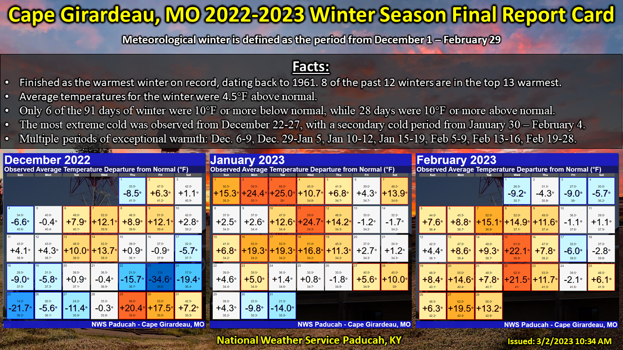
Temperatures were well above normal by 4 to 5 degrees. It was the warmest winter on record in Paducah and Cape Girardeau. The entire region experienced one of their 10 warmest winters on record. There was one impressive cold air intrusion in the days leading up to Christmas (Dec 22-25). Wind chills of -20 to -30 were observed on December 23, which were the coldest values experienced in our forecast area in over 25 years. This was the only winter in Paducah’s top 15 warmest winters on record that experienced a wind chill reading below -6 degrees (we registered a -21 wind chill on Dec 23). Besides for that brief brutal cold snap, we experienced numerous different periods of exceptional warmth, particularly in January and February. Paducah registered 31 days reaching 60 degrees, which broke the previous winter season record of 30 days set back in 2016-2017. December finished slightly below normal thanks in large part due to the extreme cold around Christmas. Meanwhile, January and February were both well above normal finishing as one of our top 10 warmest on record.
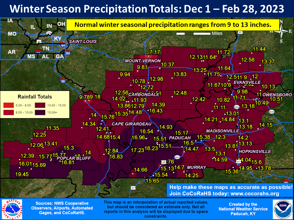
Precipitation averaged wetter than normal across much of the region. Most areas observed between 11 and 18 inches, which was 2 to 6 inches above normal. Southeast Missouri, extreme southern Illinois, and far west Kentucky observed the highest amounts. January was our wettest month compared to normal across a large part of the area. However, December and February were also quite wet in portions of the region. The highest observed amount was 19.45” at a CoCoRaHS station in far southwest Ripley County, Missouri (Gatewood 5.6 SSW).
Snowfall was below normal in many areas. A corridor across southeast Missouri into southwest Illinois received the highest amounts within the area, ranging from 7 to 13 inches. The highest amount was 13.1” at a CoCoRaHS station 1 mile SW of Jackson, MO. A good majority of this snow occurred between 2 events: December 22-23 and January 24-25. A few other winter events were experienced in December and January before snow became non-existent in February.
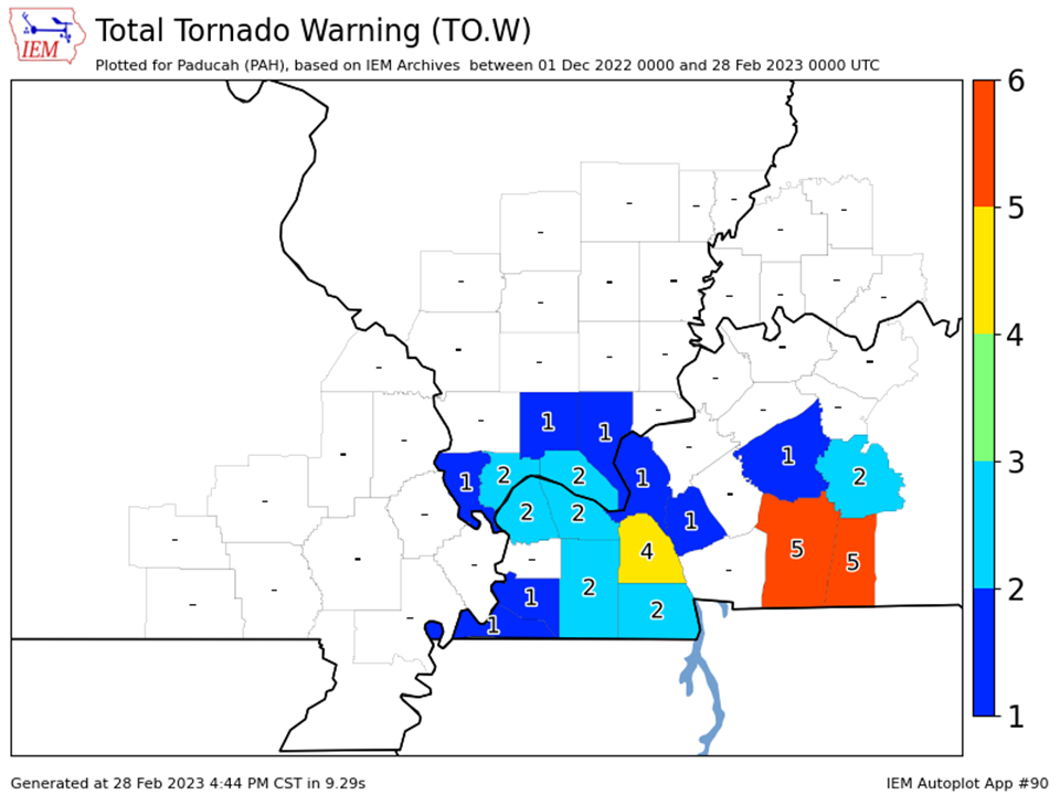
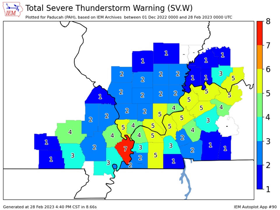
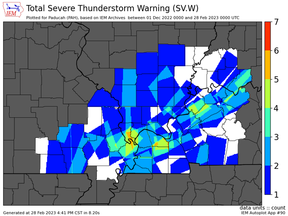
We issued 40 Severe Thunderstorm Warnings and 15 Tornado Warnings across our 58 county forecast area over the winter season (Dec 1, 2022 – Feb 28, 2023). This was a bit above the average of 25 combined warnings in a typical winter, but not as many as last year when we issued 68 combined warnings. That was in large part due to the December 10th, 2021 event.
The graphic below is an interpolated rainfall map using actual observations. Please note that there are likely discrepancies in between observations, since the values are estimated based on nearest reports.
| Fall 2022 Review: Precipitation and Temperature Maps (Click on image to enlarge) |
 |
| Climate Maps are from the Northeast Regional Climate Center |
| Severe Thunderstorm Warnings - County Based | Severe Thunderstorm Warnings - Polygon Based |
 |
 |
| Tornado Warnings - County Based | Tornado Warnings - Polygon Based |
|
|
|