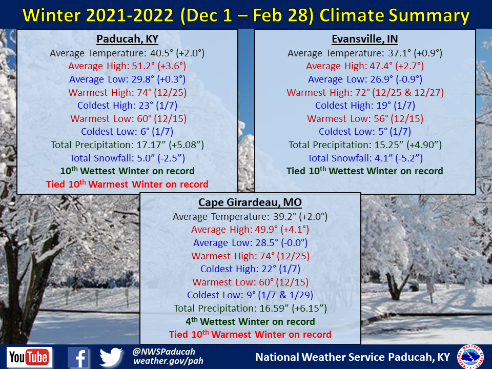
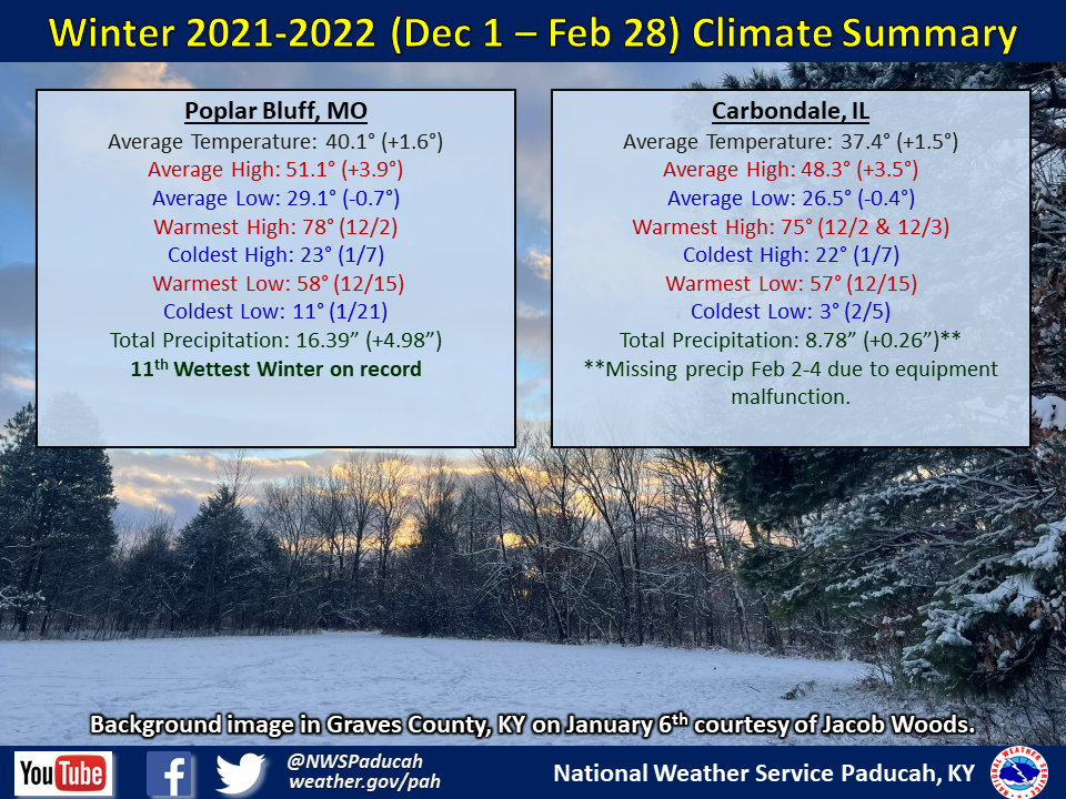
Winter 2021-2022 Climate Summary: Temperatures averaged above normal by 1 to 2 degrees. The season started with record warmth, with much of the region experiencing their warmest December on record. The rest of the winter was cooler than normal, with temperatures averaging 1.5 to 4 degrees below normal in January and February. Despite 2 of the 3 months being below normal, the record warmth in December allowed a few locations to sneak into their top 10 warmest winters on record. This occurred in Paducah and Cape Girardeau. It was also noteworthy that max temperatures averaged 3 to 4 degrees above normal, but min temperatures actually were near to slightly below normal. In Paducah, max temperatures were the 4th warmest on record for a winter season, while min temperatures were only 27th warmest. Both Paducah and Cape Girardeau set a record for the most number of days reaching 65 degrees or higher with 20 and 16 respectively (previous record was set in the 2016-2017 winter).
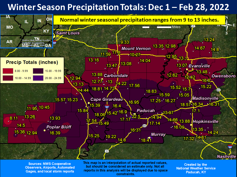
Precipitation was wetter than normal across the Quad State. All 3 months were wetter than normal for many locations, but February experienced the greatest departure. Paducah, Evansville, Cape Girardeau, and Poplar Bluff all experienced one of the top 10 wettest winters on record. Amounts ranged from 10 to 20 inches across the area, which was generally 4 to 8 inches above average. The highest amount was 22.50” at a CoCoRaHS station 4.5 miles SW of Paducah, KY. This was only 6 miles southeast of the official observing station at the airport too, which observed amounts over 5” less.
Most our area finished the winter season with below average snowfall amounts ranging from 2 to 8”. The highest amount reported was 9.4” at the Du Quoin, IL COOP. Winter storms impacted the region on January 6, February 3-4, and February 23-24. The first event was all snow, while the last two consisted of a mixture of freezing rain, sleet, and snow.
The graphic below is an interpolated rainfall map using actual observations. Please note that there are likely discrepancies in between observations, since the values are estimated based on nearest reports.
| Winter 2021-2022 Review: Precipitation and Temperature Maps (Click on image to enlarge) |
| COMING SOON! |
| Climate Maps are from the Northeast Regional Climate Center |
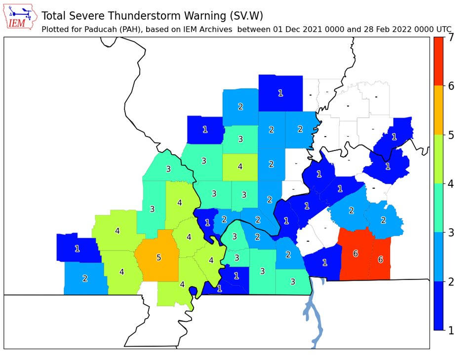
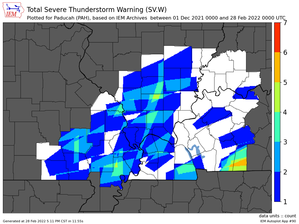
| Severe Thunderstorm Warnings - County Based | Severe Thunderstorm Warnings - Polygon Based |
 |
 |
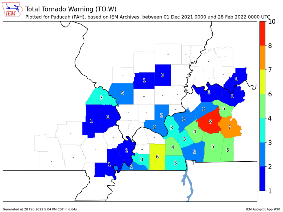
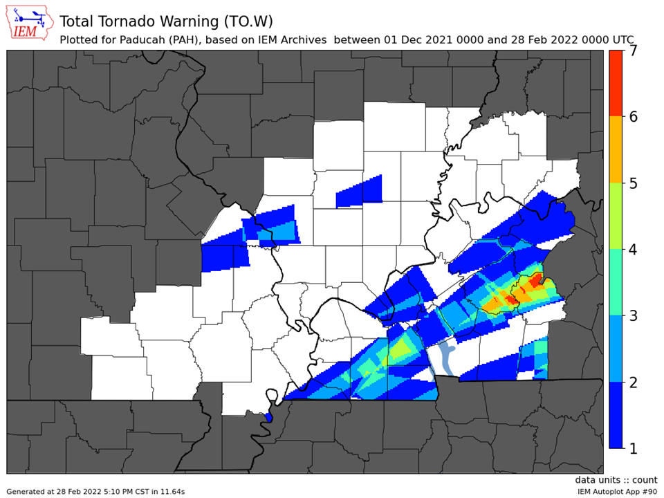
| Tornado Warnings - County Based | Tornado Warnings - Polygon Based |
 |
 |

