Scattered severe thunderstorms capable of damaging wind gusts and some hail are expected this afternoon and evening from the Upper Ohio River Valley into the Northeast, and from the Appalachians into the Mid-Atlantic States. Excessive rainfall from heavy thunderstorms may produce areas of flash flooding from southern New Mexico into the western and northern Gulf Coast into Wednesday. Read More >
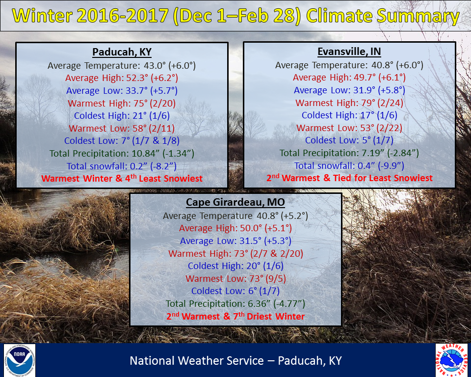
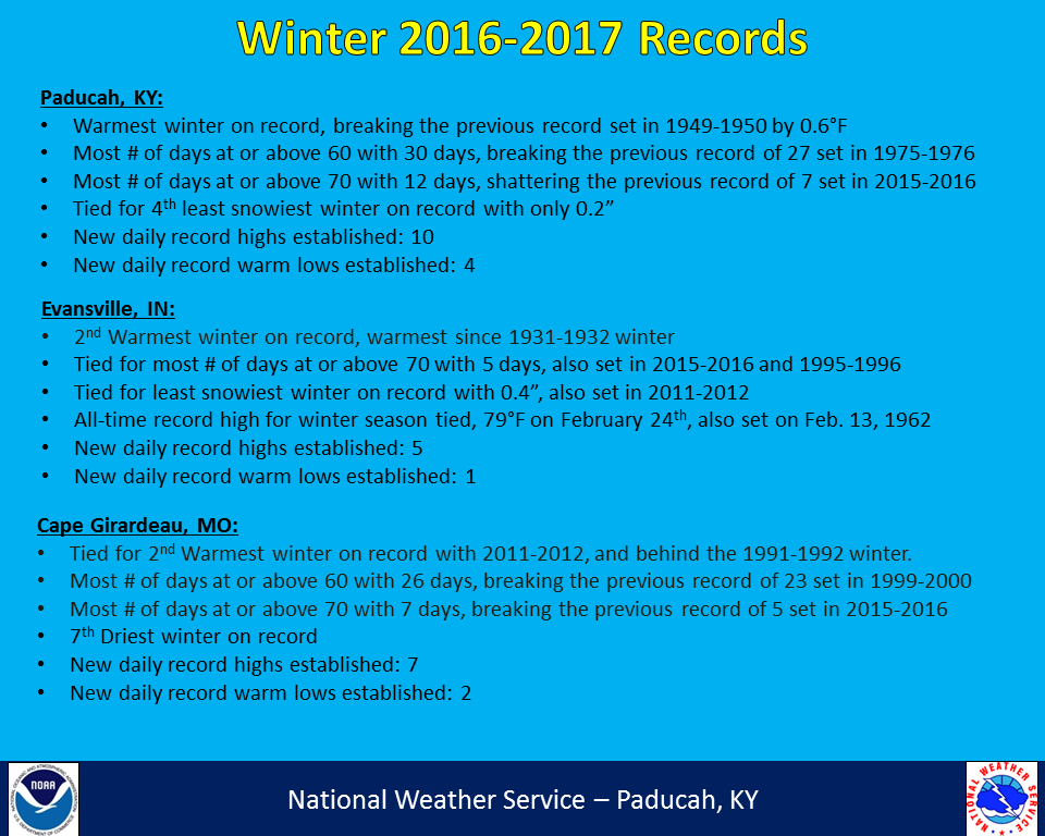
Winter 2016-2017 (December-February) was record warm and relatively dry across our region along with hardly any snowfall. Paducah recorded their warmest winter season on record, beating the old record set back in 1949-1950. Evansville and Cape Girardeau finished as their 2nd warmest winter, with Evansville recording their warmest since 1931-1932. You likely noticed that snow was basically nonexistent this winter. Paducah finished with a measly 0.2” which ranks as the 4th least snowiest winter on record. We haven’t had a winter with less snow since 1991-1992 when no measurable snow occurred in Paducah. Evansville tied for their least snowiest winter on record (dating back to 1897), with only 0.4”, which also occurred in 2011-2012. The area with the most snow was up along and north of the I-64 corridor where 1.5 to 2 inches occurred, mainly in one event on January 5th. It was also a drier than normal winter for most of the region, with many areas finishing 2 to 6 inches below normal winter precipitation. The lone exception was portions of western KY, particularly the Pennyrile region. The winter season ended with a significant severe weather event/tornado outbreak on February 28th.
| Winter 2016-2017 Review: Precipitation and Temperature Maps (CLICK TO ENLARGE IMAGE) |
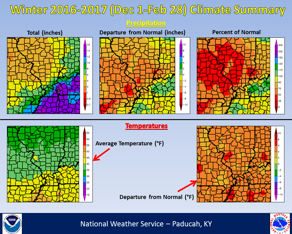 |
| Climate Maps are from the Northeast Regional Climate Center |